Ticker for March 16, 2020
MESONET TICKER ... MESONET TICKER ... MESONET TICKER ... MESONET TICKER ...
March 16, 2020 March 16, 2020 March 16, 2020 March 16, 2020
Here comes spring!
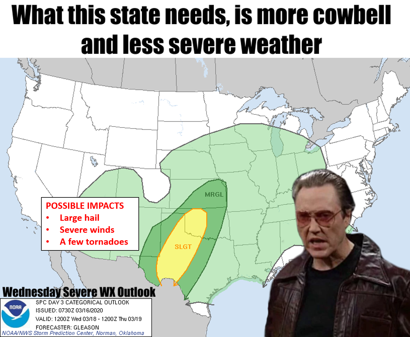
It's spring break in Oklahoma, so smart folks like myself put two and three
together and came up with six (you know, aught from naught), but also that it
must be spring! Mother Nature thinks so as well. So far over the last few days
we've had mainly rain and a few peals(Okie translator: claps) of thunder. But
here we go with some REAL spring weather. No, it's not May severe weather, but
it is a bit more springish than what we've been seeing. It's starts for Oklahoma
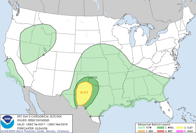
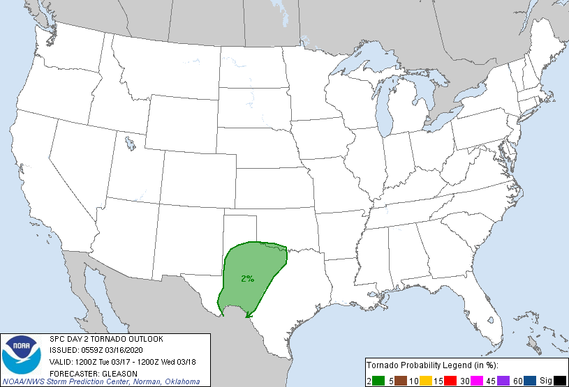
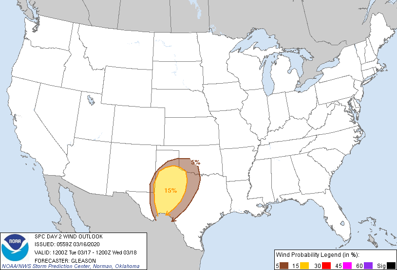
on Tuesday, and then extends into Wednesday. Tuesday's SPC outlook shows mostly
"marginal" chances for severe weather, all in far southwest Oklahoma.
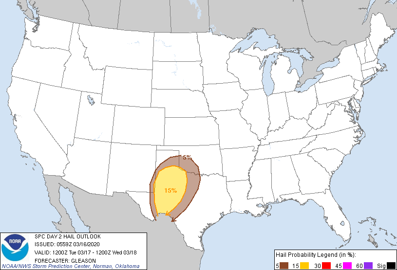
Then we hit day 3, and that's when we might see the more classic severe weather
setup come into focus. It's still conditional, of course, meaning the models
point towards this, but both this and that have to materialize. Here's what
SPC says:
"The front/dryline should serve as the primary forcing mechanism to
promote storm initiation, with a cap probably inhibiting storms
through the afternoon. Consensus of 00Z guidance is that this
convective development may not occur until after 00Z, and perhaps as
late as 03-06Z Wednesday evening/night. Regardless of the timing,
increasing low and mid-level flow will result in strong effective
bulk shear capable of supporting organized updrafts. Storms may have
a tendency to become linear along the eastward-moving front as a
southerly low-level jet markedly strengthens overnight across the
southern/central Plains. If this occurs, then damaging winds would
be the main threat. But, given the degree of low-level shear
forecast, a few tornadoes would also be a concern."
In other words, looks like there will be some severe weather. It might line out
and become a squall line, in which case tornadoes will be less of a threat. But,
and that's a big but (WATCH IT!), if we get some discrete cells there could be
more of a tornado threat.
One of the things we will need is heat, and it looks like we'll have it in
the middle of the week.
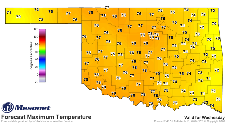
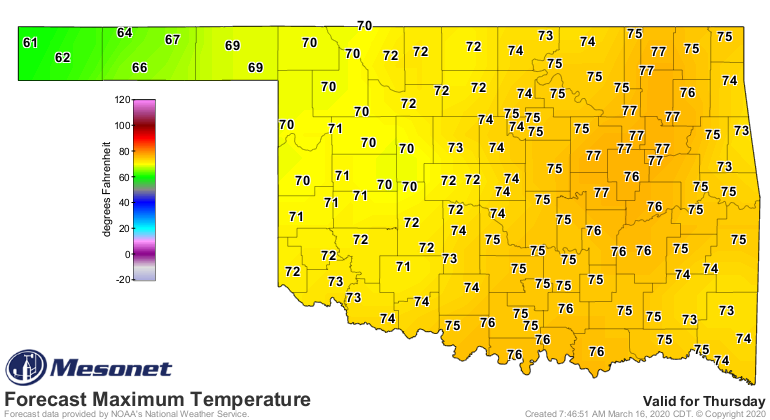
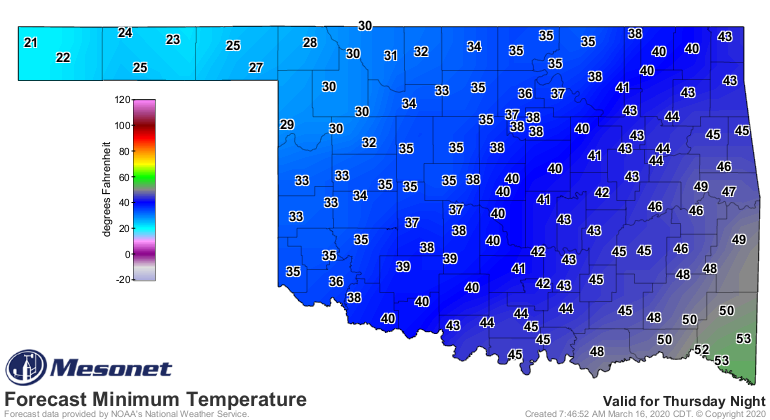
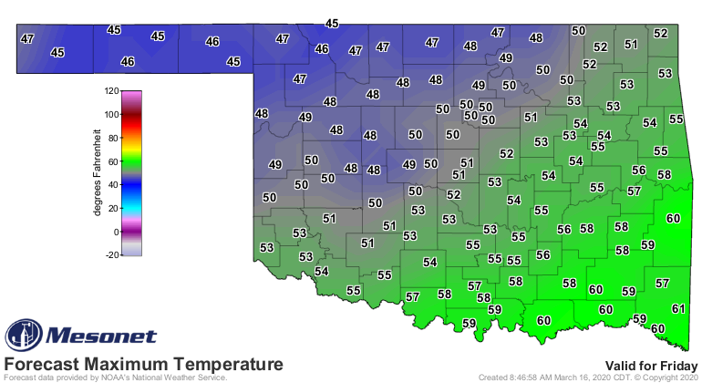
Dang, that looks like spring to me. Thursday will be a transition day. When we
have a system like this come through in March, it will normally have cold air
behind it. Friday morning lows are dangerously close to freezing for much of
the state, and the northwest will probably see a good (bad?) freeze. Then
Friday afternoon will be back to reality.
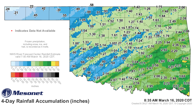
Not sure a lot of us need more rain. Some do, of course, especially in the
western Panhandle. The eastern parts of the state look to see the most, as
per usual.

Hey, it's early spring. It's expectable. But we need to stay weather aware
later this week.
Gary McManus
State Climatologist
Oklahoma Mesonet
Oklahoma Climatological Survey
(405) 325-2253
gmcmanus@mesonet.org
March 16 in Mesonet History
| Record | Value | Station | Year |
|---|---|---|---|
| Maximum Temperature | 91°F | BEAV | 2015 |
| Minimum Temperature | 11°F | BOIS | 2005 |
| Maximum Rainfall | 3.01 inches | CALV | 1998 |
Mesonet records begin in 1994.
Search by Date
If you're a bit off, don't worry, because just like horseshoes, “almost” counts on the Ticker website!