Ticker for March 12, 2020
MESONET TICKER ... MESONET TICKER ... MESONET TICKER ... MESONET TICKER ...
March 12, 2020 March 12, 2020 March 12, 2020 March 12, 2020
Spring Break Shenanigans
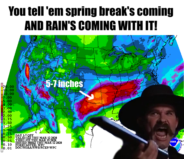
Hey, no quarantine for the Ticker, nor is there a vaccine. Just pure,
unadulterated insanity, free of charge. Just in time for spring break, Mother
Nature says active weather pattern...ACTIVATE! Uh, well, I should have thought
that sentence out better. Some people are great writers...other people, not
write good. But we are going to see a series of storm systems rotate through
the Southern Plains and give Oklahoma a great chance for moisture (or a horrible
chance of moisture, depending on your point of view) over the next week to
10 days.
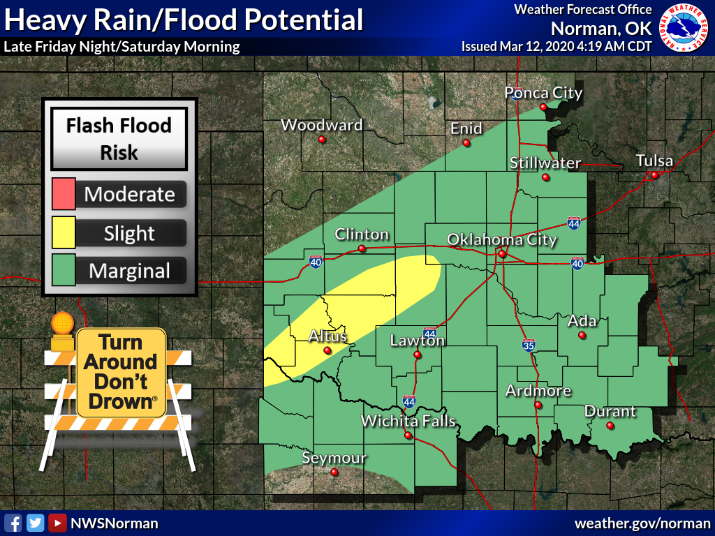
The fun starts tonight and extends through next week, but let's concentrate on
just the next few days. There will be a chance of severe weather, although those
chances are pretty low. The bigger threat will be flooding, especially across
parts of southwestern Oklahoma, as we go through Friday night into Saturday
morning. It does look like for parts of the state, the weekend is a washout.
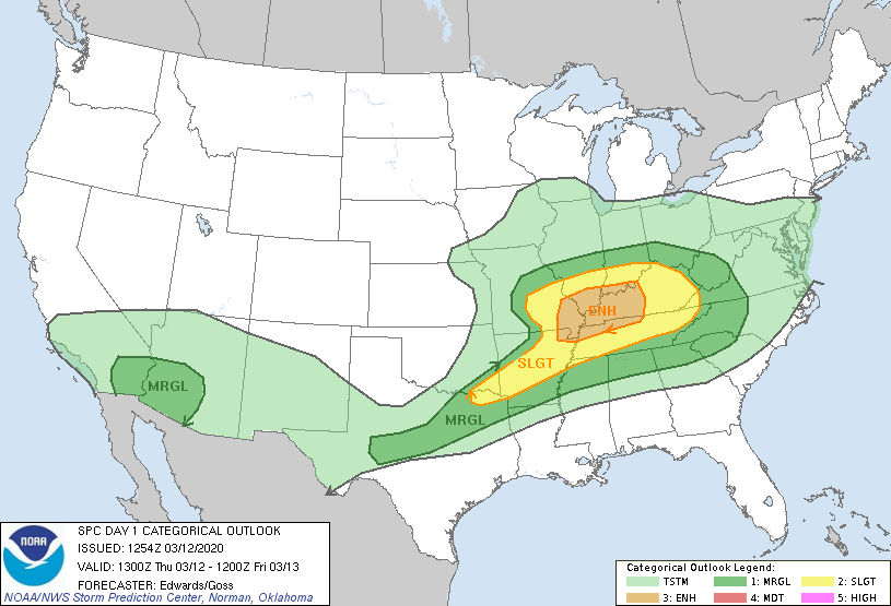
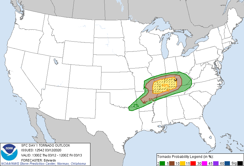
The severe weather threat tonight should be confined to far southeastern
Oklahoma, with high winds and hail being the main threats. And flooding, of
course. But there could be a brief tornado or two as well. That threat is pretty
low.
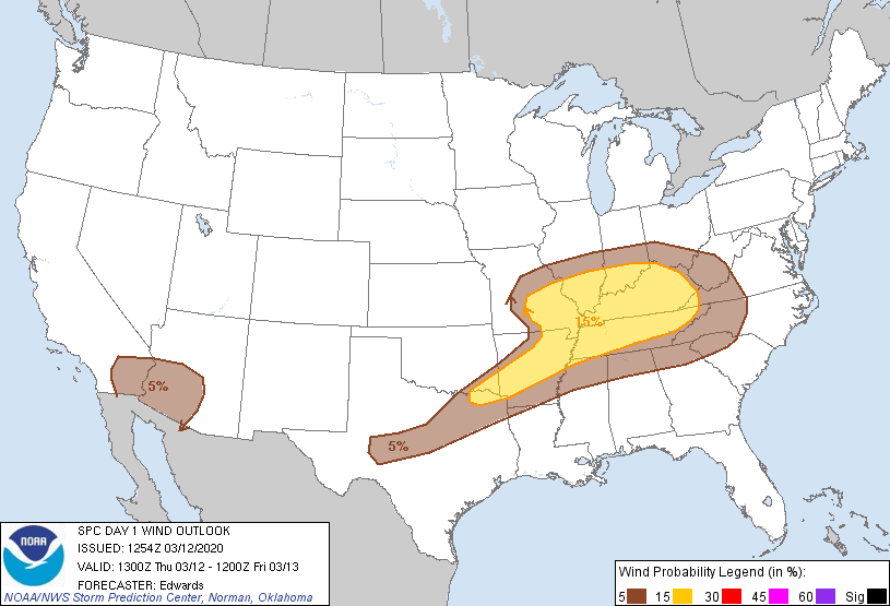
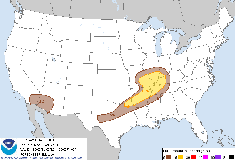
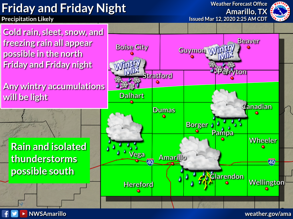
And we're not done with winter just yet, especially in the Panhandle!
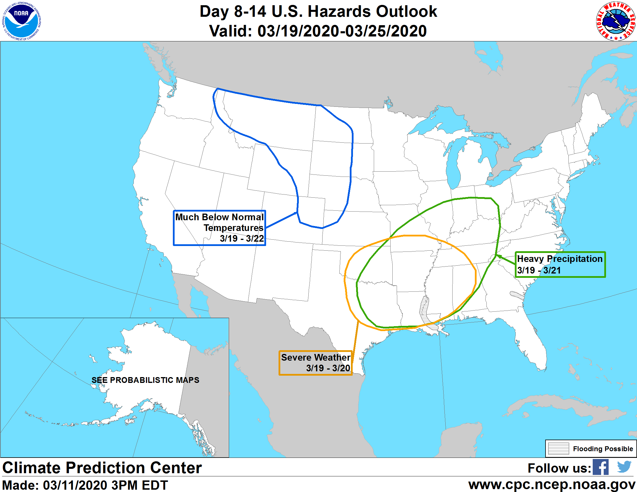
As we get later into next week, we might see a bit more of a threat for severe
weather, like classic spring severe weather. This is still a ways out, but
it will bear watching for later next week. Flooding will be a possibility as
well.
Turn around, don't drown. Listen to Billy Ray Cyrus, don't catch the virus.
That last one might not be valid. The first one could save your life, however.
So typical spring break weather for Oklahoma. Remember that one year that
the weather was nice during spring break?
Yeah, me either.
Gary McManus
State Climatologist
Oklahoma Mesonet
Oklahoma Climatological Survey
(405) 325-2253
gmcmanus@mesonet.org
March 12 in Mesonet History
| Record | Value | Station | Year |
|---|---|---|---|
| Maximum Temperature | 91°F | WALT | 2006 |
| Minimum Temperature | 7°F | EVAX | 2022 |
| Maximum Rainfall | 3.29 inches | STUA | 1999 |
Mesonet records begin in 1994.
Search by Date
If you're a bit off, don't worry, because just like horseshoes, “almost” counts on the Ticker website!