Ticker for February 20, 2020
MESONET TICKER ... MESONET TICKER ... MESONET TICKER ... MESONET TICKER ...
February 20, 2020 February 20, 2020 February 20, 2020 February 20, 2020
Shrinkage?
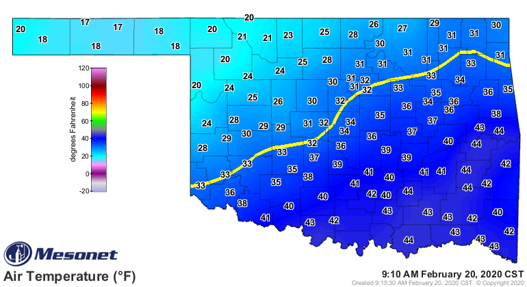
BRRRR! It's too cold to talk about, uhhhh, the cold. The current maps say it all.

And the snow and rain showed up for a bit, but pretty underwhelming in actuality.

So let's talk about drought. You know, the one hazard we climatologists get all
to ourselves after those high highfalutin meteorologists get all the exciting
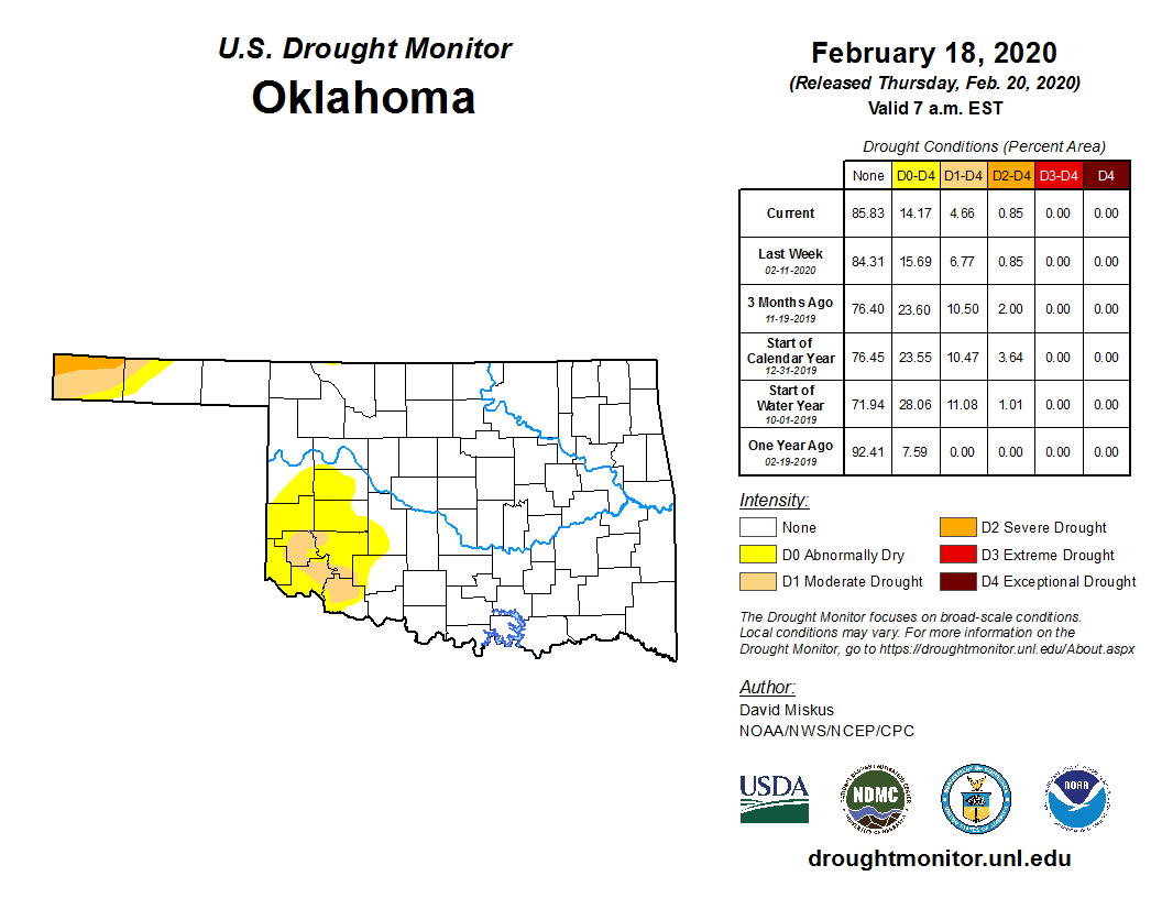
stuff. As you see in the top graphic, yes indeed drought does shrink, and it
continues to slowly dwindle in the far southwest where just a small sliver of
moderate drought remains. The surrounding yellow in this case, the abnormally
dry conditions, represents areas more likely going OUT of drought than entering.
The drought in the far western Panhandle remains firm as they haven't received
nearly as much precip as the rest of the state. If we take a look at the rainfall
maps for the year thus far vs. the water year (Oct. 1-present) thus far, we
can see why the SW drought is shrinking, but the Panhandle drought remains
unchanged.


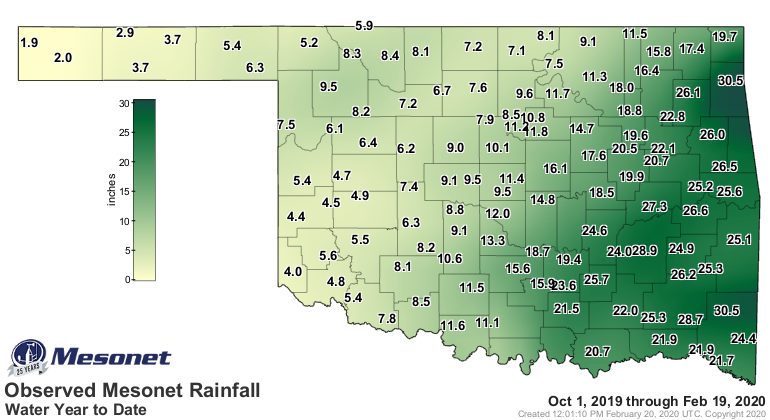

I'm telling ya, one more general rain across the southwest would probably
wipe those colors off the map...arguable it could have been done this week if
not for the longer-term deficits shows in the water year departure map above.
What about as we go forward? Our next storm system is usually right around the
corner. Well, maybe not so fast to the Panhandle, but the SW is in luck
(possibly). Let's take a look at the March and then March-May temperature
and precipitation outlooks from the Climate Prediction Center.
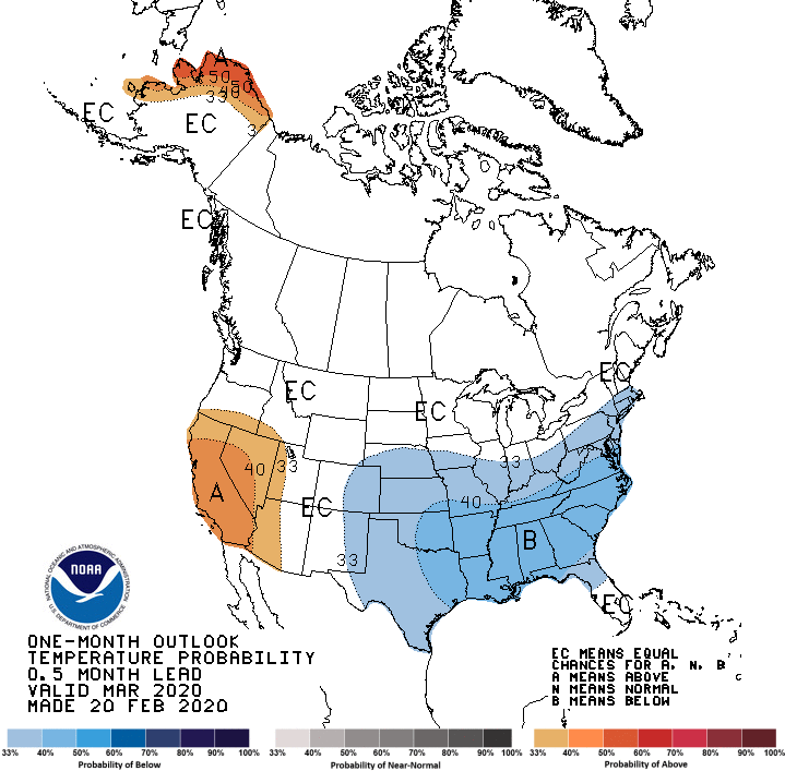
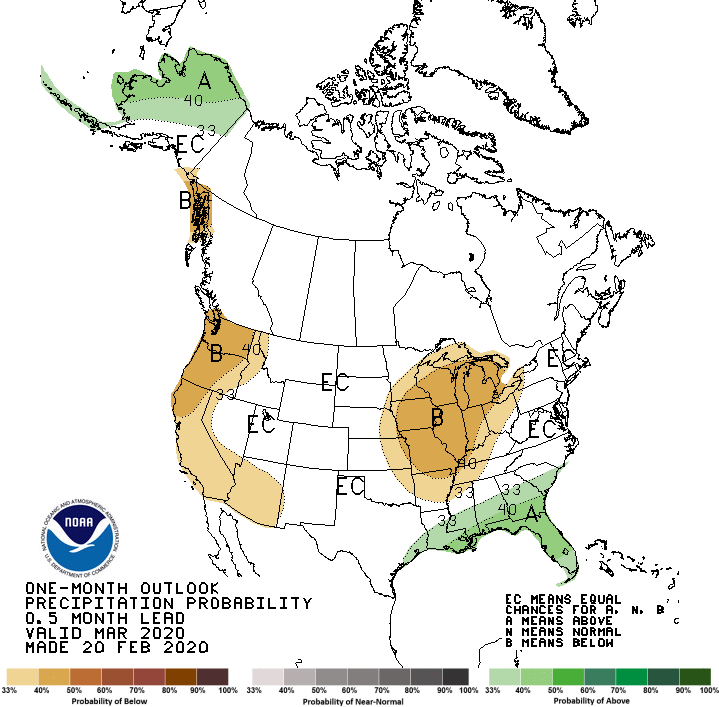
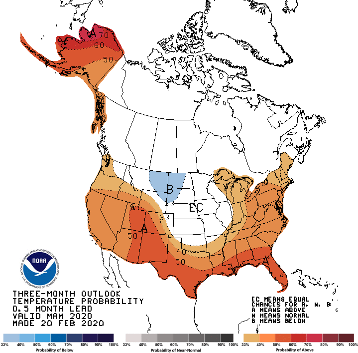
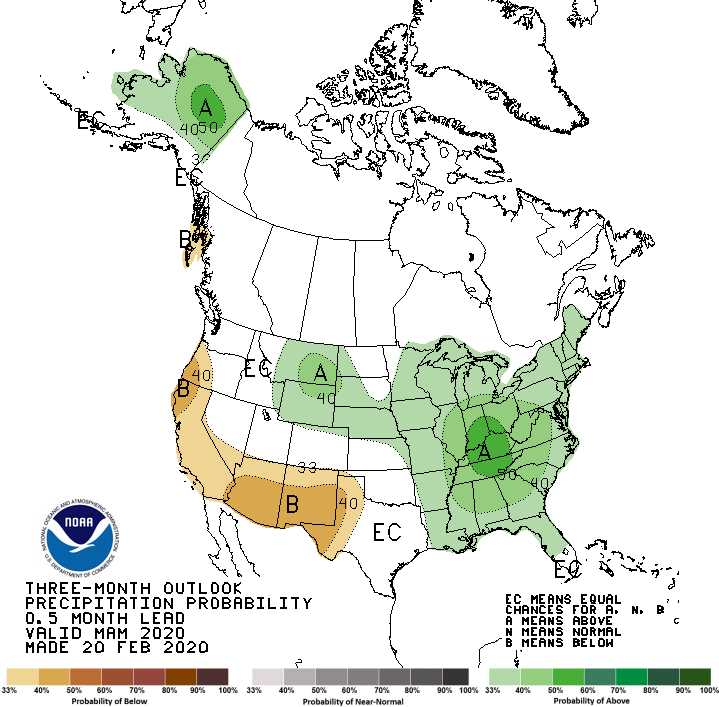
We see increased odds of below normal temperatures across the entire state for
March, but especially across eastern Oklahoma. We also see increased odds of
below normal precipitation across northeast Oklahoma, which I'm sure they would
welcome with open arms (but not open spillways!).
Then for the 3-month March-May period, increased odds of above normal
temperatures across the southern and far western Panhandle sections, and
below normal precip in the far western Panhandle.
Now when you put those together, they don't really tell you much about the
upcoming storm season, although what we tell you is that you should prepare for
every storm season in Oklahoma to be the worst on record just to be
prepared. And in Oklahoma, storm season is January 1-December 31. What it can
tell us is that drought could be expected to be relieved and maybe eradicated
across southwestern Oklahoma, but persist in the far western Panhandle. Other
than that, there is no call towards drought development in other parts of the
state through May, which is good if not overly optimistic news.
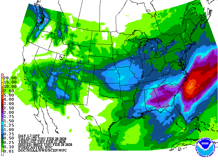
Now in the shorter term, as we exit February, look for a few minor bouts with
cold fronts and precipitation, but nothing drought-shattering.
Gary McManus
State Climatologist
Oklahoma Mesonet
Oklahoma Climatological Survey
(405) 325-2253
gmcmanus@mesonet.org
February 20 in Mesonet History
| Record | Value | Station | Year |
|---|---|---|---|
| Maximum Temperature | 86°F | ALTU | 2016 |
| Minimum Temperature | -7°F | FORA | 2025 |
| Maximum Rainfall | 4.01″ | SALL | 1997 |
Mesonet records begin in 1994.
Search by Date
If you're a bit off, don't worry, because just like horseshoes, “almost” counts on the Ticker website!