Ticker for February 24, 2020
MESONET TICKER ... MESONET TICKER ... MESONET TICKER ... MESONET TICKER ...
February 24, 2020 February 24, 2020 February 24, 2020 February 24, 2020
The Price is Spring

As we sit looking at gray skies across most of the state, some of us dealing with
drizzle while others have rain showers (lucky Panhandle folks and those in the
SE are seeing sun), we can tell that spring is coming closer with each day. The
sun is getting higher in the sky and sticking around a bit longer, and therefore
the amount of lovely life-and-heat-giving solar radiation increases accordingly.
Our cold fronts will start to get a bit warmer, relatively speaking, and our rain
will start to be accompanied more and more by peals of thunder (which is better
than peels of thunder).
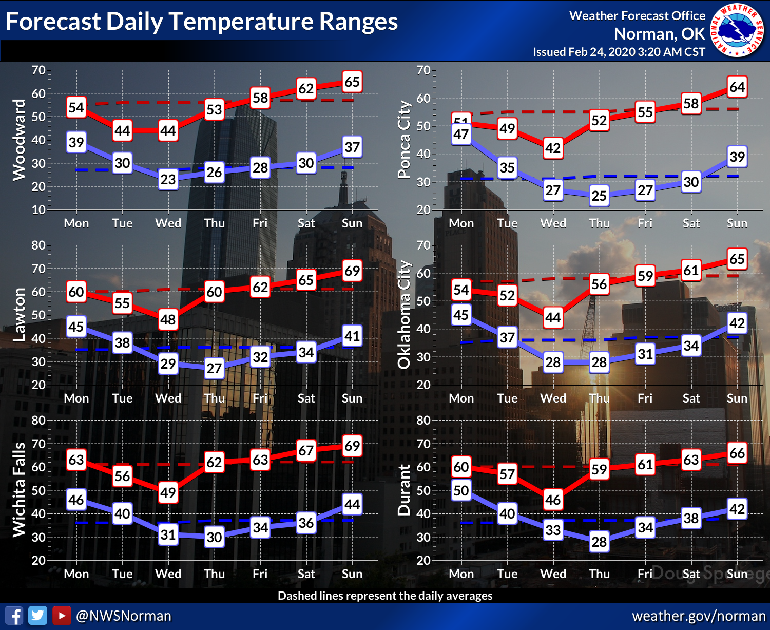
Until spring has finally sprung, however, we'll continue to deal with more late-
winter type of scenarios. This week we'll see several not-so-cold fronts that
drop our temperatures below normal, but we will see quick rebound as we get
towards the weekend.
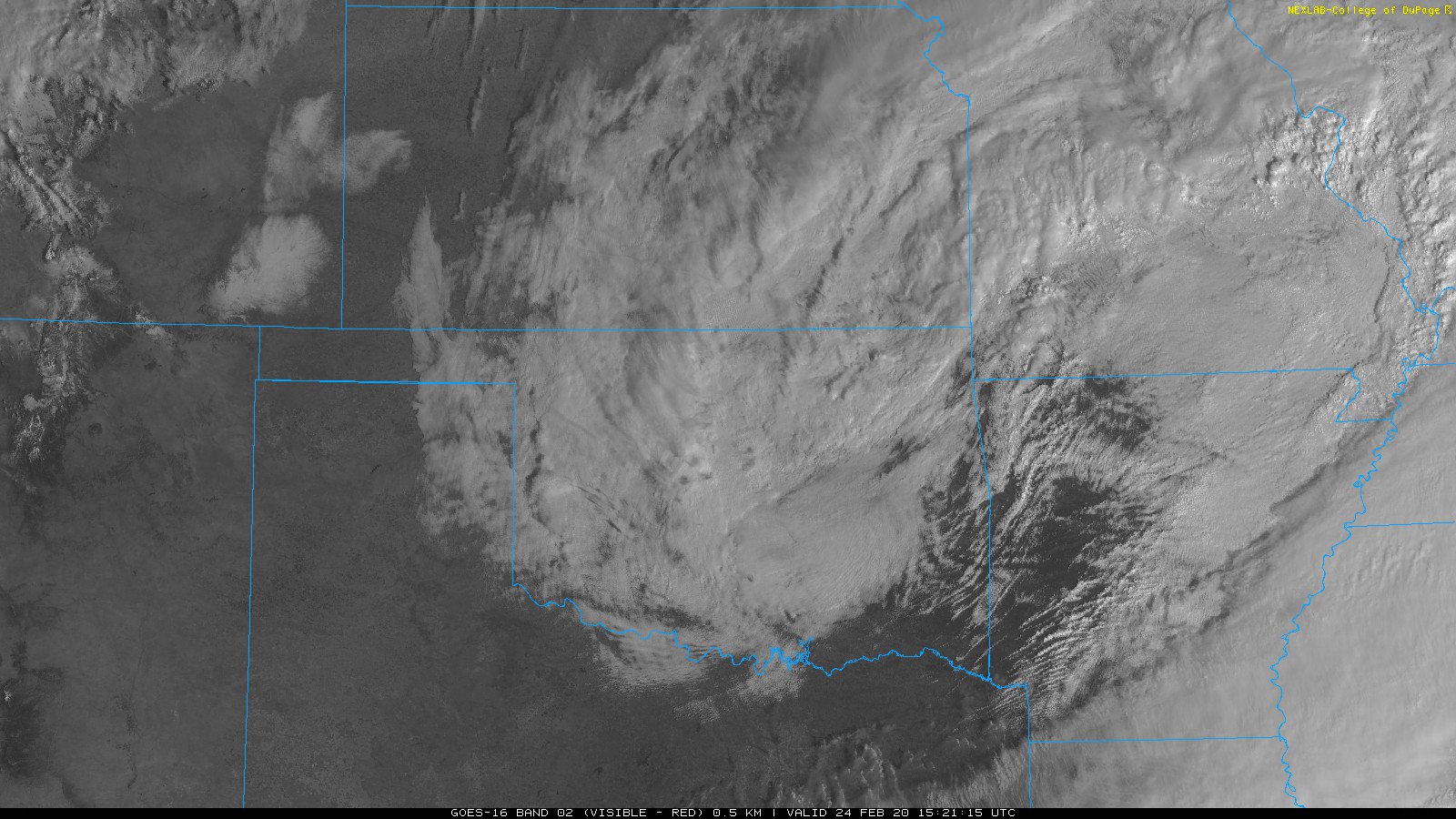
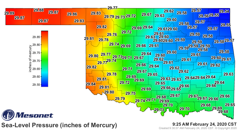
Today we're dealing with a surface low pressure system exiting the state to the
northeast. It shows up quite nicely both on satellite and the Mesonet's pressure
maps.
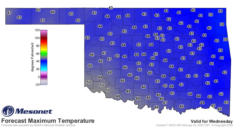
Then we'll see a cold front later tonight with a reinforcing shot for Wednesday
that will give us our coldest day of the week.
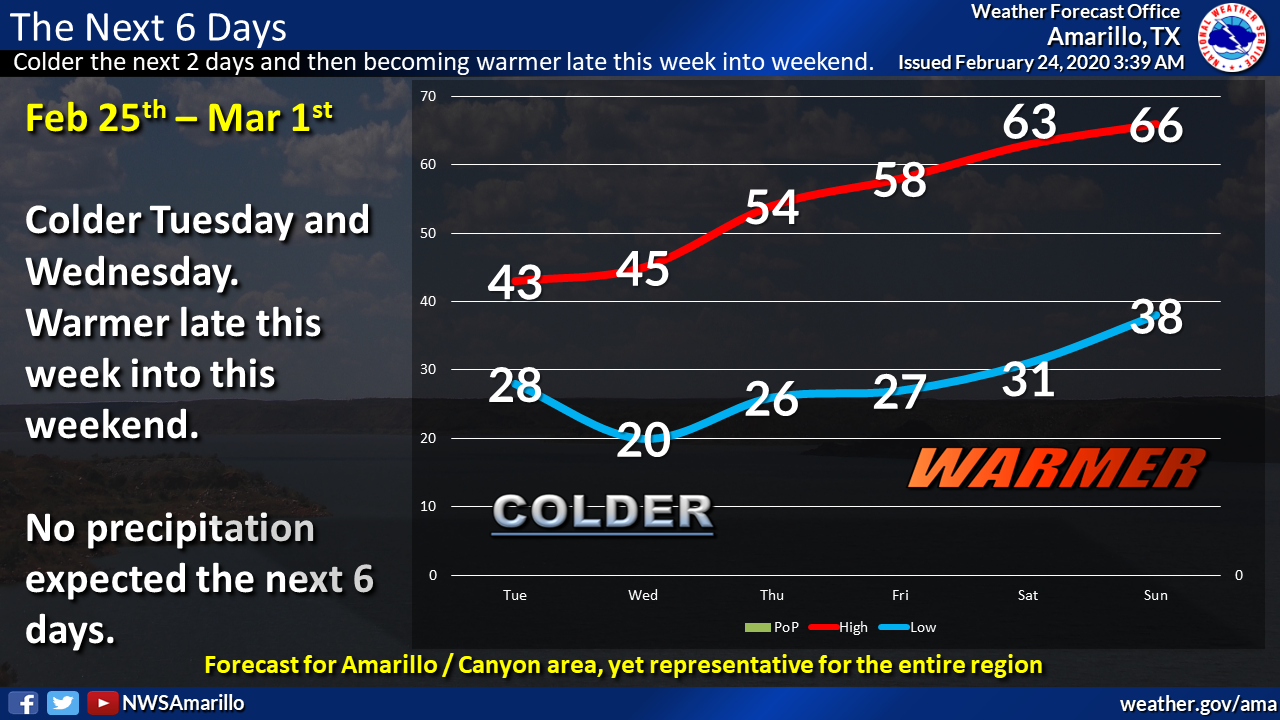
But the outlook is GOOD for the weekend, with highs in the 60s and a few 70s
as we have another foray into early spring. And that's just in time, too, since
climatological spring starts March 1.
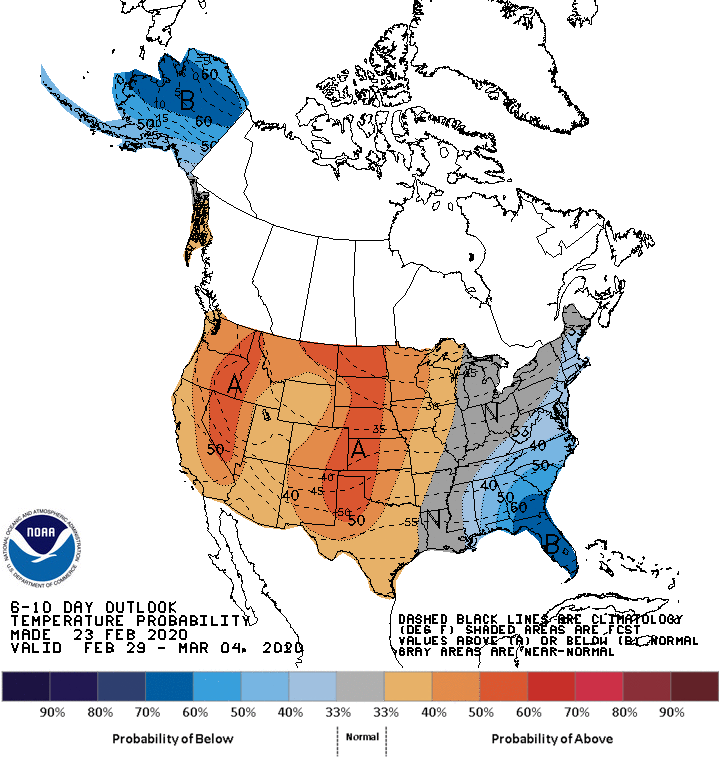
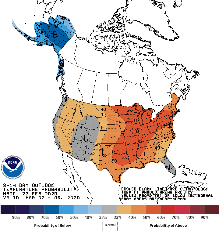
And Mother Nature is bullish on the spring market, with those chances for
above normal temperatures increased through next week.
Precip chances look to be increased as well. So as we enter spring...wait;
above normal temperatures, increased precip odds, spring? Well, I'll let you
put 2 and 2 together (a climatologist would say that equals an average of 2,
meteorologists would say a total of 4).
If that's the price of spring, I'll take it!
Gary McManus
State Climatologist
Oklahoma Mesonet
Oklahoma Climatological Survey
(405) 325-2253
gmcmanus@mesonet.org
February 24 in Mesonet History
| Record | Value | Station | Year |
|---|---|---|---|
| Maximum Temperature | 82°F | HOLL | 2002 |
| Minimum Temperature | -3°F | EVAX | 2022 |
| Maximum Rainfall | 2.61″ | MTHE | 2018 |
Mesonet records begin in 1994.
Search by Date
If you're a bit off, don't worry, because just like horseshoes, “almost” counts on the Ticker website!