Ticker for January 27, 2020
MESONET TICKER ... MESONET TICKER ... MESONET TICKER ... MESONET TICKER ...
January 27, 2020 January 27, 2020 January 27, 2020 January 27, 2020
Models say what?
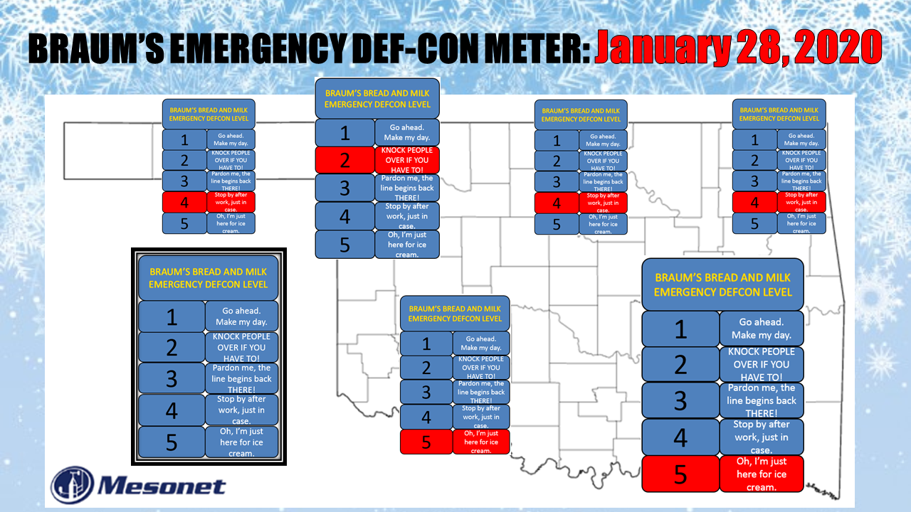
Okay, the forecast models have done gone and did it now (you can parse all that
questionable english out later, as well as figuring out if I should capitalize
"english")! Very reminiscent of that storm that left 13 inches of snow in
Ellis County back in October, we have another somewhat potent little storm
system approaching the state that the forecast models say might dump a very
localized band of heavy snow across that general vicinity. There is at least
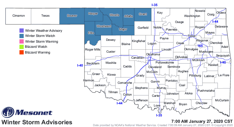
enough agreement amongst the various forecast models that the NWS has issued a
winter storm watch for the far NW region of the state.
And here are the takes from the local NWS forecast offices.
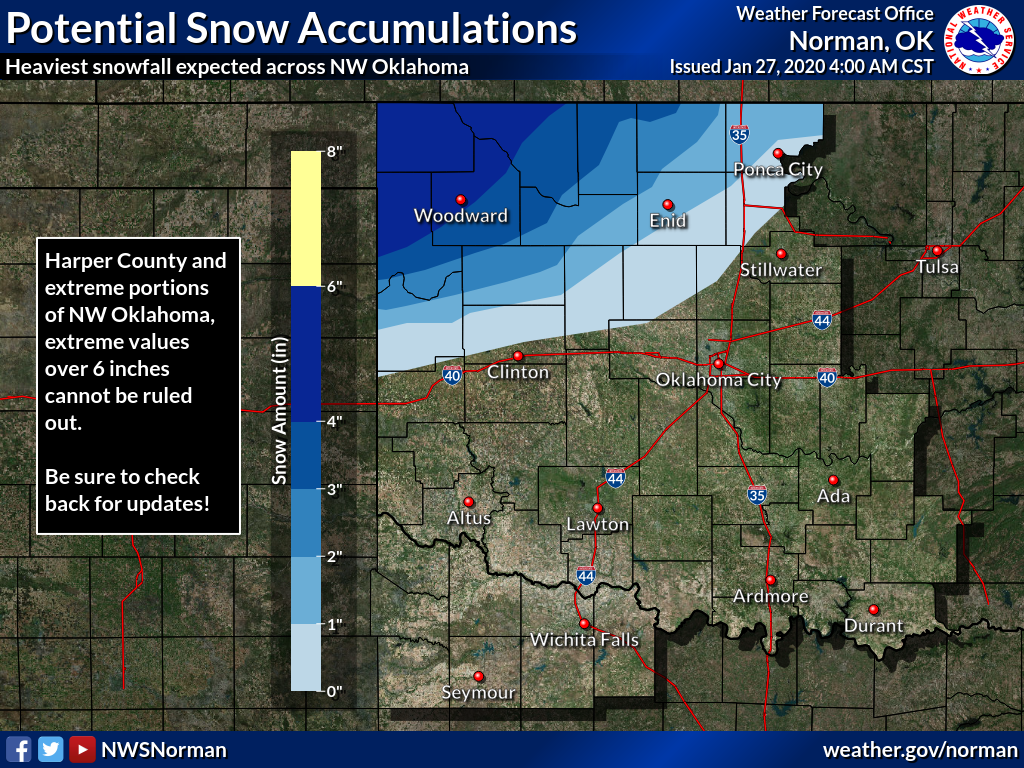
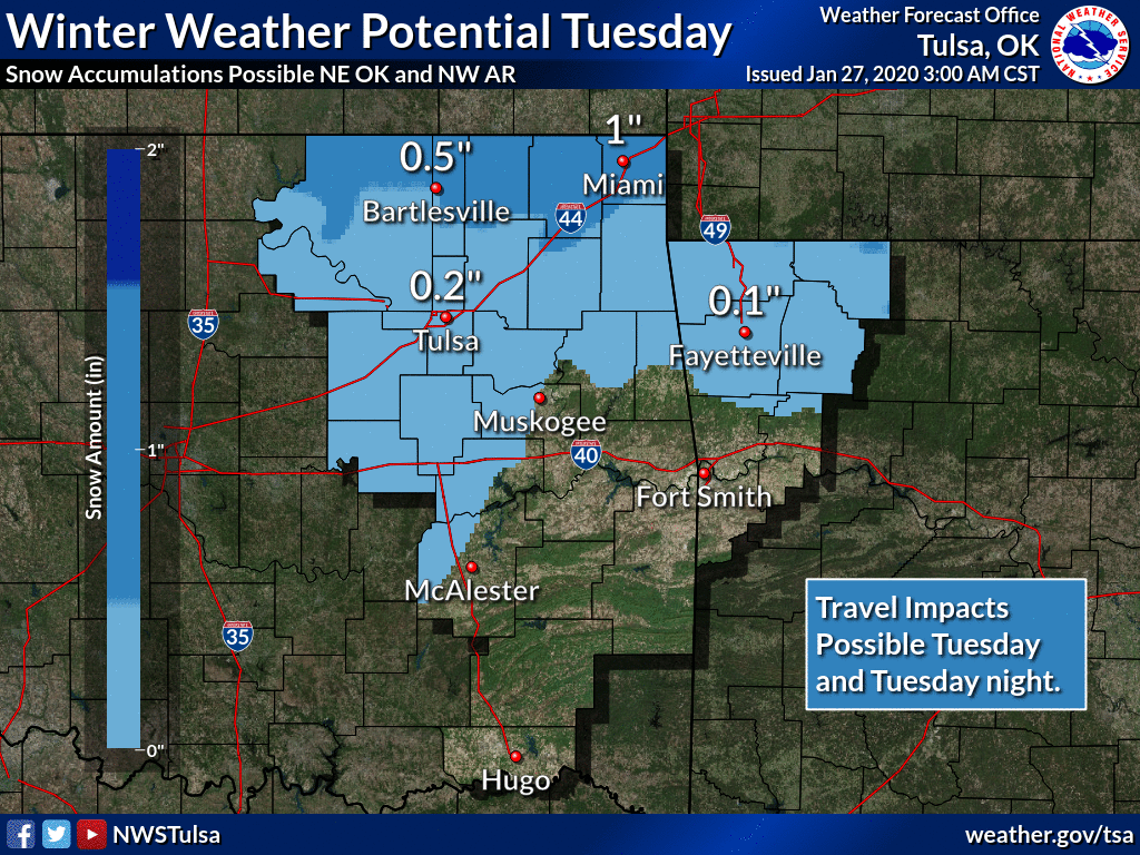
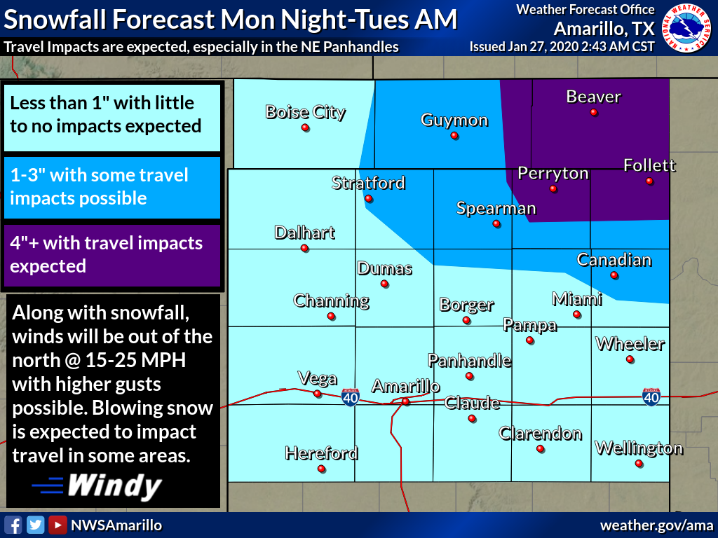
But it's a winter storm WATCH. And we're dealing with some uncertainties still
just about 18 hours before the action is set to begin. One thing is we're not
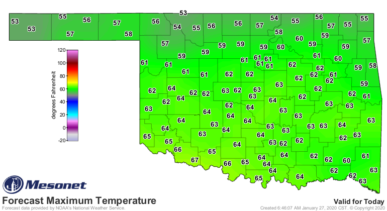
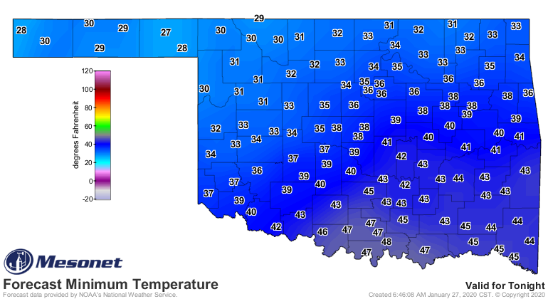
dealing with a large pool of arctic air here. Temperatures are barely going to
remain in the snow-producing zone with highs today in the 50s and 60s before
a quick chill down to the lower 30s -- maybe some upper 20s -- overnight
into tomorrow morning. We also have to remember our lesson from a couple of
weeks ago about evaporative cooling, which may aid the snow production and
anti-meltage factors for this system.
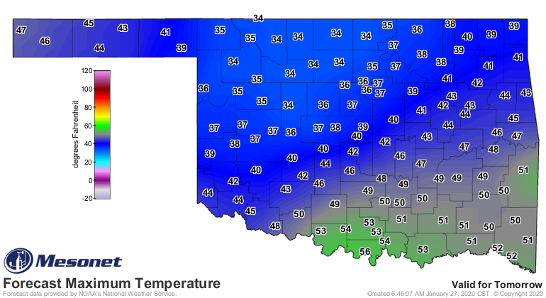
Given the moist nature of this storm system and the temperatures barely below
freezing, watch out for a robust heavy wet snow band setting up somewhere in
the NW, from the Texas Panhandle to SW KS, traversing Oklahoma. It will
definitely be enough to have significant impacts if this does come to fruition.
Speaking of fruit, watch out if the unusually warm weather we've had since
late November have left your trees wondering if they should peek out for spring
for awhile and have some green foliage sprouting. That would make for a good
heavy wet snow suspension system with some broken branches a possible outcome.
That's how we lose power sometimes.
Now away from that area, it does appear there will be enough warm air to
provide yet another miserable-and-boring cold rain with totals of over an inch
possible in some areas.
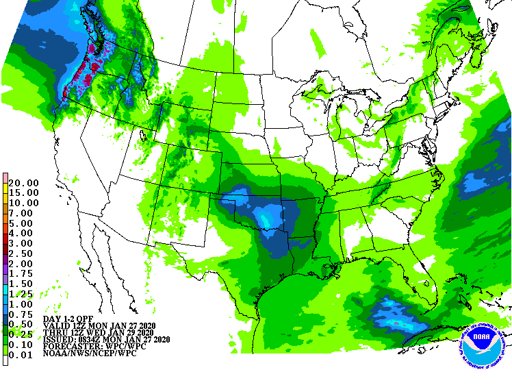
Nothing would shock me too much, however, save for lightning which I understand
is quite shocking. Don't be surprised, at least too badly, if some of that snow
cover manages to sneak farther to the west east or south. In that case, the
NWS could possibly expand those winter weather watches and warnings just a bit.
So tomorrow's weather is concerning for NW OK. Might be a good day to curl up
on the couch with a good book, or even curl up a good book on the couch.
If you manage to curl up your couch on a good book, send pics.
Gary McManus
State Climatologist
Oklahoma Mesonet
Oklahoma Climatological Survey
(405) 325-2253
gmcmanus@mesonet.org
January 27 in Mesonet History
| Record | Value | Station | Year |
|---|---|---|---|
| Maximum Temperature | 84°F | ALV2 | 2015 |
| Minimum Temperature | 0°F | KENT | 2009 |
| Maximum Rainfall | 3.39″ | SALL | 2009 |
Mesonet records begin in 1994.
Search by Date
If you're a bit off, don't worry, because just like horseshoes, “almost” counts on the Ticker website!