Ticker for January 28, 2020
MESONET TICKER ... MESONET TICKER ... MESONET TICKER ... MESONET TICKER ...
January 28, 2020 January 28, 2020 January 28, 2020 January 28, 2020
BEAST MODE!
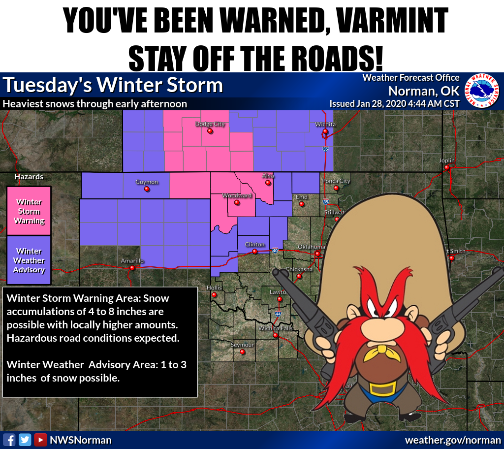
As forecast (ahem!), the winter storm is hitting NW OK hard right now. Snow bands
are set up across the Panhandles through SW KS, and reports from the field say
large half dollar sized flakes are falling throughout the area. Seven inches of
snow was reported from Hooker and Turpin, with drifts of over a foot. Blowing
snow had reduced visibility down to nothing. Needless to say, not a day to be
out on the roads in NW OK. I've even heard the basketball games between Buffalo
and Laverne are cancelled! When you cancel rivalry games like that, you know
it's serious.
Here are some graphics from out local NWS offices to help us make sense of this
mess.

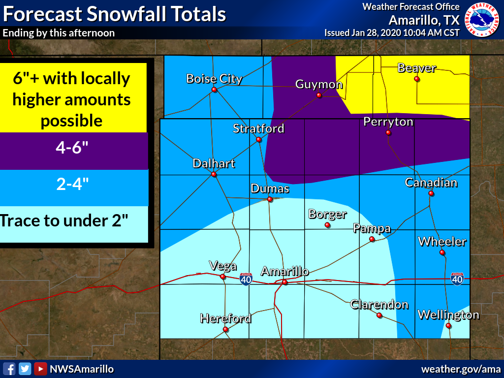
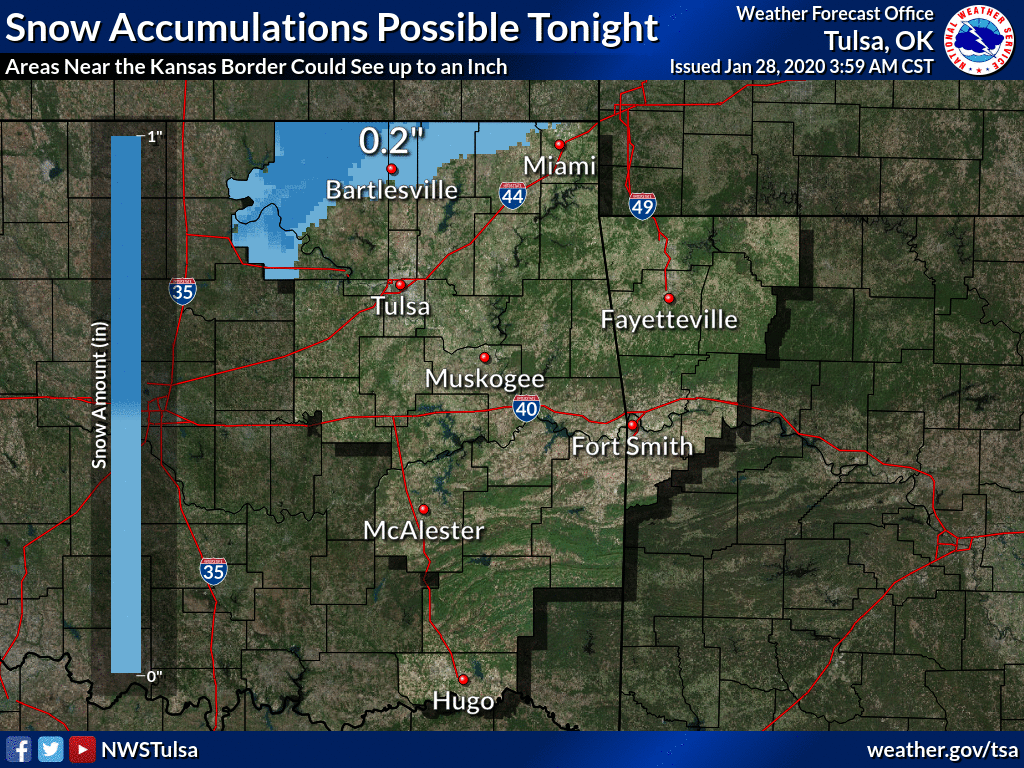
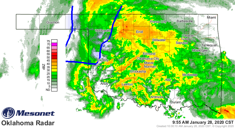
Now for the rest of us (no, not Festivus), just a dreary, cold rain to keep
moving January up the record books. As of now, we're on pace for a top-10 finish
for wet Januaries. This ain't getting any better soon, but at least it is
helping to stamp out that drought across SW OK.
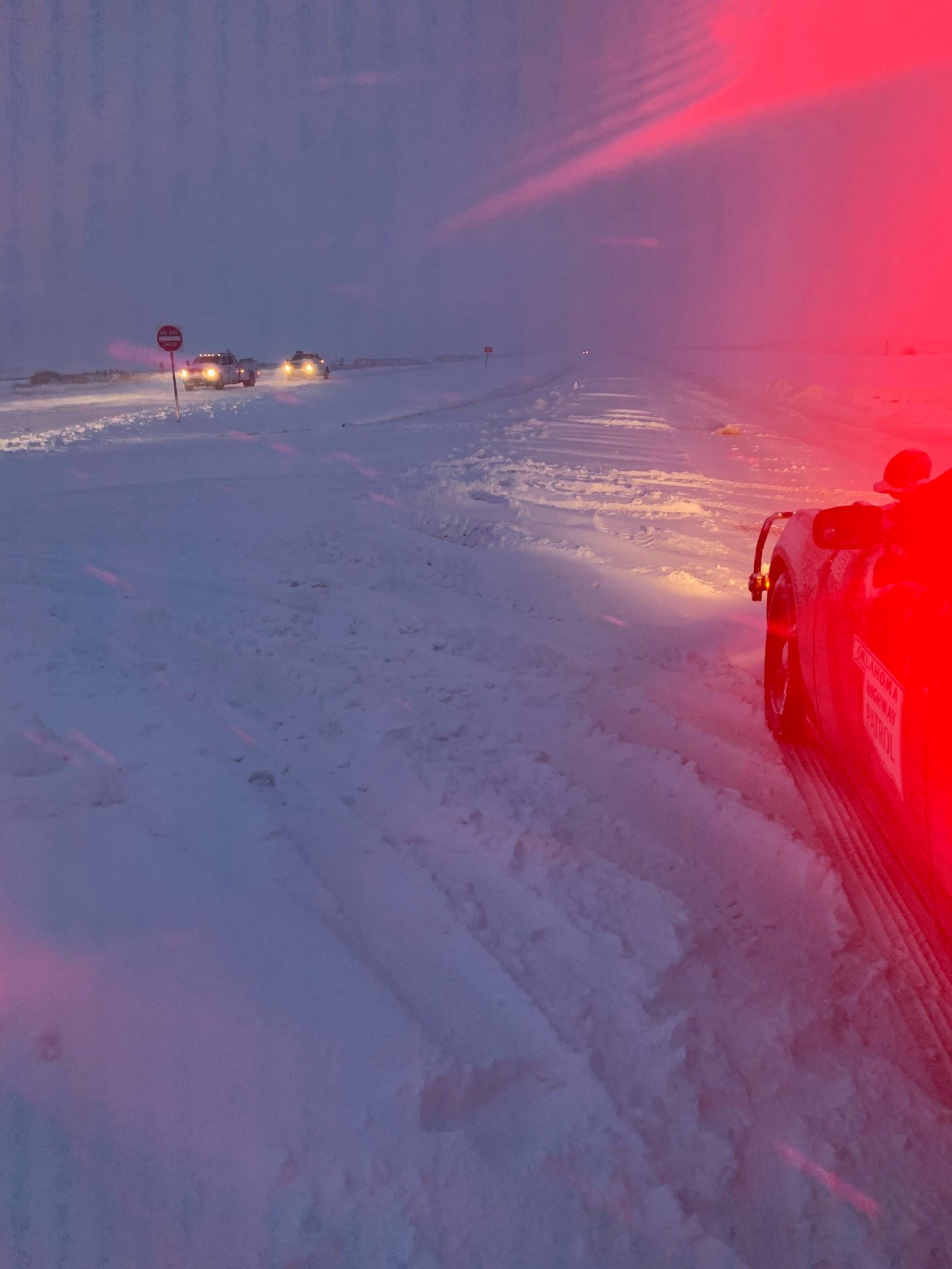
Now it's time for everybody to stay safe. Not only with the slipper stuff out
west, but with the wet roadways across the rest of the state. This pic from
this morning near Hooker should help persuade ya, or make you intensely
jealous (come on, you know who you are!).
Gary McManus
State Climatologist
Oklahoma Mesonet
Oklahoma Climatological Survey
(405) 325-2253
gmcmanus@mesonet.org
January 28 in Mesonet History
| Record | Value | Station | Year |
|---|---|---|---|
| Maximum Temperature | 83°F | MANG | 2015 |
| Minimum Temperature | -1°F | BUFF | 2009 |
| Maximum Rainfall | 2.87″ | TIPT | 2010 |
Mesonet records begin in 1994.
Search by Date
If you're a bit off, don't worry, because just like horseshoes, “almost” counts on the Ticker website!