Ticker for January 23, 2020
MESONET TICKER ... MESONET TICKER ... MESONET TICKER ... MESONET TICKER ...
January 23, 2020 January 23, 2020 January 23, 2020 January 23, 2020
Drought Interruptus
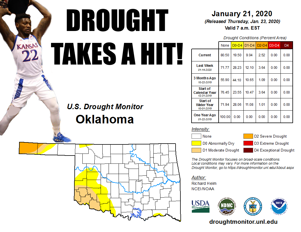
FINALLY, drought in southwest Oklahoma takes a hit. After months and months (and
months) of precipitation events avoiding that area like the Dallas does the Super
Bowl, enough rain (and freezing rain and snow) has fallen to put a
dent in those brown and red colors.
Yeah, read it again...I took a shot at the Dallas Cowboys. Hey, I'm trying to be
timely!
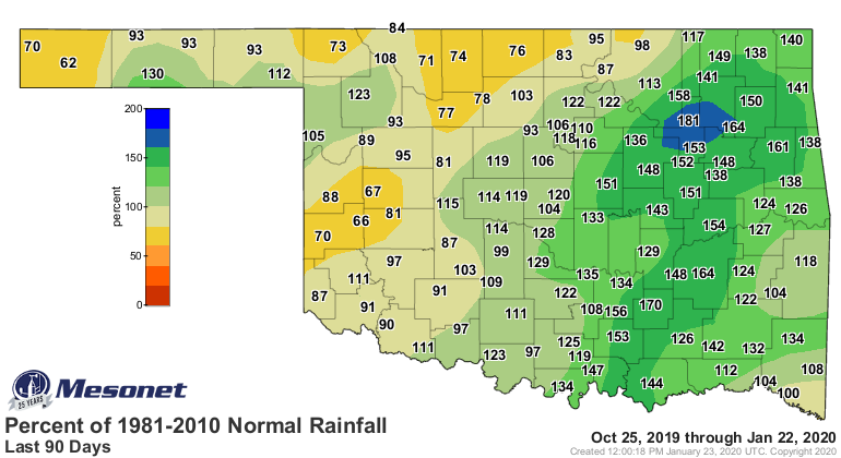
Anyway, if you take a look at the percent of normal rainfall maps from the
Mesonet, you can plainly see how the fortunes have turned over the last 30-60
days. Now when you get longer out...90-120 days, the basis for the continued
moderate drought becomes clear. And the Panhandle drought is plain to see as
well. I'll throw the total maps on there as well so you can see the, uhhhhh,
totals. They're not that hefty, but considering the time of the year, they're
enough.
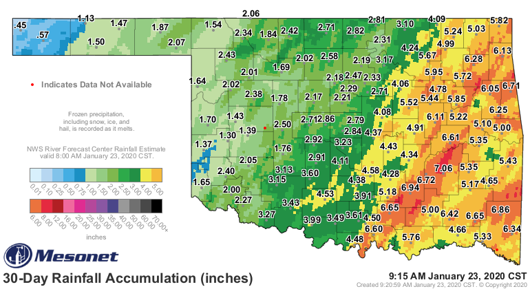
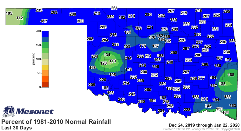
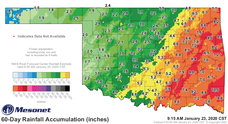
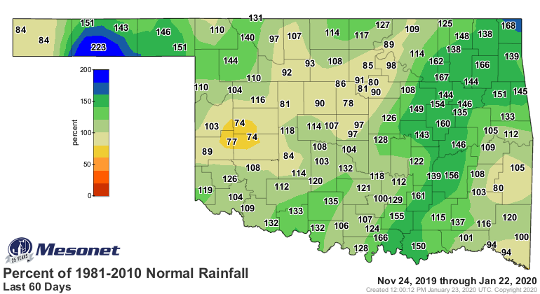

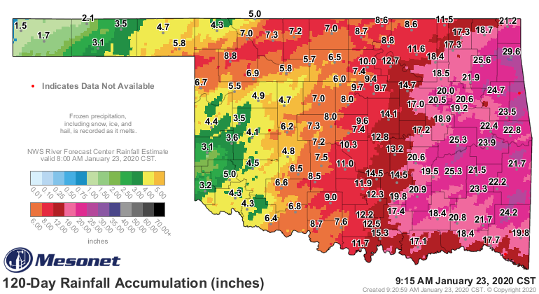

So 200% of normal in western Oklahoma in during a 30-day period on the winter
isn't that impressive on the totals map, but it darned sure is relative of
what you could normally expect for this time of year. Now one of the pressures
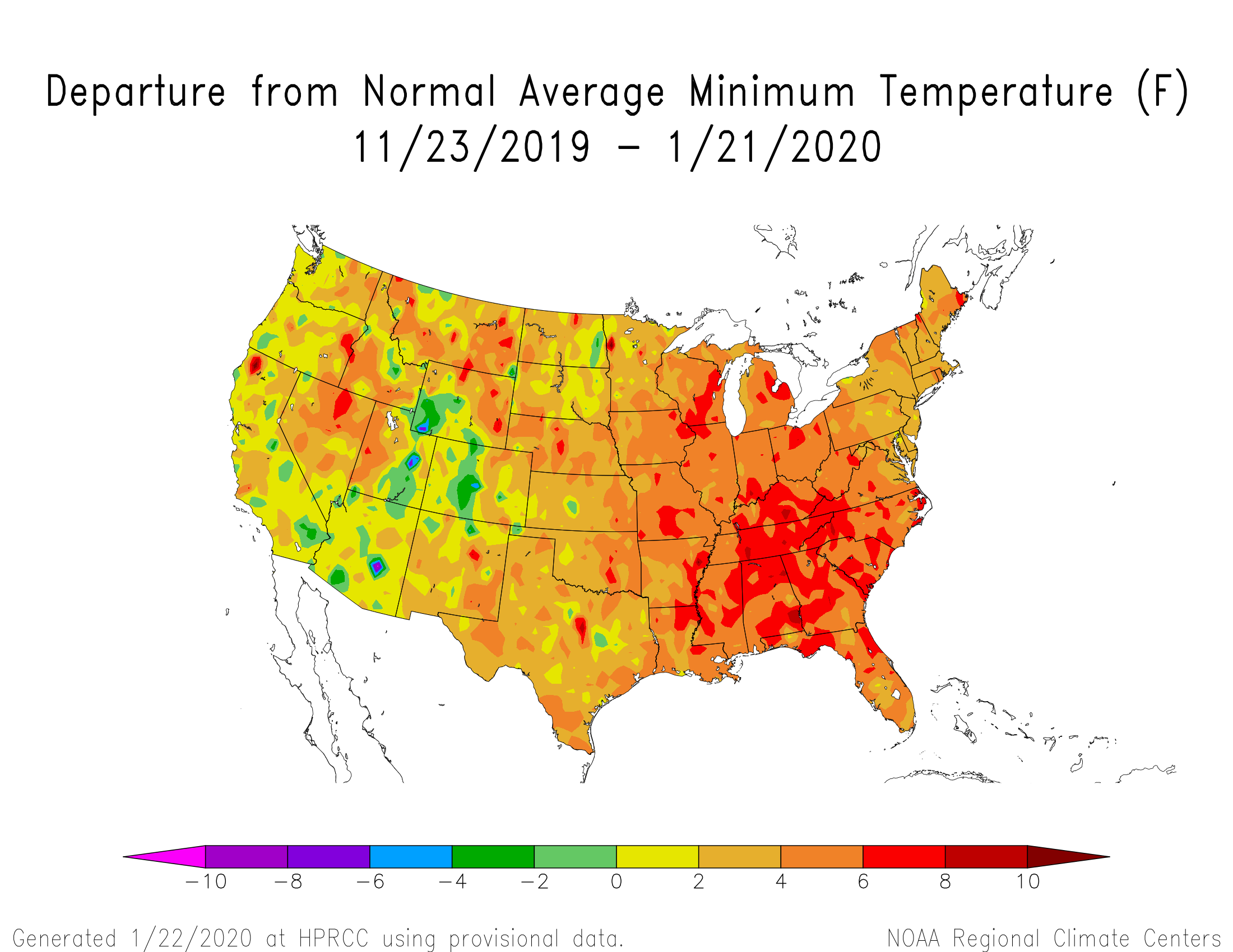
put on the moisture received this season is just how warm it has been since
early this winter...again, relative to normal. Check out the departure from
normal MAXIMUM temperature map for the last 60 days.

So much of the eastern half of the country, including Oklahoma, has seen high
temperatures some 4-8 degrees above normal. Low temperatures have been
similarly elevated.
Now we look ahead for more precipitation for more drought hits. There could be
a couple of more chances as we get into the weekend and then the middle
of next week. We'll wait a few days before we get too excited, but to throw a
bit of lukewarm water on any snow lovers out there...still not much cold air
showing up.
Gary McManus
State Climatologist
Oklahoma Mesonet
Oklahoma Climatological Survey
(405) 325-2253
gmcmanus@mesonet.org
January 23 in Mesonet History
| Record | Value | Station | Year |
|---|---|---|---|
| Maximum Temperature | 78°F | WEBB | 2002 |
| Minimum Temperature | -3°F | HOOK | 2014 |
| Maximum Rainfall | 1.90 inches | STIG | 2002 |
Mesonet records begin in 1994.
Search by Date
If you're a bit off, don't worry, because just like horseshoes, “almost” counts on the Ticker website!