Ticker for January 21, 2020
MESONET TICKER ... MESONET TICKER ... MESONET TICKER ... MESONET TICKER ...
January 21, 2020 January 21, 2020 January 21, 2020 January 21, 2020
Blah
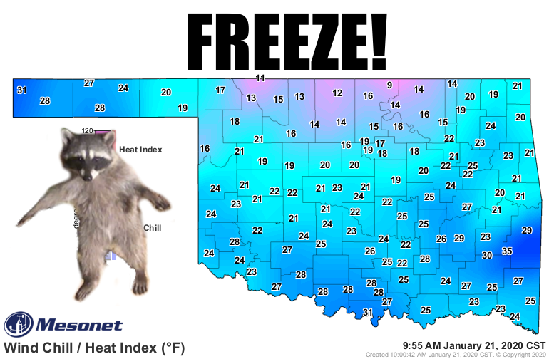
Hey, if this was the first system of the season, this might be a big deal: CHANCE
OF A RAIN/SNOW MIX? Wow, count me in! But now...blah. After the near misses and
wide misses and actual hits from frozen precip thus far, this is just another
chance for some not-so-exciting wintry weather. Might not even get a winter
weather advisory out of this one.
Blah.
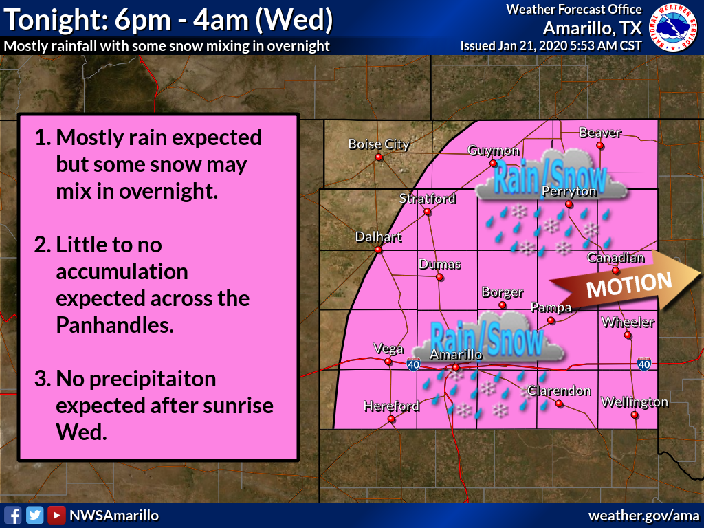
Here are some graphics from our local NWS offices telling us what to expect from
out latest weather producer.
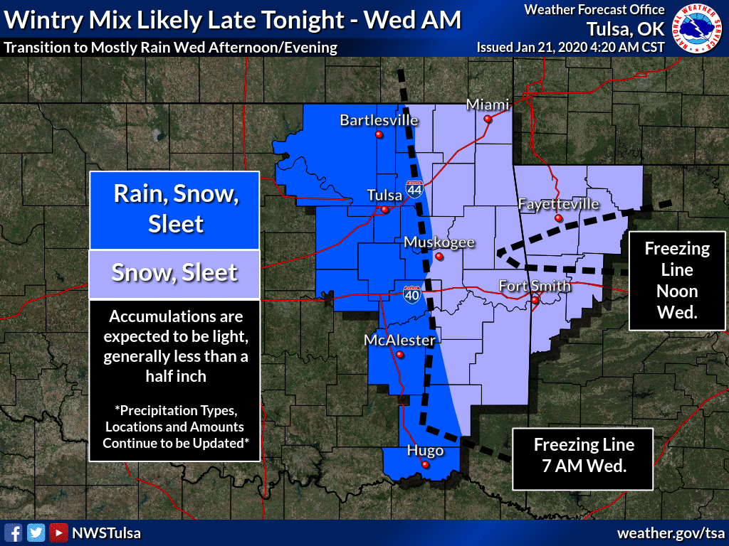
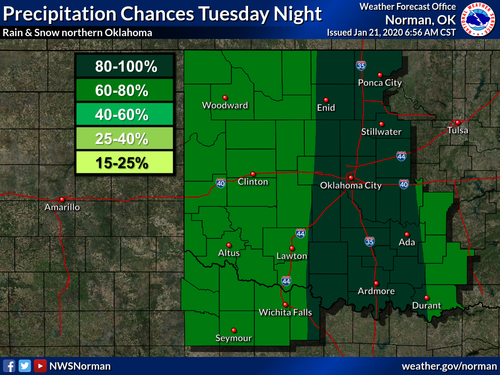
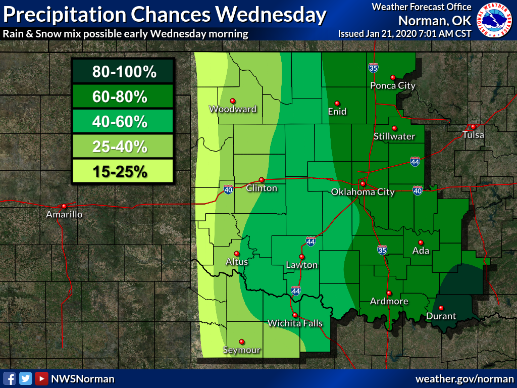

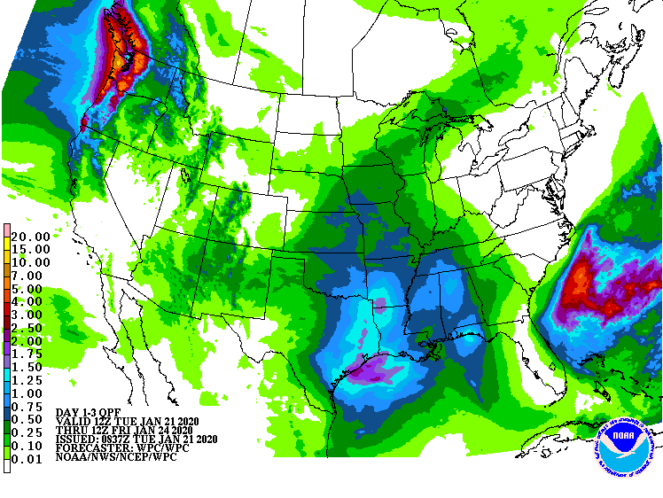
Forecast amounts aren't too exciting either, especially in SW OK and the
western Panhandle where they still need a good dose. And eastern OK probably
doesn't need any at all.
We're gonna leave it there. Nothing else exciting showing up just yet either. A
few minor systems over the next week, and occasionally cold befitting January
in Oklahoma.
Blah blah blah.
Gary McManus
State Climatologist
Oklahoma Mesonet
Oklahoma Climatological Survey
(405) 325-2253
gmcmanus@mesonet.org
January 21 in Mesonet History
| Record | Value | Station | Year |
|---|---|---|---|
| Maximum Temperature | 78°F | WOOD | 2005 |
| Minimum Temperature | -17°F | BEAV | 2025 |
| Maximum Rainfall | 3.48″ | CLOU | 2018 |
Mesonet records begin in 1994.
Search by Date
If you're a bit off, don't worry, because just like horseshoes, “almost” counts on the Ticker website!