Ticker for January 16, 2020
MESONET TICKER ... MESONET TICKER ... MESONET TICKER ... MESONET TICKER ...
January 16, 2020 January 16, 2020 January 16, 2020 January 16, 2020
Brand new invention
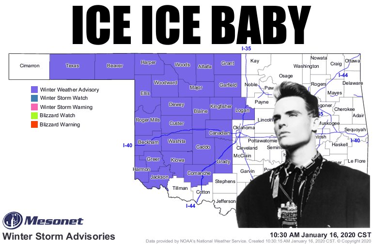
Ice. The worst of all precipitation types, save for frozen milk duds. But let's
be honest, after they hit and and it hurt, you could at least eat them to feel
better. From what I can tell, it's gonna be a slippery, slidery (don't bother to
look it up, it's not a word) afternoon and evening across much of western
Oklahoma (hence the winter weather advisory pictured above). We're just waiting
for this dry layer of air between the clouds and ground to moisten up so the
precipitation will stop evaporating on the way down. There is still some
uncertainty about the vertical temperature profile, which goes a long way to
determining whether your slipping, sliding, or splashing. Remember this graphic
I've showed before? It still holds sway here.
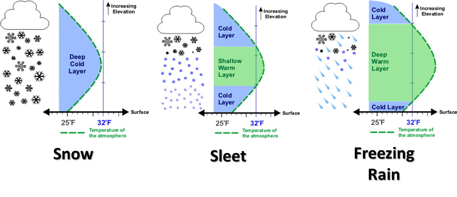
Not pictured there is just a plain cold rain. That can occur if there is enough
warm air in that temperature profile to melt any frozen precip, then the lowest
layer remains above freezing. Now one thing I've learned to not underestimate is
the amount of cooling that can occur when that precip falls and then evaporates
in a dry layer, like near the ground. When it evaporates, it cools the surrounding
air. Then all of a sudden your 34 degrees becomes 32 or 31 degrees and you're
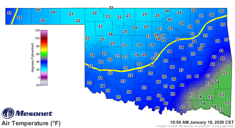
wondering why you are sitting in the ditch. You can see the air temperatures
now, and some areas of the state could be dancing around that 32 degrees line
throughout the day. If precipitation is occurring, it's time to be careful.
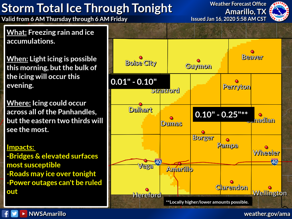
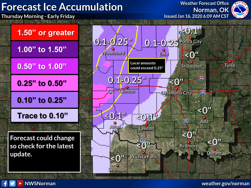
West central Oklahoma looks like it could get the most ice, but all of the
western half of the state should be on the lookout. The rest should be prepared
for a good dose of ice water.

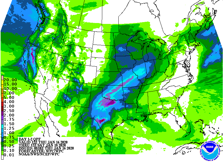
But it still looks like a good drink of water for much of the state...ice water
or not.
Collaborate and listen. Word to your meteorologist.
Gary McManus
State Climatologist
Oklahoma Mesonet
Oklahoma Climatological Survey
(405) 325-2253
gmcmanus@mesonet.org
January 16 in Mesonet History
| Record | Value | Station | Year |
|---|---|---|---|
| Maximum Temperature | 79°F | MANG | 2012 |
| Minimum Temperature | -15°F | VINI | 2024 |
| Maximum Rainfall | 2.43 inches | ALTU | 2004 |
Mesonet records begin in 1994.
Search by Date
If you're a bit off, don't worry, because just like horseshoes, “almost” counts on the Ticker website!