Ticker for December 9, 2019
MESONET TICKER ... MESONET TICKER ... MESONET TICKER ... MESONET TICKER ...
December 9, 2019 December 9, 2019 December 9, 2019 December 9, 2019
Now I have a cold front: HO HO HO
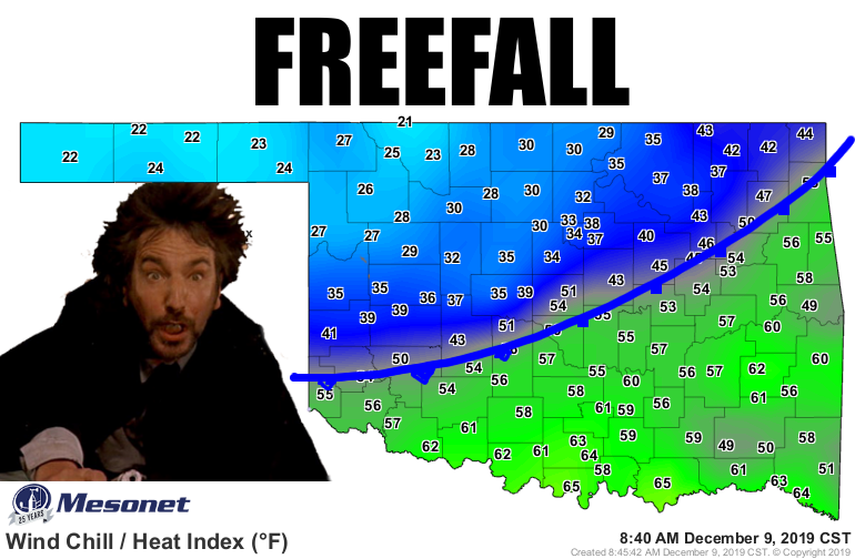
YIPPEE-KAI-YAY...well, in the interest of further employment, we'll just leave it
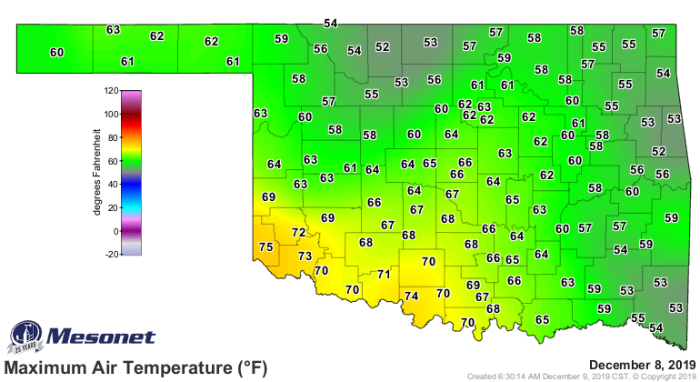
at that. Another mostly-dry cold front moving through the state, ending a somewhat
mild last couple of days behind. Heck, they got into the 70s in SW OK yesterday.
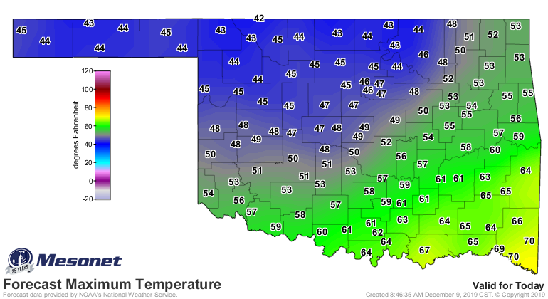
As the cold front moves through, prepare for a good 20-30 degrees drop in the
"feels like" temperature, and a 10-15 degrees drop in the actual air temps. Maybe
a bit of a warmup starting on Wednesday, continuing into the weekend. That huge
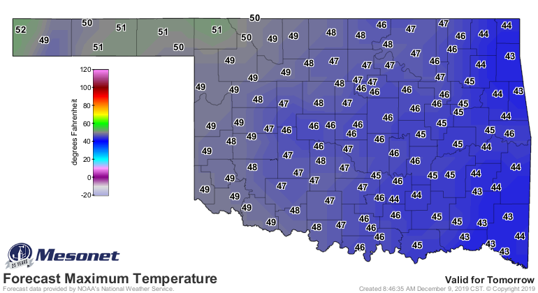
burst of cold air never materialized for the weekend, at least. The rest of today
and tomorrow look like, well...December.
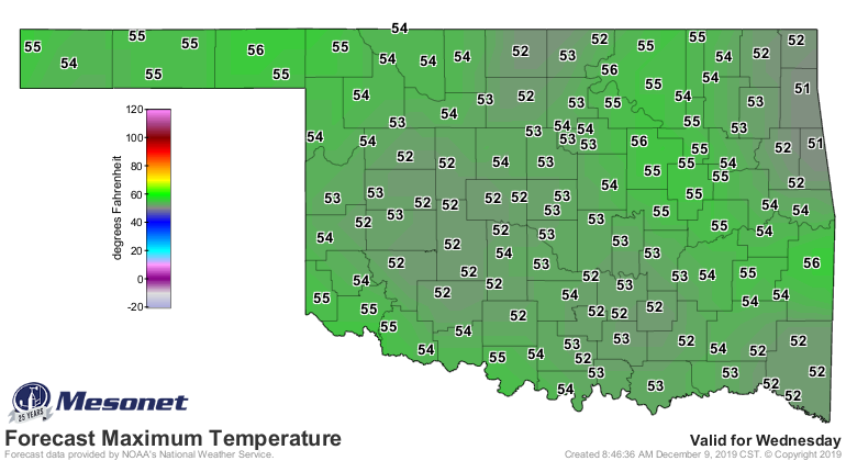
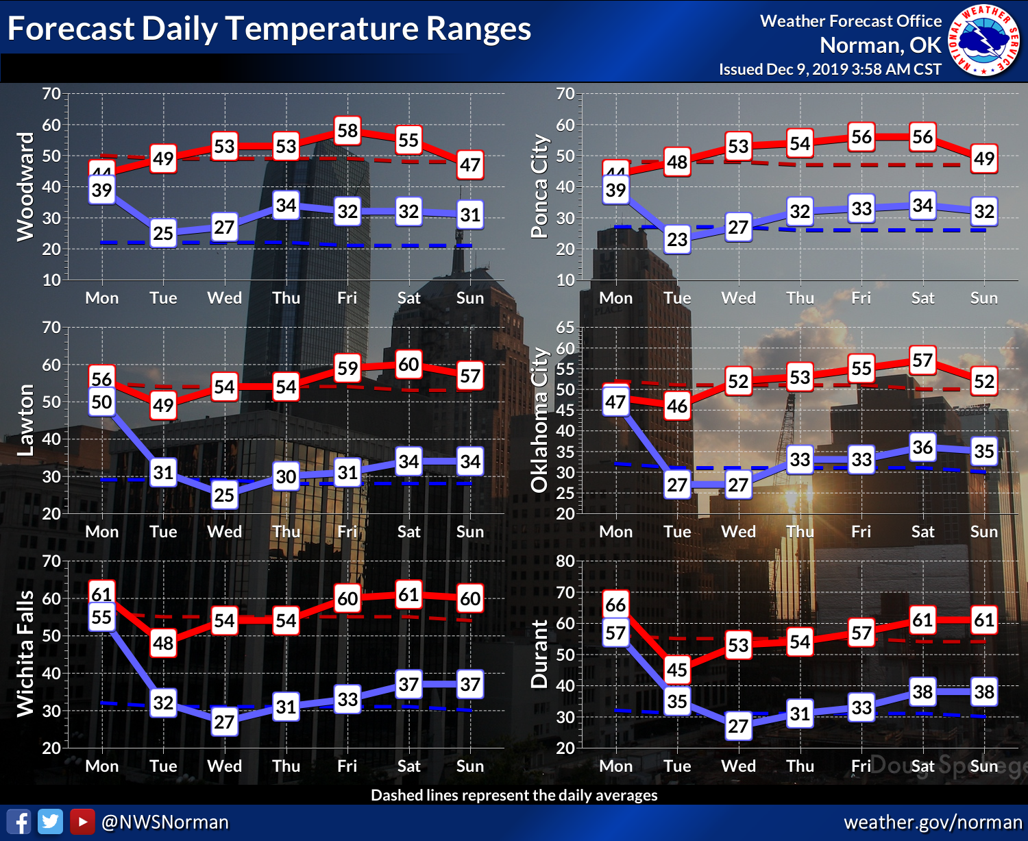
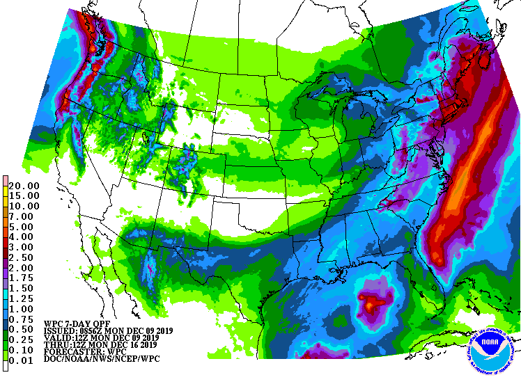
And if you're like me (best answer for yourself would be "I'm not") and the
inside of your nose has been drier than Boise City during the Dust Bowl, no
help from Mother Nature on the moisture front anytime soon, it appears.
Even next week looks warm for this time of year.
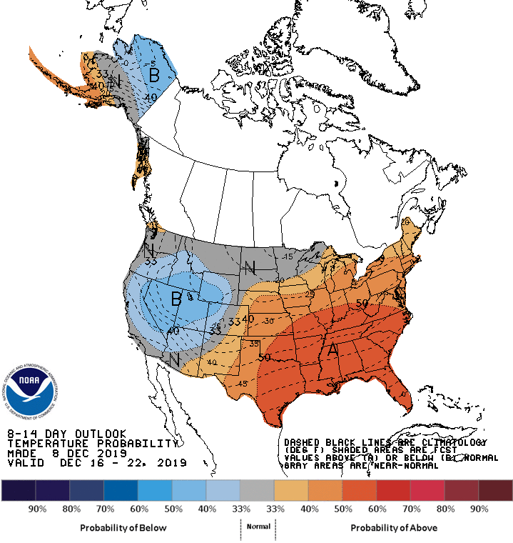
Santa's gonna be looking at putting wheels on the old sleigh at this rate.
Gary McManus
State Climatologist
Oklahoma Mesonet
Oklahoma Climatological Survey
(405) 325-2253
gmcmanus@mesonet.org
December 9 in Mesonet History
| Record | Value | Station | Year |
|---|---|---|---|
| Maximum Temperature | 82°F | BURN | 2021 |
| Minimum Temperature | -7°F | VINI | 2005 |
| Maximum Rainfall | 2.51″ | JAYX | 1999 |
Mesonet records begin in 1994.
Search by Date
If you're a bit off, don't worry, because just like horseshoes, “almost” counts on the Ticker website!