Ticker for November 25, 2019
MESONET TICKER ... MESONET TICKER ... MESONET TICKER ... MESONET TICKER ...
November 25, 2019 November 25, 2019 November 25, 2019 November 25, 2019
Black Cloud Friday
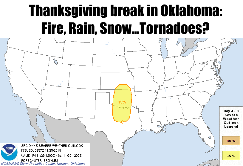
Why bury the lead? I didn't see this coming, but lo and behold, there it is. SPC
has put a 15% severe threat on their Day 5 outlook. Not momentous, really, but
even for spring that's a telling sign. I'll just go ahead and put their pertinent
info, fresh from their forecast discussion:
"By Friday afternoon, an axis of moderate
instability is forecast to develop from the Texas Hill Country
northward to near the Oklahoma-Kansas state line. Thunderstorms
should develop along the dryline and move quickly northeastward
across the southern Plains during the late afternoon and early
evening. A severe threat appears probable with this activity. The
strong deep-layer shear should support supercell development. A
potential for all hazard types will exist with tornadoes, large hail
and wind damage possible. The models are in much better agreement
this cycle."
Well that'll put some grit in your leftover turkey sandwich! Black Friday indeed.
All severe modes are possible. Something to watch out for in your search for
shopping deals. Stay discount AND WEATHER aware.
Before we get there, however, we have other exciting news to account for. First
on Tuesday, with winds gusting from 50-65mph and lots of dead vegetation out
there, low humidity and a bit of warmth, watch out for fire danger. Any spark
could quickly get out of control and put a damper on your Thanksgiving holiday.
No test-firing the turkey fryer on Tuesday, please.
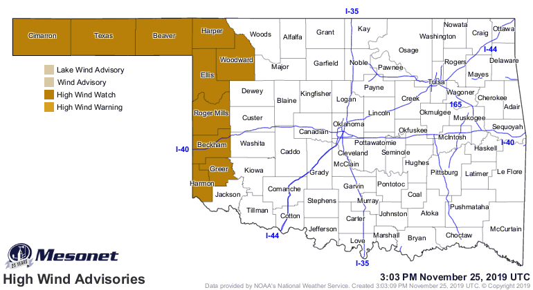

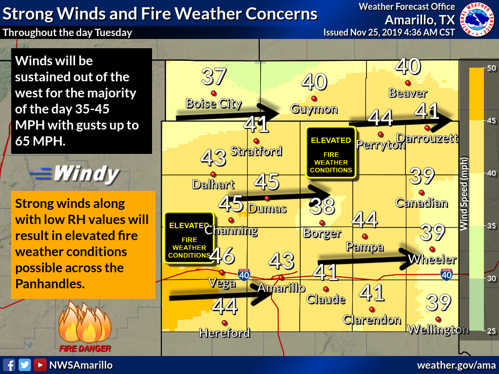
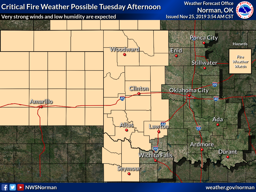
Then we get a cold front Tuesday night, and then later on Wednesday/Thanksgiving
a chance of rain/snow/freezing rain. Travel across NW OK late Wednesday night
into Thanksgiving morning might be a bit treacherous; wet elsewhere.
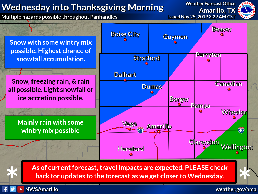
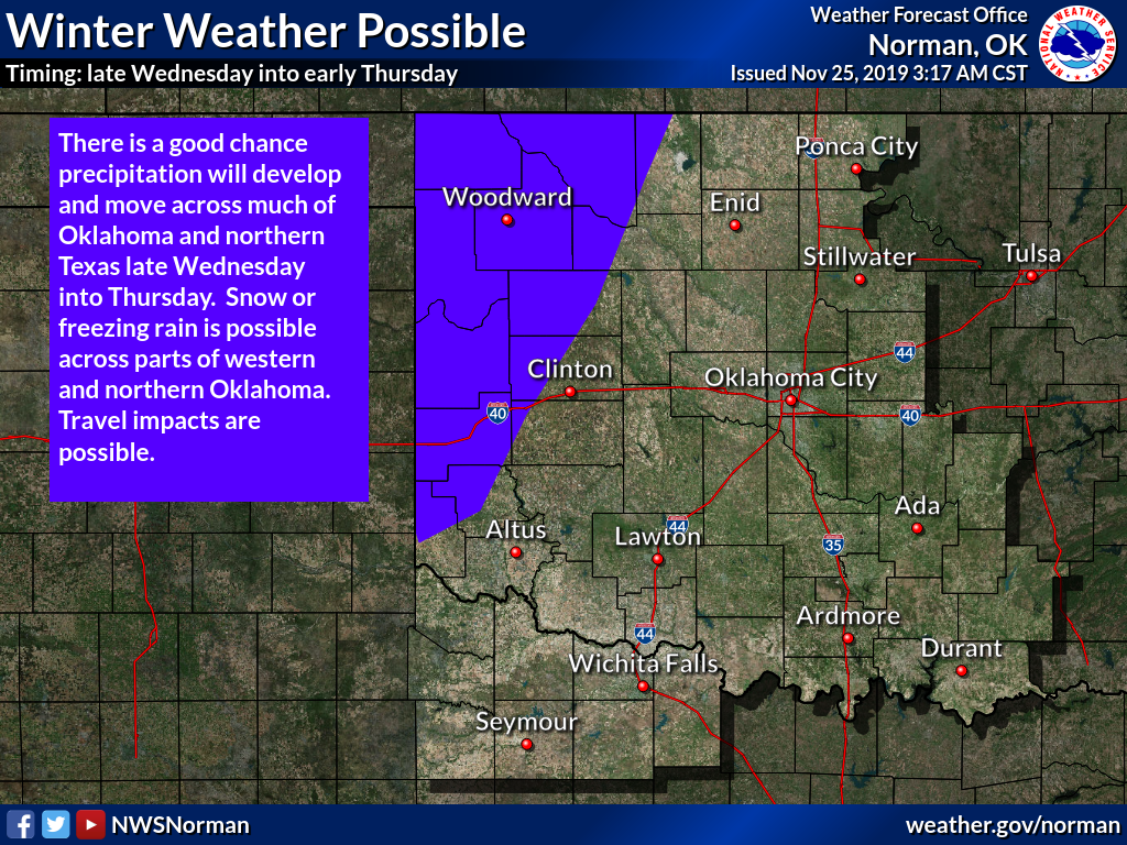
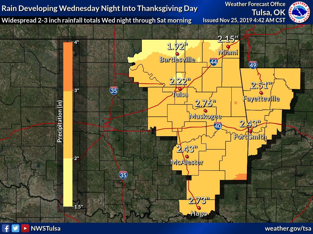
Then we get to the severe threat on Friday with a strong jet stream overhead,
lots of moisture return from the Gulf of Mexico, and a storm system rotating
through providing the impetus for storms.
What more can I say? Enjoy your Thanksgiving break!
Gary McManus
State Climatologist
Oklahoma Mesonet
Oklahoma Climatological Survey
(405) 325-2253
gmcmanus@mesonet.org
November 25 in Mesonet History
| Record | Value | Station | Year |
|---|---|---|---|
| Maximum Temperature | 78°F | WAUR | 2012 |
| Minimum Temperature | 6°F | HOOK | 2023 |
| Maximum Rainfall | 1.59″ | EUFA | 2010 |
Mesonet records begin in 1994.
Search by Date
If you're a bit off, don't worry, because just like horseshoes, “almost” counts on the Ticker website!