Ticker for November 21, 2019
MESONET TICKER ... MESONET TICKER ... MESONET TICKER ... MESONET TICKER ...
November 21, 2019 November 21, 2019 November 21, 2019 November 21, 2019
Days of Bread and Milk

It's been a couple of days since we all tocked, and what better way to break the
frozen water than with our first EMERGENCY BRAUM'S DEF-CON METER of the year?
Yeah, we blew our chance with the October 24th record snowfall up in NW OK (I
would say we were washing our hair, but, you know...ain't none left to wash!),
and today's snowstorm (ahem!) doesn't look too bad. But October 24th's didn't
either. So with today's cold front ruining the lovely spring-y weather we had
-- could have said "fall," but we're ready for spring already -- the folks in
the western Panhandle are gonna be slip-sliding away. 3+ inches isn't much for
those folks, we went ahead and put them in a DEF-CON 3 level. NW OK gets a 4
just in case. No sense in being out in it, so get your emergency bread and milk
rations now.
Now on to more nonsense. That front is barrelling through the state as we speak,
dropping temperatures from the 60s into the 30s and 40s. Wind chills are even
lower, of course. OH THE HUMANITY!
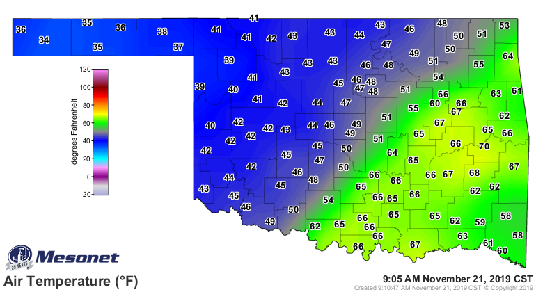
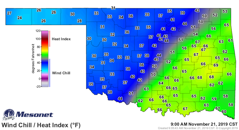
With rain (and snow) arriving later, watch for a pretty miserable day to shape
up as we get later and later into it.
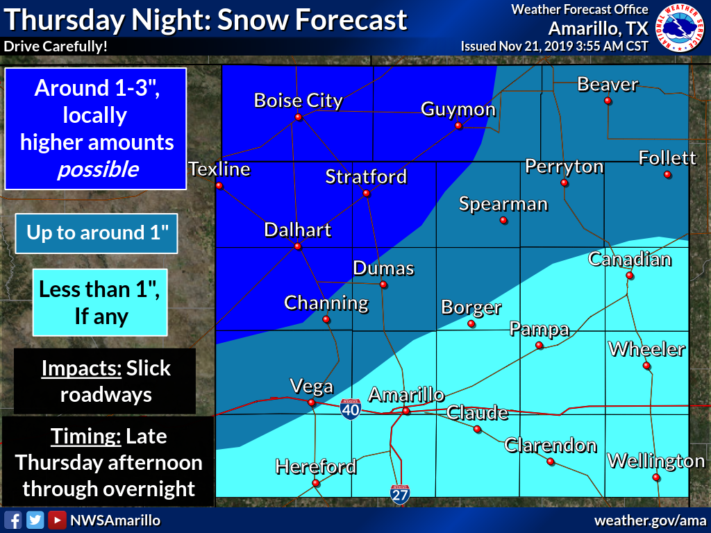
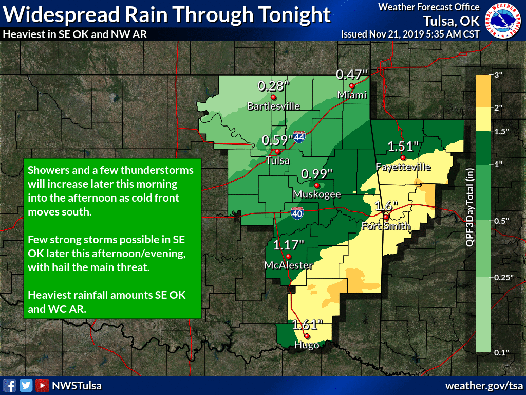
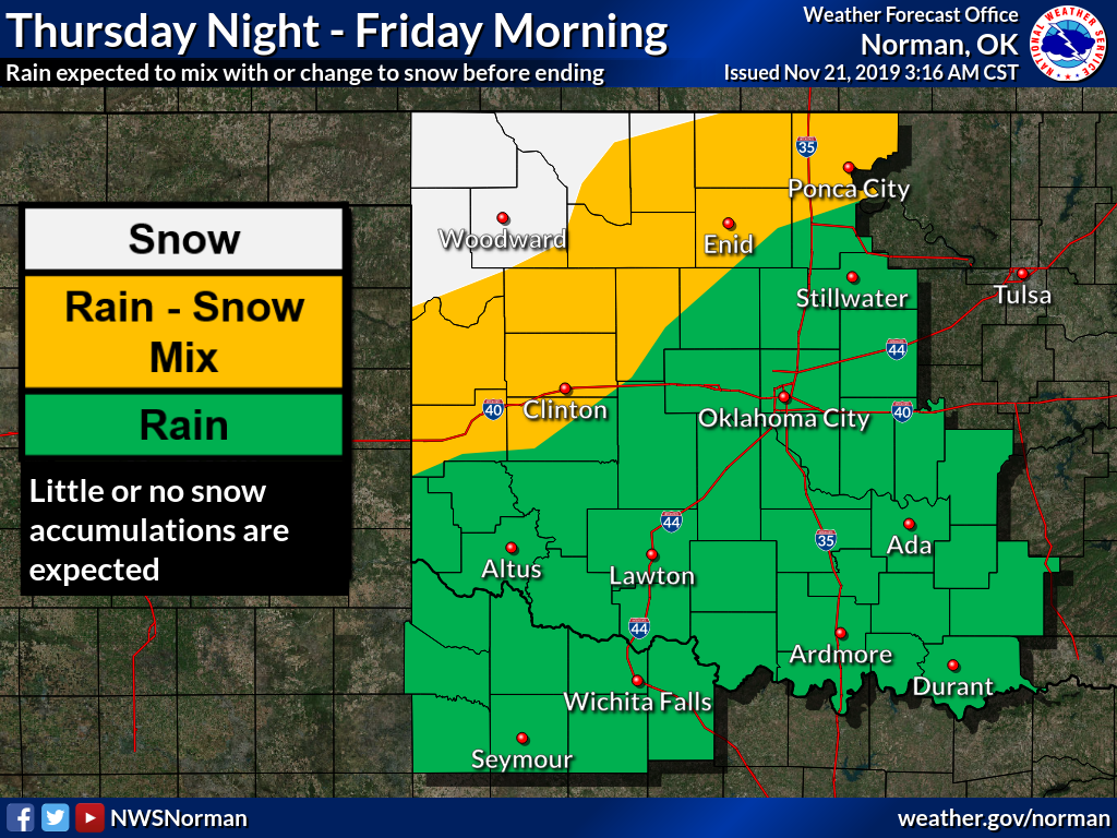
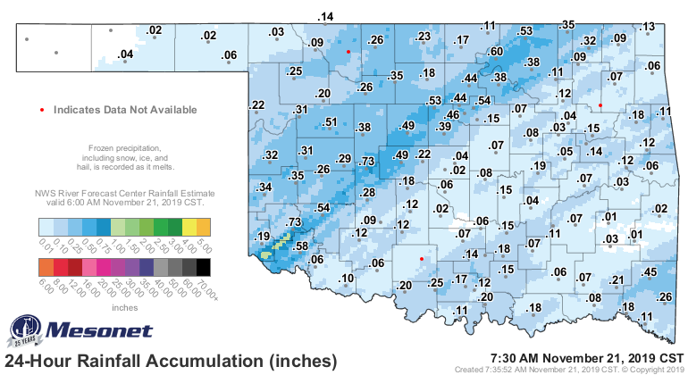
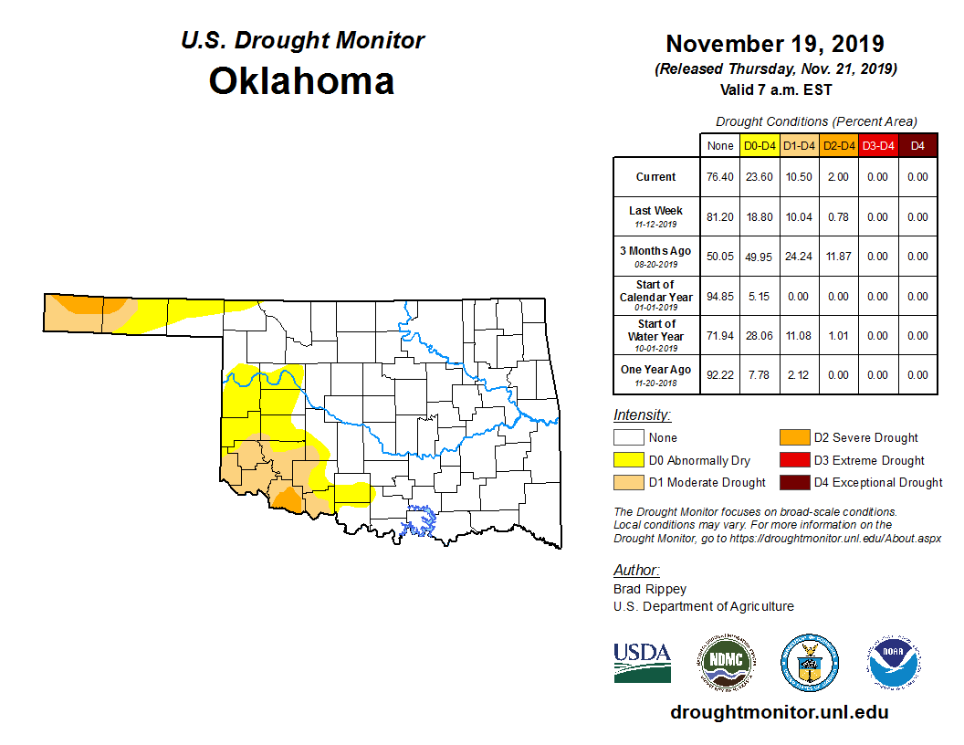
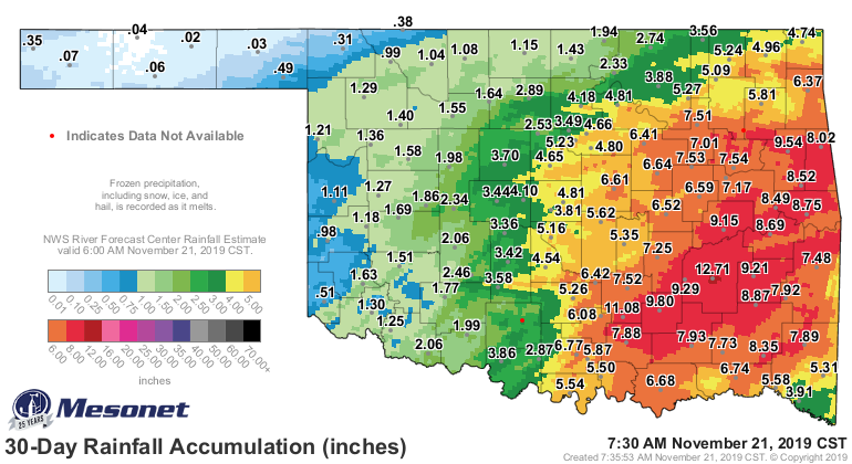
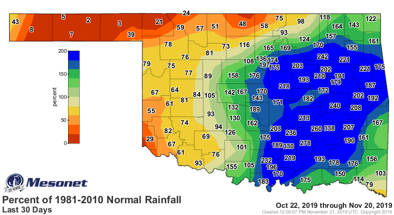
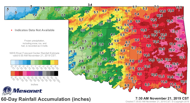
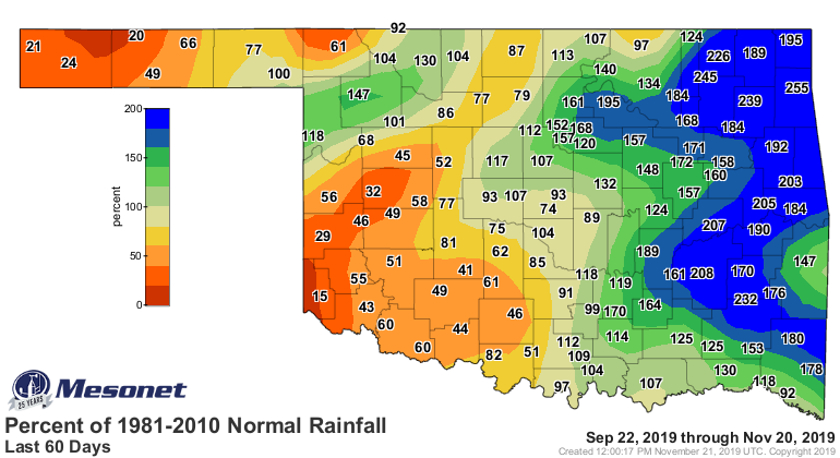
We do need the rain (AND SNOW...come on, keep up!) since that drought is still
going strong out across the Panhandle and the SW quarter of the state. We got
a bit of moisture in those areas, but not nearly enough to quench the areas'
thirst. Especially when we look out to the deficits we see 30-60 days.
Following today and tomorrow's mess, watch for temperatures to even out into
the 50s and 60s. Maybe a front next week to cool down Thanksgiving. There is
still a lot of uncertainty about next week's weather pattern however, so we'll
hold off on giving the all clear just yet.
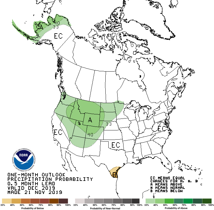
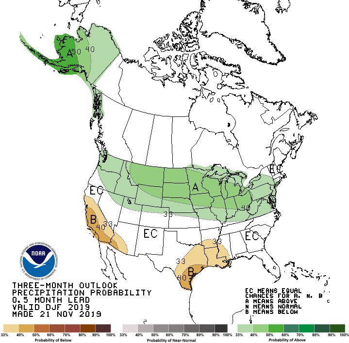
How about farther out? The Climate Prediction Center has released their December
and December-February outlooks for temperature and precipitation. And drought.
What do they show? Really the only signal they see would be increased odds of
above normal temperatures across the entire state. Precip gets the dreaded
"EQUAL CHANCES" of above-, below-, and near-normal. THAT DOESN'T MEAN NORMAL IS
EXPECTED! It means, given the lack of evidence to tip the odds in any direction,
it's just as likely to be above or below normal, along with "normal."
*normally I wouldn't talk so much about normal, but there's nothing normal about
out normal weather...or me*
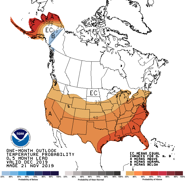

Funny, they keep saying "warmer than normal." I don't think they know what that
means. Still waiting for the "warmer than normal" November to pan out, last
few days notwithstanding.
Now in the absence of any strong climate signal, like a significant ENSO
episode (la nina, el nino), the confidence on these outlooks isn't as great as
they could be. The equatorial sea surface temperatures down on the pacific are
ENSO-neutral, and they're favored to stay that way through the winter. At least
part of the reason for the warm outlook is that's just the way temperatures
have trended over time. When the new 30-year normals come out in 2021, which
will be based off of the 1991-2020 period, we'll see an adjustment and possibly
less "above normal" outlooks for a bit. Losing the cooler 1981-1990 period and
replacing it with the much warmer 2011-2020 period will be somewhat significant,
possibly. Something to think about.
These outlooks don't say much about the possibility of snow. Take that Oct. 24th
snowstorm as an example. It takes just the perfect ingredients coming together
to get a snowstorm. Gotta have the moisture available, the cold air at the
surface and vertically in the atmosphere, etc. These broad outlooks don't take into
account the day-to-day weather conditions in which these extreme events can
occur.
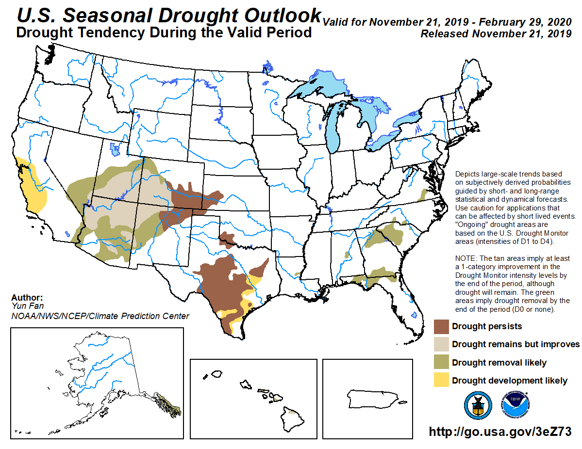
With those outlooks, and drought already in place, there is no reason to forecast
either drought reduction or new development in the state, so the CPC seasonal
drought outlook through February 29 is for persistence of the current drought
areas.
Okay, we ticked. We tocked. Time to hunker down until spring.
Gary McManus
State Climatologist
Oklahoma Mesonet
Oklahoma Climatological Survey
(405) 325-2253
gmcmanus@mesonet.org
November 21 in Mesonet History
| Record | Value | Station | Year |
|---|---|---|---|
| Maximum Temperature | 82°F | WAUR | 2010 |
| Minimum Temperature | 11°F | KENT | 2022 |
| Maximum Rainfall | 4.52 inches | TALI | 2011 |
Mesonet records begin in 1994.
Search by Date
If you're a bit off, don't worry, because just like horseshoes, “almost” counts on the Ticker website!