Ticker for October 24, 2019
MESONET TICKER ... MESONET TICKER ... MESONET TICKER ... MESONET TICKER ...
October 24, 2019 October 24, 2019 October 24, 2019 October 24, 2019
It'll get worse
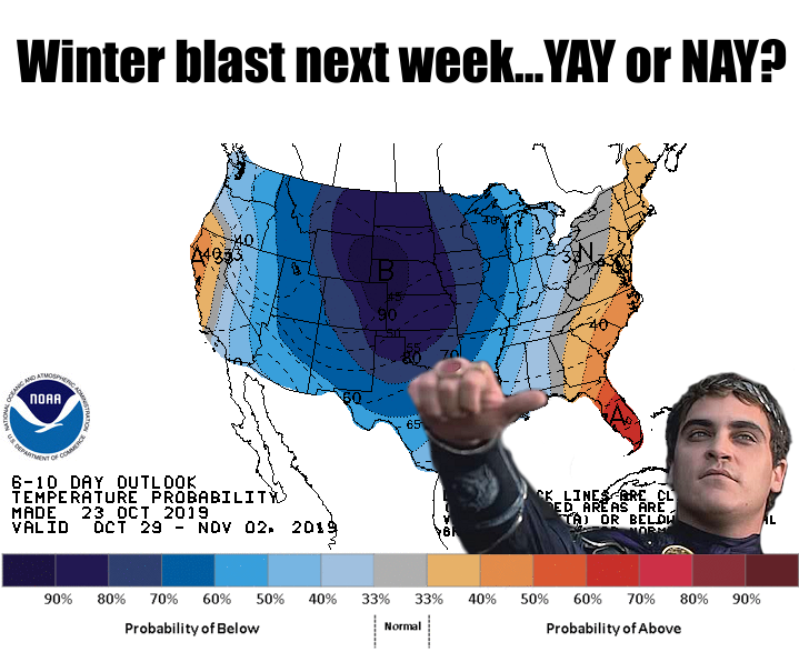
Yeah, come next week, Wednesday-ish or Thursday-ish, we're-ish gonna-ish...
wait-ish, something-ish is-ish wrong-ish. My ish-ish bot-ish is-ish stuck-ish.
Okay, there we go. Anyway, come next week, this is going to look like a nice
day. Are you ready for highs in the 30s? Maybe some snow flurries (stay tuned
on that one)? How about afternoon wind chills in the 20s? Come to think of it,
some of us have that now.
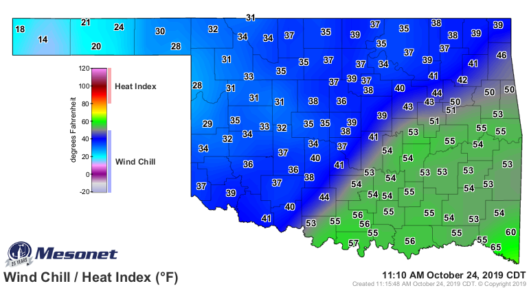
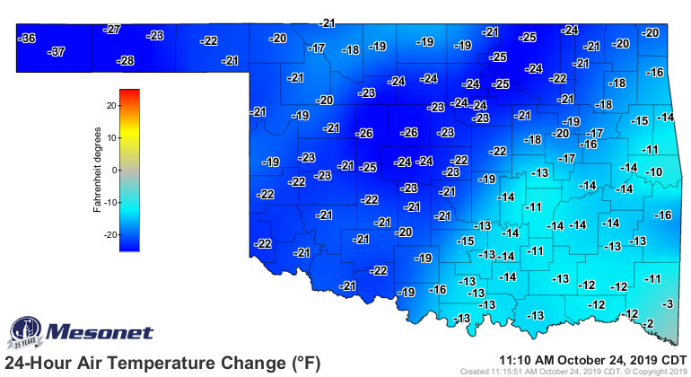
A 180-degree (more like a 20-25 degree) turn from yesterday.
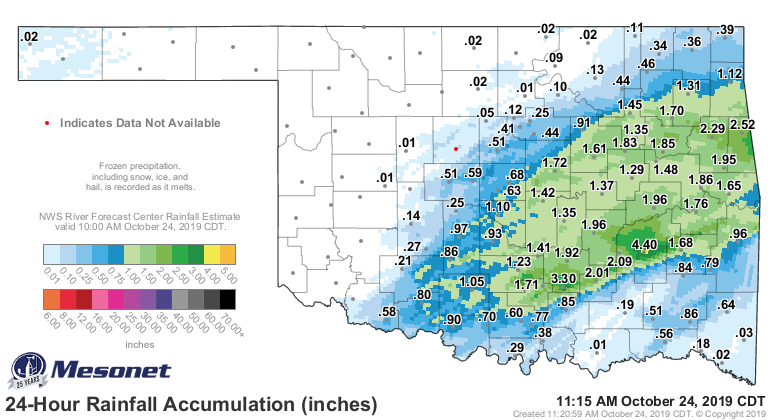
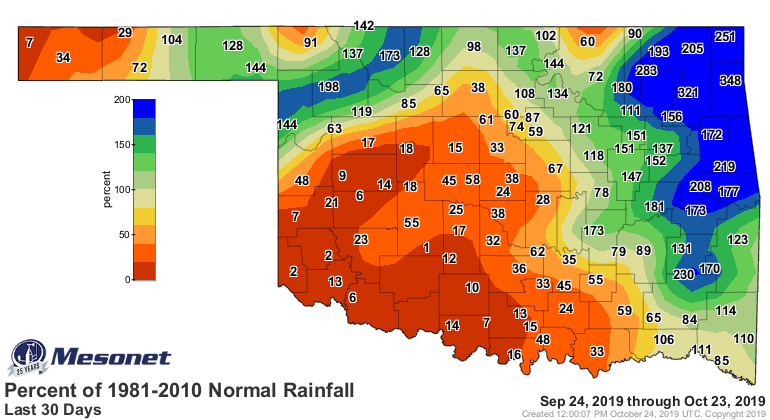
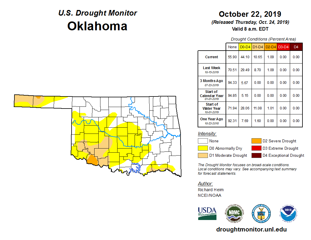
We appreciate the rain, at least for those areas that need it. But it has missed
those areas hurting the most lately, including all of SW and SC Oklahoma, and
the western Panhandle. It's tough to improve the drought map when there's no
new moisture to work with!
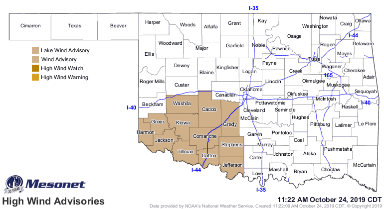
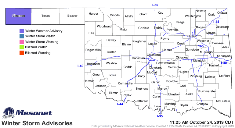
So enjoy the wind. Enjoy the cold (and snow if'n you're in the western
Panhandle).
Now, YAY or NAY for next week? Well, doesn't matter much anyway. Mother Nature
has the only thumbs that matter.
Gary McManus
State Climatologist
Oklahoma Mesonet
Oklahoma Climatological Survey
(405) 325-2253
gmcmanus@mesonet.org
October 24 in Mesonet History
| Record | Value | Station | Year |
|---|---|---|---|
| Maximum Temperature | 96°F | GRA2 | 2003 |
| Minimum Temperature | 20°F | BEAV | 2005 |
| Maximum Rainfall | 6.72 inches | MCAL | 2019 |
Mesonet records begin in 1994.
Search by Date
If you're a bit off, don't worry, because just like horseshoes, “almost” counts on the Ticker website!