Ticker for October 23, 2019
MESONET TICKER ... MESONET TICKER ... MESONET TICKER ... MESONET TICKER ...
October 23, 2019 October 23, 2019 October 23, 2019 October 23, 2019
Whitesnow
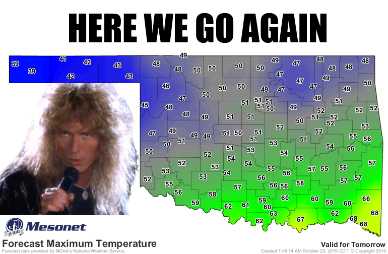
Here we go again on our own, going down that winter road that makes us groan...
Come on, sing it! No no, ignore the hair spray, that will dissipate. Okay, even
for the follicularly challenged like myself, that's too much hair. Come on, dude,
get a haircut.
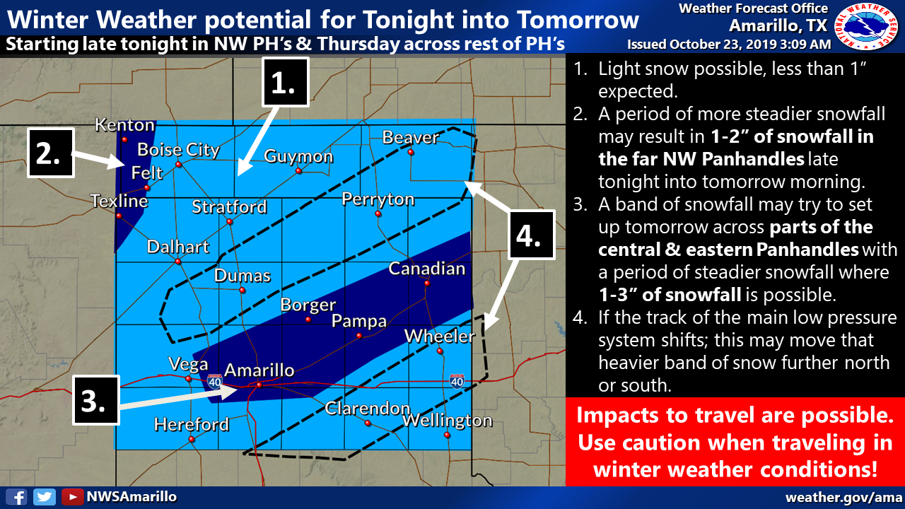
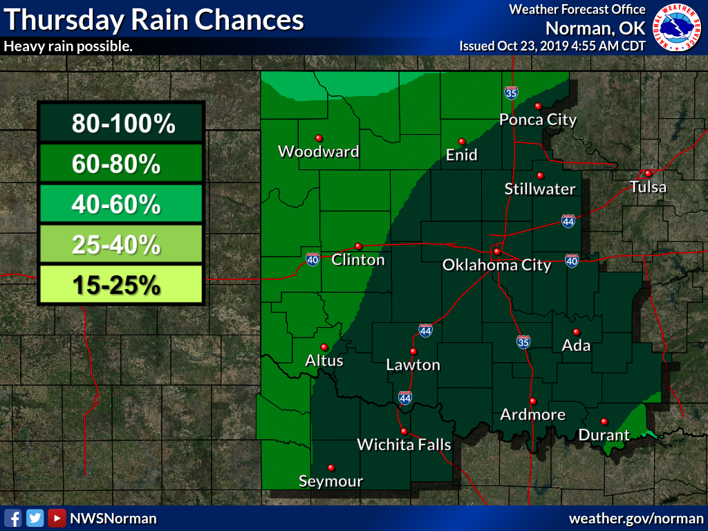
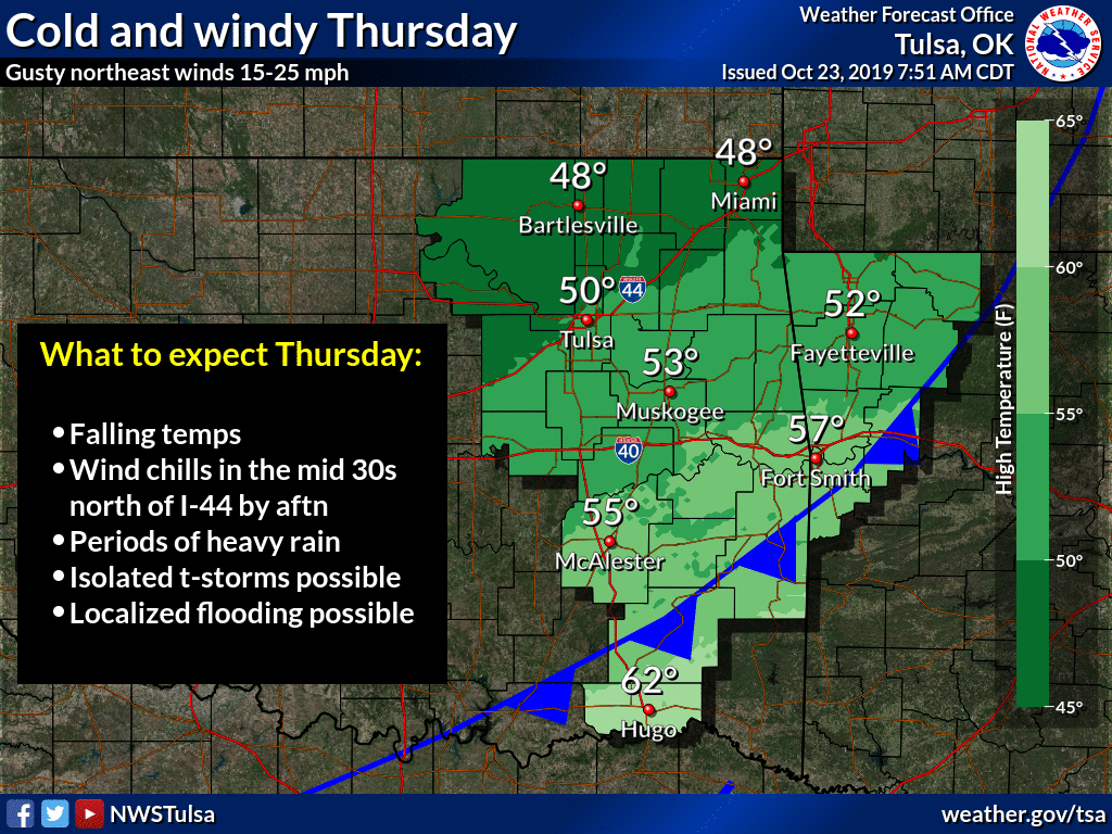
Winter roars back tonight and tomorrow with heavy rain across the I44 corridor,
snow in the Panhandle, a rain/snow mix in the northwest, and plenty of cold
air. Tomorrow afternoon expect heavy rains and wind chills in the 30s and 40s
across much of the state, if not lower in the northwest. Maybe a flash flood
watch for the I44 corridor, a winter weather advisory for the Panhandle. Here's
a bunch of graphics to tell you what you really need to know before I start
singing again.
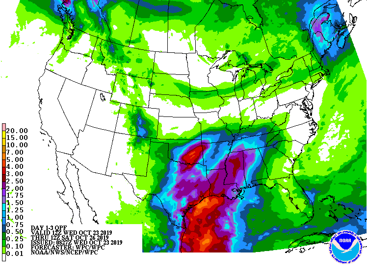
And if that hair, I mean FORECAST, isn't scary enough, tomorrow's front is a
bit pale in comparison to next week's version, coming soon to ruin a Halloween
near you.

How about farther out? Let's go all the way to winter, and for you budding
climatologists out there, please, get help. Now we're talking climatological
winter, December-February. CPC's official winter outlook shows increased odds
of above normal temperatures across most of the U.S., including all of Oklahoma.
Those odds are greater across southern Oklahoma and the western Panhandle. So
in this case, if you were betting a dollar, you'd be a tremendous cheapskate.
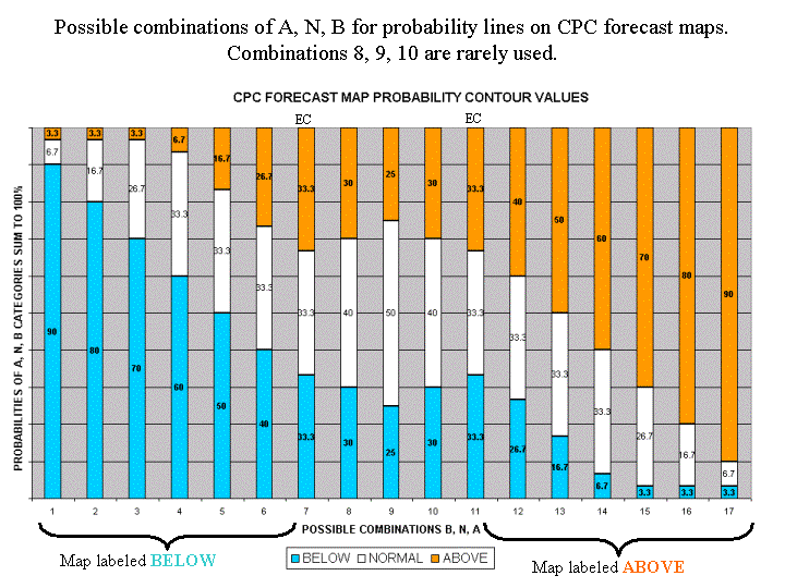
But also, you'd throw down 40 cents on the warmer than normal slot, 33 cents
on the near normal slot, and 27 cents on the cooler than normal action.
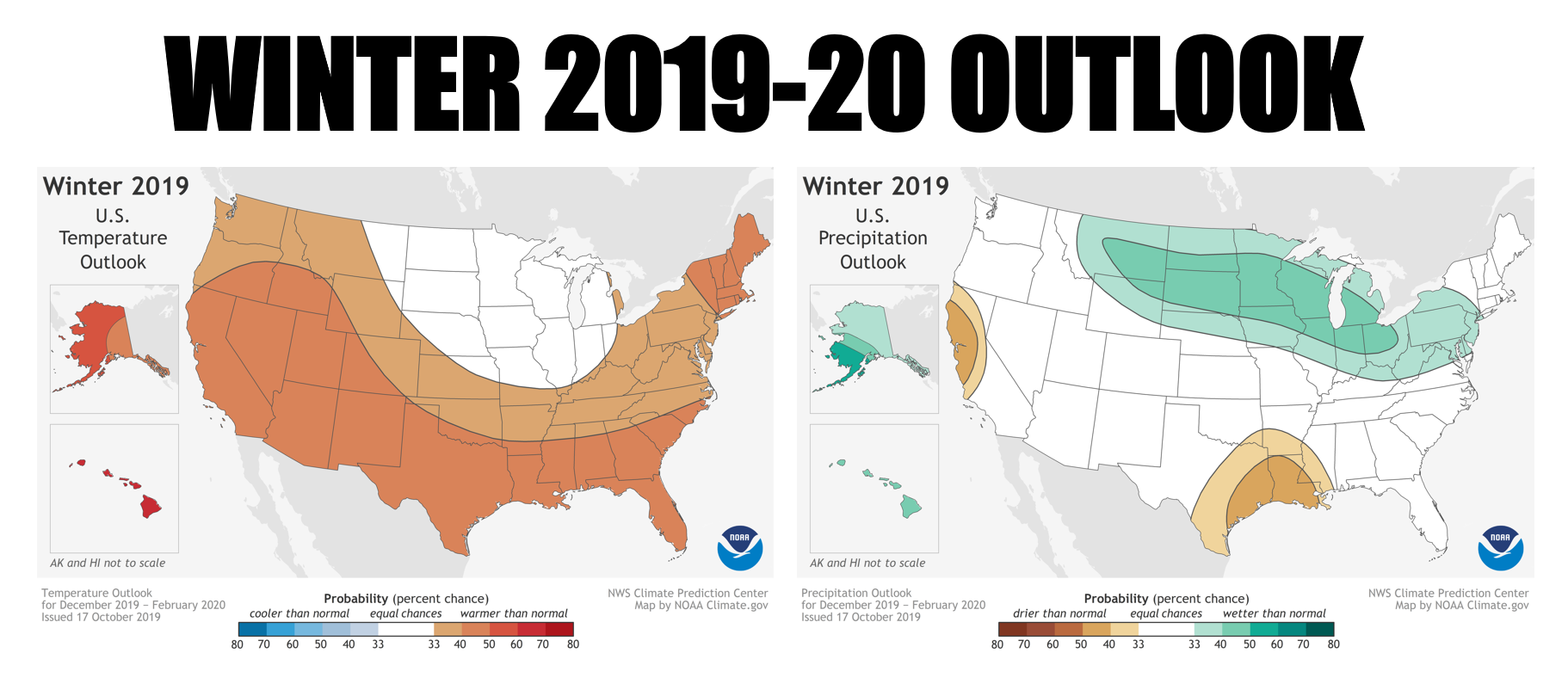
How about for precipitation? Well, most of the state is in the dreaded "Equal
Chances" category, meaning we see equal chances for all three categories:
above-, below- and near-normal precipitation, again averaged over the entire
3-month period. So betting a dollar again (LOOSEN UP, WILL YA! It's not going
to break you!), you'd throw down a third on each category. Except in far
southeastern Oklahoma, where the odds are just a bit greater for below normal
precipitation. So it doesn't mean near-normal. It means all three categories
have equal chances to occur. Fine-but-important distinction. If "EC" meant
near normal, they'd have thrown a big "N" up on the map instead.
Here's a primer on how to divide up that cash given the different categories
on the map, big spender.
So what does all this mean? Well it means the odds are tilted a bit towards
a warmer than normal winter, with climatology ruling the precip chances. It
doesn't tell you much about snow, ice, winter wonderlands, what it's going to
be like on Christmas, New Year's Eve, etc., because those individual days/events
are ruled by our day-to-day weather. We've had some of our biggest snows during
warm, dry winters (think February 2011), and we've had some tremendous heat
during cold, wet winters.
So what can you take from these outlooks? Well, might need sweaters and jackets
more than your parka, so get those down and put them in your closet. Keep your
parka on the upper rung, but be ready to grab it every once in awhile. Umbrellas
and galoshes, snow melt and snow shovels, keep all of those handy just in case.
But you might need the umbrella for the sun more than the wet stuff.
Day-to-day rules apply, so just keep watching that 7-day forecast for changes
you need to be aware of.
Gary McManus
State Climatologist
Oklahoma Mesonet
Oklahoma Climatological Survey
(405) 325-2253
gmcmanus@mesonet.org
October 23 in Mesonet History
| Record | Value | Station | Year |
|---|---|---|---|
| Maximum Temperature | 96°F | WAUR | 2024 |
| Minimum Temperature | 21°F | EVAX | 2020 |
| Maximum Rainfall | 4.31 inches | BROK | 2015 |
Mesonet records begin in 1994.
Search by Date
If you're a bit off, don't worry, because just like horseshoes, “almost” counts on the Ticker website!