Ticker for October 14, 2019
MESONET TICKER ... MESONET TICKER ... MESONET TICKER ... MESONET TICKER ...
October 14, 2019 October 14, 2019 October 14, 2019 October 14, 2019
Fall again!
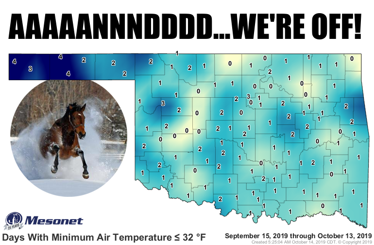
Winter has done struck. Might not winter again for awhile, despite another cold
front set to arrive tomorrow, but we've definitely rung that bell a bit early
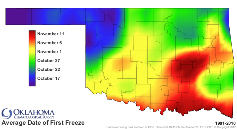
this year. For some areas, 2-3 weeks early, at least compared to the average
date of the first fall freeze. For most of the state, that occurs sometime in
November. Now the earliest fall freeze dates aren't that far away, but some of
those have been reset after this weekend.
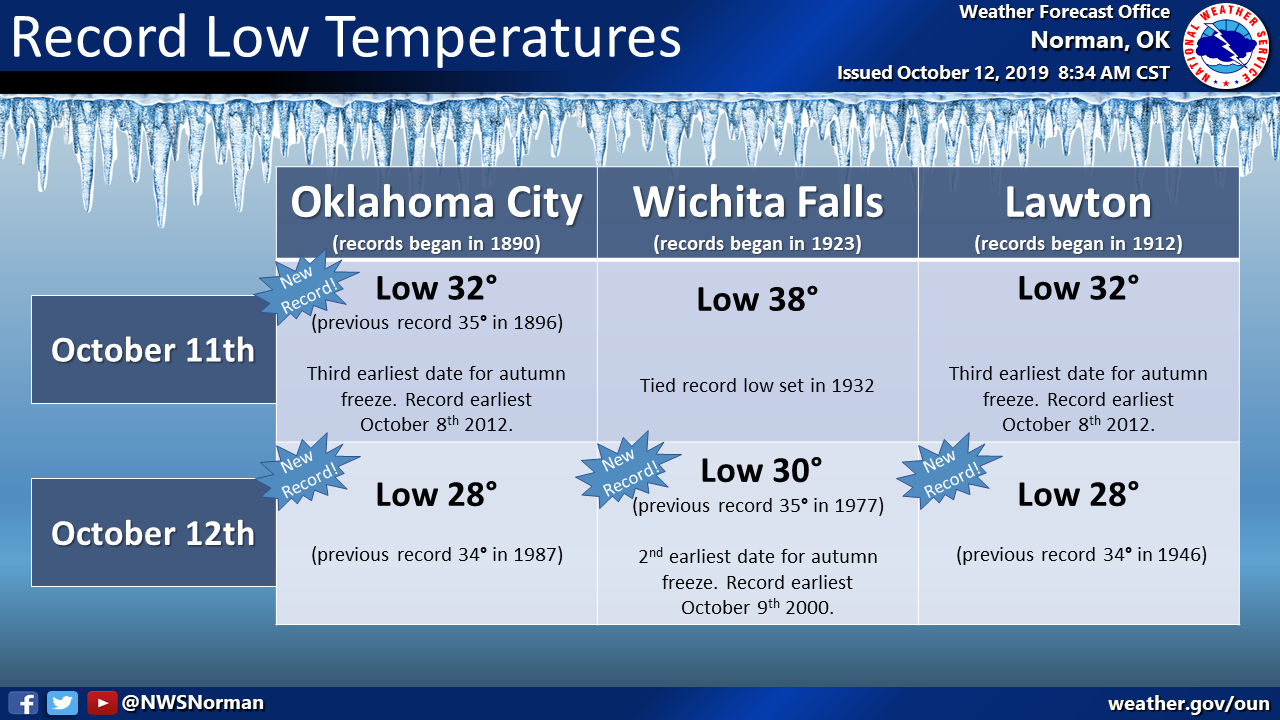
Oklahoma City had it's 3rd earliest freeze on record, as did Lawton.
Some areas had a hard freeze -- let's call it a scattered hard freeze?? -- while
the northwest had a widespread hard freeze.

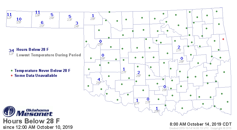
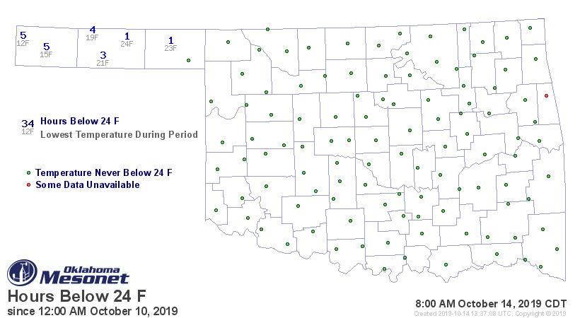
Keep in mind this occurred over the last four mornings, so the impacts of "hours
below 28 degrees," for example, will not be as significant as had they
occurred consecutively. The cumulative hours will have SOME impacts, regardless.
Hopefully some find some relief from allergies. I know I hope to not see
another mosquito until March (February? April?).
This next front is more fall front than winter, with temperatures dropping down
into the upper 30s and lower 40s, and highs in the 60s mostly.
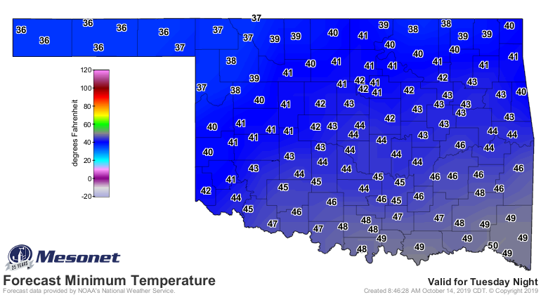

Winter returns on Monday, possibly, with another strong cold front. Rain
chances tonight into tomorrow with the front, and again this weekend (of
course).
The starting gate is gone, but we're still on the first leg.
Gary McManus
State Climatologist
Oklahoma Mesonet
Oklahoma Climatological Survey
(405) 325-2253
gmcmanus@mesonet.org
October 14 in Mesonet History
| Record | Value | Station | Year |
|---|---|---|---|
| Maximum Temperature | 100°F | HOLL | 2020 |
| Minimum Temperature | 26°F | PRYO | 2002 |
| Maximum Rainfall | 2.83 inches | ARD2 | 2013 |
Mesonet records begin in 1994.
Search by Date
If you're a bit off, don't worry, because just like horseshoes, “almost” counts on the Ticker website!