Ticker for September 26, 2019
MESONET TICKER ... MESONET TICKER ... MESONET TICKER ... MESONET TICKER ...
September 26, 2019 September 26, 2019 September 26, 2019 September 26, 2019
Flippin' temperatures!
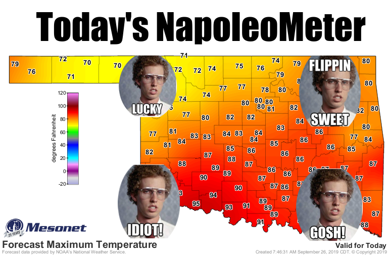
Will this actually happen today? I guess we'll find out. Seems a bit low up in
the northwest, but aided by the cool front, rain and clouds...maybe they'll get
lucky. No joy for tomorrow, however, as everybody bakes after that cool front
retreats back to the north.

But owing to the idea that the real fun is in overdoing it, we are just now
wrapping up yet another flooding rainfall across northeastern Oklahoma.

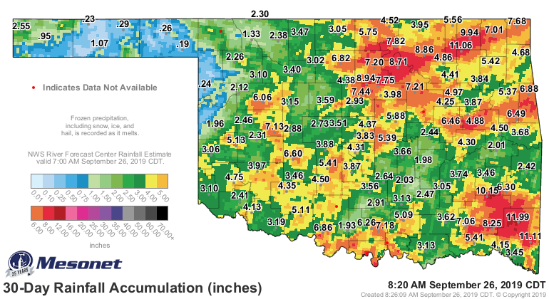
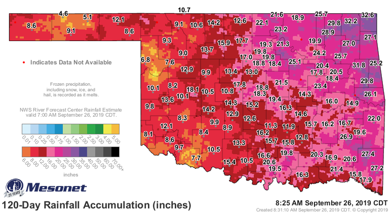
The rainfall over the last 30 days has caused flooding across much of the state,
and even some good old drought relief across the southern half of Oklahoma.
However, the lack of those good (debatable for some!) rains in the northwest has
led to drought intensification in that area. Check out these rain maps for the
story behind the story.
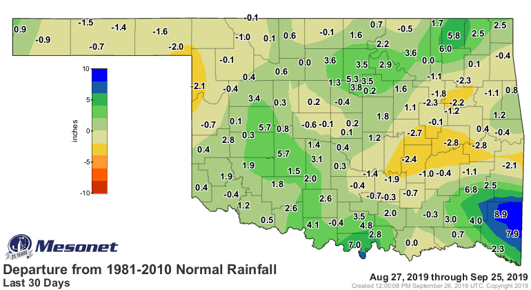
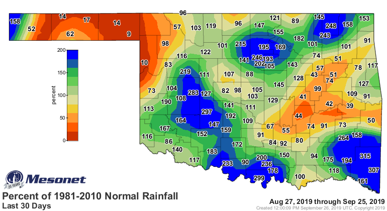
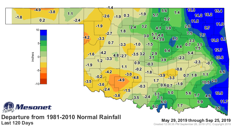
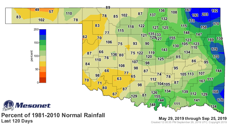
Now with all that rain, why is there STILL drought across southern Oklahoma?
Those surpluses aren't that big down there, as it turns out. Barely above or
below normal down across the southwest. AND the true lack of rain in the
northwest. Also, if you look at the 120-day rain maps, you can see the
longer-term basis for the continuing drought coverage in Oklahoma.
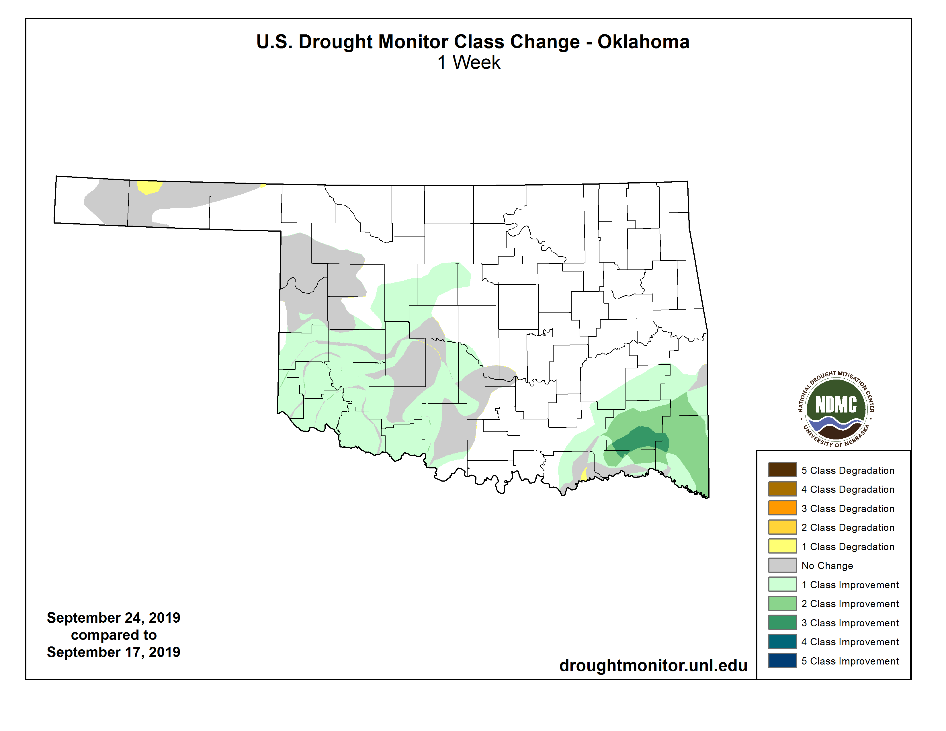
Here's the resulting Drought Monitor report issued today, and the 1-week
Drought Monitor map change.

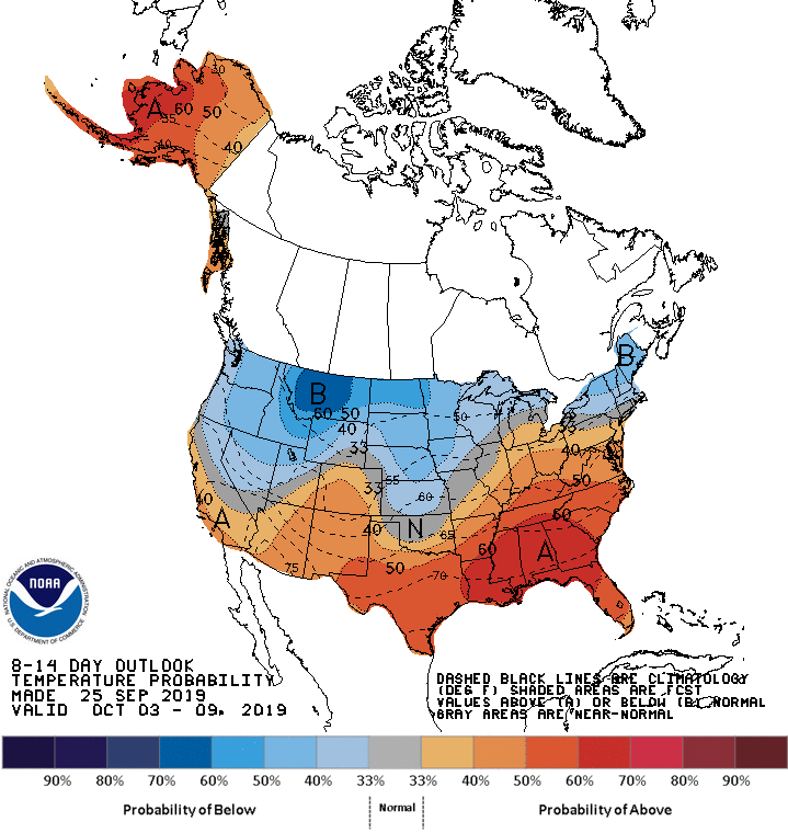
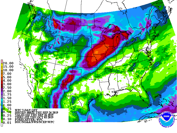
Now sometime late next week (stop us if you've heard this before...well, don't
or you'll miss the rest) we expect to see a true fall cold front swoop down
from the north and bring us into more seasonable to even below seasonable
temperatures with another chance of rain. You can sorta see that in the 7-day
rain forecast and the temperature outlook for that time frame.
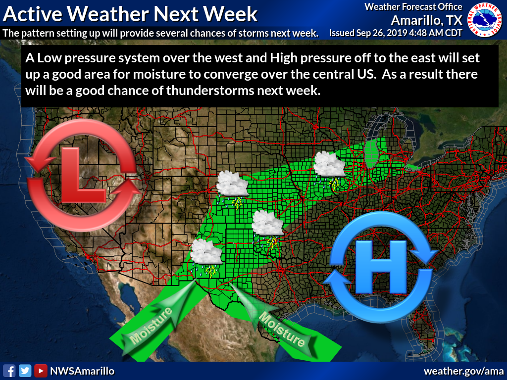
Or maybe this graphic from the Amarillo NWS office will give you a better idea.
It has to happen sometime! I swear! GOSH!
Gary McManus
State Climatologist
Oklahoma Mesonet
Oklahoma Climatological Survey
(405) 325-2253
gmcmanus@mesonet.org
September 26 in Mesonet History
| Record | Value | Station | Year |
|---|---|---|---|
| Maximum Temperature | 101°F | SLAP | 2020 |
| Minimum Temperature | 29°F | CAMA | 2000 |
| Maximum Rainfall | 7.70 inches | WEST | 1996 |
Mesonet records begin in 1994.
Search by Date
If you're a bit off, don't worry, because just like horseshoes, “almost” counts on the Ticker website!