Ticker for September 25, 2019
MESONET TICKER ... MESONET TICKER ... MESONET TICKER ... MESONET TICKER ...
September 25, 2019 September 25, 2019 September 25, 2019 September 25, 2019
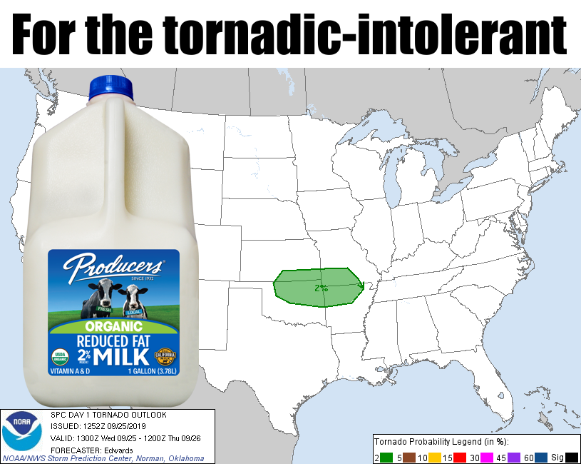
Low, but not tornadic-free
Ah yes, 2% milk. It's the Peter Brady of milks. Not bold enough to go entirely
fat free like skim milk, and too weak to be whole milk. All we know is that it
makes your cereal wet, but the taste is right up there with hummus and white rice
on the "blah" scale. Something a bit more exciting: the fall severe weather season
in Oklahoma. It's another one of "those" days when things could get bad, probably
won't given all the ingredients that have to link up at the perfect time, but we
should still remain weather aware. The Storm Prediction Center's tornado outlook
from this morning does show a 2% chance of tornadoes across northeastern Oklahoma,
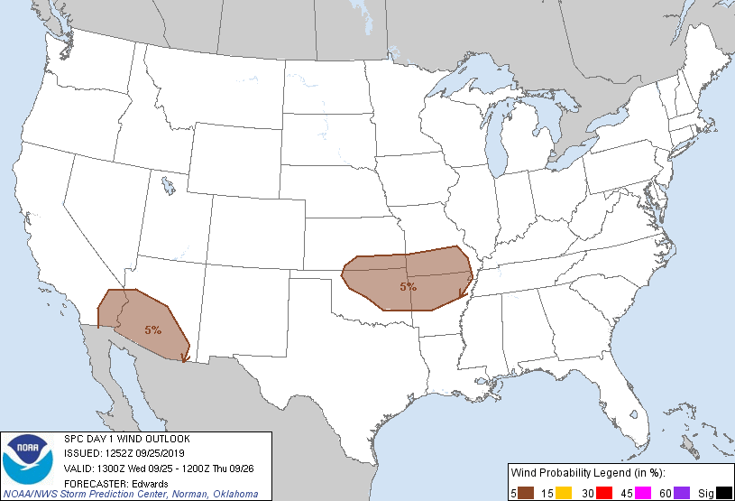
but there is also a chance (low, but not zero!) for severe wind and hail in this
marginal risk day.
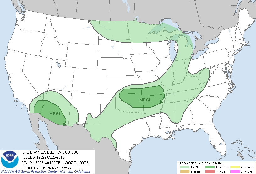

So nothing major, but given the conditional risk (meaning if this happens and
then this happens, and throw this in at the same time...none of it certain,
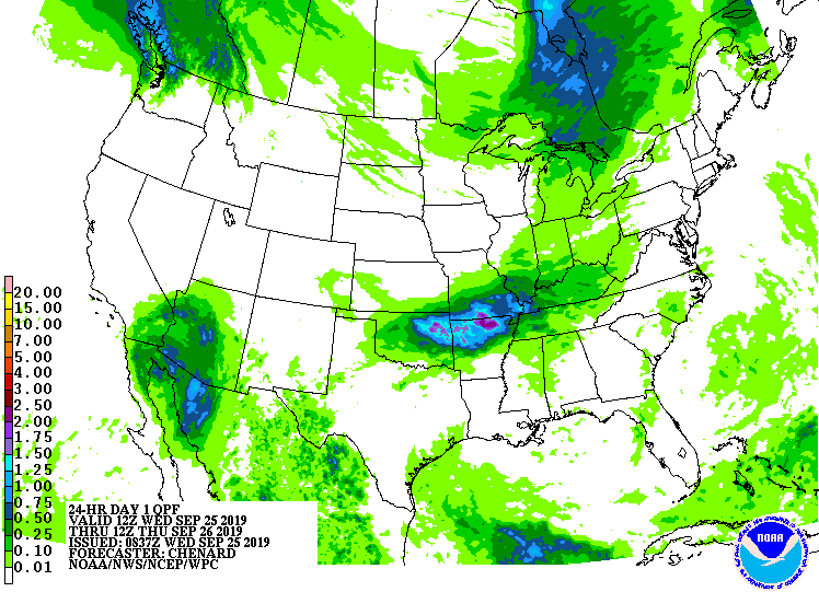
and perhaps not even likely), something to watch as the day goes by. The biggest
threat is perhaps heavy rains associated with any storms that might go up.
You can feel how moist the air is yourself, and know that that moisture
extends up into the atmosphere, awaiting a chance to precipitate out.
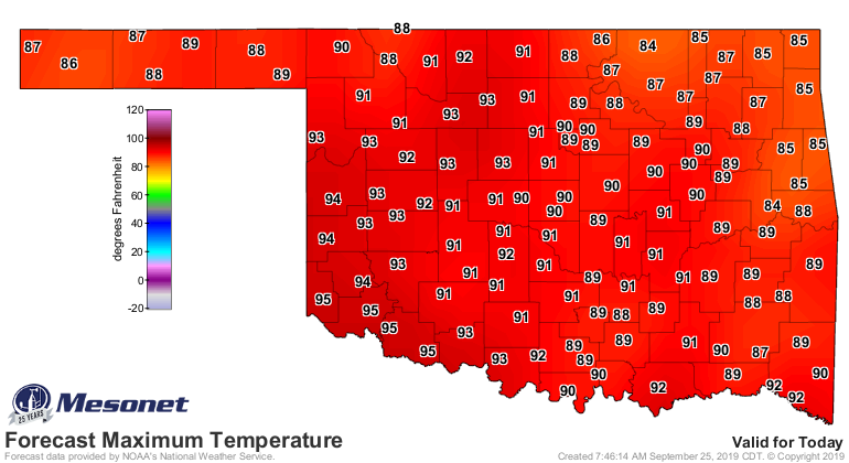
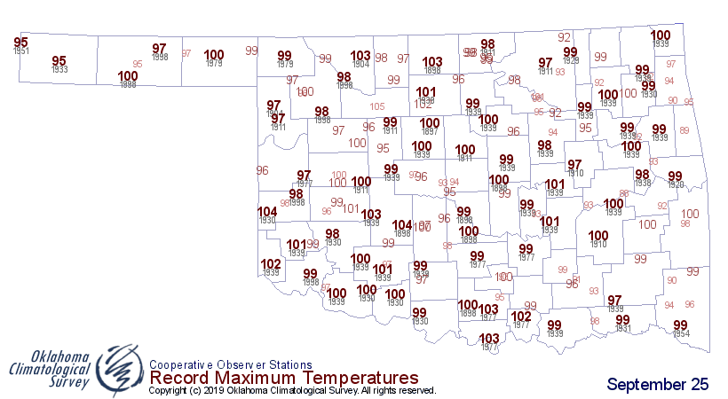
Other than that, watch out for the heat today. We can still do nasty, even
though it's late September. Forecast highs today are going to be about 5-10
degrees below all-time highs for Sept. 25, but the heat index will boost
the uncomfortable meter up even higher.
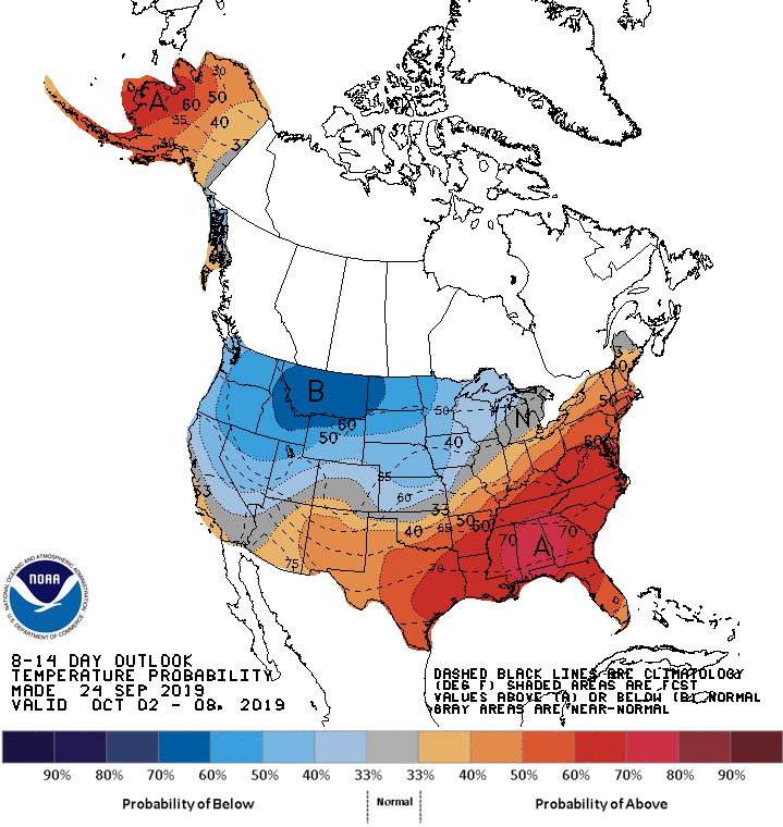
The temperature will be near- or above-normal for the next week or so, but the
first chance for a decent fall front is just starting to show up in the
forecasts.
How many times have we said this before? Several. But it's gotta happen
eventually, might as well be next week!
Gary McManus
State Climatologist
Oklahoma Mesonet
Oklahoma Climatological Survey
(405) 325-2253
gmcmanus@mesonet.org
September 25 in Mesonet History
| Record | Value | Station | Year |
|---|---|---|---|
| Maximum Temperature | 102°F | SLAP | 2020 |
| Minimum Temperature | 29°F | BOIS | 2000 |
| Maximum Rainfall | 4.95 inches | TISH | 2016 |
Mesonet records begin in 1994.
Search by Date
If you're a bit off, don't worry, because just like horseshoes, “almost” counts on the Ticker website!