Ticker for September 23, 2019
MESONET TICKER ... MESONET TICKER ... MESONET TICKER ... MESONET TICKER ...
September 23, 2019 September 23, 2019 September 23, 2019 September 23, 2019
We're mad too, Eddie. This really is getting ridiculous. I guess the only saving
grace is we're getting September-ish upper 80s and low 90s for highs instead of
August-ish upper 90s and 100s. And we COULD be talking about more rain that's
expected over the next few days, but that in itself is part of an equally vexing
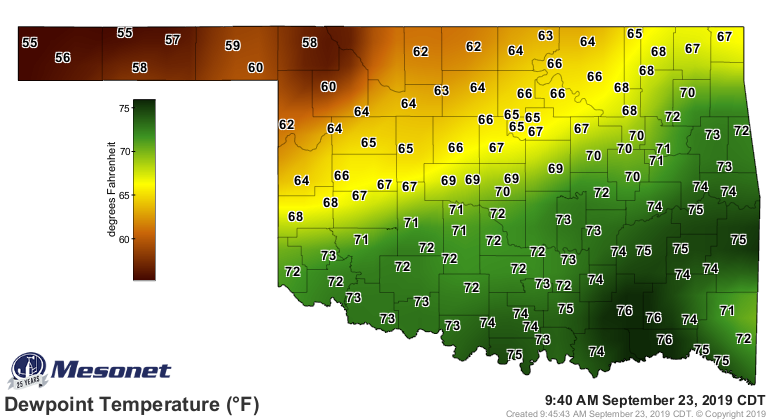
problem that seems to continue unabated: our humidity. If you just look at the
current dewpoints, you see those up into the 70s across the southeastern half of
the state. Keep in mind that the idea of dewpoints are kind of abstract when
trying to describe how muggy it is outside, but when you get up in the 60s and
70s, generally that makes things pretty uncomfortable around these parts. You know
that feeling when you go outside and it feels like a scene from "The Abyss" where
the deep sea divers are breathing liquid? That's what it feels like outside right
now, at least where those dewpoints are elevated.
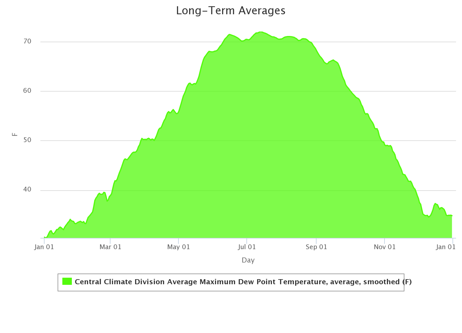
Normally, we start to see those dewpoints gradually wind down as we go through
September into October. Here's a graph of the long-term average maximum dewpoint
for central Oklahoma. Notice that steep dropoff as you exit summer (it mirrors
actual air temperatures quite well).
Now look at the departure from that long-term average for August through
yesterday; again for central Oklahoma. Units are in degrees Fahrenheit, or in
this case, degrees UGH!
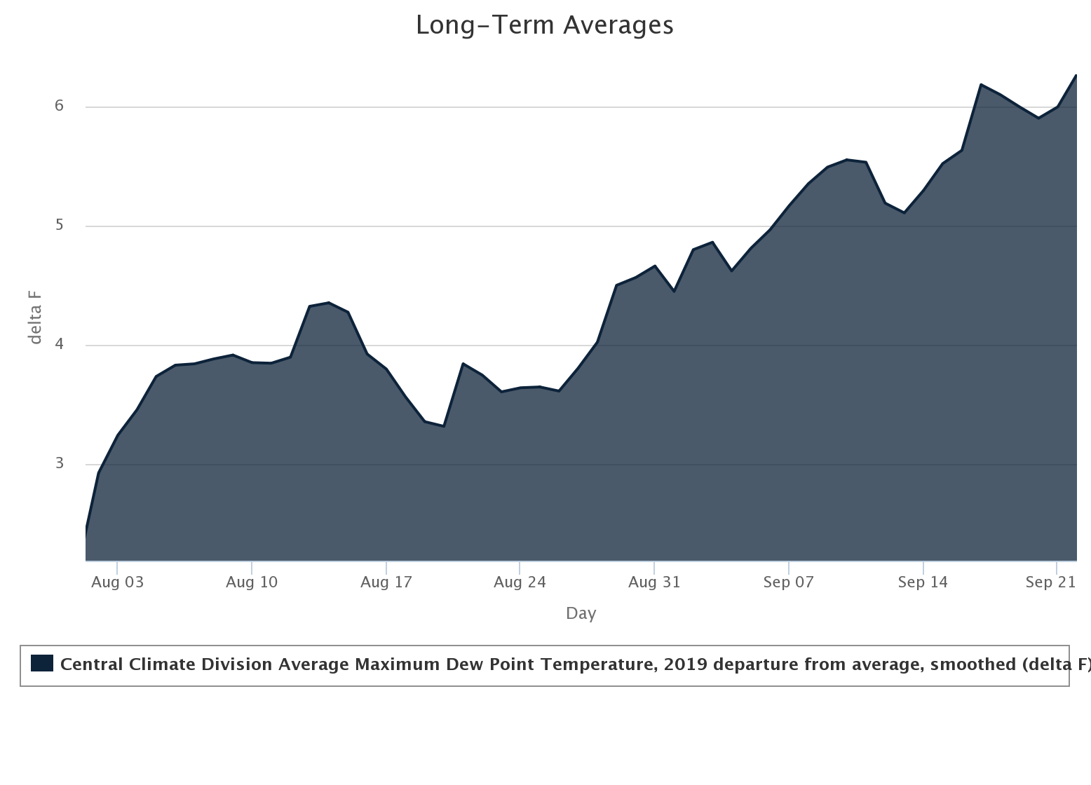
The departure is actually going up! That's because the daily dewpoints seem
to be hanging steady while the long-term average drops. It matters. It becomes
evident when we look at the same type of graphs for departure from average heat
index across the same area; again from August 1 forward.
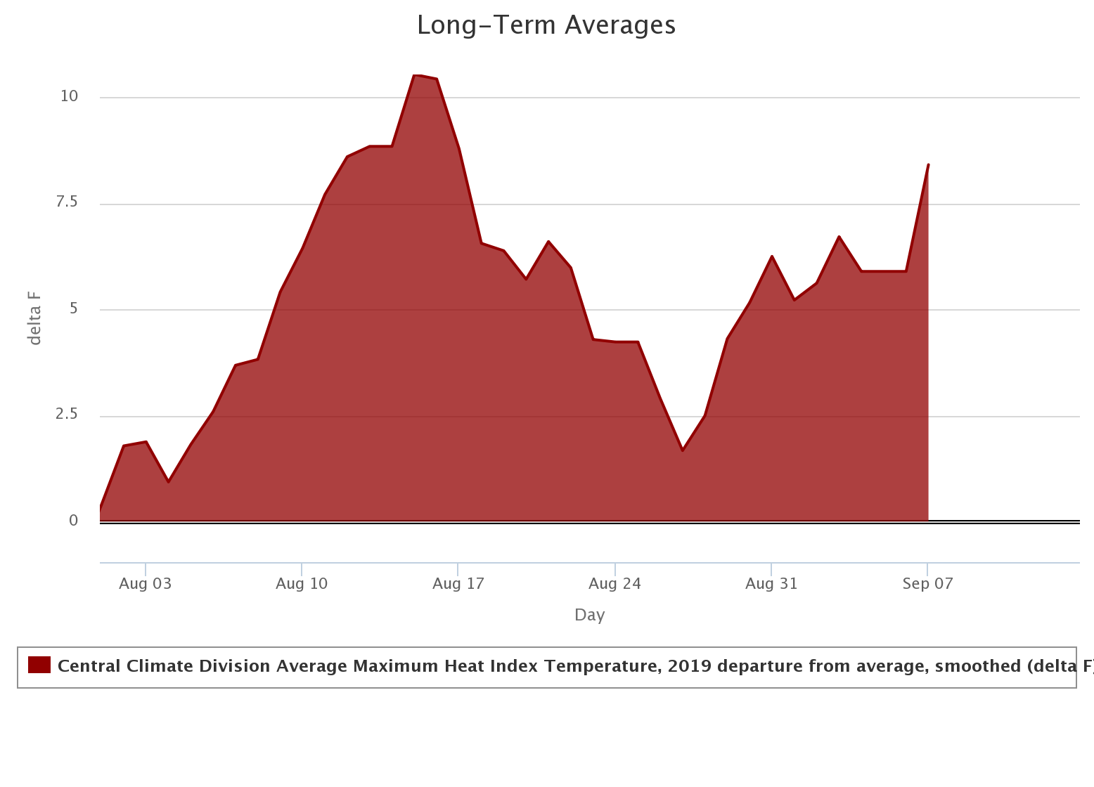
Well that's odd. Here I was going to show you a nice graph of how the heat index
was staying above average, but the graph ends abruptly on Sept. 7? Well, that's
because NORMALLY (which is always a dangerous word in Oklahoma) there aren't
enough heat index values at enough stations to create an average, at least over
the 2004-18 time frame, as calculated by the Mesonet.
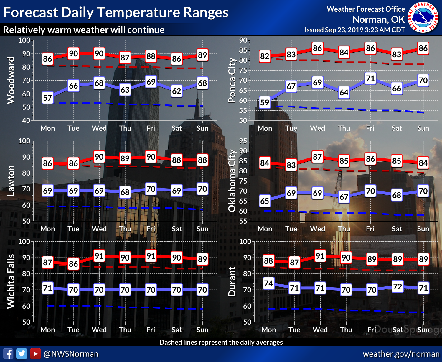
Whew, that was a very long-winded way to tell you that it has been muggier
than normal. Now obviously you don't need me telling you that, since you live
it every day. So yes, we stay in summer mode for at least another week, it
looks like (these temperatures are for central Oklahoma, but they should be
representative of what the entire state sees...give or take a soaked hankie or
two).
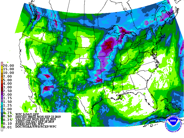
Like I said, the other big story is RAIN over the next five days. Tuesday and
Wednesday, and again on Friday.
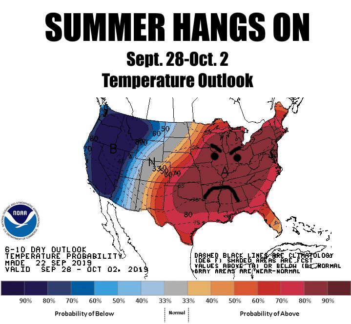
I hate to do this, but the outlooks for October, and the 3-month period of
October-December. This says increased odds of ABOVE NORMAL temperatures for
both periods.
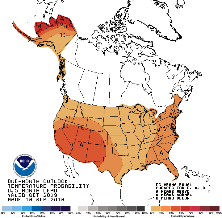
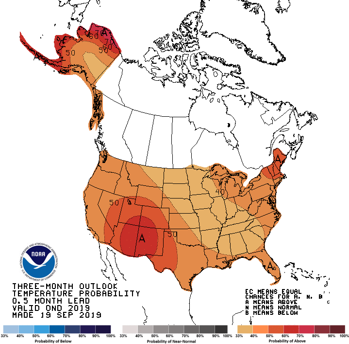
Oh yeah, the scale? Percentage of UGH!
Gary McManus
State Climatologist
Oklahoma Mesonet
Oklahoma Climatological Survey
(405) 325-2253
gmcmanus@mesonet.org
September 23 in Mesonet History
| Record | Value | Station | Year |
|---|---|---|---|
| Maximum Temperature | 106°F | ALTU | 2023 |
| Minimum Temperature | 37°F | KENT | 2004 |
| Maximum Rainfall | 7.07 inches | BROK | 2019 |
Mesonet records begin in 1994.
Search by Date
If you're a bit off, don't worry, because just like horseshoes, “almost” counts on the Ticker website!