Ticker for August 29, 2019
MESONET TICKER ... MESONET TICKER ... MESONET TICKER ... MESONET TICKER ...
August 29, 2019 August 29, 2019 August 29, 2019 August 29, 2019
Droughtius Interruptus
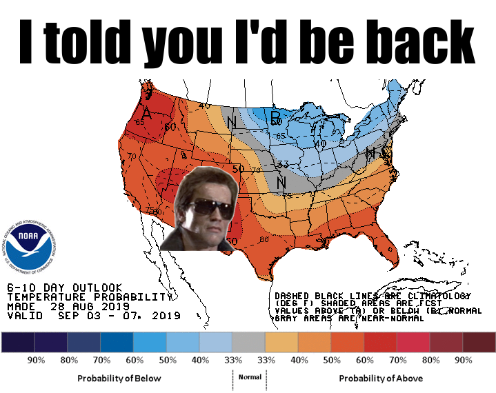
Hasta la vista, fall. It was actually nice there for a day or two. Okay, 1.5.
Yesterday I thought it would be nice and comfortable outside, so I moseyed
(English translation: moved in a leisurely manner) and proceeded to sweat like it
was 1999...or Monday. No wind and lots of humidity made it pretty stuffy. Now
you're probably saying to yourself "but Gary, highs were in the upper 80s, and
the heat index was in the 90s." We've gone over this before, but it bears
repeating -- if you're calling yourself Gary, you probably need to stop. I don't
go around calling myself "State Climatologist Mabel McManus," do I Mabel? How
about you, Frank? I thought so.
And Frankly, or Garyly, I don't know why it felt so bad yesterday. I was used
to the 70s and low 80s of Tuesday, maybe? At any rate, with news of the heat
dome *probably* building back for early next week, we best enjoy the stuffy 80s
whilst we can. Yes, much better than the heat index up into the 110-120 range
of the past week, but glimpses of fall make it tough to go back to even a
milder version of summer.
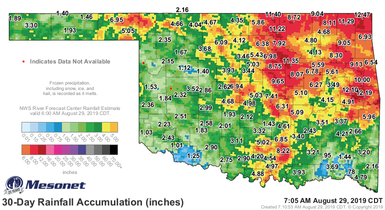
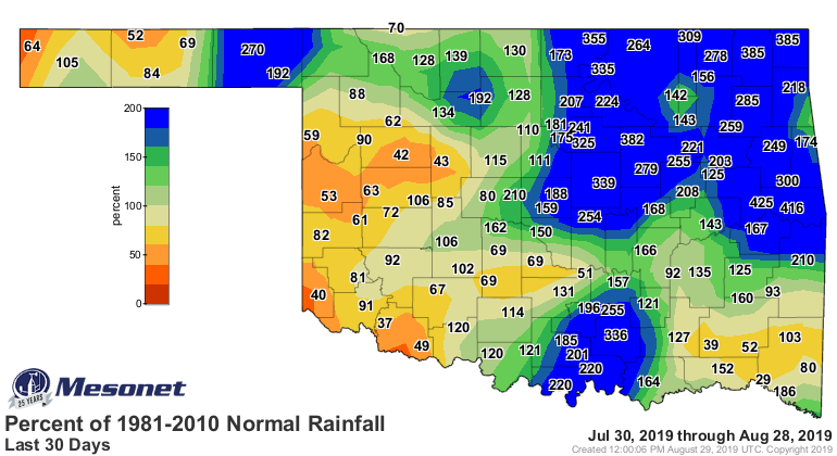
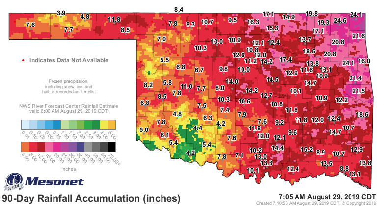
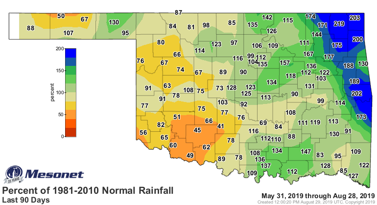
Let's talk rain, though. We've had just enough to give us a drought reprieve
over parts of the state, but not enough to cause drought to intensify in other
areas. Check out the rainfall maps for 30, 60 and 90 days and you'll quickly see
were the problem areas are. Ahem...southwestern Oklahoma, we're talking about
you.


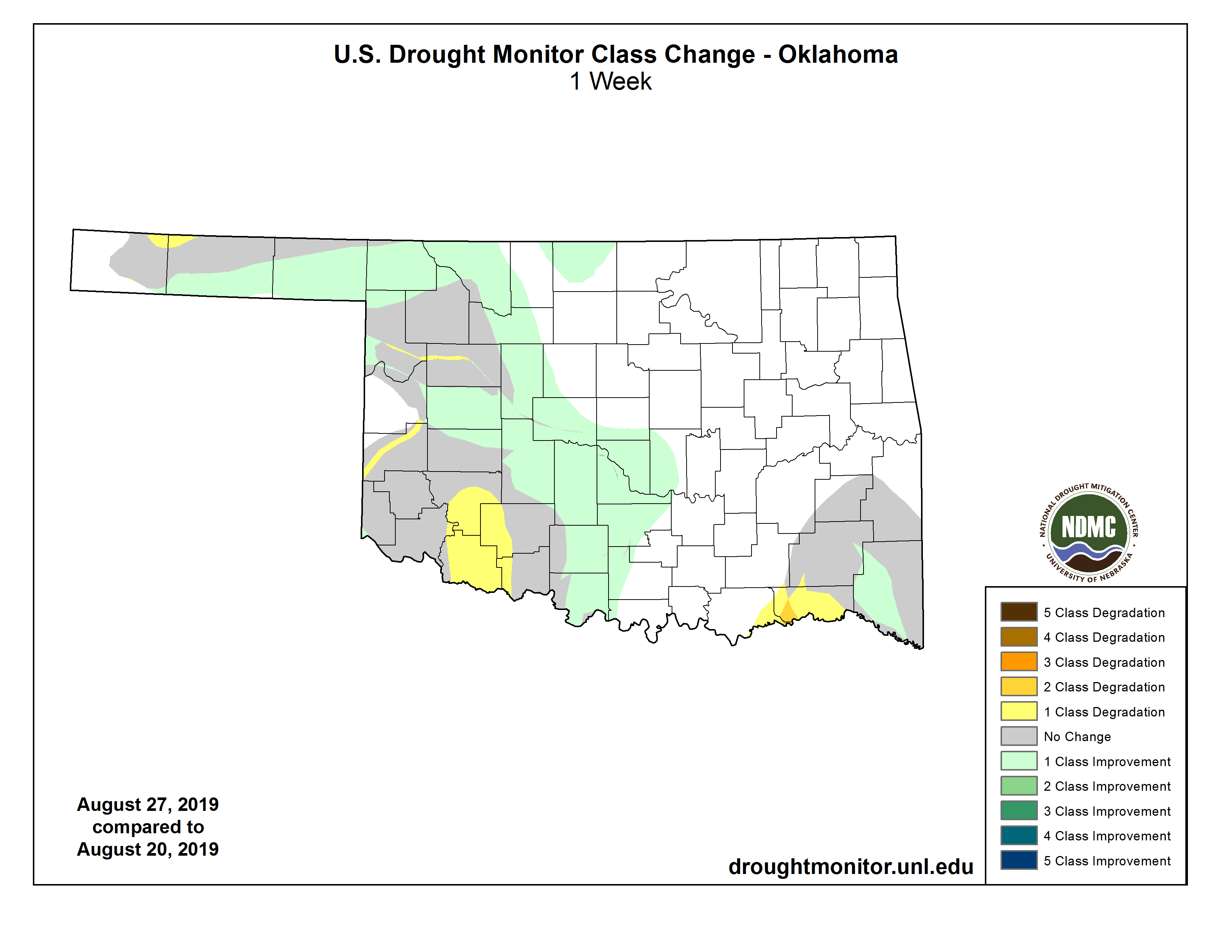
In terms of drought, we saw yet another increase in the southwest where we asked
for and received a designation of "extreme" drought, an increase from "severe."
I'll throw the one-week change map on there as well so you can see the details
of where we improved vs. worsened.

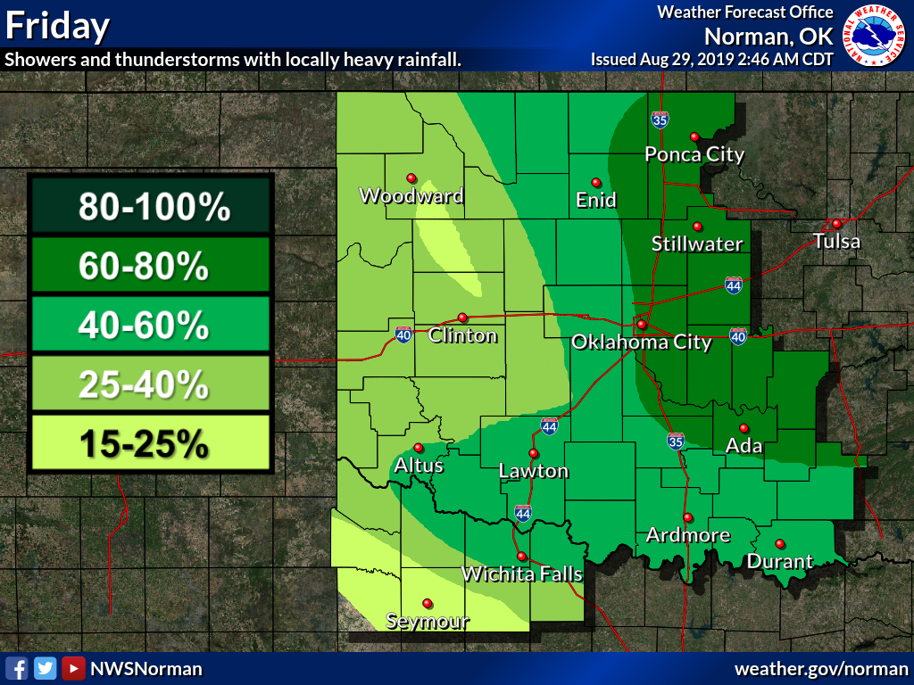
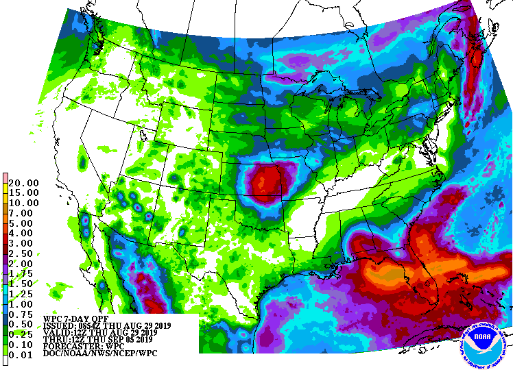
We hope to get another dose of rain over the next 2-3 days, hopefully
spreading down into the southwest, but as of now it appears northern Oklahoma
will bear the brunt of the moisture.

So rain chances for the next few days, then a return to sunny skies and
building heat. It's okay, though, because relatively speaking, 90s aren't as
bad as 100s, and a heat index of 98 isn't as bad as 108.
And autumn is inevitable.
The real Gary McManus
State Climatologist
Oklahoma Mesonet
Oklahoma Climatological Survey
(405) 325-2253
gmcmanus@mesonet.org
August 29 in Mesonet History
| Record | Value | Station | Year |
|---|---|---|---|
| Maximum Temperature | 109°F | WAUR | 2011 |
| Minimum Temperature | 48°F | EVAX | 2017 |
| Maximum Rainfall | 5.06 inches | VINI | 2003 |
Mesonet records begin in 1994.
Search by Date
If you're a bit off, don't worry, because just like horseshoes, “almost” counts on the Ticker website!