Ticker for July 29, 2019
MESONET TICKER ... MESONET TICKER ... MESONET TICKER ... MESONET TICKER ...
July 29, 2019 July 29, 2019 July 29, 2019 July 29, 2019
Flash drought!
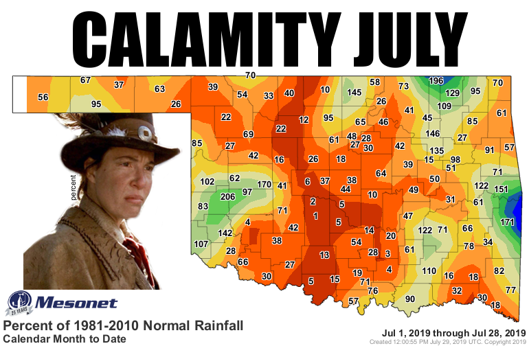
I don't know how many "Deadwood" fans there are on the Ticker list, but if you're
one of them, then you know that's about the only caption I could put on that
graphic and not get fired. Foulmouthed western legends aside, this July has turned
out to be VERY July. Almost August, even. And before I hear a bunch of "this is
what summer is like, though" remarks, I get it. But even for July, this is pretty
darned dry. We're used to getting some moisture-laden popcorn showers around the
fringe of the heat dome as it shifts east and west, north and south. Not so much
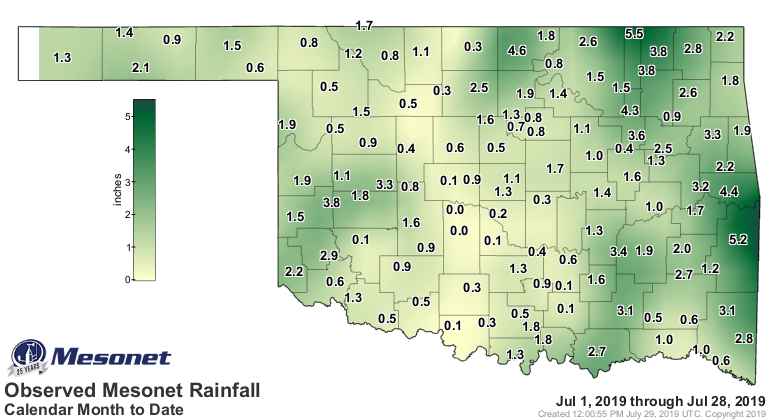
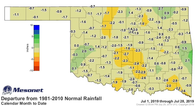
this go-round. The rest of the July-thus-far rainfall maps tell a sometimes hot
and mostly dry tale.
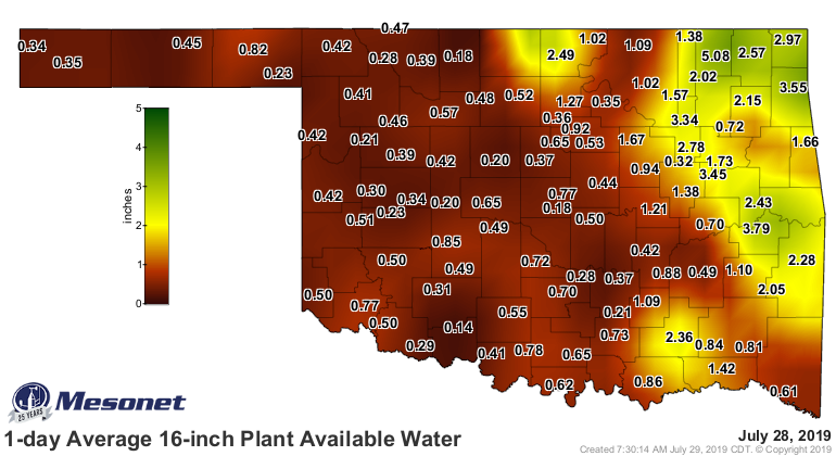
And the stats paint a picture of just how dry it has been so far this month.
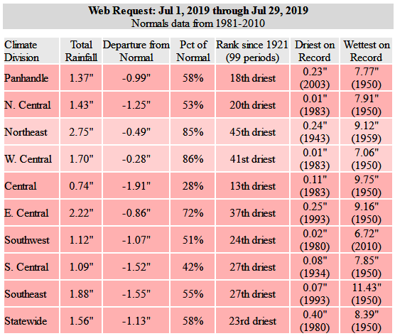
Too much red (or pink? salmon? I'm a dude, I don't do colors...I sez red) on
that table. And it's not like the deficits are huge in most cases, but when you
combine it with the heat spells we've had, it means evaporation going into
overdrive. And don't forget the incredible amount of rain we had during spring
and into June. That sent vegetation growth into hyperspace, leaving a lot of
thirsty plants wanting water. So combine the heat and the eager plants and you
have EVAPOTRANSPIRATION trying to make the Kessel run in less than 12 parsecs.
Sorry, ran out of adjectives, so fell back on Star Wars.
And the fact is the slowdown in precip started well before the first of July.
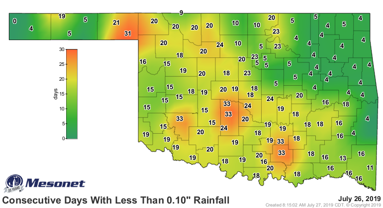
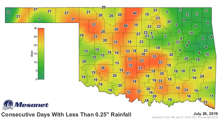
The impacts to the soil are beginning to show quite readily. I have cracks all
over in my yard, and nary a plumber in sight!
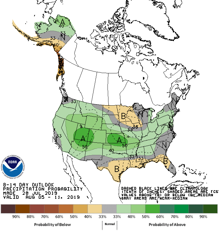
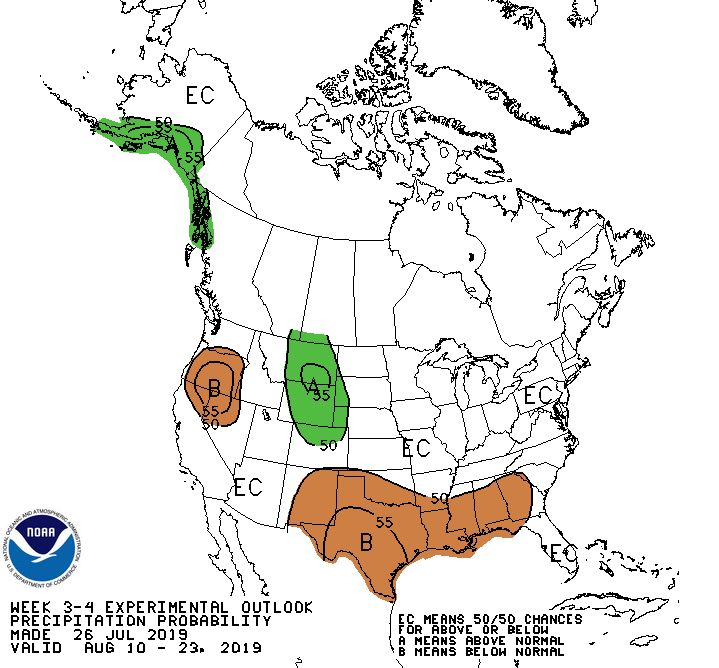
Now if you look at the next few weeks from CPC's outlooks, you can see some
relief possible, but then August being August.
August 5-11:

August 10-23:

Rain chances this weekend, but HOT until then. Just July being July.
Gary McManus
State Climatologist
Oklahoma Mesonet
Oklahoma Climatological Survey
(405) 325-2253
gmcmanus@mesonet.org
July 29 in Mesonet History
| Record | Value | Station | Year |
|---|---|---|---|
| Maximum Temperature | 110°F | INOL | 2012 |
| Minimum Temperature | 51°F | BEAV | 2005 |
| Maximum Rainfall | 4.67 inches | OKMU | 2020 |
Mesonet records begin in 1994.
Search by Date
If you're a bit off, don't worry, because just like horseshoes, “almost” counts on the Ticker website!