Ticker for June 17, 2019
MESONET TICKER ... MESONET TICKER ... MESONET TICKER ... MESONET TICKER ...
June 17, 2019 June 17, 2019 June 17, 2019 June 17, 2019
What??
Oh, it's mid-June and we should be done with the majority of our tornado
shenanigans? We should be transitioning to our summertime weather pattern, with
more heat than rain starting to show up?
What?
What!
WHAT?
WHAT!
Okay, I love that commercial. I mean, Mr. Mayhem is certainly better than that
annoying Flo gal, right? But I'd rather not be buying what Mother Nature is
selling right now. The tornadoes over the weekend were ridiculous enough, but the
rain was icing (a really nasty, salt-laden lard based icing, with onions and
garlic in it...and if you just got hungry, I fear for your safety) on the
proverbial cake. Again, THIS WAS RAIN WE DID NOT NEED!
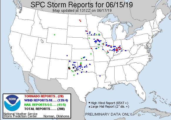
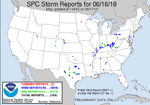
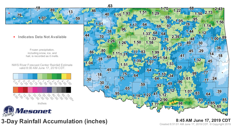
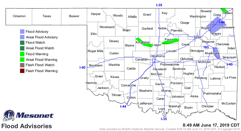
Notice that a lot of that rain fell across Oklahoma's wheat belt from
southwest through north central Oklahoma. Ag producers wanting to either finish
or start harvesting their winter wheat were out of luck for the most part. We're
still dealing with flooding from this rainfall.
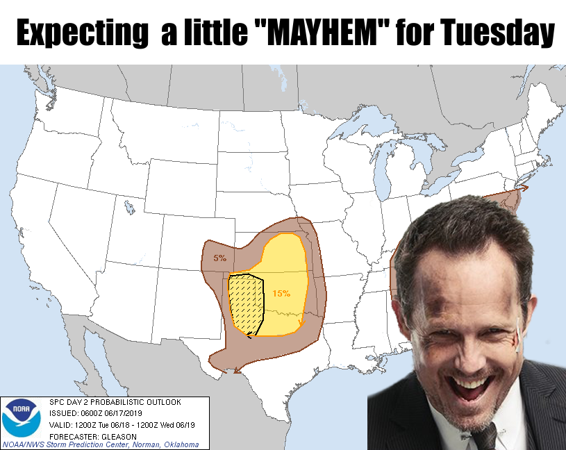
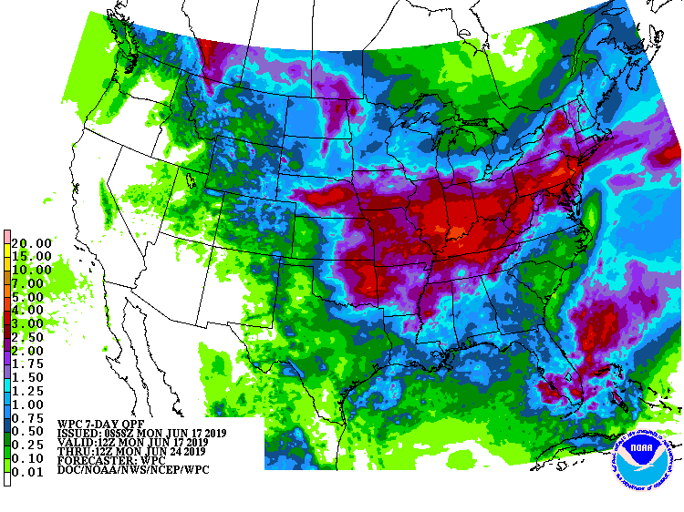
And that will probably occur again, with more rain chances Tuesday overnight
into Wednesday, then again over the weekend. Of course over the weekend, because
that's how Mayhem works.
What?
WHAT!
Gary McManus
State Climatologist
Oklahoma Mesonet
Oklahoma Climatological Survey
(405) 325-2253
gmcmanus@mesonet.org
June 17 in Mesonet History
| Record | Value | Station | Year |
|---|---|---|---|
| Maximum Temperature | 114°F | GRA2 | 2011 |
| Minimum Temperature | 45°F | BEAV | 1999 |
| Maximum Rainfall | 10.49 inches | NEWP | 2015 |
Mesonet records begin in 1994.
Search by Date
If you're a bit off, don't worry, because just like horseshoes, “almost” counts on the Ticker website!