Ticker for June 13, 2019
MESONET TICKER ... MESONET TICKER ... MESONET TICKER ... MESONET TICKER ...
June 13, 2019 June 13, 2019 June 13, 2019 June 13, 2019
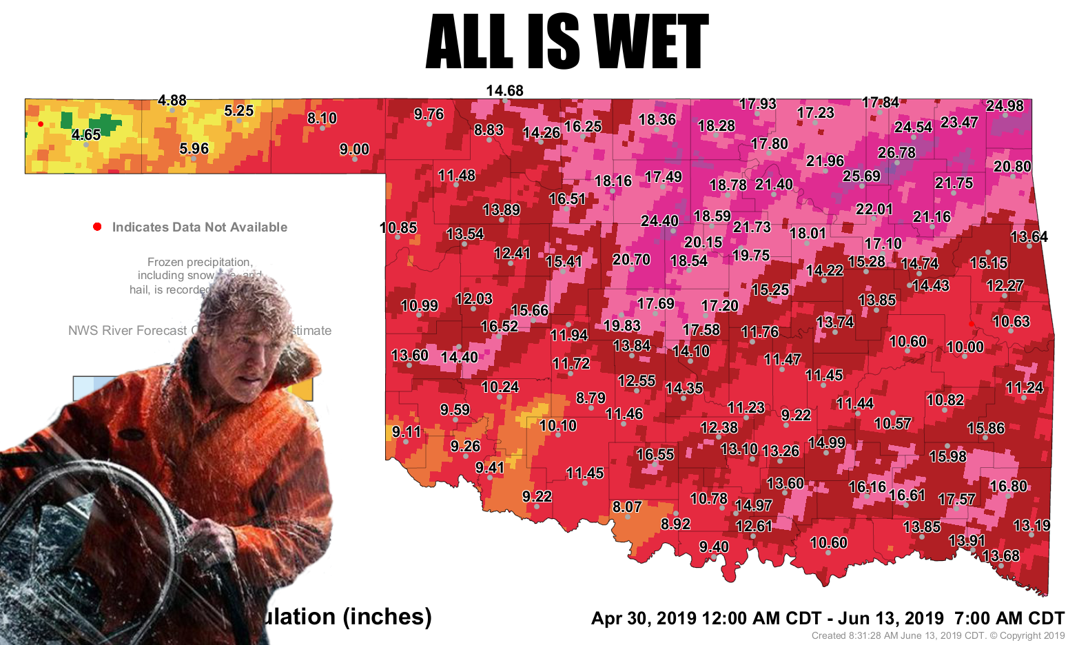
All is wet
Yes, that's Bob Redford. He looks better at 103 (estimating) that I did at 23.
But he also looks drier than most of us after all this rain.
We can hear about it, but it looks quite impressive/depressive when seeing the
actual totals on a map, and even more depressive/impressive when seeing it in
person. Trouble is, we're still primed to see even more in person. Looks like
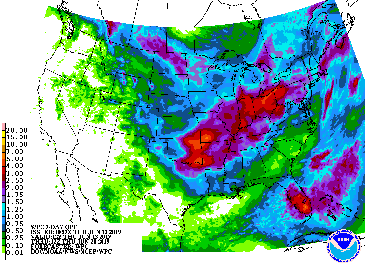
later into the weekend and early next week is still prime time for rain chances,
although there will be showers and storms on and off on a more isolated basis for
the next few days. And again, heavy rains are still showing up in the forecast,
mainly for eastern Oklahoma.
Some interesting things going on with all this cool/wet weather. The OK wheat
belt across southwestern into north central Oklahoma is still feeling the effects
of the cool spring we had and continued moisture. The view from space shows a bit
of the crop still looks a bit immature. Not immature like the Ticker is immature
(oh yeah, we've heard what you said!), but the crop just hasn't had an extended
period of hot, dry weather to cure it as well as we would normally expect this
time of year. And the crop is probably a week or two behind it's normal life
cycle thanks to that cold weather. Check out the statewide average temperature
we've seen for this year vs. what we saw back in 2016, a year which saw prime
growing conditions for winter wheat for virtually the entire crop cycle, from
planting in the fall to harvest in June. The blue is the departure from average
for 2019 thus far, and the red line shows the same for 2016.
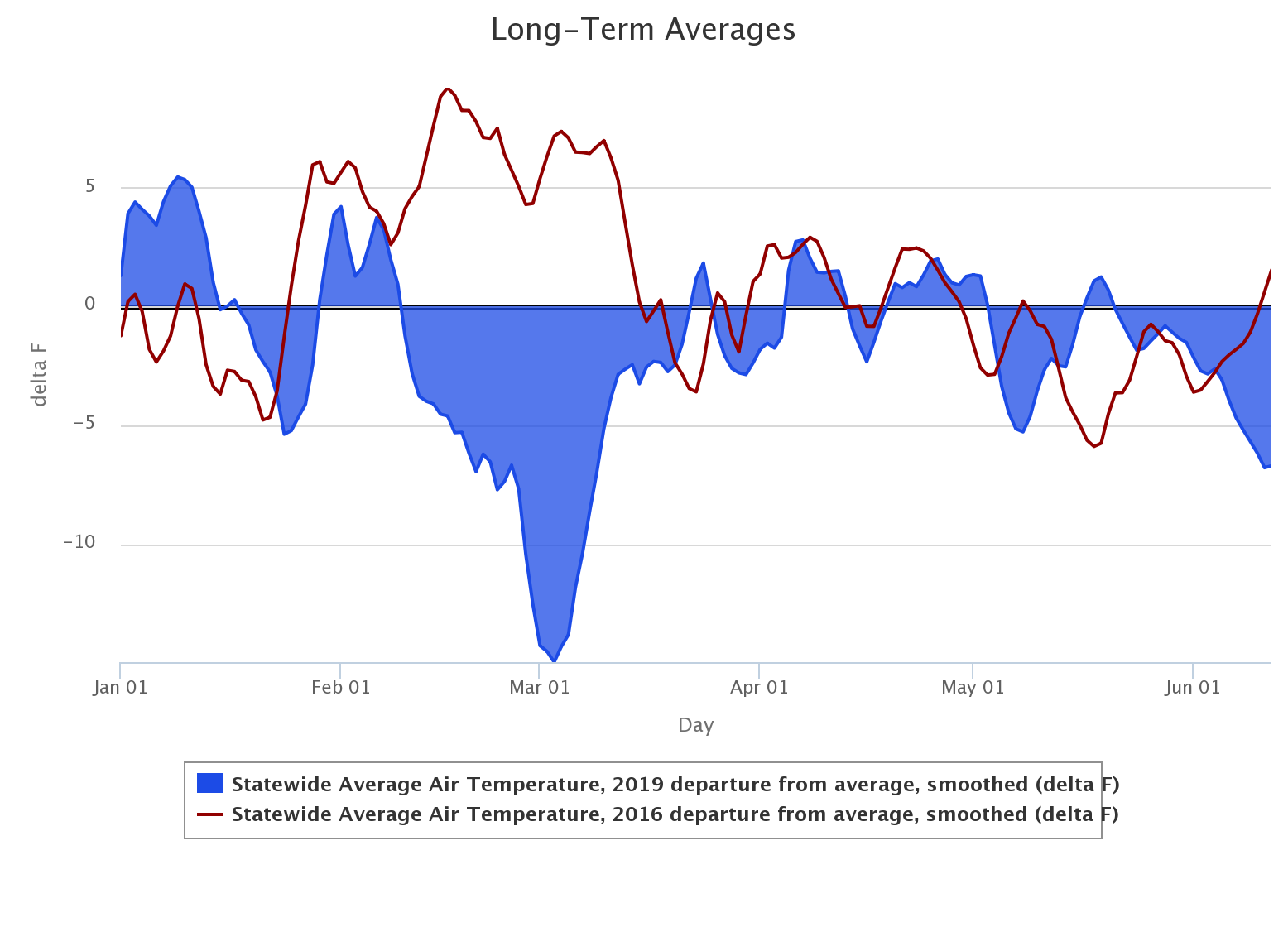
It's that period from mid-January through mid-March that slowed the wheat
down, a vast difference from what they saw in 2016. There were differences in
moisture, timing of freezes and whatnot, but that overriding picture shows
what happened pretty well.
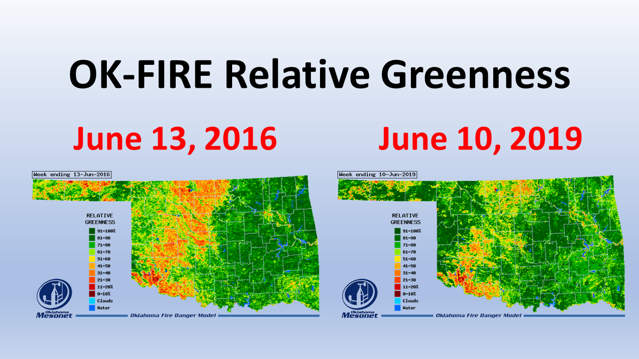
Wait, what about the pictures from space! Almost forgot about these. The maps
below are relative greenness maps from the Mesonet's OK-FIRE program. Again,
you can see the difference between the partially harvested and fully mature
crop at this time in 2016, vs. the still-have-a-long-ways-to-go harvested
amount and still a bit immature wheat this year. Also notice how green it is
outside of the wheat belt across western Oklahoma. That's some good looking
pasture and range land.
At any rate, expect the combines to continue rolling through the wheat belt
as they dodge showers, storms and heavy dew. We could really use a good week
of blast furnace heat and dry weather, but that's probably not in the offing.
Speaking of humidity (we were, kinda), here's where we are this year for
average humidity vs. the long-term average (2004-2018) across the entire
Mesonet.
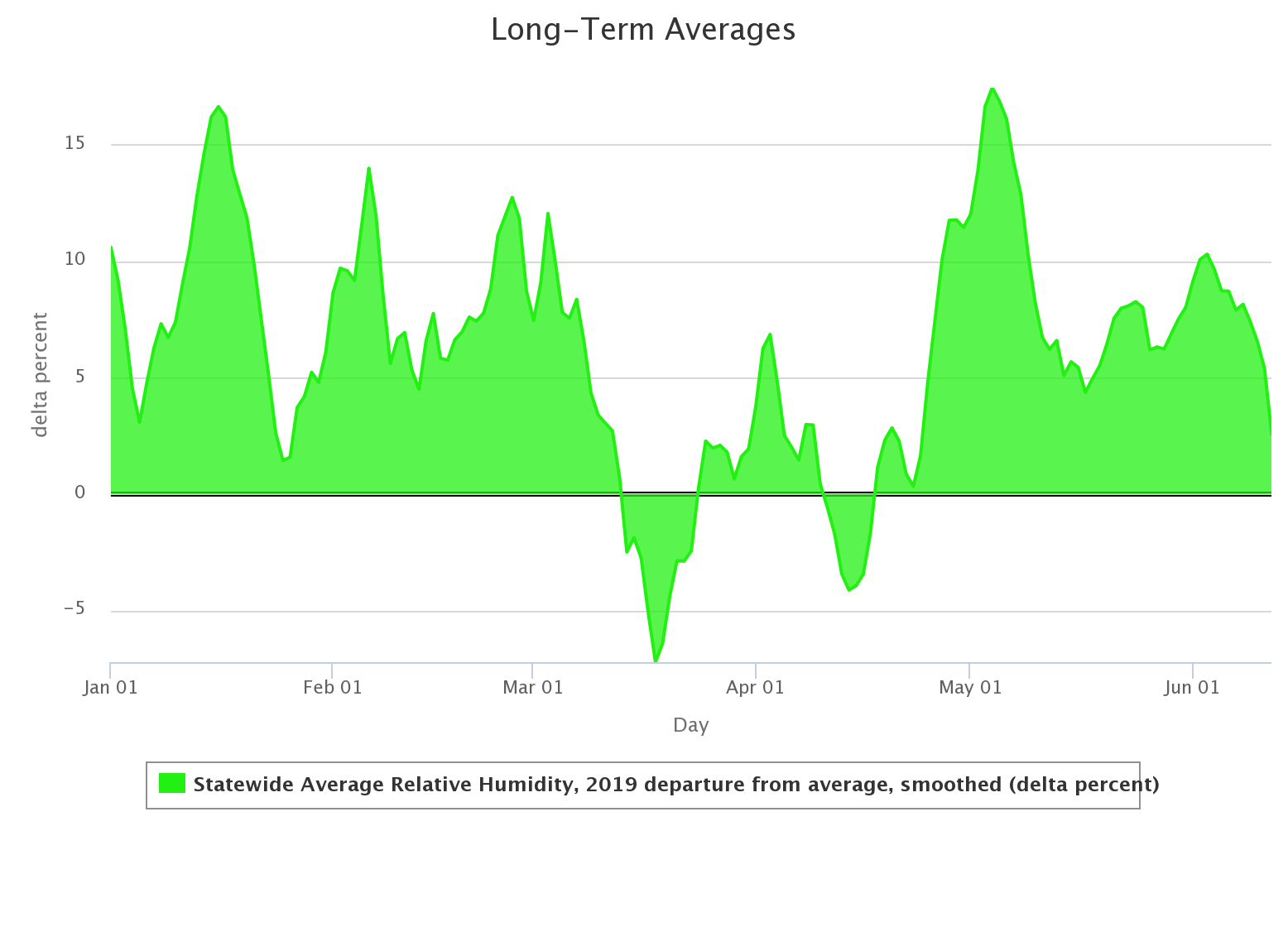
Wow, remember that week in March when it was dry? Or the few days in April?
Yeah, me either.
Gary McManus
State Climatologist
Oklahoma Mesonet
Oklahoma Climatological Survey
(405) 325-2253
gmcmanus@mesonet.org
June 13 in Mesonet History
| Record | Value | Station | Year |
|---|---|---|---|
| Maximum Temperature | 110°F | BUFF | 2011 |
| Minimum Temperature | 47°F | BOIS | 2005 |
| Maximum Rainfall | 4.15 inches | HOBA | 2007 |
Mesonet records begin in 1994.
Search by Date
If you're a bit off, don't worry, because just like horseshoes, “almost” counts on the Ticker website!