Ticker for June 18, 2019
MESONET TICKER ... MESONET TICKER ... MESONET TICKER ... MESONET TICKER ...
June 18, 2019 June 18, 2019 June 18, 2019 June 18, 2019
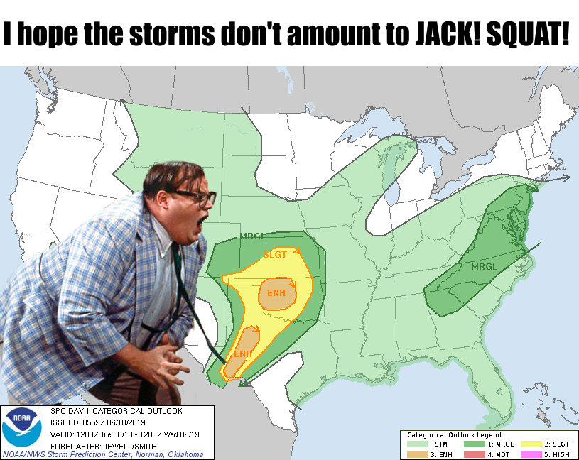
Jack SQUAT!
43rd (forty-third for you purists) verse, same as the first! Let's hope many of
us don't end up living in a van down by the river after today's expected severe
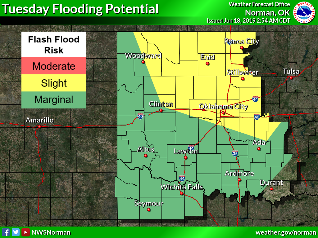
weather. Of course, for most people, the river is now up by the van thanks to
all the flooding. And, as has usually been the case, all modes of severe weather
are possible, but not necessarily likely.
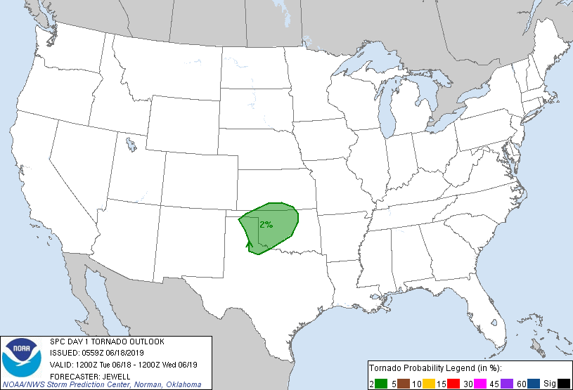
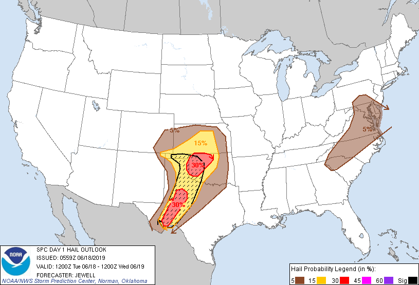
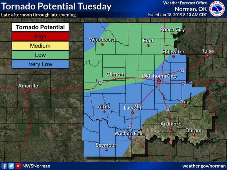
According to SPC, the tornado threat is fairly low (but not zero), but the hail
and wind threat are a bit more substantial.

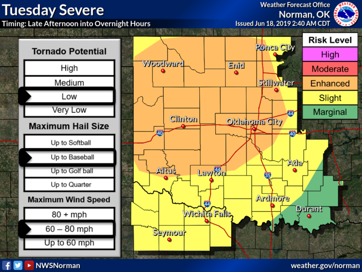
I would expect further adjustments to be made during the day today, so be sure a
and stay weather aware. Probably more likely the threat will increase rather than
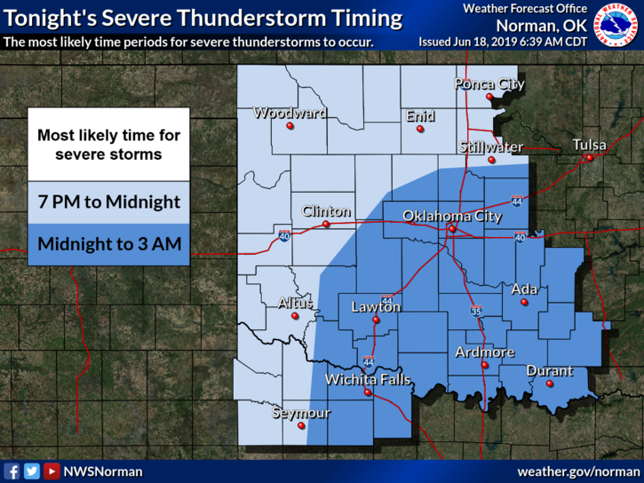
decrease, if anything. Here are a few more detailed graphics from your friendly
neighborhood Spiderma...I mean NWS forecast office.

More storms tomorrow farther south. Then more for this weekend? But maybe
not as severe? Then maybe a summertime pattern? Does phrasing these as questions
absolve me of any culpability if it doesn't happen?
Gary McManus
State Climatologist
Oklahoma Mesonet
Oklahoma Climatological Survey
(405) 325-2253
gmcmanus@mesonet.org
June 18 in Mesonet History
| Record | Value | Station | Year |
|---|---|---|---|
| Maximum Temperature | 110°F | GRA2 | 2011 |
| Minimum Temperature | 42°F | KENT | 1998 |
| Maximum Rainfall | 5.74 inches | HOOK | 2024 |
Mesonet records begin in 1994.
Search by Date
If you're a bit off, don't worry, because just like horseshoes, “almost” counts on the Ticker website!