Ticker for May 7, 2019
MESONET TICKER ... MESONET TICKER ... MESONET TICKER ... MESONET TICKER ...
May 7, 2019 May 7, 2019 May 7, 2019 May 7, 2019
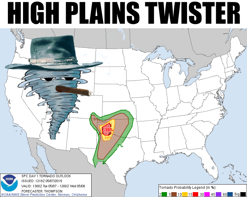
High Plains Twister
NOTE: I know you're seeing a "High Plains Drifter" meme and you're hearing that
Ennio Morricone score from Sergio Leone's classic spaghetti westerns. Let me
remind you, however, that Clint Eastwood directed this one, and Dee Barton did
the soundtrack. But I'm doing the same thing, so carry on.
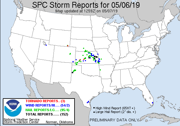
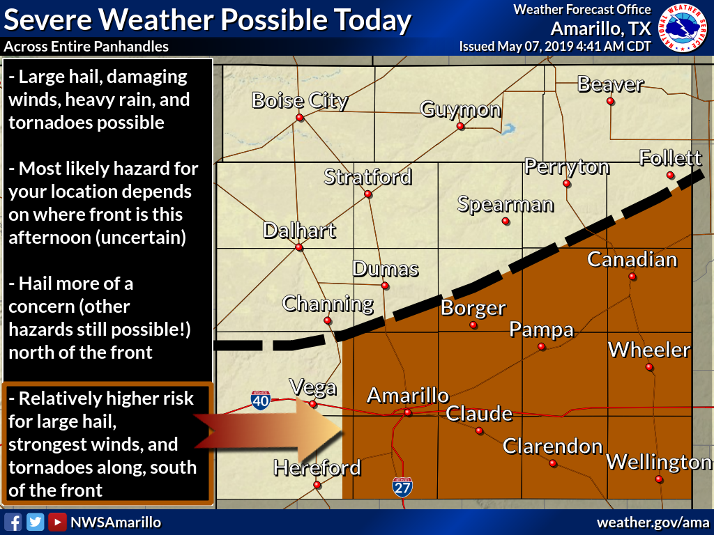
Day 2 of our 3-day delight of severe weather wonders. Last night wasn't "too" bad,
considering. Some golfball size hail in the Panhandle...a bit of wind and rain.
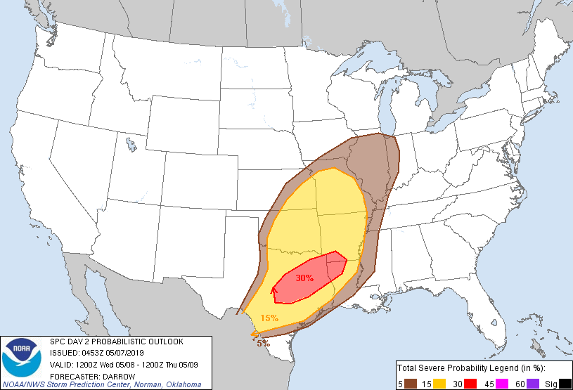
Today looks to be a different animal, however, as you can tell from SPC's tornado
outlook graphic above. Anytime you see a hatched area on an SPC map, it's
generally not good. The 15% is somewhat high from an SPC perspective, and the
hatched area indicates the possibility of significant tornadoes, EF2-EF5, within
25 miles of a point. So for folks out there, they hope they're at least 26 miles
away from said point. Well, it doesn't really work that way, but you get the
drift.
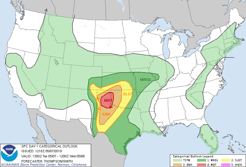
All modes of severe weather are possible across the High Plains of Texas and
Oklahoma tonight, with a bit of that risk pushed to the east as the storms
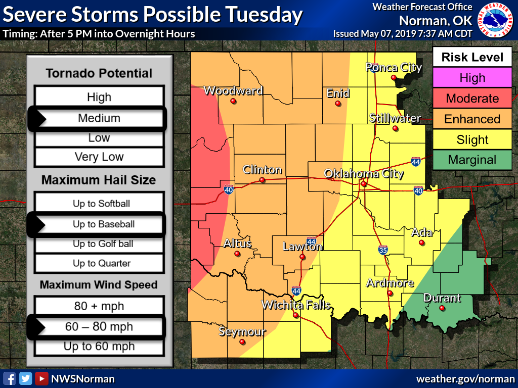
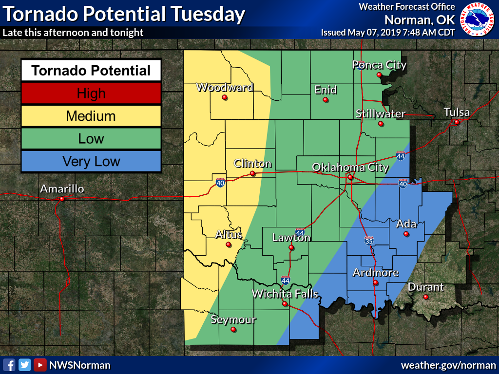
progress overnight. At this point, SPC labels the area in "moderate" risk,
which is definitely something to take notice of. Hail and high winds are
going to be particularly prevalent if this scenario plays out.
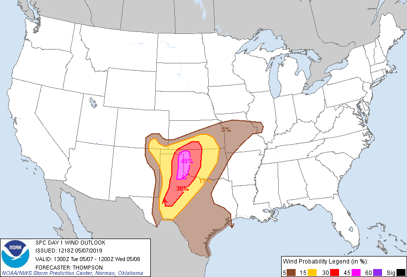
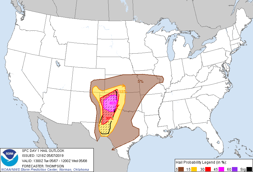
So we could see discrete supercells in the afternoon/evening out west, then
a line forming with possible bow echo storm formations pushing east into the
overnight hours. That would mean more of a wind/hail threat for points east,
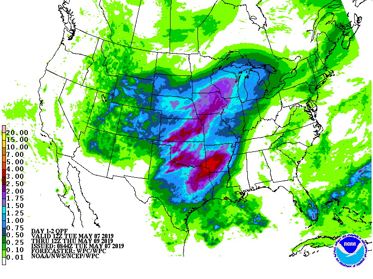
but those tornado spin ups can still occur along points in the line. And heavy
rains and flooding will remain likely in areas already flooded and/or saturated.
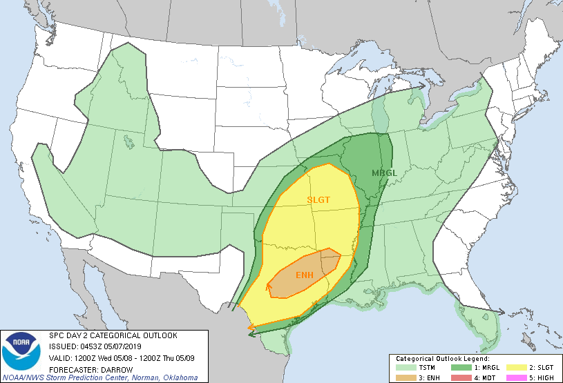
Wednesday's outlook looks a bit better for most of the state, mostly thanks to
the storms overnight tonight. So look for the silver lining there. Doesn't mean
that significant weather is not expected over the state, since the outlook
right now is conditional on what happens today and overnight. But it doesn't
look as bad as it did yesterday (again, CONDITIONALLY!). You'll definitely
want to watch the latest forecasts tomorrow to see if substantial changes are
made.
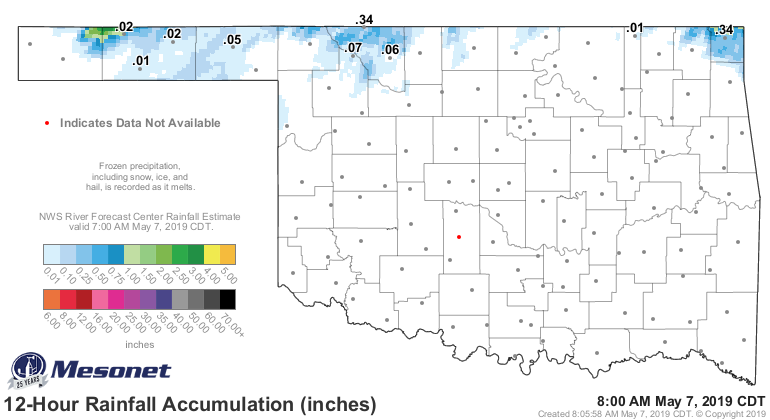
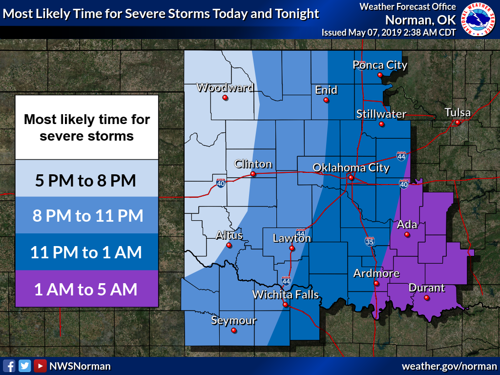
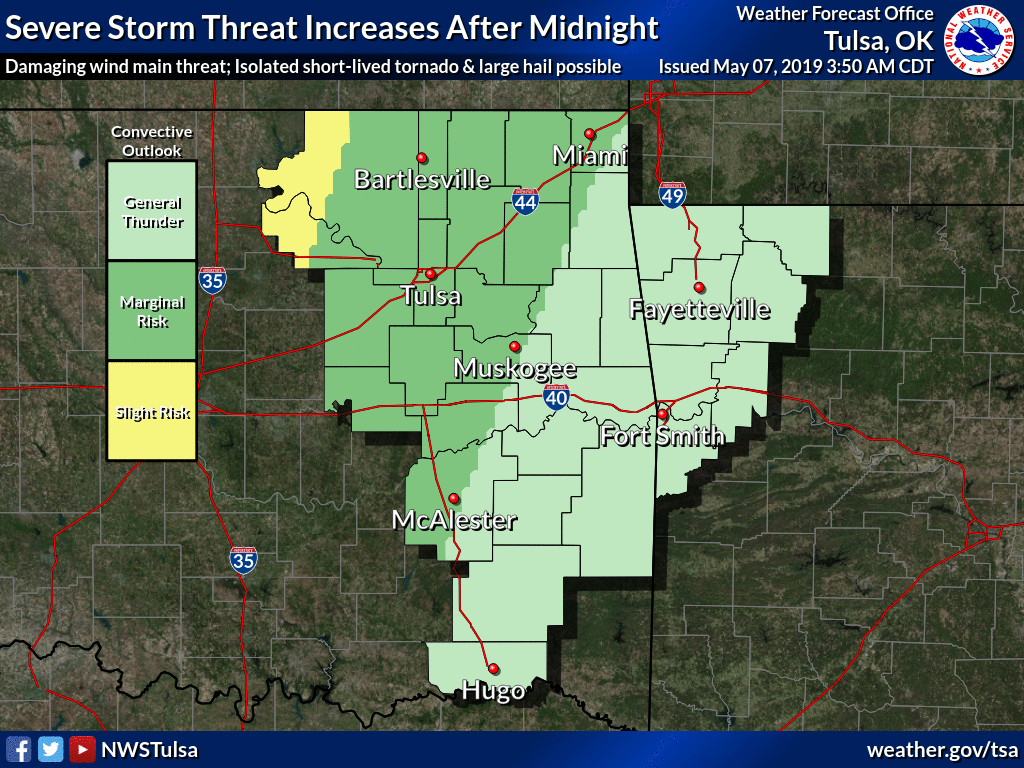
We'll seal it with a few graphics from our local NWS offices, giving you a bit
more detail. Stay weather aware. You don't want Mother Nature painting your
town red.
Gary McManus
State Climatologist
Oklahoma Mesonet
Oklahoma Climatological Survey
(405) 325-2253
gmcmanus@mesonet.org
May 7 in Mesonet History
| Record | Value | Station | Year |
|---|---|---|---|
| Maximum Temperature | 104°F | GRA2 | 2000 |
| Minimum Temperature | 32°F | KENT | 1999 |
| Maximum Rainfall | 6.81 inches | LANE | 2007 |
Mesonet records begin in 1994.
Search by Date
If you're a bit off, don't worry, because just like horseshoes, “almost” counts on the Ticker website!