Ticker for May 9, 2019
MESONET TICKER ... MESONET TICKER ... MESONET TICKER ... MESONET TICKER ...
May 9, 2019 May 9, 2019 May 9, 2019 May 9, 2019
John Wet
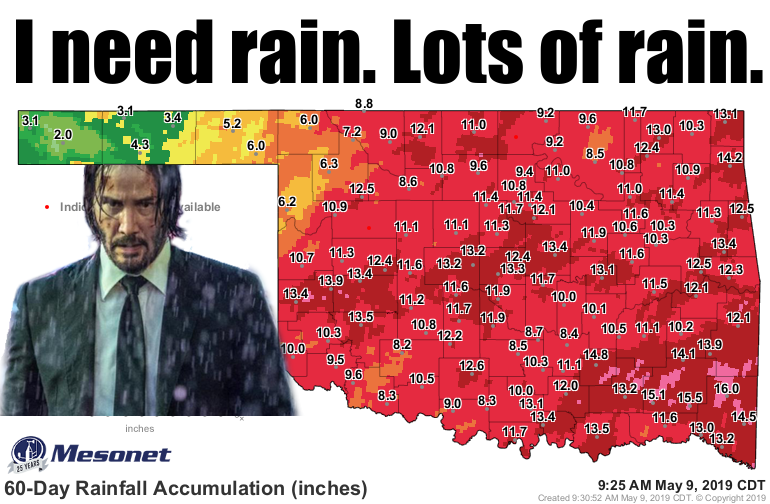
No, John Wick, you DON'T need more rain! It might make for good cinematography,
but it doesn't do so well for Oklahoma's lakes and rivers when it refuses to stop.
Is there a major river in the state NOT in flood stage?
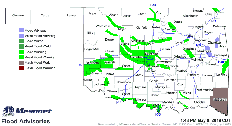
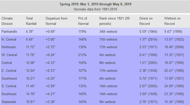
Heck, just look at the rain for spring thus far. West central is 6-8 inches above
normal, but a large area of the state is 4-6 inches above as well.

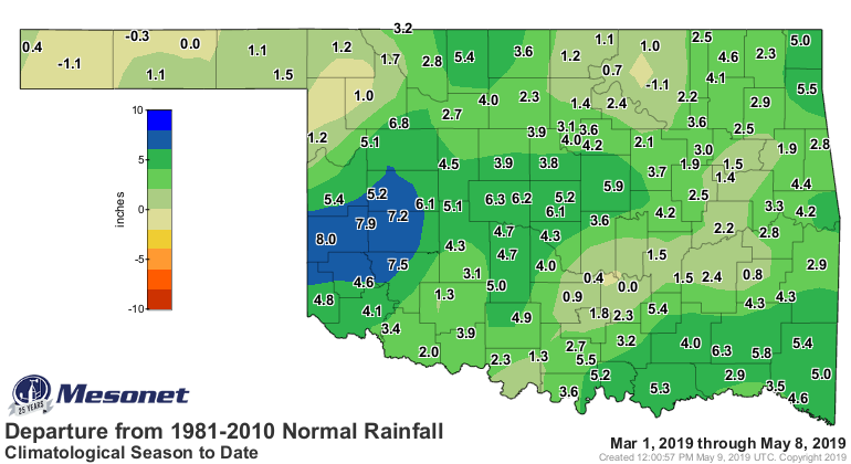
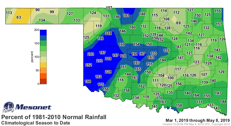
That period, March 1-May 8, is already the 9th wettest on record across the state
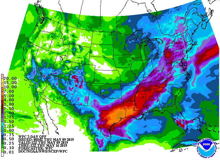
since at least 1921, and more rain is in the forecast over the next 7 days (and
it's spring, so why wouldn't it continue?).
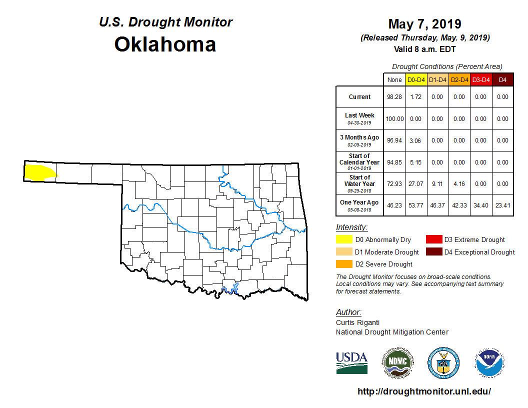
The only areas running a deficit are the western Panhandle and a tiny spot
around the Wynona Mesonet site in Osage County. Aaaaand, that caused us to ask
for a bit of D0 (abnormally dry conditions) out in Cimarron County. So we're
back with another yellow spot on this week's U.S. Drought Monitor map.
I'm betting we can wipe that out before the month is over. Surely that one
area of the state can get some rain eventually. I'm not ACTUALLY betting, but
come on...
Gary McManus
State Climatologist
Oklahoma Mesonet
Oklahoma Climatological Survey
(405) 325-2253
gmcmanus@mesonet.org
May 9 in Mesonet History
| Record | Value | Station | Year |
|---|---|---|---|
| Maximum Temperature | 107°F | ALTU | 2022 |
| Minimum Temperature | 31°F | EVAX | 2020 |
| Maximum Rainfall | 4.56″ | STIG | 2015 |
Mesonet records begin in 1994.
Search by Date
If you're a bit off, don't worry, because just like horseshoes, “almost” counts on the Ticker website!