Ticker for May 6, 2019
MESONET TICKER ... MESONET TICKER ... MESONET TICKER ... MESONET TICKER ...
May 6, 2019 May 6, 2019 May 6, 2019 May 6, 2019
Let's Rock
It took awhile to get here, and now that spring has arrived, it's letting its
hair down (same thing my scalp did years ago). It's been a tough one thus far.
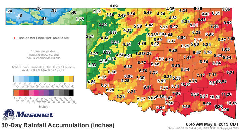
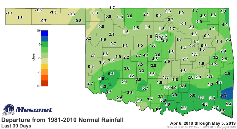
Plenty of rain, for those that need it. The last 30 days have been soggy to say
the least, at least for most of the state. The western Panhandle could use a bit
more, but the rest of us are ready for a dry spell I'd say.

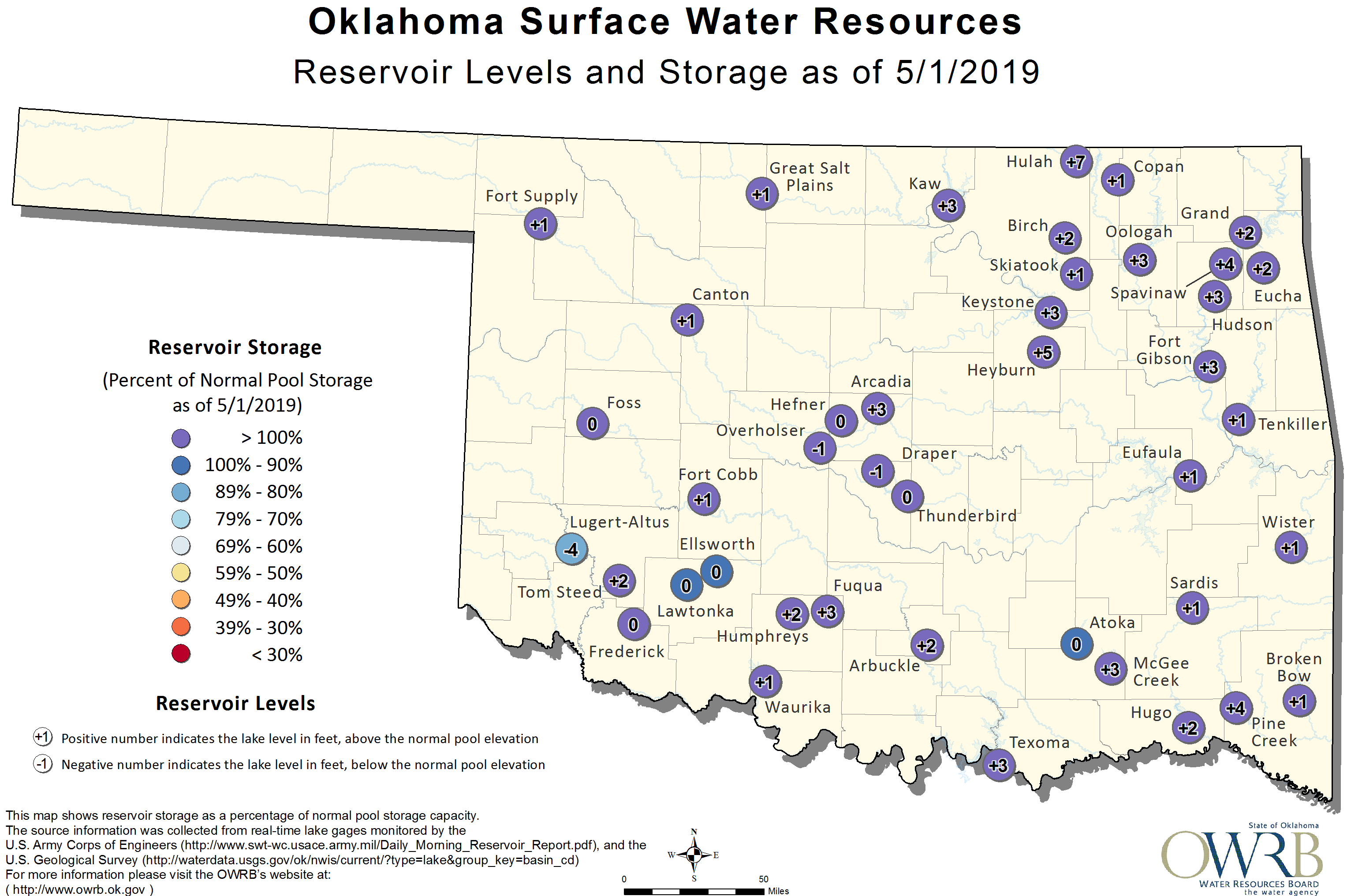
Most state lakes are full, or overflowing, so we have that going for us if we
dry out later. Flooding has been particularly bad, though, so not so great at
the current time.
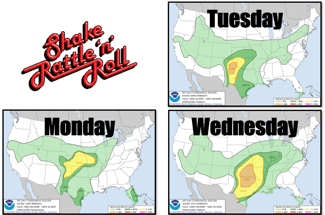
After a mostly benign first four months of the season, severe weather really
ramped up since the last day of April. I think we're well over a dozen tornadoes
for the year thus far, including that EF3 monster that traveled 27 miles from
Bryan to Atoka County. And it looks like the next three days will be active as
well, with most sights set on Wednesday as the big severe weather day with our
old nemesis, the western Oklahoma dryline firing off storms in the afternoon
to march to the east. Each day will have specific severe weather threats in
different parts of the state, however. Mostly western Oklahoma today and
tomorrow, then broadening out after that to include the rest of the state. As
per usual, Wednesday's severe threat is conditional on how the atmosphere
evolves between now and then.
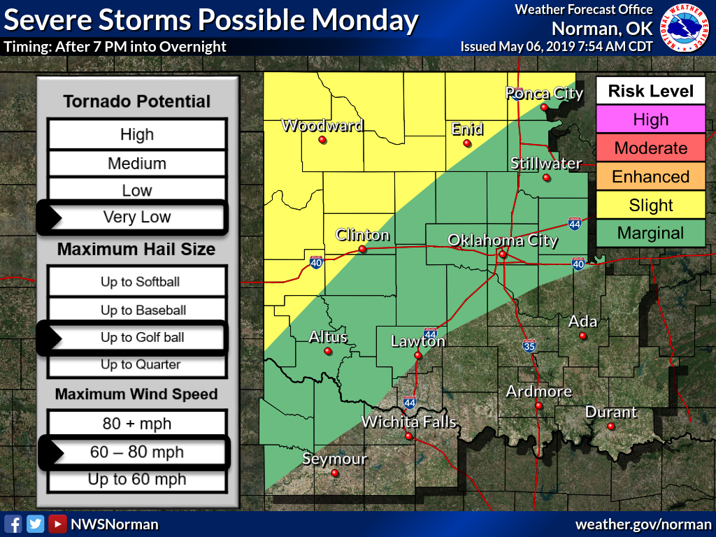
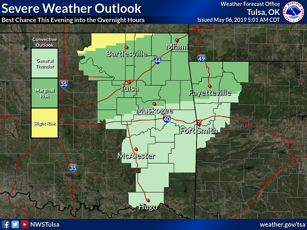
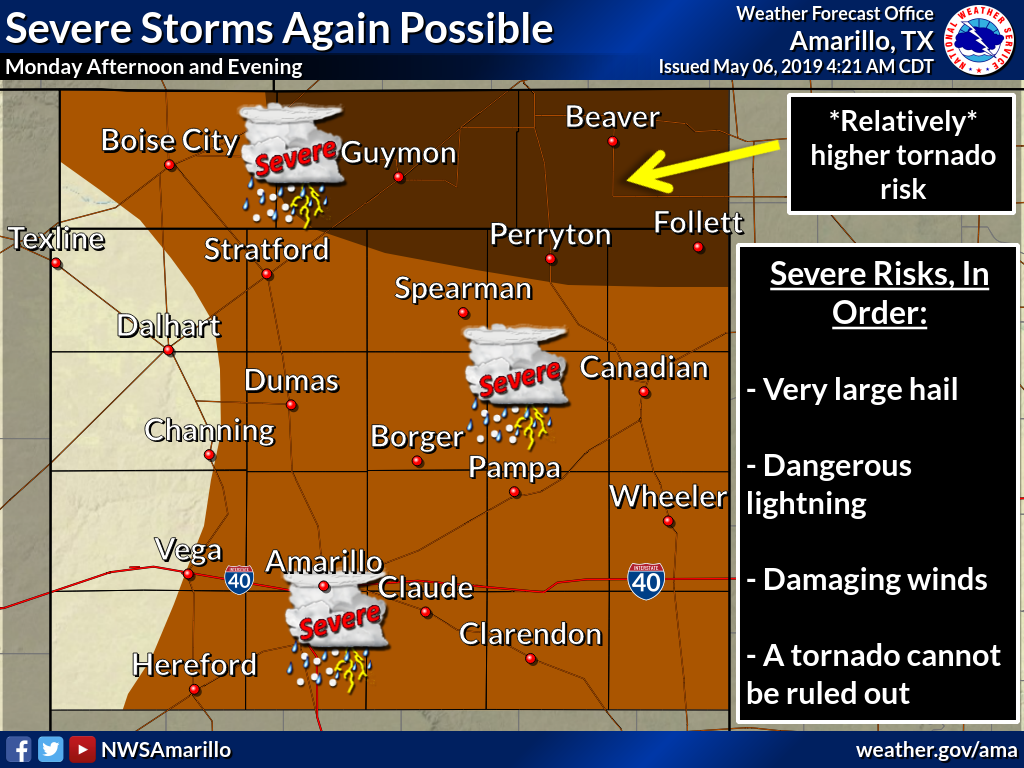
For today's threat, we'll rely on our NWS friends to tell the story.
More rain, more flooding will be possible. The next seven days look particularly
wet, especially across SE OK.

Looks like the tornado threat today is pretty low, higher tomorrow out
west, then throughout much of the state on Wednesday.
Turn around, don't drown. Stay weather aware. Don't spit into the wind.
Something about roller skating in a buffalo herd, etc.
Gary McManus
State Climatologist
Oklahoma Mesonet
Oklahoma Climatological Survey
(405) 325-2253
gmcmanus@mesonet.org
May 6 in Mesonet History
| Record | Value | Station | Year |
|---|---|---|---|
| Maximum Temperature | 105°F | CHER | 2014 |
| Minimum Temperature | 33°F | BOIS | 1999 |
| Maximum Rainfall | 5.02 inches | OKCE | 2015 |
Mesonet records begin in 1994.
Search by Date
If you're a bit off, don't worry, because just like horseshoes, “almost” counts on the Ticker website!