Ticker for April 4, 2019
MESONET TICKER ... MESONET TICKER ... MESONET TICKER ... MESONET TICKER ...
April 4, 2019 April 4, 2019 April 4, 2019 April 4, 2019
Oh (COLD) snap!
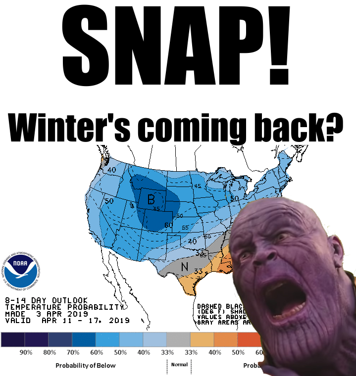
Hey, I'm an "April half-cold" kind of a guy. While the rest of the clodhoppers
are talking severe weather (you know, something exciting and actually worth
talking about), I'm constantly scanning the CPC medium-range outlooks for any
sign of cold fronts. Well, looks like one is brewing for sometime around next
weekend. Not sure HOW cold yet, or even if it will come to fruition, but any
sign of cold weather after I've seen an 80-degree temperature is enough to raise
my hackles (my hackles are about as impressive as my scalp, however, so it's
a rhetorical hackle-raise). And if it's the one thing to scare Thanos (other than
trying to buy tickets online to his own movie), it's enough to scare me.
Here's a fantasy-cast (more like horror-cast) of what the long-range model output
is showing for next Friday morning.
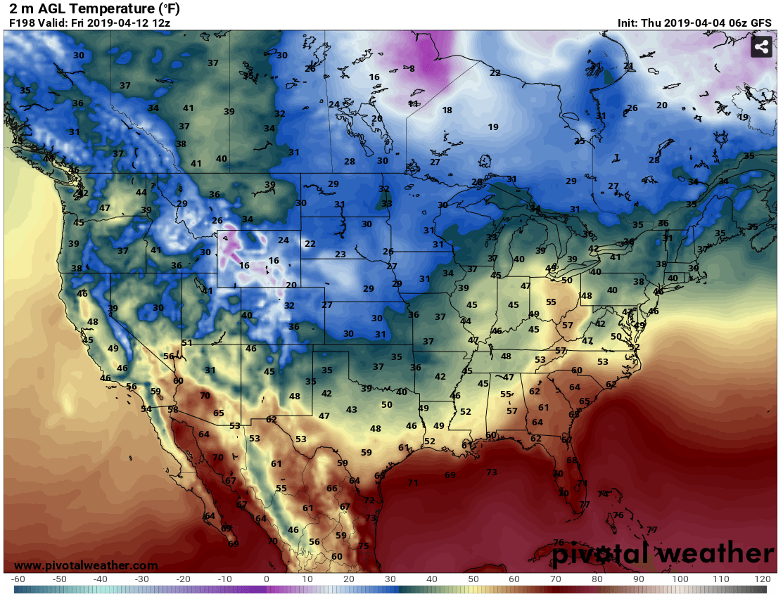
That freezing weather is WAY too close to Oklahoma, and more importantly, ME!
Luckily, this is so far out it has lots of time to change, hopefully for the
better.
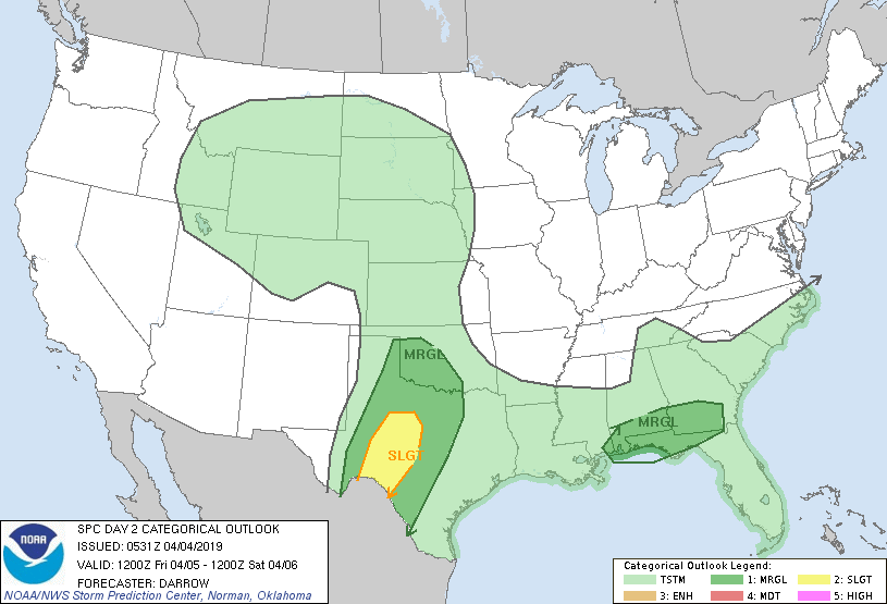
About that severe weather last night. I thought the NWS and SPC did an
excellent job pinpointing the location, as we showed you their risk map from
yesterday morning.
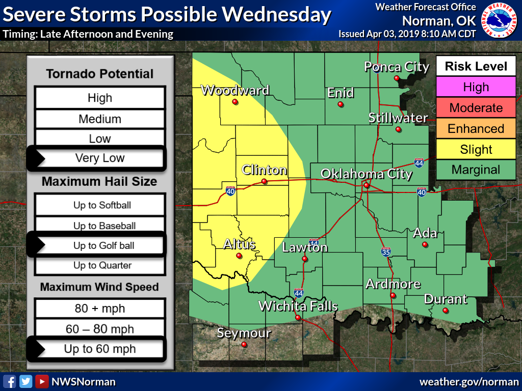
And the tennis-to-baseball size hail down in the far southwest would qualify as
severe, I'd say.
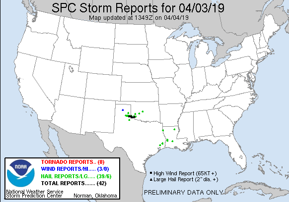
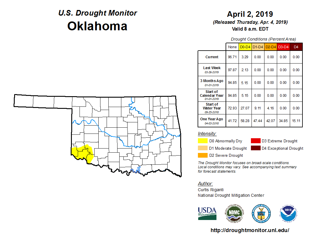
They didn't get nearly enough rain down in that far SW corner, however, although
others got a pretty good soaking.
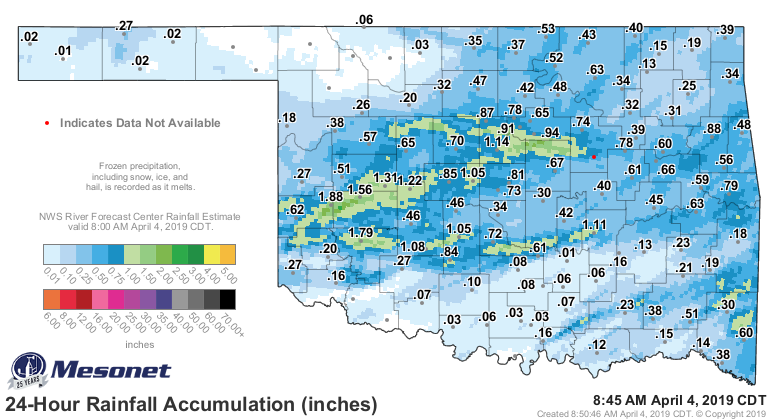
So that left the "abnormally dry" conditions down in that area mostly untouched,
so we'll need to try again for next week's Drought Monitor report.
Luckily, we have another chance of rain this weekend, although as usual, for
now it looks like eastern Oklahoma will have the biggest totals.

More severe weather chances as well, possibly.
As for me, I'll continue gazing in fear at NEXT weekend's forecast. Come on,
Mother Nature, just give us a finger snap and eliminate HALF of that cold
weather.
Gary McManus
State Climatologist
Oklahoma Mesonet
Oklahoma Climatological Survey
(405) 325-2253
gmcmanus@mesonet.org
April 4 in Mesonet History
| Record | Value | Station | Year |
|---|---|---|---|
| Maximum Temperature | 94°F | ALTU | 2023 |
| Minimum Temperature | 16°F | BUFF | 2018 |
| Maximum Rainfall | 4.31 inches | TALI | 2025 |
Mesonet records begin in 1994.
Search by Date
If you're a bit off, don't worry, because just like horseshoes, “almost” counts on the Ticker website!