Ticker for April 3, 2019
MESONET TICKER ... MESONET TICKER ... MESONET TICKER ... MESONET TICKER ...
April 3, 2019 April 3, 2019 April 3, 2019 April 3, 2019
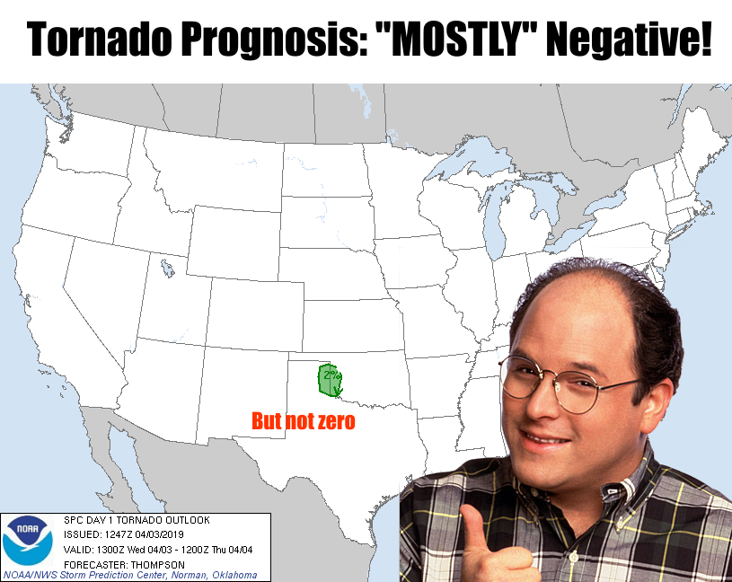
George is getting happy!
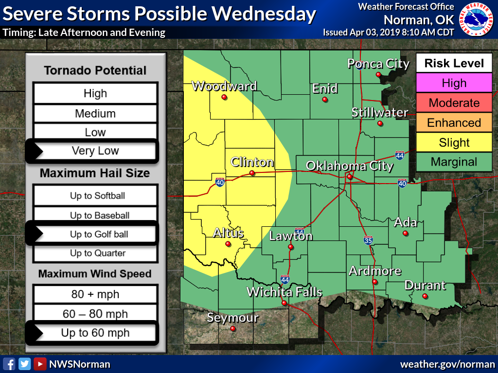
It's April, you have a strong-ish storm system approaching from the west with a
dryline setting up later this afternoon, some decent heat...normally a perfect
setup for severe weather in these parts. And as we know in Oklahoma, severe
storms in the spring can and often will bring hail and winds...and rarely a
tornado or two (or 60). But today doesn't really look like one of those days.
There IS a chance for severe weather, but the conditions aren't perfect. What's
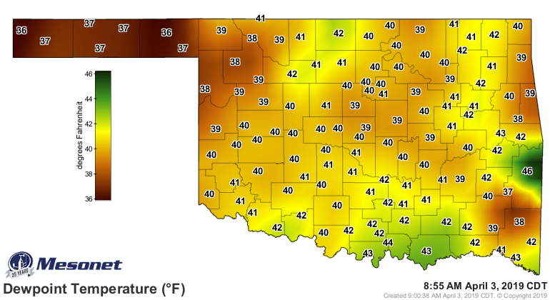
lacking, at least it looks that way right now, is some good deep moisture for
the storms to work with. Dewpoints are in the 30s and 40s, for crying out loud,
and they're not that great to our south!
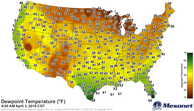
Some of that should make its way north on strong southerly winds, but it's not
looking good for robust severe weather (YAY!!!), but it's also not looking good
for some significant rains across western Oklahoma either (BOO!!!). Another
impediment will be some warm air aloft trying to cut off any of those updrafts
before they manage to take off into full blown thunderstorms. So we do need
that afternoon heat to kick it up a notch or three.
But suppose (and you might as well say "EXPECT" so you can be prepared, just in
case) storms form and they do go severe? Well, remember the phrase, the tornado
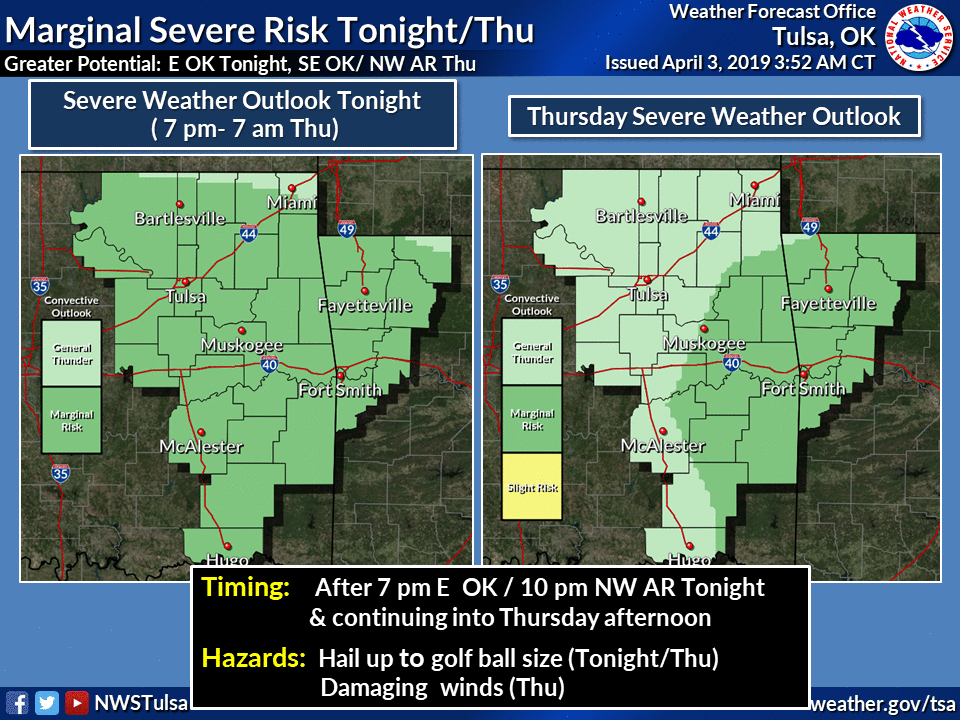
threat is low, even very low, but it ain't zero. Here are the takes from all
the local NWS offices that cover Oklahoma.
There will be another chance of rain as we get into the weekend (OF COURSE!),
but we are starting to need it out west. I'd say this forecast is the best case
scenario...these do tend to disappoint it seems.

Stay weather aware as we deal with today and then the weekend! Lots of time for
those forecasts to change for the worse (or better).
Gary McManus
State Climatologist
Oklahoma Mesonet
Oklahoma Climatological Survey
(405) 325-2253
gmcmanus@mesonet.org
April 3 in Mesonet History
| Record | Value | Station | Year |
|---|---|---|---|
| Maximum Temperature | 103°F | ALTU | 2011 |
| Minimum Temperature | 15°F | KENT | 2002 |
| Maximum Rainfall | 3.12 inches | WAUR | 2012 |
Mesonet records begin in 1994.
Search by Date
If you're a bit off, don't worry, because just like horseshoes, “almost” counts on the Ticker website!