Ticker for April 8, 2019
MESONET TICKER ... MESONET TICKER ... MESONET TICKER ... MESONET TICKER ...
April 8, 2019 April 8, 2019 April 8, 2019 April 8, 2019
Springtime Rock
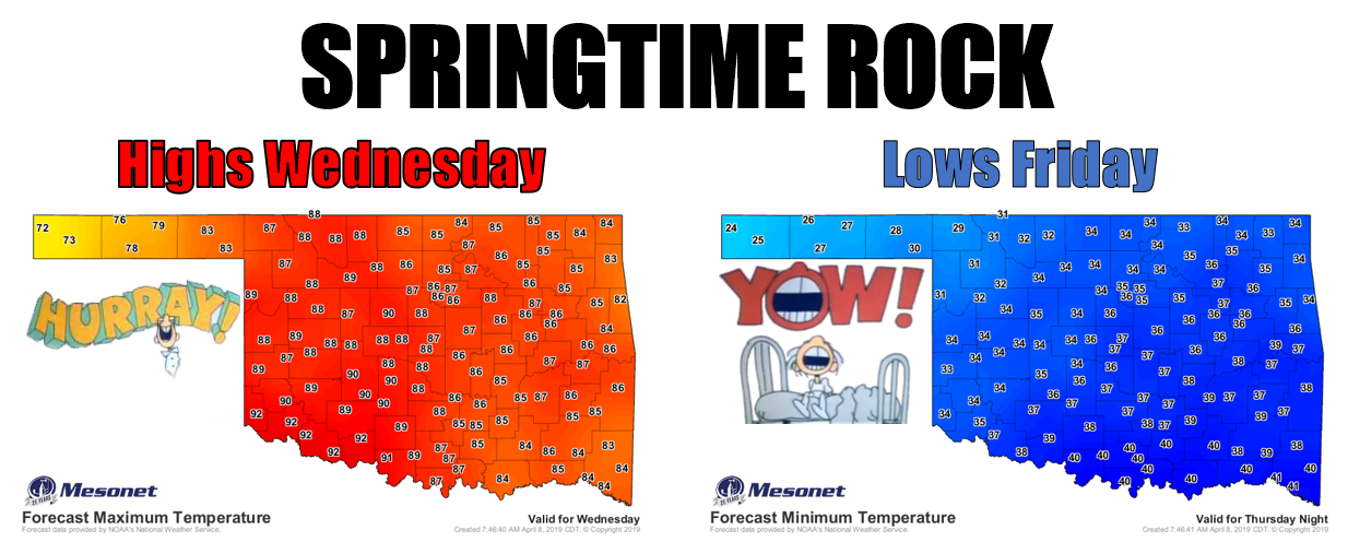
SPRIIINNNGGGGTIIIIIME, IN OKLAHOMAAAAAAA (add your own reverb effect)! We're gonna
get one of those classic "hey, what season is it?" weeks, with heat, fire, a
few storms, then a blast of cold, and maybe even a few flakes in far northern
Oklahoma. Yes, there WILL be a hard freeze Friday morning across the far northwest.
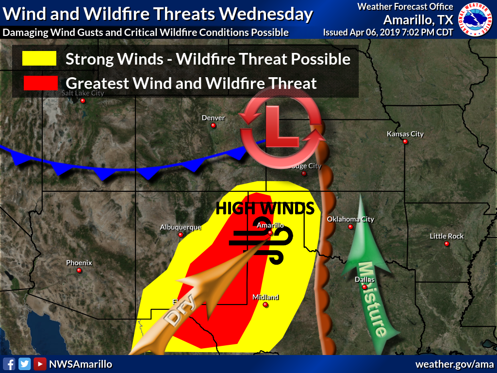
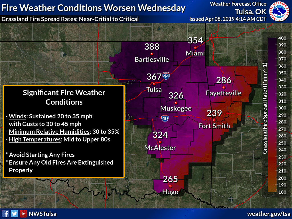
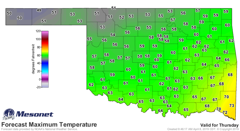
I think the biggest story will be the fire danger on Wednesday, however. The heat
we're going to see on Wednesday will be in advance of a storm system bringing
us that cold front and accompanying dryline. So expect winds gusting to over 50
mph with extremely low humidity and highs close to 90 degrees. That's a perfect
recipe for some fiery mayhem. Here's the take from our NWS friends.
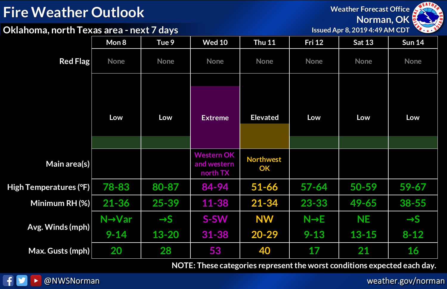
That cold front will be quite a shock to the system as it moves through, with
highs on Thursday through the weekend struggling to reach 60.
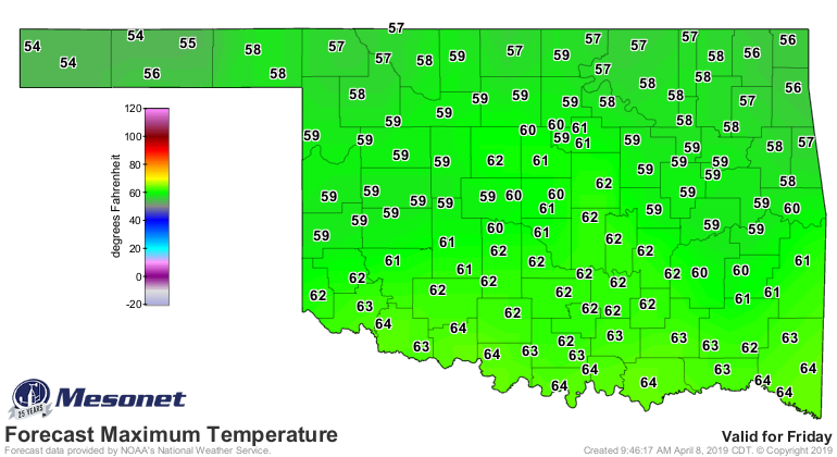
MAYBE a few storms as that dryline moves to the east of I-35, but not a lot of
moisture to work with, unfortunately. Maybe a better chance of rain this
weekend, but still looks a bit on the dry side for the western half of the
state.
I guess enjoy the variety? Soon it will just be hot (YAYYY!), and then it will
just be hot AND humid (YOW!).
Gary McManus
State Climatologist
Oklahoma Mesonet
Oklahoma Climatological Survey
(405) 325-2253
gmcmanus@mesonet.org
April 8 in Mesonet History
| Record | Value | Station | Year |
|---|---|---|---|
| Maximum Temperature | 96°F | MANG | 2020 |
| Minimum Temperature | 17°F | JAYX | 2007 |
| Maximum Rainfall | 3.22 inches | BIXB | 2008 |
Mesonet records begin in 1994.
Search by Date
If you're a bit off, don't worry, because just like horseshoes, “almost” counts on the Ticker website!