Ticker for March 7, 2019
MESONET TICKER ... MESONET TICKER ... MESONET TICKER ... MESONET TICKER ...
March 7, 2019 March 7, 2019 March 7, 2019 March 7, 2019
Floodstone
Lovely, Mother Nature, you cur! Cur's a nice word. Too bad we don't use more of
it. Kerfuffle, too. Like, "How could you give us more cold weather, you cur? You
caused quite a kerfuffle!" Cool old words aside, some folks actually need that
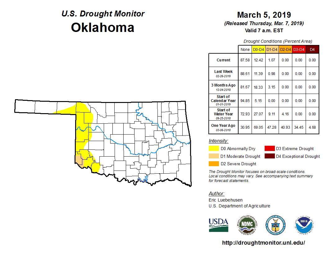
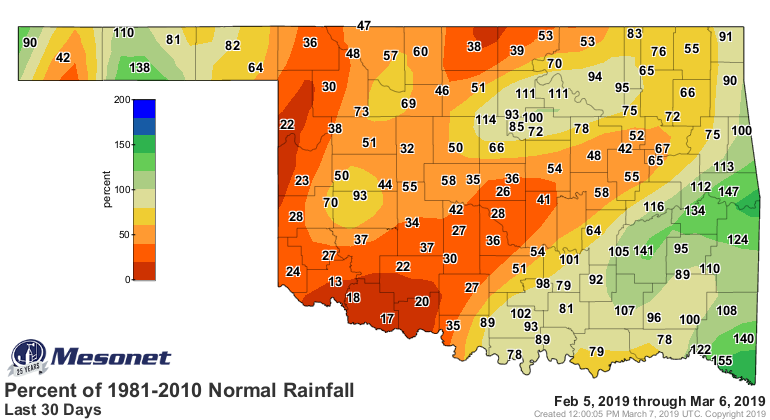
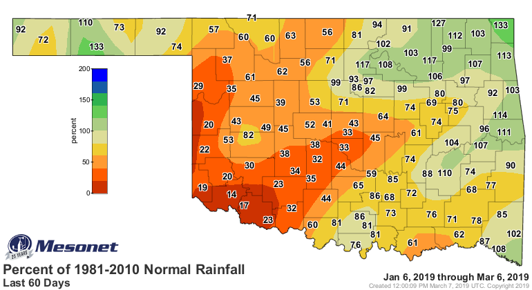
rain. Western Oklahoma has been quite dry all the way out to 90 days or so, and
has lead to more of those bad colors on the U.S. Drought Monitor map.
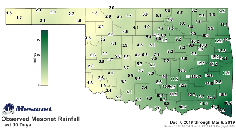
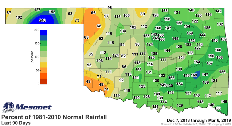
And it's been especially dry from 30-60 days.
Not everybody needs it, though. Some folks are trying to plant crops, and muddy
fields don't help in the regard. And others are just tired of having muddy
driveways and yards. But it certainly appears rain is on the way. The first
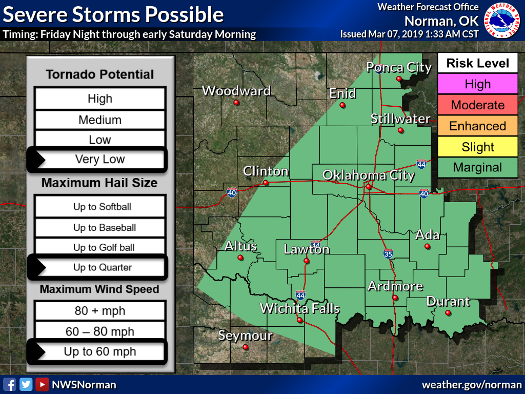
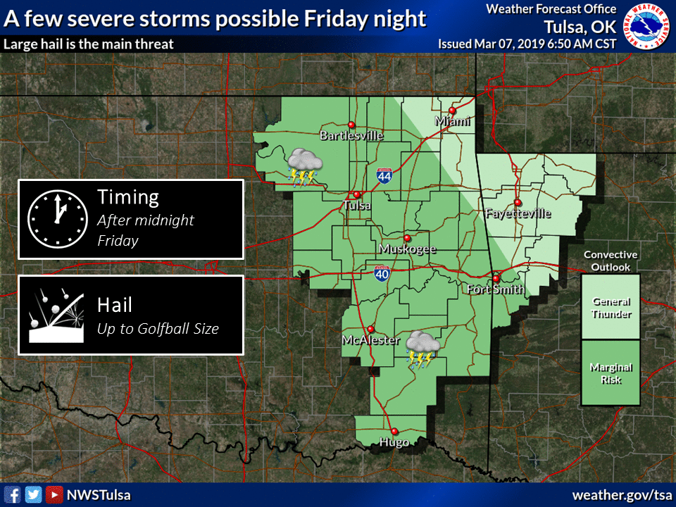
batch of moisture arrives Friday and Saturday, along with the threat of some
severe weather. We're mostly talking some small hail and marginally severe
winds here...but keep in mind it's spring in Oklahoma. A couple of days away
so that means there is some wiggle left in the forecast.
And then our next big chance comes early next week on Tuesday and Wednesday.
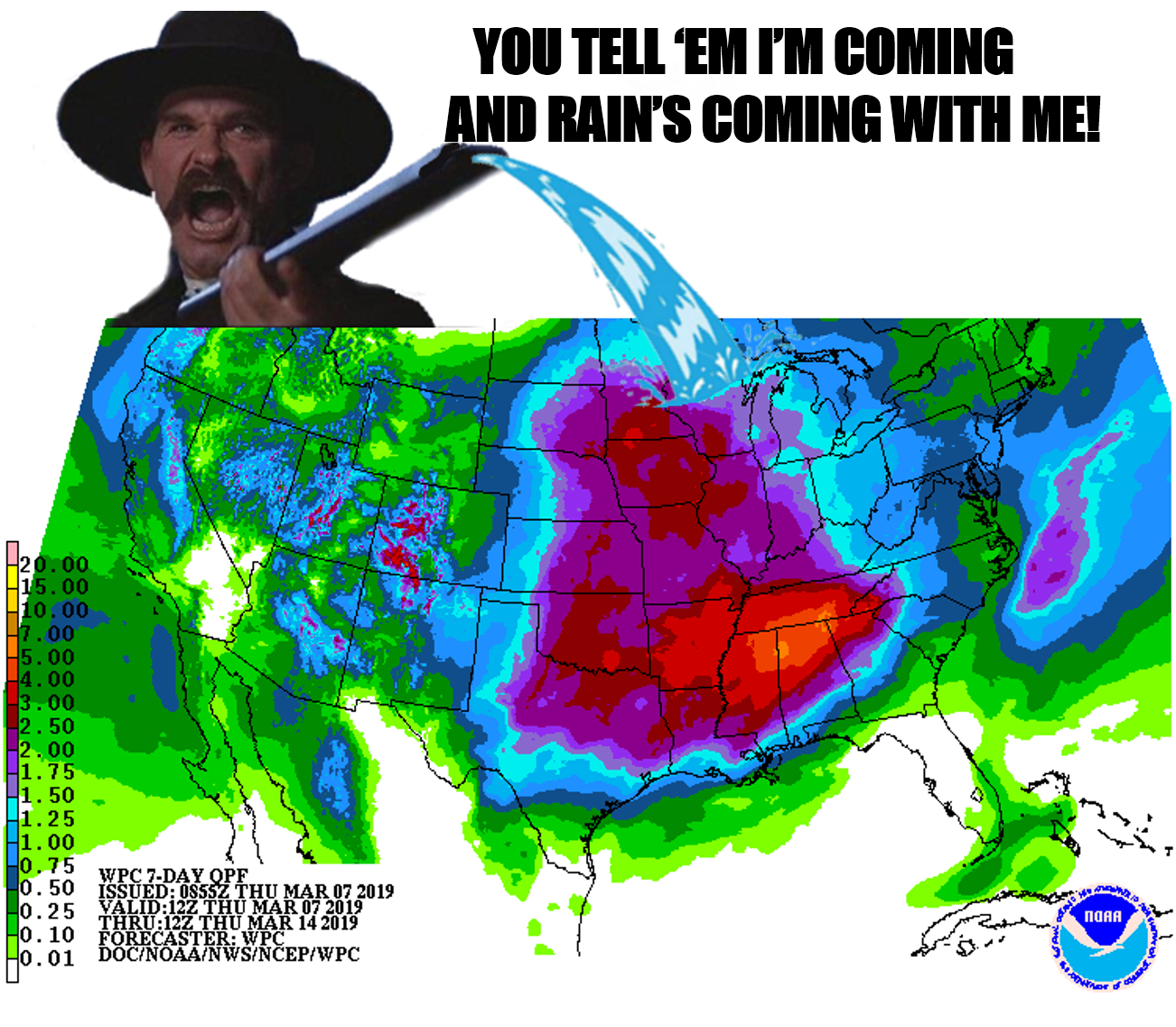
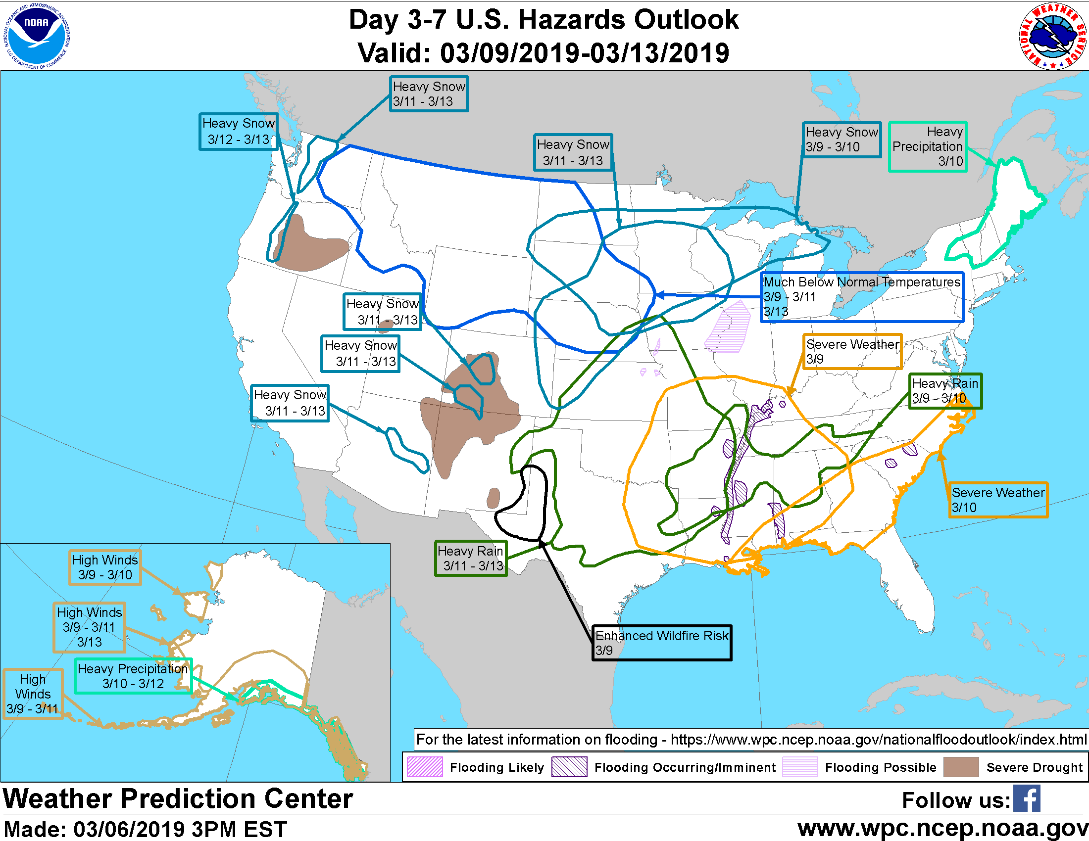
Heavy rainfall is possible, and flooding will be a concern. I know this looks
like a venn diagram created by a schizophrenic squirrel, but if you'll look
closely you can see the Weather Prediction Center has Oklahoma pegged for a
severe weather risk this weekend, and heavy rain next week.
Get those galoshes ready. Now what's next? I know, how about a spelling
contest?

Gary McManus
State Climatologist
Oklahoma Mesonet
Oklahoma Climatological Survey
(405) 325-2253
gmcmanus@mesonet.org
March 7 in Mesonet History
| Record | Value | Station | Year |
|---|---|---|---|
| Maximum Temperature | 87°F | HOLL | 2006 |
| Minimum Temperature | 8°F | SEIL | 2008 |
| Maximum Rainfall | 3.76 inches | PRYO | 1998 |
Mesonet records begin in 1994.
Search by Date
If you're a bit off, don't worry, because just like horseshoes, “almost” counts on the Ticker website!