Ticker for March 4, 2019
MESONET TICKER ... MESONET TICKER ... MESONET TICKER ... MESONET TICKER ...
March 4, 2019 March 4, 2019 March 4, 2019 March 4, 2019
MWAHAHAHAHA!
Just wait, it's almost over. Our lovely spring (climatological, which is all that
counts on this here Ticker) visit from the arctic will soon be but a terrible,
frozen memory. Heck, my memory has been frozen for years and I'm still kicking!
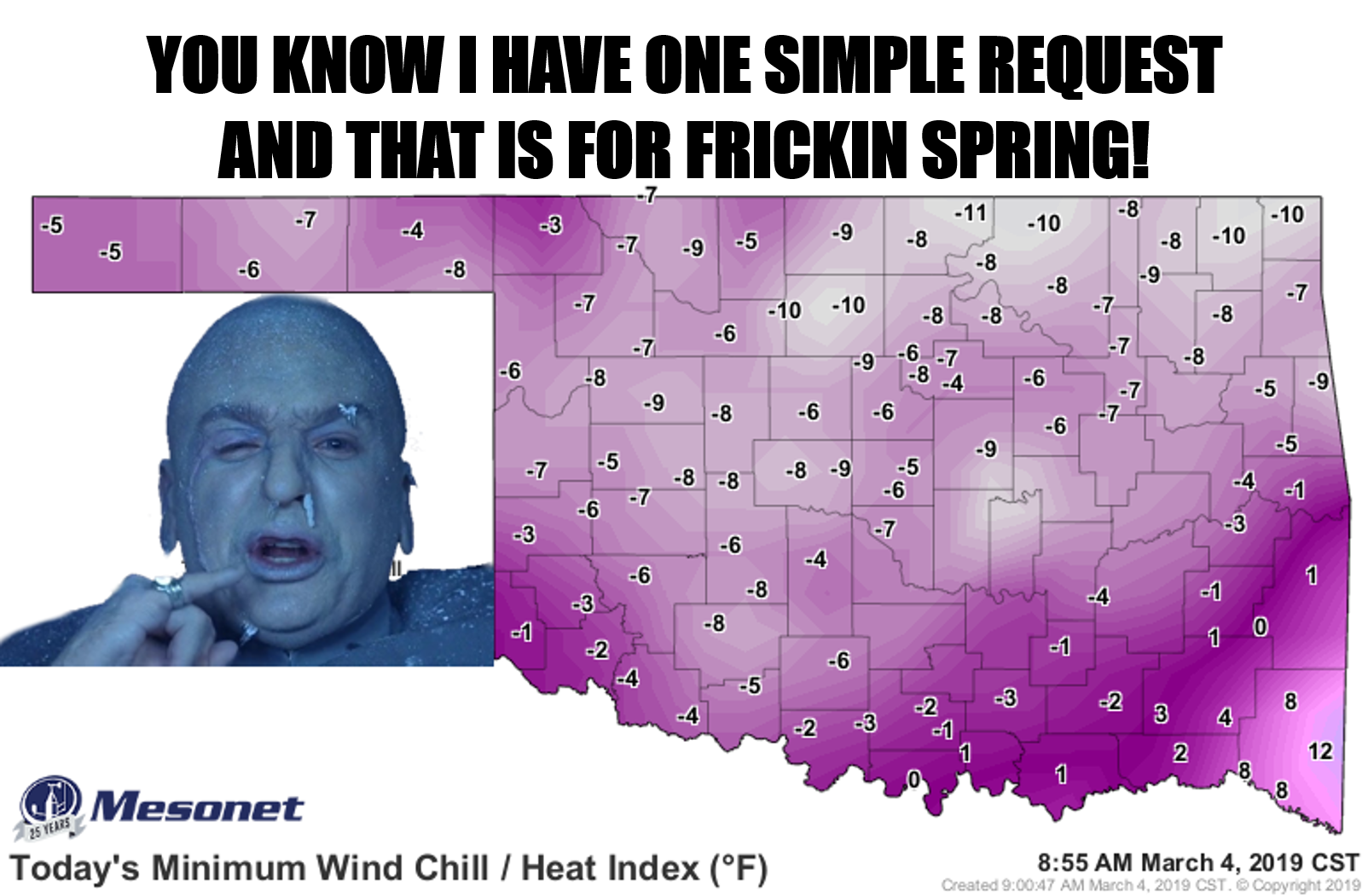
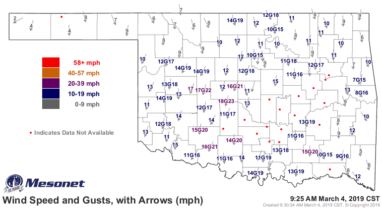
The values above are today's minimum wind chill values since midnight. It's
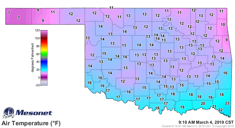
downright balmy now, with single digits dominating. And actual air temperatures
are holding in the teens after a quick trip into the single digits for some.
(BTW, we're missing some wind chills because some of our wind sensors are
frozed over..."frozed" is Okie for "frozen")
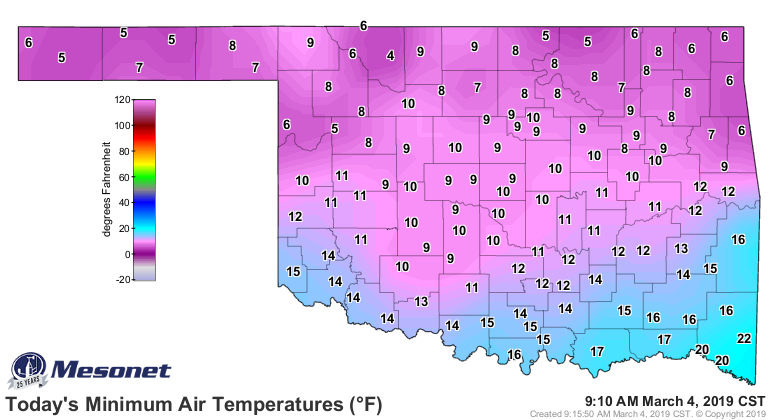
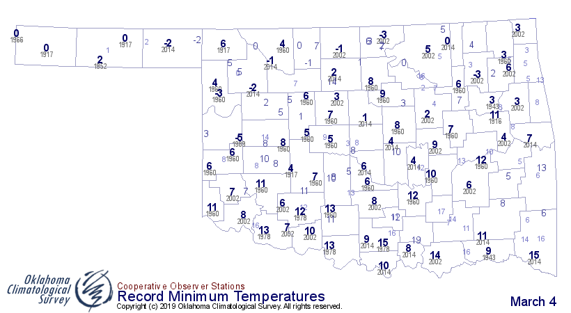
It's not the coldest March 4 on record, at least not for most of Oklahoma, but
it's pretty darned close. Here's a map with those record lows on it, including
year of occurrence. Apparently March 4, 2014, was not a pleasant one either!
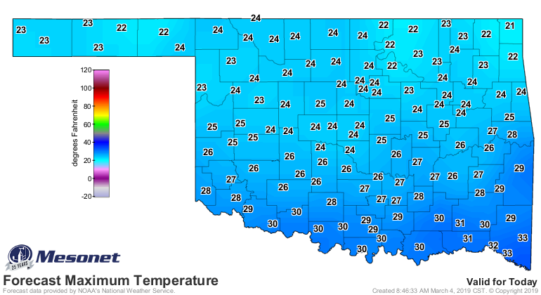
Don't fret, record seekers. we can still break some lowest maximum temperature
records if that suits ya. 1960...another not-so-pleasant March 4.

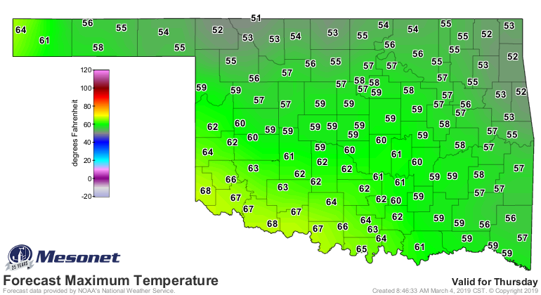
As for me, I'll just keep my eye on Thursday, when highs are forecast to
get all the way up into the 50s and 60s. A veritable heat wave!
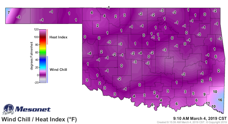
We'll leave ya with the various hours below freezing maps from the Mesonet.
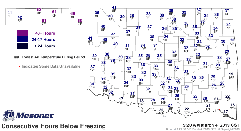

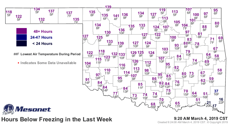
How about some zeroes on those maps. Throw us a frickin bone here, Mother
Nature!
Gary McManus
State Climatologist
Oklahoma Mesonet
Oklahoma Climatological Survey
(405) 325-2253
gmcmanus@mesonet.org
March 4 in Mesonet History
| Record | Value | Station | Year |
|---|---|---|---|
| Maximum Temperature | 91°F | HOLL | 2009 |
| Minimum Temperature | -5°F | VINI | 2002 |
| Maximum Rainfall | 5.31 inches | KING | 2004 |
Mesonet records begin in 1994.
Search by Date
If you're a bit off, don't worry, because just like horseshoes, “almost” counts on the Ticker website!