Ticker for March 11, 2019
MESONET TICKER ... MESONET TICKER ... MESONET TICKER ... MESONET TICKER ...
March 11, 2019 March 11, 2019 March 11, 2019 March 11, 2019
Ugh
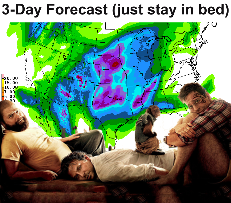
(if you wanna see the forecast map without the "Hangover" guys (and monkey),
here ya go.
I'm gonna be honest with ya...Daylight Savings Time kicked my behind this year
(and I said "behind" because I didn't want to say "butt" in the Ticker). Usually
when we do the switch, I take it in stride. Part of that is because I woke up
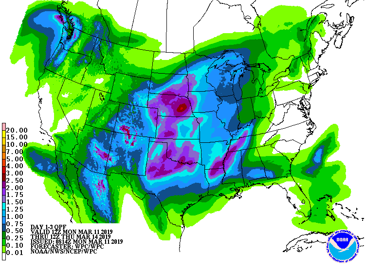
yesterday to a cold, windy and wet day, and that's basically what the forecast
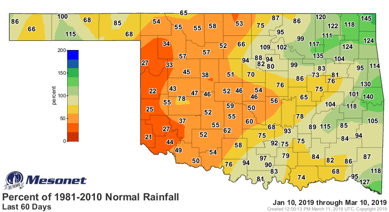
is for the next 3 days. Not everybody received rain over the weekend. It was
another one of those I-44 storms (if you were NW of I-44, you were out of luck
by and large).
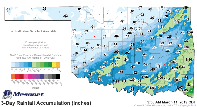
And that area of the state definitely needs some rain.
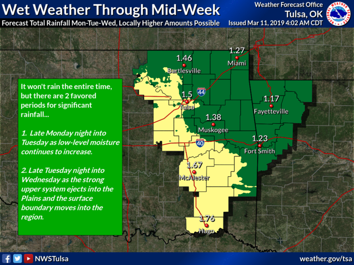
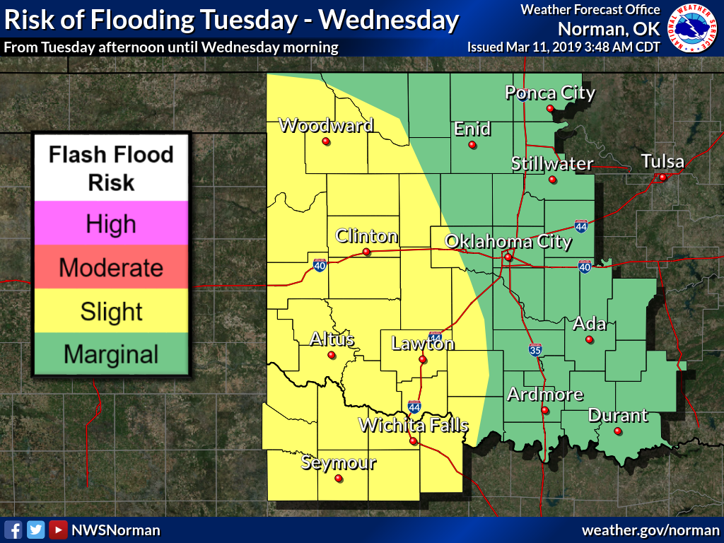
Well, here comes the rain and gray skies. We'll even have a flood risk across
far western Oklahoma, which would go a long way to dampen their drought risk.
"Dampen." Get it? I didn't either.
At least we'll see temperatures start to rise through Wednesday before our next
front, then we'll start the process all over again.
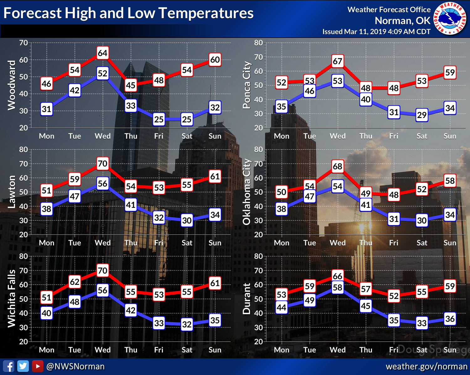
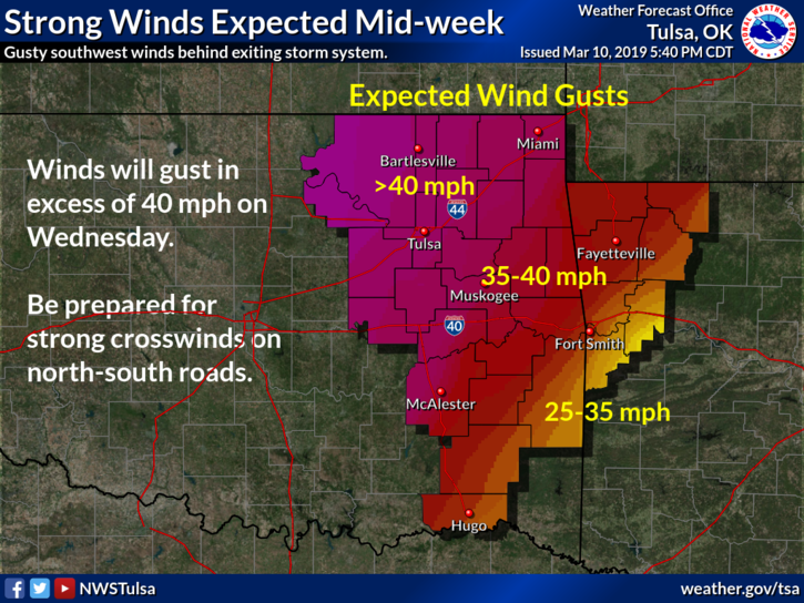
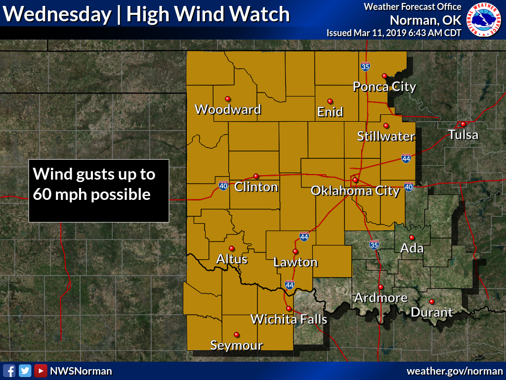
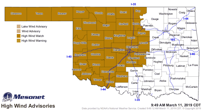
And Wednesday will be windy! Not sure how your umbrellas will work that day,
so maybe a face shield of some type is in order.
Cold then warm, gray skies, windy, wet...like the first graphic says, just
go back to bed!
Gary McManus
State Climatologist
Oklahoma Mesonet
Oklahoma Climatological Survey
(405) 325-2253
gmcmanus@mesonet.org
March 11 in Mesonet History
| Record | Value | Station | Year |
|---|---|---|---|
| Maximum Temperature | 90°F | MANG | 2023 |
| Minimum Temperature | 9°F | SLAP | 1998 |
| Maximum Rainfall | 2.62 inches | IDAB | 2012 |
Mesonet records begin in 1994.
Search by Date
If you're a bit off, don't worry, because just like horseshoes, “almost” counts on the Ticker website!