Ticker for February 18, 2019
MESONET TICKER ... MESONET TICKER ... MESONET TICKER ... MESONET TICKER ...
February 18, 2019 February 18, 2019 February 18, 2019 February 18, 2019
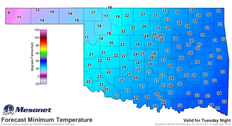
Thirty-Two fer Tuesday
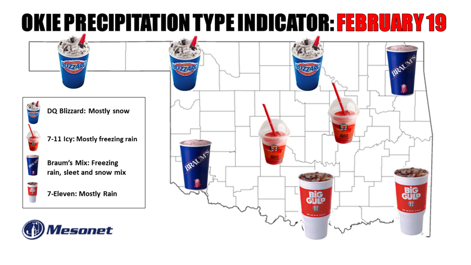
I'm a Big Gulp guy myself...should probably have gone with something from Love's
down in the southeast. But can't we all agree on the deliciousness of a Blizzard?
The Dairy Queen variety, at least.
Here we go again with another shallow later of arctic air over the state, moisture
coming up and over that air from the south, and a whole lot of complicating
factors in between. As we've talked about many times this winter alone, the key
factors for precipitation type in a winter storm rest on the vertical profile
of temperature in the atmosphere above the surface. Best show you a graphic or
two here instead of my clumsy explanation.
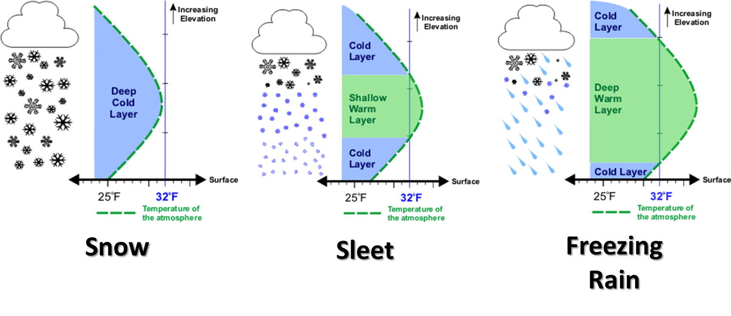
So with a probable layer of above freezing air, uhhhhh...above the surface, we'll
likely see some type of ice tomorrow across central and southern Oklahoma. Maybe
mostly snow to the north where uninterrupted freezing air aloft is more likely.
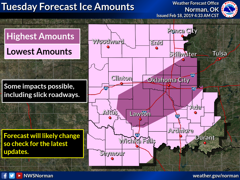
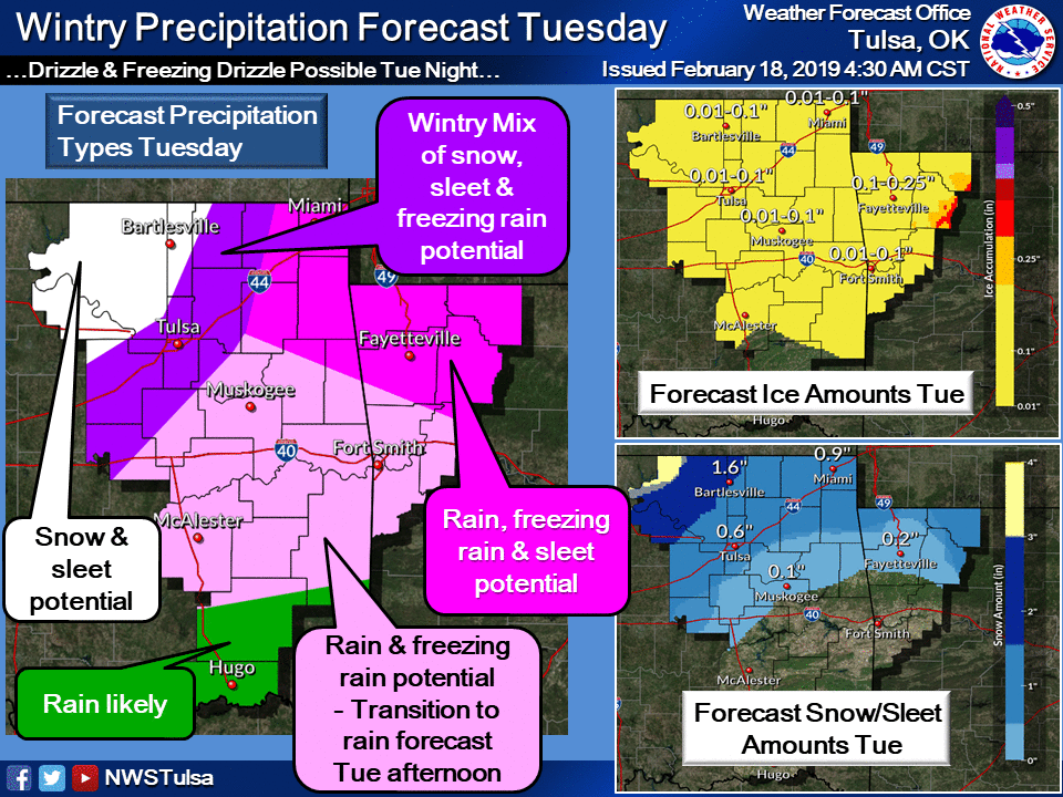
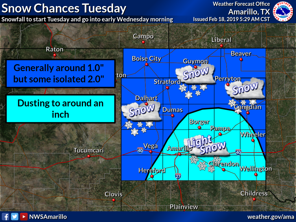
Here's what our friends at the NWS offices that cover the state think for
tomorrow (which serves as the basis for our Okie Precip Type Indicator map!).
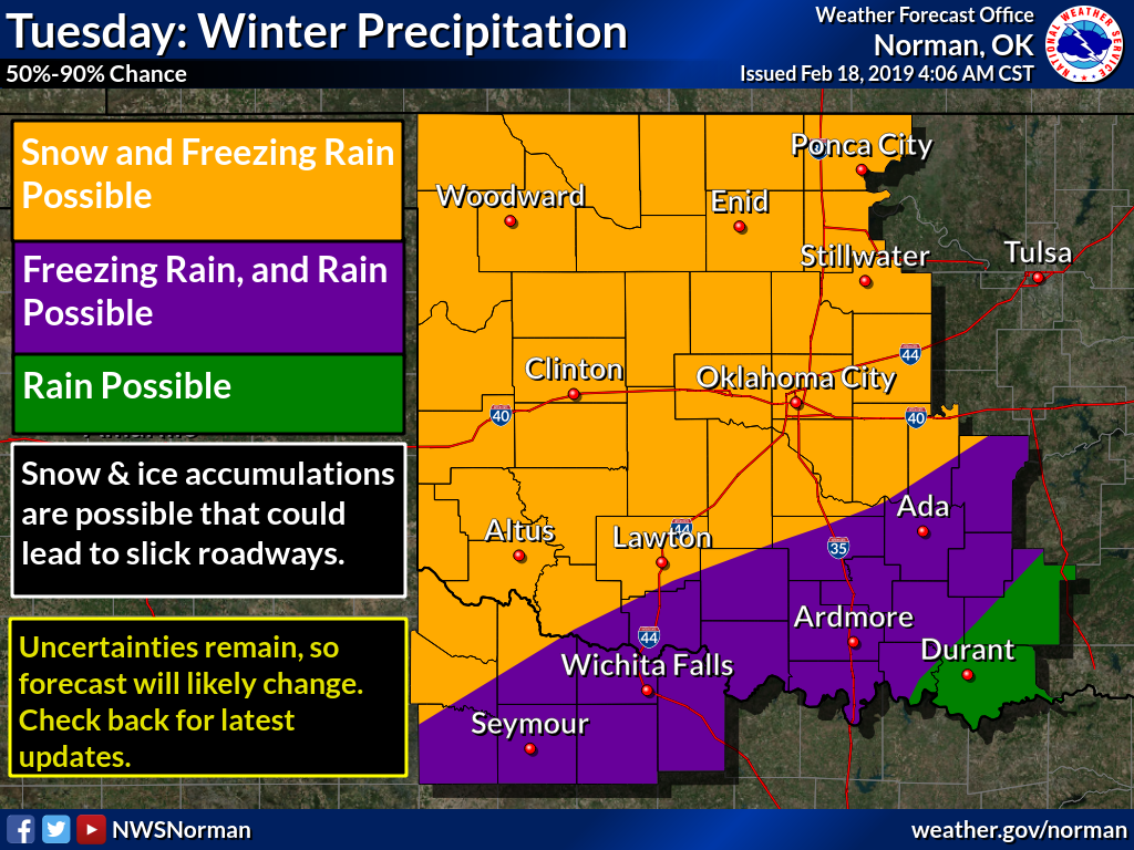
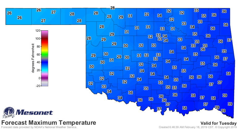
Equally important for the IMPACT types in your area...where is that darned
freezing line going to be tomorrow? Frozen precipitation falling into air near
the surface of 33 degrees is going to be a vastly different experience as
opposed to falling into 31 degrees (but especially even lower than that). These
high temperatures forecast for tomorrow aren't as important as what the actual
temps will be as the precip is falling. If that high comes at 10pm, that doesn't
really matter to you in your afternoon commute if it's 31 degrees, right?
But know that it's going to be COLD Wednesday morning, but no danger of
lingering impacts into Wednesday afternoon with climbing temperatures.

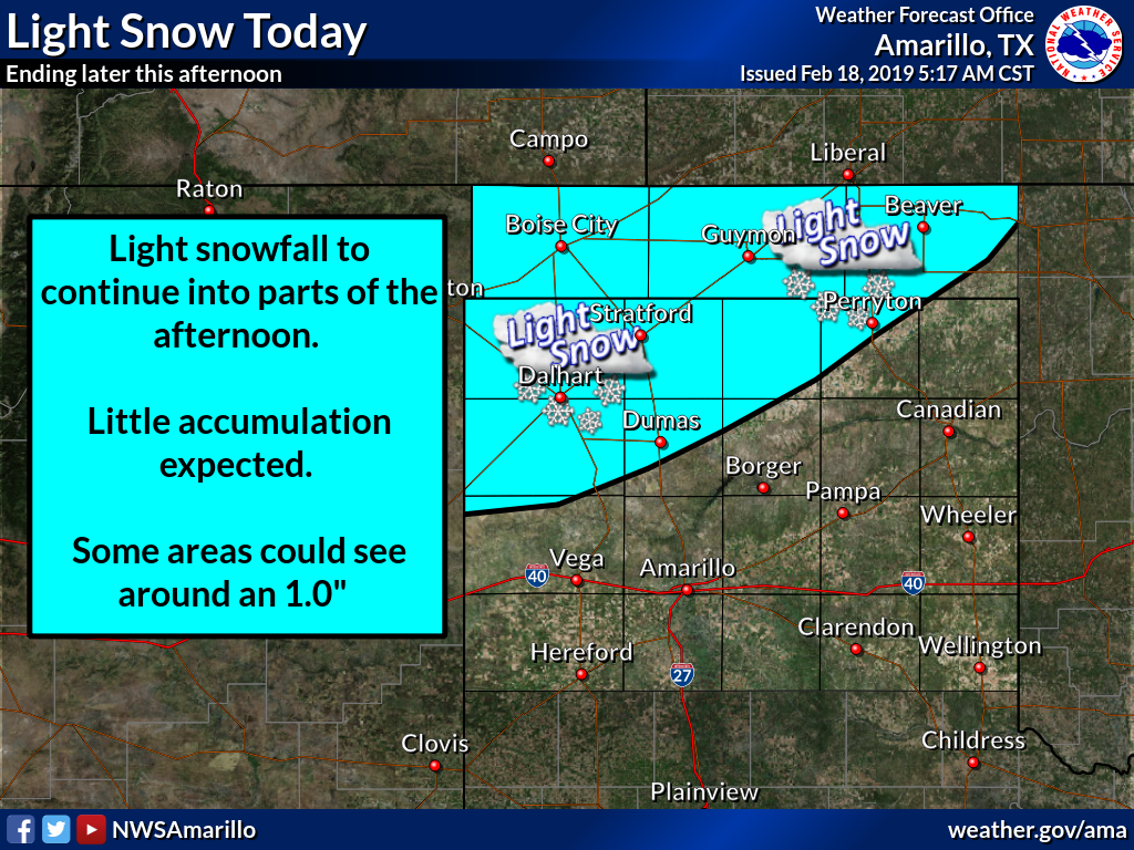
Oh by the way, let's not forget that it's snowing right now across the far
northwest, so they're getting a preview of coming attractions.

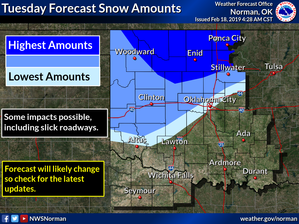
This storm doesn't look too bad...lots of warm air to mix in to prevent big
accumulations. However, looks can be deceiving. There will be short periods
where freezing precipitation will meet air cold enough at the surface to make
travel treacherous. When those conditions above the surface and near the
surface (well...I guess those are both above the surface, but you know what I
mean) come together to create those hazardous impacts are likely to be touch
and go. That's why you best keep your favorite NWS/Media weather sources handy,
and stay weather aware.
Oh yeah, your BRAUM’S EMERGENCY BREAD AND MILK DEF-CON METER for tomorrow. You
know, in case you can't go without bread and milk for at least a half-day
until conditions improve.
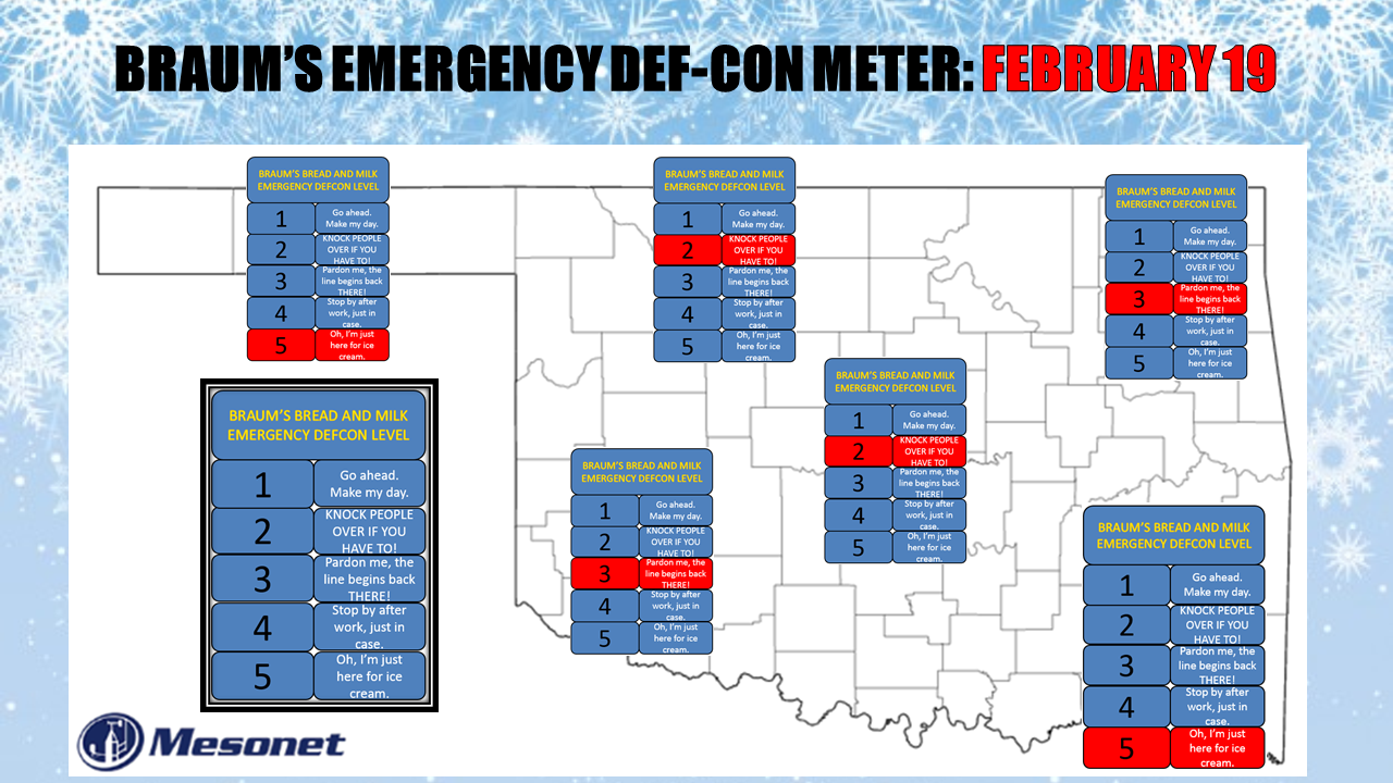
Areas with highest ice or snow accumulation potential get a DEF-CON LEVEL TWO.
Panhandle gets a FIVE (an inch or two of snow for those folks? Please).
My final hope? That the forecast hasn't changed in the couple of hours it took
to create today's Ticker. Because the forecast WILL probably change a bit. Keep
that in mind.
Gary McManus
State Climatologist
Oklahoma Mesonet
Oklahoma Climatological Survey
(405) 325-2253
gmcmanus@mesonet.org
February 18 in Mesonet History
| Record | Value | Station | Year |
|---|---|---|---|
| Maximum Temperature | 91°F | BUFF | 2016 |
| Minimum Temperature | -8°F | TIPT | 2021 |
| Maximum Rainfall | 0.78 inches | TIPT | 1998 |
Mesonet records begin in 1994.
Search by Date
If you're a bit off, don't worry, because just like horseshoes, “almost” counts on the Ticker website!