Ticker for February 21, 2019
MESONET TICKER ... MESONET TICKER ... MESONET TICKER ... MESONET TICKER ...
February 21, 2019 February 21, 2019 February 21, 2019 February 21, 2019
Spring outlooks
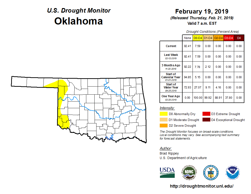

The dry conditions across far western Oklahoma held steady this week, as did
the Drought Monitor map from last week. So sort of a good news/bad news situation.
The bit of rain and snow and ice that we had out that way curtailed any spread
to the west, but it didn't hit the areas that needed it the most.

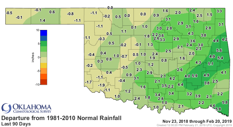
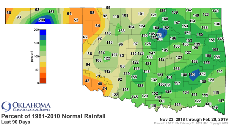
The areas of deficit are easy to spot on the Mesonet's 90-day rainfall maps. We're
still in that driest part of the year, the cold season from November through
February, so the magnitudes of the deficits aren't large...but they are as a
percentage of normal.

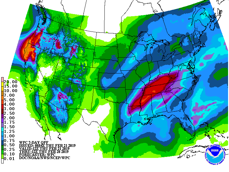
The good news? We do have some rain chances coming up over the next few days
(even some severe storm chances in the far SE Friday into Saturday). Nothing
major...maybe some large hail. But we do need that moisture. Unfortunately,
a possible swing and a miss for far western Oklahoma.
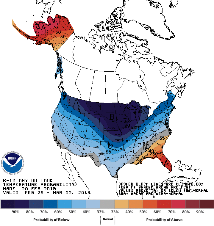
And next week looks cold (BOOOOO!!! as well as BRRRRRR!!) as well as dry.

As we go farther out into March and then the 3-month period of March-May, we
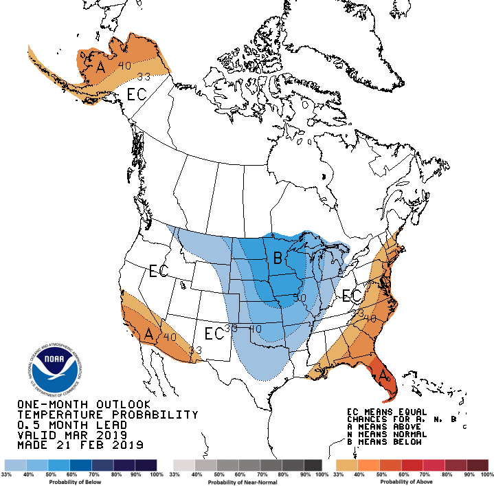
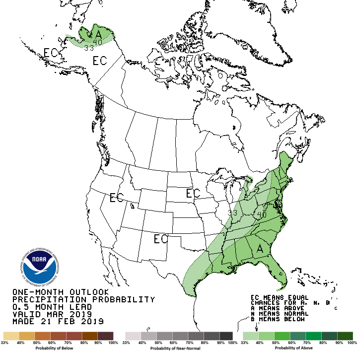
see some hope for our moisture fortunes. The March outlooks from CPC are
pretty benign in the rainfall department, with equal chances of above-, below-
and near-normal precip amounts. However, with a chance for an extended cold
period to start out the month, the temperature outlook does have us in that
colder than normal regime.
As we head to climatological spring, the temperature outlook punts but the
precip outlook does show us in a region of increased odds for above normal
precipitation.
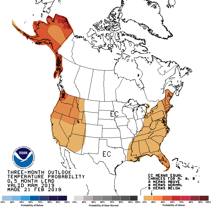

While an El Nino advisory was issued by CPC on Feb. 14 for a borderline weak
El Nino conditions, that played very little into CPC's precip forecast. But we
need to note that teleconnections from the Pacific (i.e., the impacts
on our weather) tend to weaken as we get farther into spring and the warm
season at any rate.
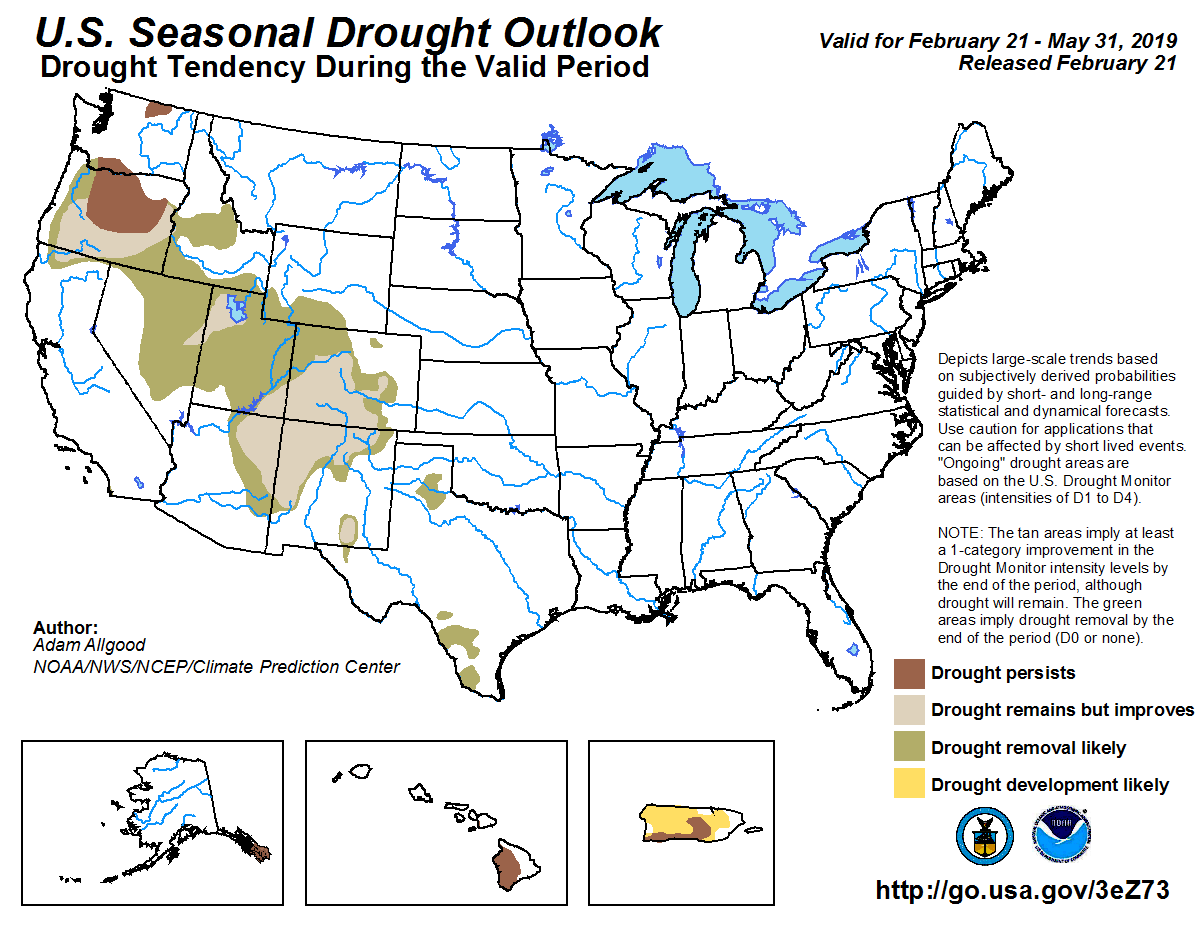
With increased odds of above normal precip being forecast for the spring, the
spring drought outlook does not foresee any drought development in the state
through the end of May.
These forecasts are based largely on model output and other factors, so for a
bit of transparency...without the impacts from a strong El Nino or La Nina
event, the confidence in the forecast is diminished somewhat.
So Mother Nature is gonna do what Mother Nature is gonna do. What else is new!
Gary McManus
State Climatologist
Oklahoma Mesonet
Oklahoma Climatological Survey
(405) 325-2253
gmcmanus@mesonet.org
February 21 in Mesonet History
| Record | Value | Station | Year |
|---|---|---|---|
| Maximum Temperature | 87°F | BURN | 2023 |
| Minimum Temperature | 2°F | HOOK | 2013 |
| Maximum Rainfall | 2.90 inches | BROK | 2018 |
Mesonet records begin in 1994.
Search by Date
If you're a bit off, don't worry, because just like horseshoes, “almost” counts on the Ticker website!