Ticker for February 14, 2019
MESONET TICKER ... MESONET TICKER ... MESONET TICKER ... MESONET TICKER ...
February 14, 2019 February 14, 2019 February 14, 2019 February 14, 2019
We're gonna need a bigger rain

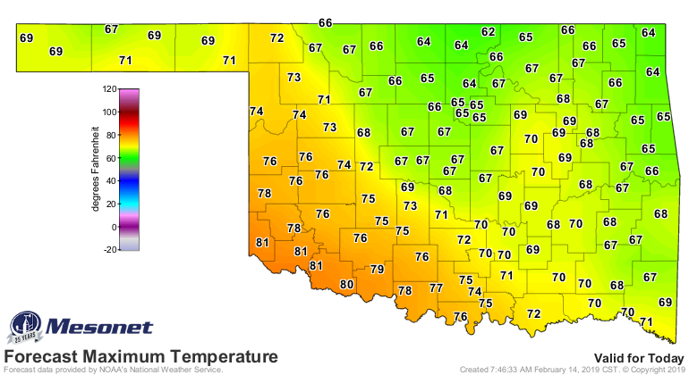
You can hear it, can't ya? As you bask on the beach in 70s and even a few 80s
that ominous sound of a great white cold front stalking you.
"duunnn dunnn... duuuunnnn duun... duuunnnnnnnn dun dun dun dun dun dun dun dun
dun dun dunnnnnnnnnnn dunnnn"
Oh yeah, well YOU try and transcribe the theme from "Jaws" and see how you do!
Anyway, after today's glorious warmth, the bottom will drop out once again, a
familiar seesaw that we've been experiencing all winter (and every winter, for
that matter). There will be a chance of some inclement weather tonight and into
early tomorrow in the form of light freezing rain and freezing drizzle...to me
the worst of what winter has to offer. Just a smidge will send you into the ditch.
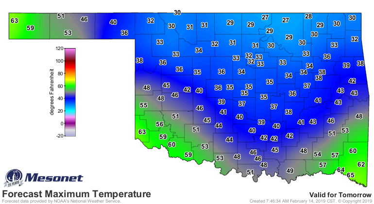
Tomorrow's highs will reflect that cold air mass as it eases down into the
Southern Plains, in a battle with the southerly winds ahead of a large upper-level
trough to our west.
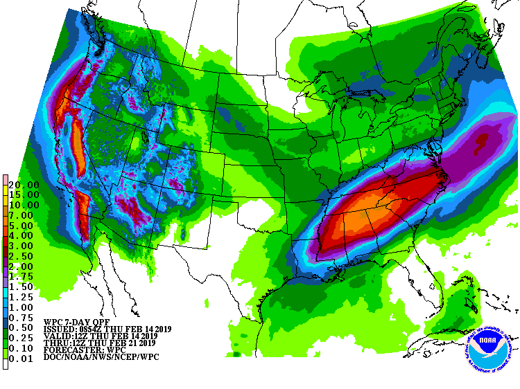
By early next week, after a shot of reinforcing cold air, it'll just be frigid
for everybody.
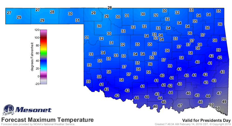
It's February...no biggie. Maybe a bit of wintry precip Monday and Tuesday,
or maybe a lot. We'll know more as we get closer.
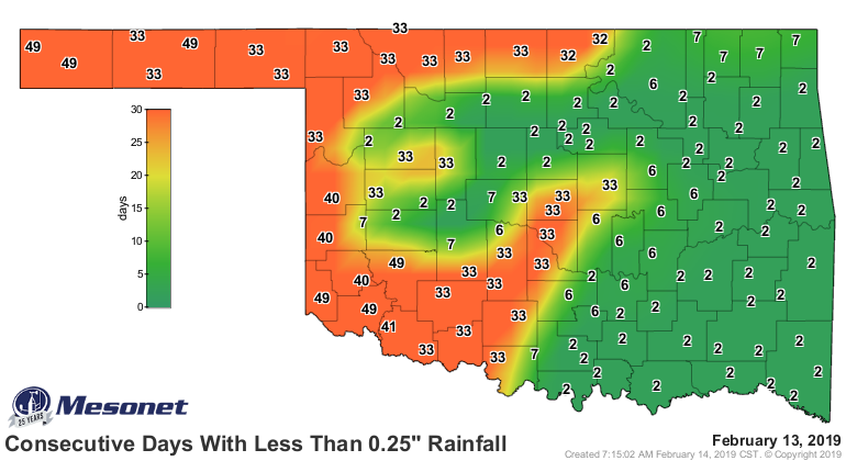
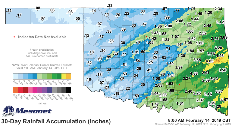
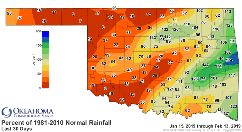
Whatever may come, we need the moisture out west. We now see more Abnormally
Dry (D0) conditions spreading from the Texas Panhandle into far western
Oklahoma, painting the border counties with yeller.
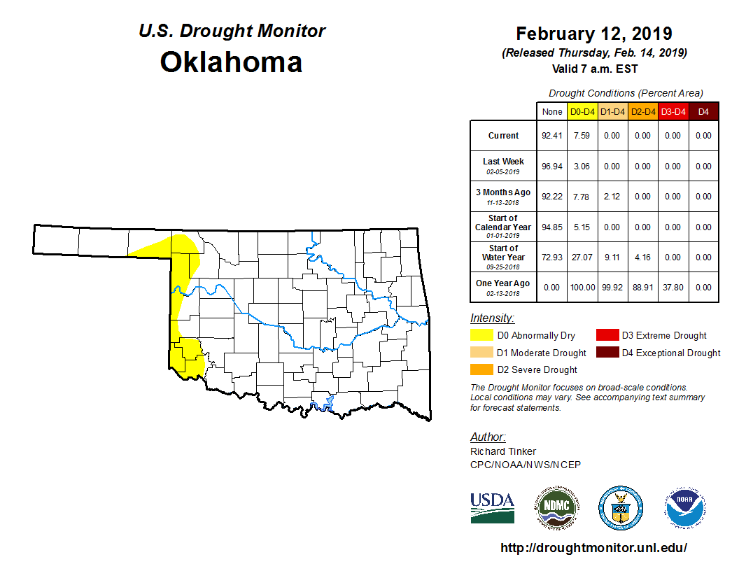
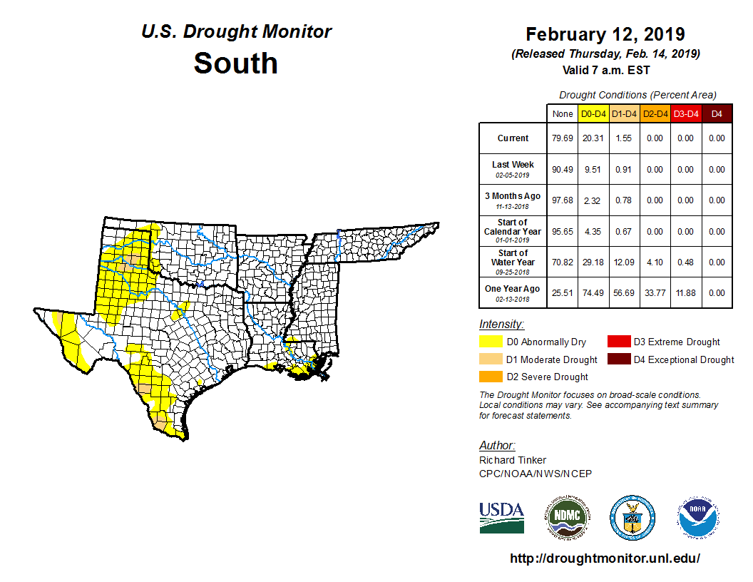
This is not shocking, considering the length of time they've gone without
significant moisture in that area.

And while it's normally (HA!) dry this time of year out that way, in a tired
old refrain we're getting used to around here, this year it's unusually dry.

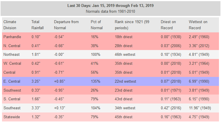
There's a bit of hope? For part of the area? I'm scared to put a period on
either of those sentences.
Not looking good right now though, at least for the western portions of the
main body of the state. This always ends, doesn't it? Only question is will it
end next week, the week after that, or June.
Gary McManus
State Climatologist
Oklahoma Mesonet
Oklahoma Climatological Survey
(405) 325-2253
gmcmanus@mesonet.org
February 14 in Mesonet History
| Record | Value | Station | Year |
|---|---|---|---|
| Maximum Temperature | 84°F | FREE | 2018 |
| Minimum Temperature | -18°F | KENT | 2021 |
| Maximum Rainfall | 3.30 inches | MTHE | 2017 |
Mesonet records begin in 1994.
Search by Date
If you're a bit off, don't worry, because just like horseshoes, “almost” counts on the Ticker website!