Ticker for November 29, 2018
MESONET TICKER ... MESONET TICKER ... MESONET TICKER ... MESONET TICKER ...
November 29, 2018 November 29, 2018 November 29, 2018 November 29, 2018
The Droughtinator
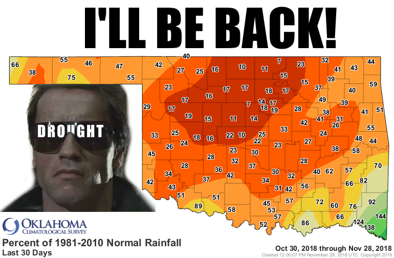
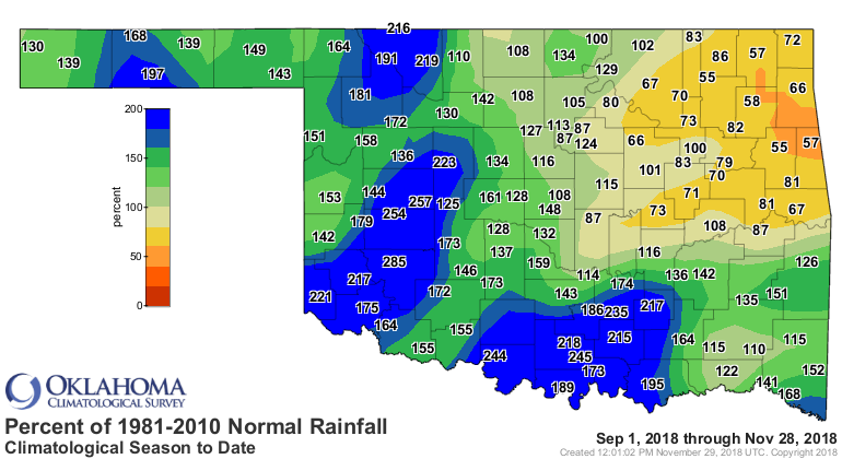
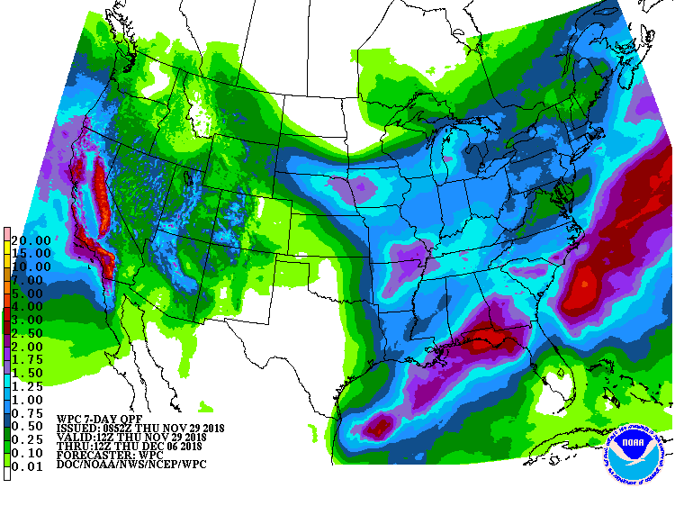
Calm down, Arnold! It's not bad just yet. But that percentage of normal rainfall
map from the last 30 days is not looking pretty at all (even if you are an OU
or OSU fan, those reds and oranges spell trouble). Most places have barely even
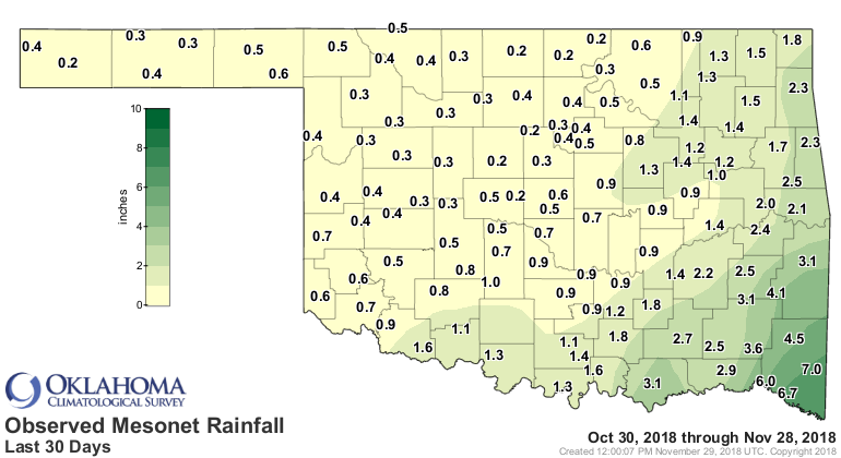
seen rain at all, an inch or two down for the period.
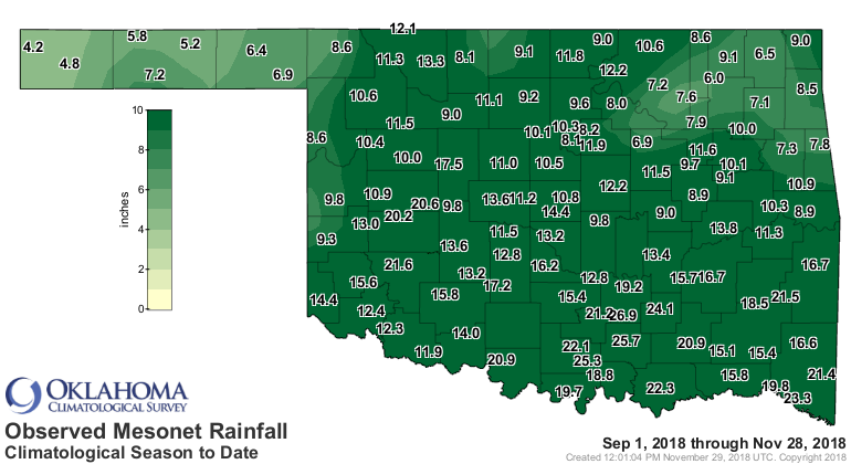
It gets a bit different when you go out to the beginning of fall. Remember,
climatological fall ends tomorrow after starting on Sept. 1. On those maps, some
pretty good moisture shows up for most of the state. That
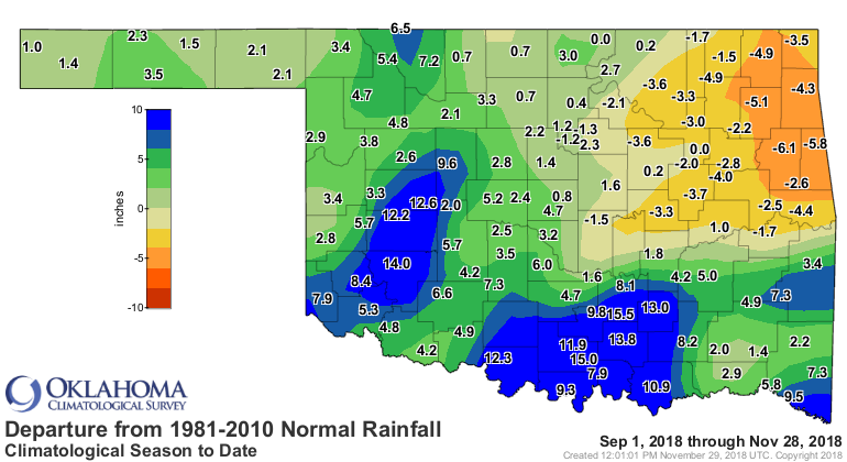
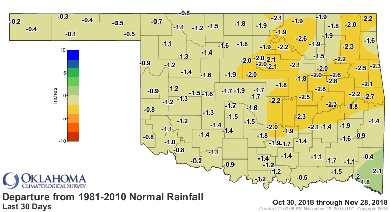
But it's the northeast where the trouble lies, and that even extends over into
north central Oklahoma where those Sept. 1-Nov. 28 surpluses are getting close
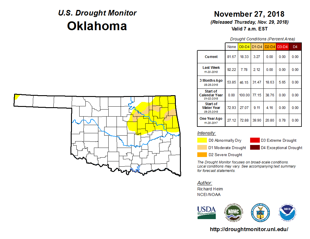
to zero. The new U.S. Drought Monitor map doesn't show a lot more drought, but
it DOES have a big increase of the "Abnormally Dry -- D0) category. While not
actually a drought category itself, it indicates areas either headed towards or
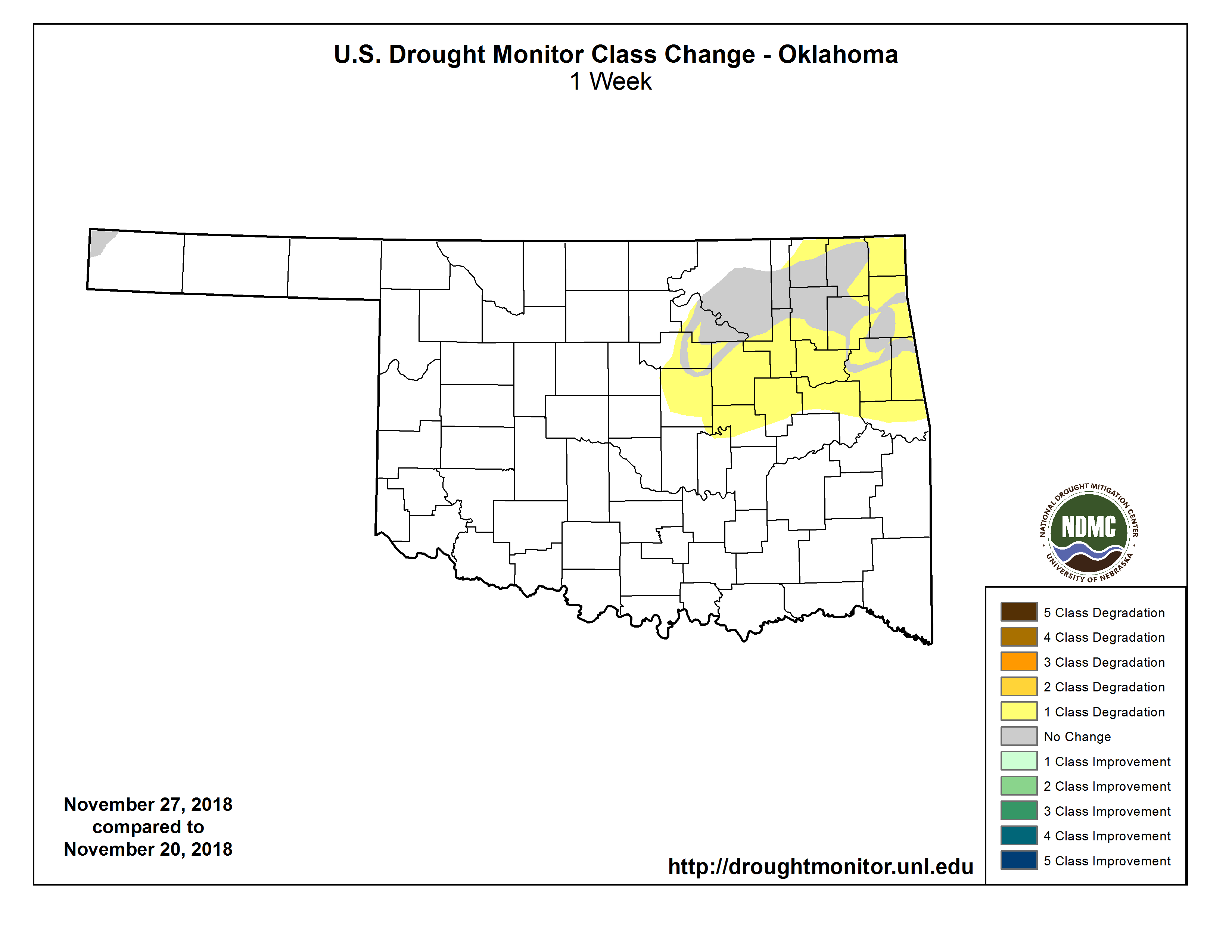
coming out of drought. Definitely the former in this case. The 1-week change map
shows that big increase from 8% to 18% in D0 or D1. Luckily, the moderate
drought (D1) only increased about 1%.
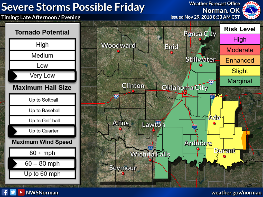
We do have a chance for rain coming up tomorrow, along with a chance for severe
weather. Let's hope it's more rain and less severe.

And then we have a chance for a bit of snow early next week. Nothing to get too
excited about right now, but it's there. The usual suspects -- NW OK and the
Panhandle -- have the best chance for some light accumulations (at least as of
now).
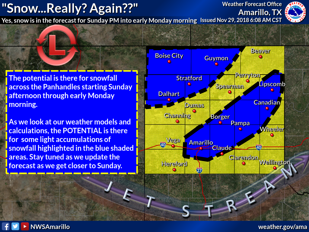
There's just not a lot of moisture there to work with.
So we have the drought in NE OK intensifying and possibly spreading to the west
and southwest into north central and central Oklahoma. I really thought we would
have wiped out that remaining drought by now, but it looks like we may be going
backwards.
Sorry Arnold, maybe we'll tell it "Hasta la vista, baby" soon.
Gary McManus
State Climatologist
Oklahoma Mesonet
Oklahoma Climatological Survey
(405) 325-2253
gmcmanus@mesonet.org
November 29 in Mesonet History
| Record | Value | Station | Year |
|---|---|---|---|
| Maximum Temperature | 84°F | ARNE | 2014 |
| Minimum Temperature | 8°F | TIPT | 2001 |
| Maximum Rainfall | 3.85 inches | TALI | 2006 |
Mesonet records begin in 1994.
Search by Date
If you're a bit off, don't worry, because just like horseshoes, “almost” counts on the Ticker website!