Ticker for November 28, 2018
MESONET TICKER ... MESONET TICKER ... MESONET TICKER ... MESONET TICKER ...
November 28, 2018 November 28, 2018 November 28, 2018 November 28, 2018
YIKES yawn YOW!

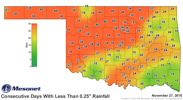
Ahhh, late November, where exciting weather dreams often get shattered. It's
better than mid-January or mid-August (usually), but we've been mired in BORING
weather for quite some time now. The days without a quarter-inch of rainfall map
says it all.
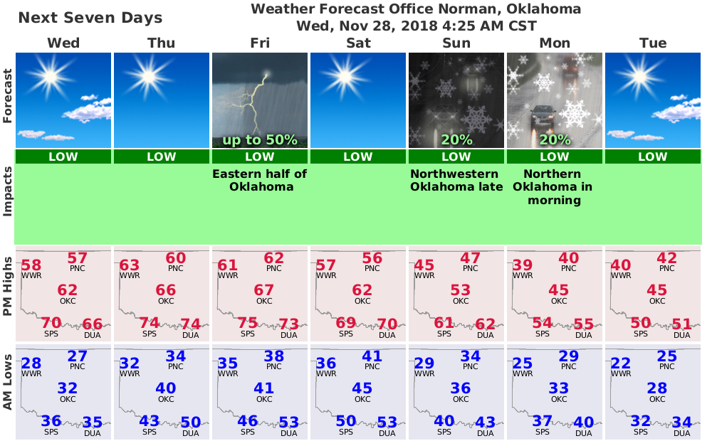
But then comes Friday, with another storm system/cold front. Depending on where
you are, you might be in a bit of danger. Hazardous weather, if you will. In the
northwest (and really a bit more of the state), when the wind comes sweeping down
the Plains, you'll see low humidity and an uptick in the fire danger. We're not
talking bigtime Starbuck or Rhea fire activity, but elevated fire danger
nonetheless. Here's a good reminder of the dangers and safety measures of fire
danger, provided by our friends at the NWS Amarillo.
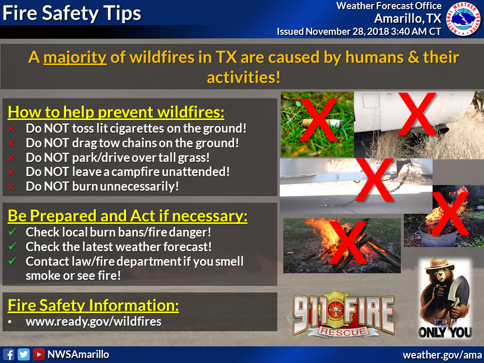
So be careful up that way. I know there have been some pretty big fires the last
week or two. Now as for the tornado threat down in the southeast...well, I put
that there because it's not zero. And with a non-zero tornado threat comes the
implied threat for severe storms as well. Here are some more helpful graphics
from our friends at NWS-Tulsa.
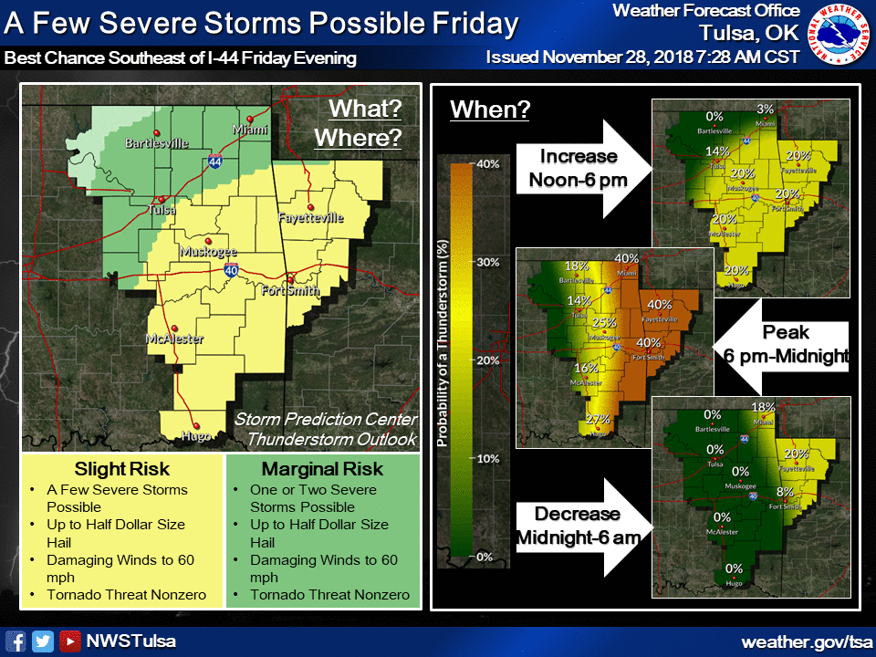
And a bit of explanatory text from them as well:
A Slight Risk of severe thunderstorms will exist mainly Friday
evening across parts of eastern Oklahoma and western Arkansas. A
few storms may produce hail up to the size of half dollars and
damaging winds to 60 mph. Tornadoes also cannot be ruled out.
Maybe a bit inflammatory (no, that's in the northwest) to put a tornado up
there on the map for a slight risk, but that may help get the point across that
severe weather CAN AND DOES HAPPEN every month of the year, including
November/December.
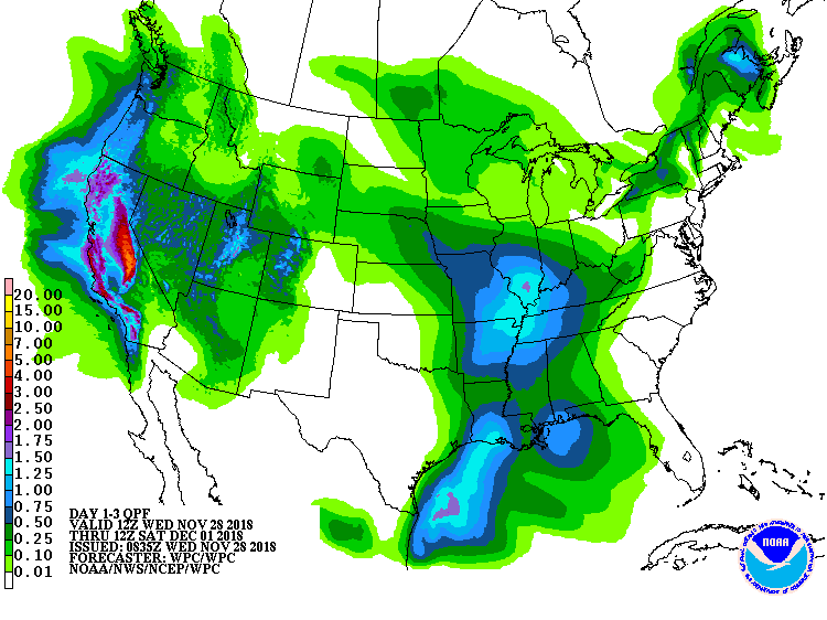
Now as for those of us in between the two hazard areas...don't get too excited.
Maybe a slight chance of storms, and definitely no need to risk a fire, but
we're probably not going to see much but a lot of wind and then some
dropping temps. Heck, the 3-day rain forecast is barely painting any of our
state green.
We might have a bit of excitement (if you find light snow exciting) next
week, but other than that, periodic cold fronts, lots of wind and other
sundry and boring weather events are in the offing.
Gary McManus
State Climatologist
Oklahoma Mesonet
Oklahoma Climatological Survey
(405) 325-2253
gmcmanus@mesonet.org
November 28 in Mesonet History
| Record | Value | Station | Year |
|---|---|---|---|
| Maximum Temperature | 83°F | GOOD | 2014 |
| Minimum Temperature | 8°F | KENT | 2001 |
| Maximum Rainfall | 2.71 inches | IDAB | 2016 |
Mesonet records begin in 1994.
Search by Date
If you're a bit off, don't worry, because just like horseshoes, “almost” counts on the Ticker website!