Ticker for December 3, 2018
MESONET TICKER ... MESONET TICKER ... MESONET TICKER ... MESONET TICKER ...
December 3, 2018 December 3, 2018 December 3, 2018 December 3, 2018
INSANITY NOW, serenity later
Don't worry, I'm not going to bore you too long with all this big snow/ice storm
coming this weekend. I know what you're really here for...the November monthly
summary! You can read about that below. Skip ahead if gigantic winter storms
aren't your thing. But yes, it does appear we have a classic setup for major
winter impacts across the state coming this weekend. A large upper-level low
pressure system will be diving into California then tracking our way, and before
it gets here it'll pump up plenty of moisture and slow down a bit, setting the
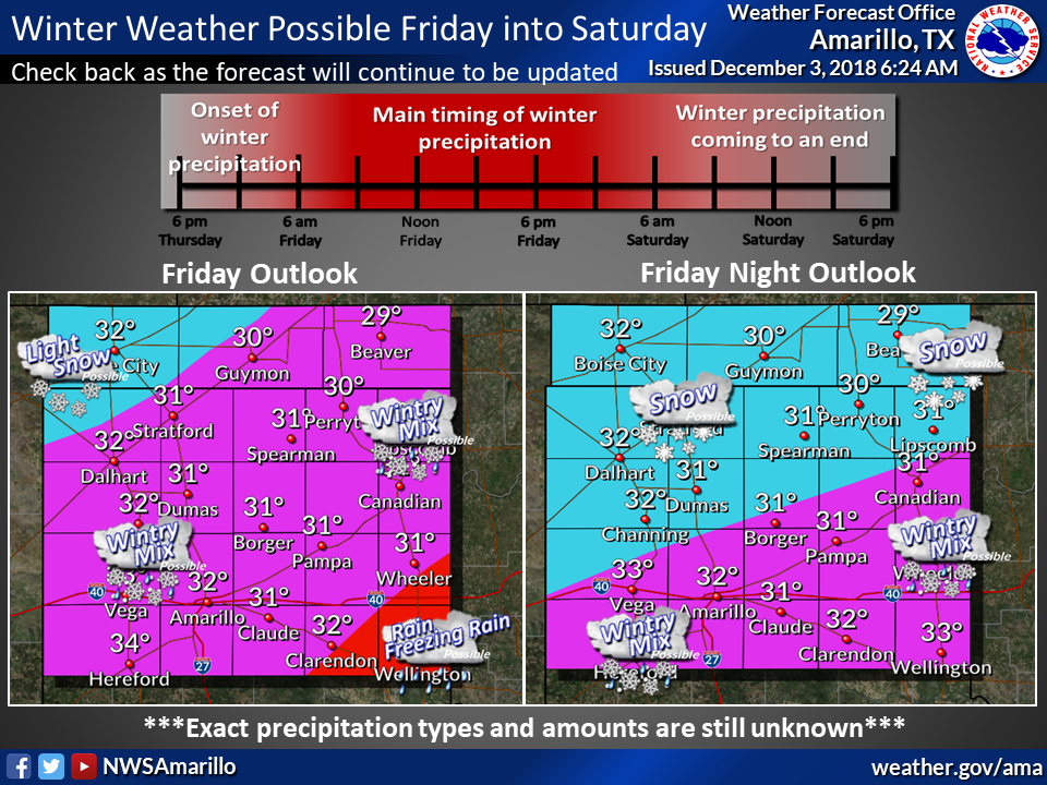
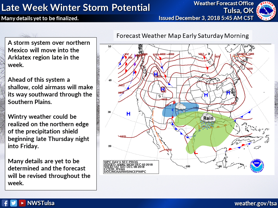
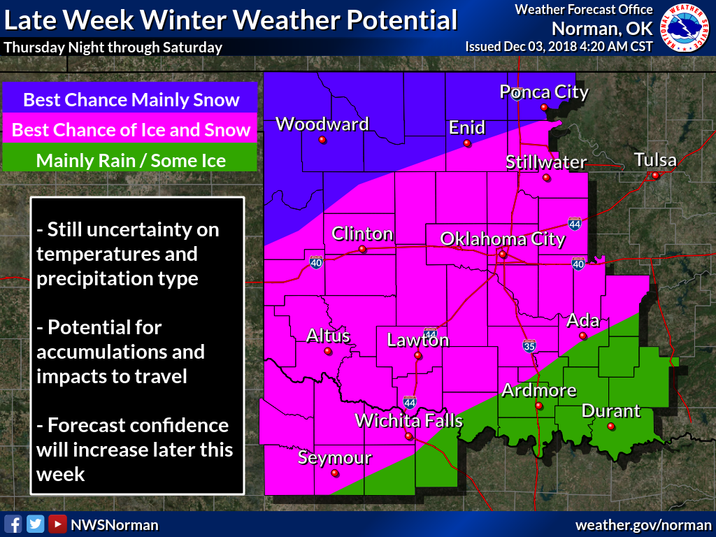
stage for a winter wonderland (nightmare?). Here are some helpful graphics from
our local NWS offices to help pinpoint what cannot be pinpointed at this point.
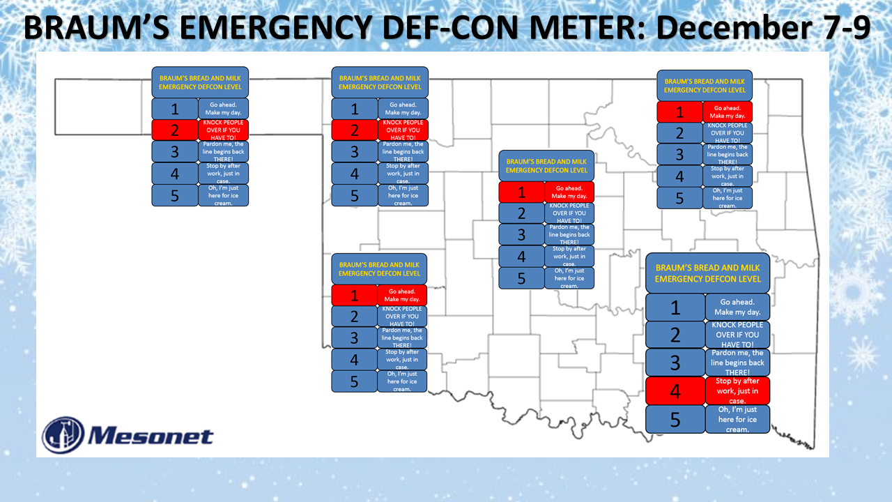
So that's the reason why I have the I-44 corridor the BRAUM'S DEF-CON LEVEL 1...
ICE! The heavy snows farther to the northwest are treacherous, of course, but
ice. I shudder to even say the word. Or maybe I'm just cold.
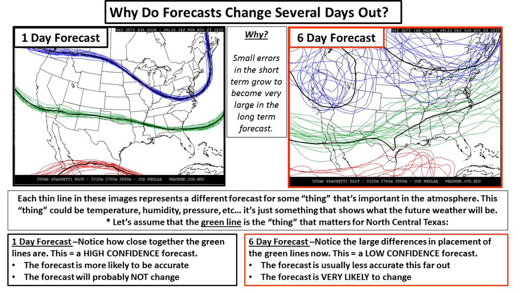
Now here we go again with the standard precautions. The storm is still out over
the ocean, not being sampled by our dense observational network of instruments
over land. The computer models generating this forecast storm can and probably
will change some important factors as the week goes on. As the models start
to come into agreement with their forecasts, we'll get a much better sense of
what to expect. Remember the old chaos effect on the computer models.
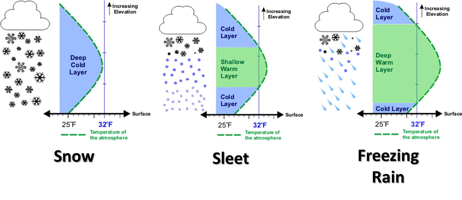
And then how important that vertical profile of temperature is to what TYPE of
precipitation a location will get...from snow to freezing rain to sleet (or
just a cold rain).
So you might say to yourself "But Gary (and if your name isn't Gary, seek help!),
why put out BRAUM'S DEF-CON MAP this far out if things can change so much?
Shouldn't you wait?"
No, because that's just what Mother Nature will be expecting us to do.
The battle continues. One day, I'll win. And now, onto the November summary!
-------------------------------------------------------------------------------
November’s Eventful Weather
Dec. 3, 2018
Much of Oklahoma’s weather was downright boring during November – cold and dry
with a few warm days in between. Despite that monotony, Mother Nature still
managed to sneak in a couple of stretches of exciting weather. The first bout
struck on the 12th with Oklahoma’s first significant winter storm of the season.
Snow fell across the northwestern half of the state and dropped as much as 5
inches of snow. While most of it melted as it fell, enough accumulated across
the far northwest to prompt a winter storm warning from the National Weather
Service (NWS). The arctic blast that accompanied the snow plunged temperatures
into the teens and twenties the next morning, and wind chills fell into the
single digits. The bigger show came on November’s final day, however. A
powerful storm system funneled unusually warm, moist air into the state from
the south. A round of storms erupted across western Oklahoma and quickly became
severe. Hail was the main hazard west of Interstate 35, but the storms were
more intense to the east. Numerous instances of wind damage were reported east
of I-35, along with at least two confirmed tornadoes from a single long-lived
supercell. The first tornado, rated EF-1, touched down near Webbers Falls to
northeast of Gore, damaging trees, farm equipment and barns. The second twister,
a more powerful EF-2 tornado, traveled along the eastern shore of Lake
Tenkiller into the outskirts of Cookson, destroying numerous homes, boat docks,
and airplane hangars.
The month finished as the 11th coldest November on record with a statewide
average of 44.5 degrees, 4.8 degrees below normal. Those records began in 1895.
The Mesonet site at Eva recorded the month’s lowest temperature of 7 degrees on
the 13th. November’s highest reading was 82 degrees at Hollis on the 29th.
Climatological fall (August-November) ranked as 26th coolest with a statewide
average of 59.5 degrees, 1.3 degrees below normal. The first 11 months of the
year were 0.3 degrees below normal, the 46th warmest January-November on record.
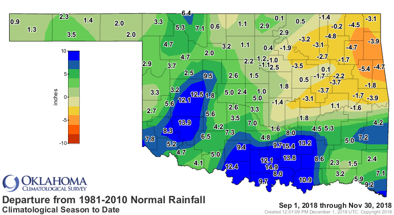
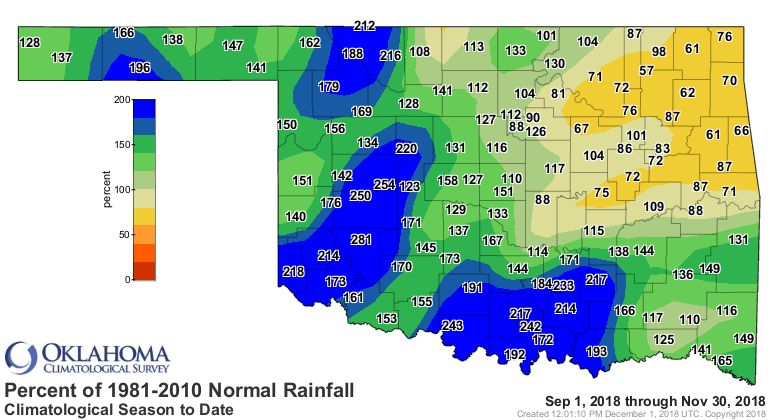
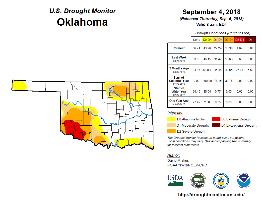
Following three consecutive months of wetter than normal conditions, Oklahoma
finally saw its luck turn sour during November. The August-October statewide
average precipitation total of 16.27 inches ranked as the fifth wettest such
period on record, more than 9 inches above normal. Contrast that with November,
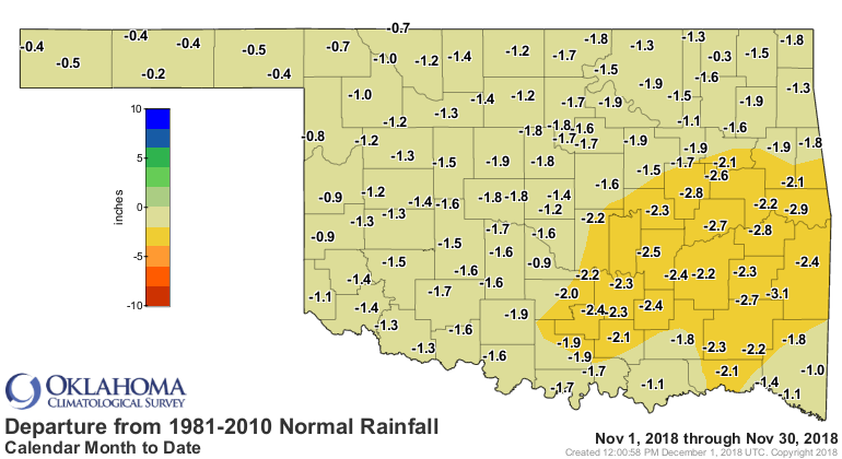
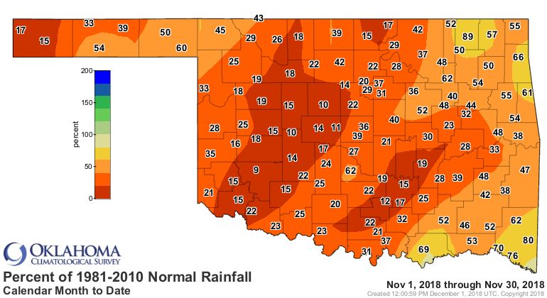
which finished with a statewide average of 0.94 inches, 1.57 inches below
normal. That ranked the month as the 32nd driest November on record.
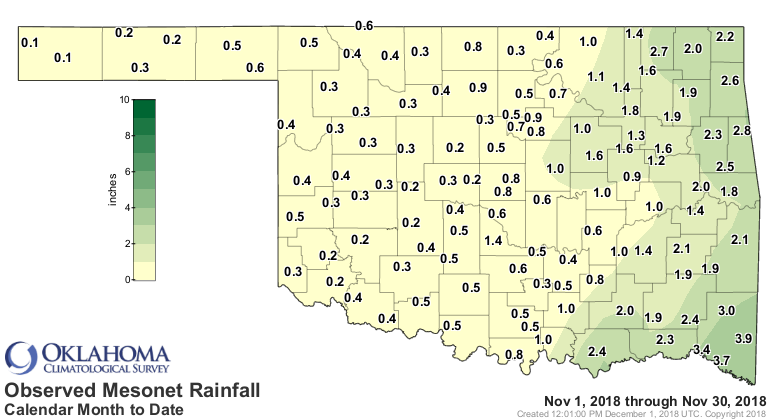
Thirteen of the Mesonet’s 120 stations recorded a quarter-inch or less, and
another 25 failed to reach the half-inch mark. Boise City and Kenton shared the
lowest total at 0.09 inches. Broken Bow led the state with 3.88 inches. Fall
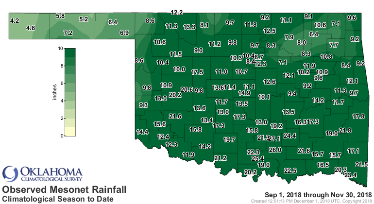
ended on the wet side with a statewide average of 12.93 inches, 3.35 inches
above normal and ranked as the 10th wettest autumn on record.
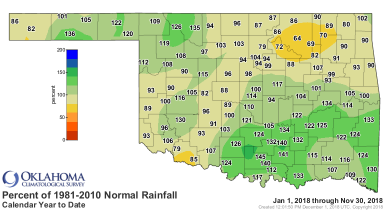
The year remains on track to finish well above normal with a January-November
average of 36.98 inches, the 23rd wettest such period with a surplus of 2.54
inches.

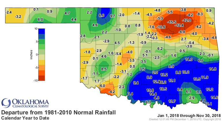
While drought didn’t increase substantially during the month, its potential to
do so in the future certainly did. According to the U.S. Drought Monitor, the
percentage of the state considered in drought increased slightly from 1.6
percent to 3.27 percent through November. The percentage considered “Abnormally
Dry,” a drought precursor, jumped from 6 percent to 15 percent over the same
period.

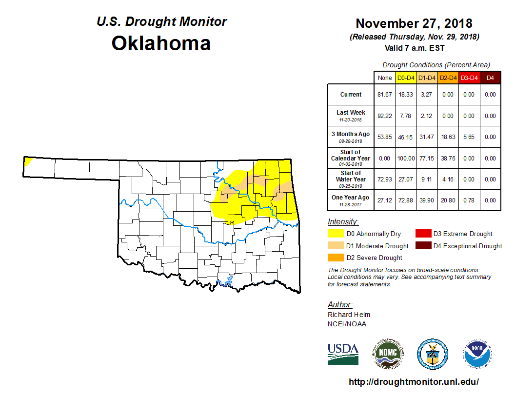
The abundant rains during the first two months of fall reduced drought in the
state dramatically, from 27 percent in early September to 3.27 percent at the
end of November.
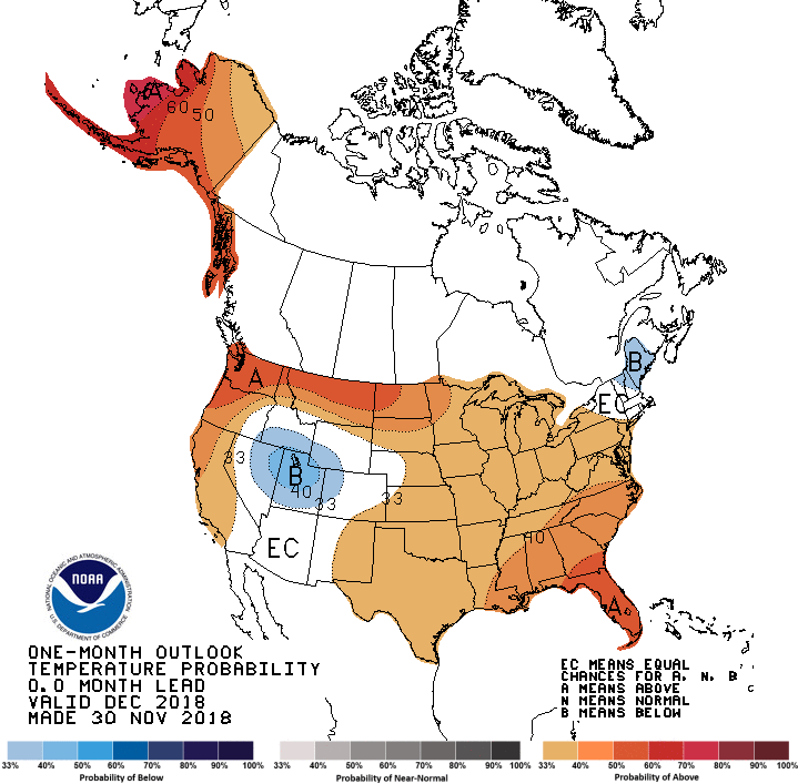
The December outlooks from the Climate Prediction Center (CPC) saw increased
odds for above normal temperatures across the entire state, as well as above
normal precipitation for all but the Panhandle.
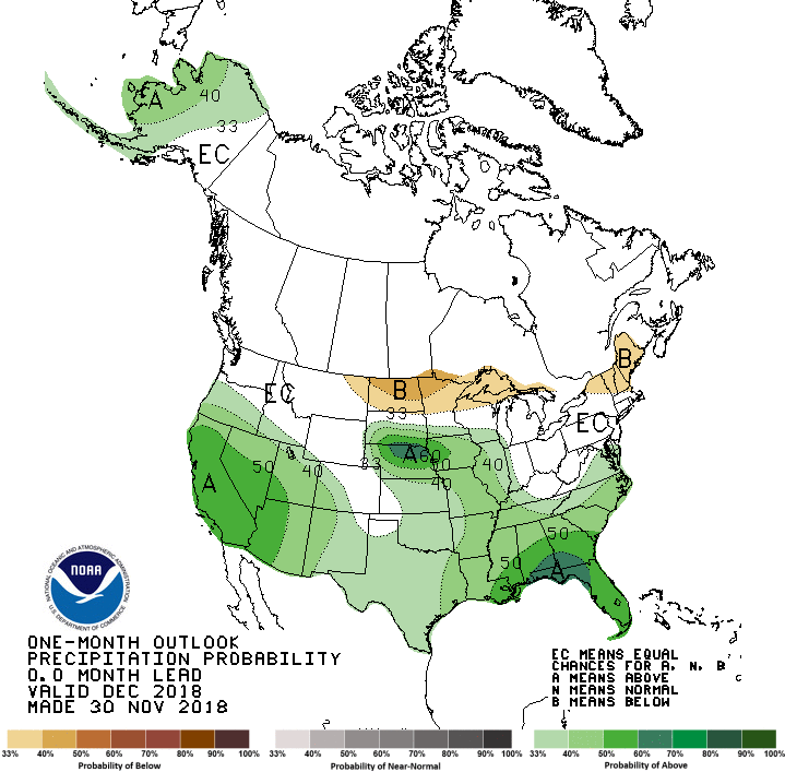
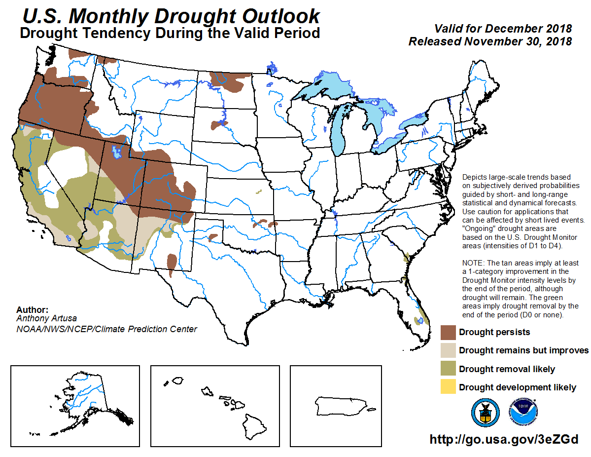
Their December Drought Outlook expected the drought areas across northeastern
Oklahoma to persist through the month, but no additional development was
anticipated.
Gary McManus
State Climatologist
Oklahoma Mesonet
Oklahoma Climatological Survey
(405) 325-2253
gmcmanus@mesonet.org
December 3 in Mesonet History
| Record | Value | Station | Year |
|---|---|---|---|
| Maximum Temperature | 84°F | DURA | 2005 |
| Minimum Temperature | 0°F | NOWA | 2006 |
| Maximum Rainfall | 1.97 inches | KETC | 2002 |
Mesonet records begin in 1994.
Search by Date
If you're a bit off, don't worry, because just like horseshoes, “almost” counts on the Ticker website!