Ticker for July 26, 2018
MESONET TICKER ... MESONET TICKER ... MESONET TICKER ... MESONET TICKER ...
July 26, 2018 July 26, 2018 July 26, 2018 July 26, 2018
Flock of rainfall
Falling on my head like a new emotion? NO! I don't even know what that means. Why
did 1980s pop have to be so weird? Google "Flock of Seagulls hair."
I rest my case.
No, this rain is just falling, hopefully, on some very parched areas of Oklahoma.
Might be like a memory (May?), but as the title says, just in the nick of time.
Drought is intensifying quite rapidly across the state, as evidenced by the
latest drought monitor and its change maps.
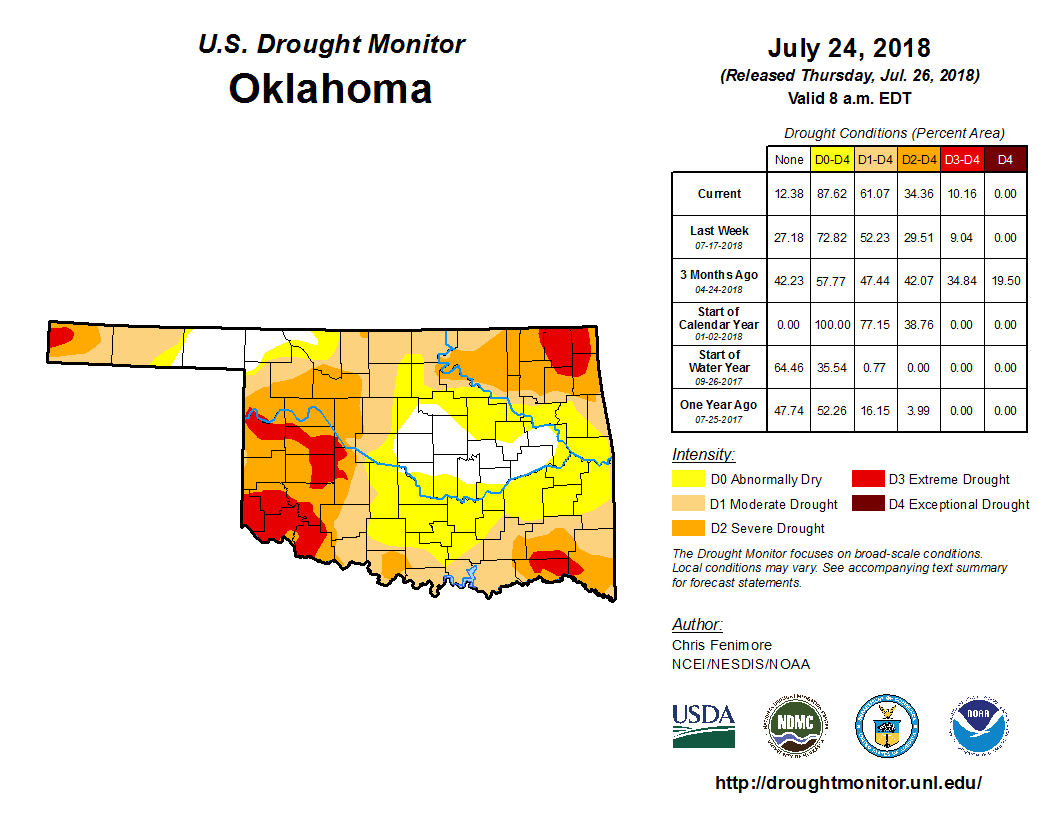

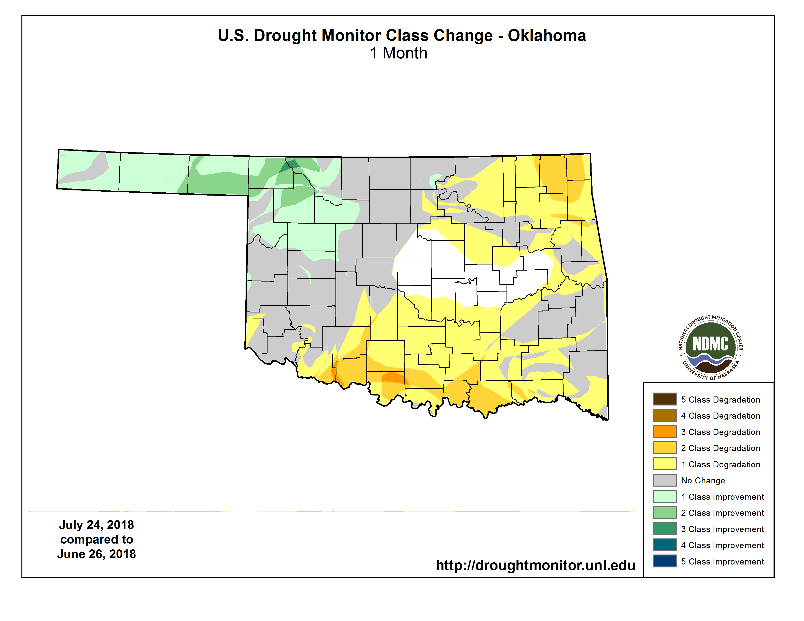
The 4-week change is bad enough, but that 1-week change was massive. And not a
shock, considering the week of record heat that we just came off of, AND
extended above normal temperatures dating back to May (warmest on record for
Oklahoma), and even back to last fall. It takes its toll. The rainfall data
might not support all these changes, but the on-the-ground reports definitely
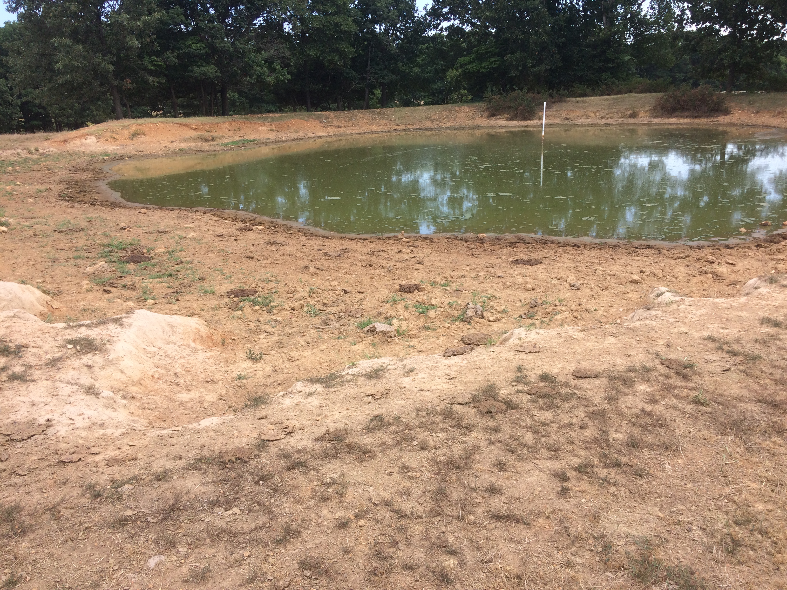
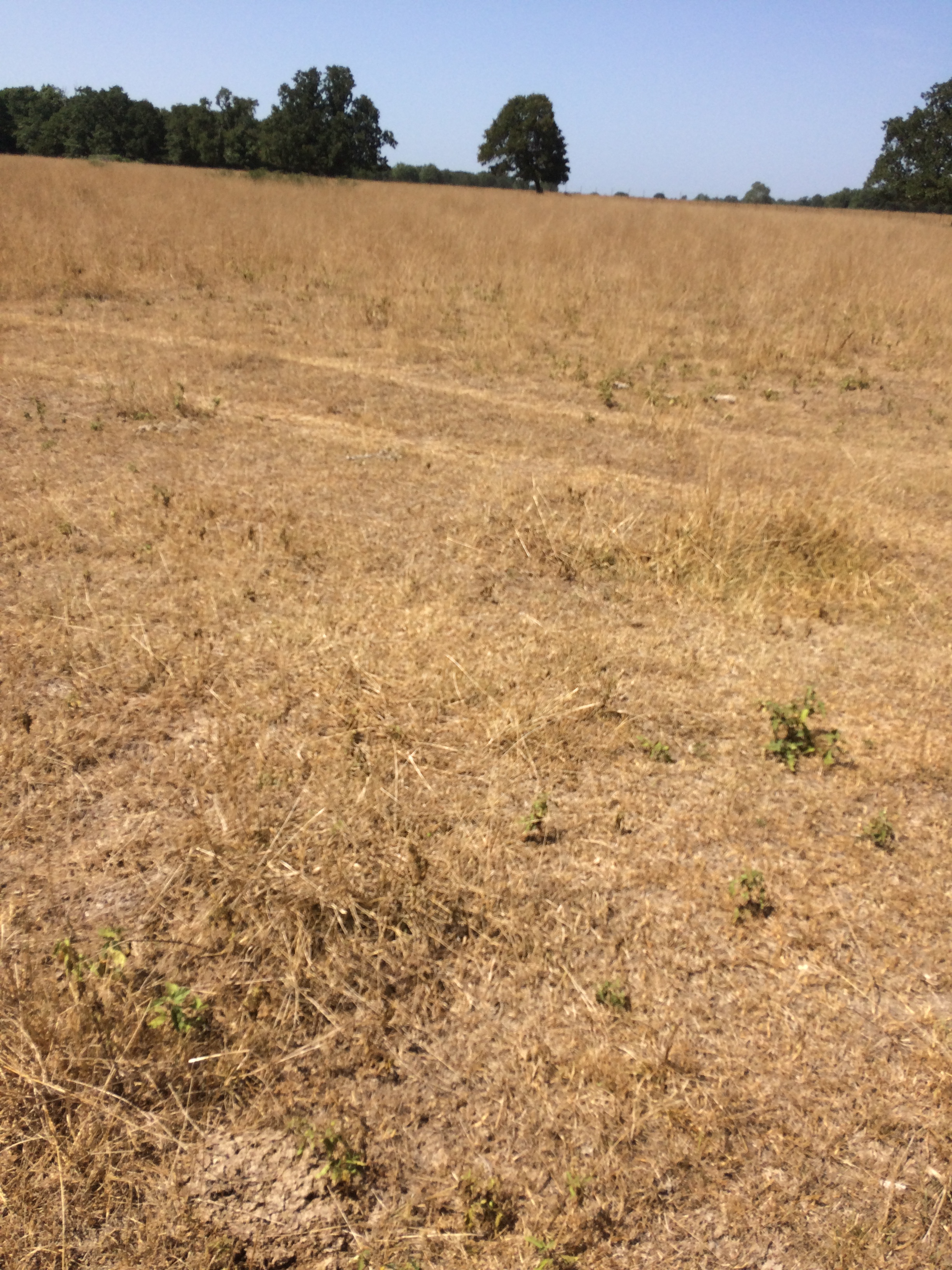
do. We received these pictures from a rancher up in southern Delaware County
just this week. Now I ask you, does this look like moderate drought, which
is what they were in on the Drought Monitor?
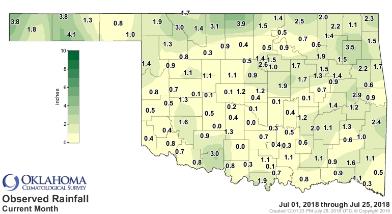
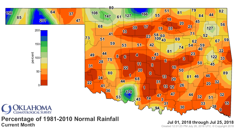
July has been particularly nasty across the state, with very little rainfall
in most areas.
It's not as if July has been massively hot throughout...just a short burst onto
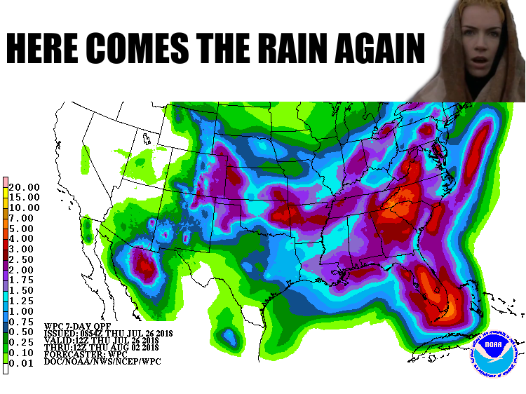
the surface of the sun last weekend. Again, it takes a toll. The good news,
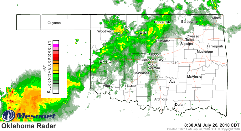
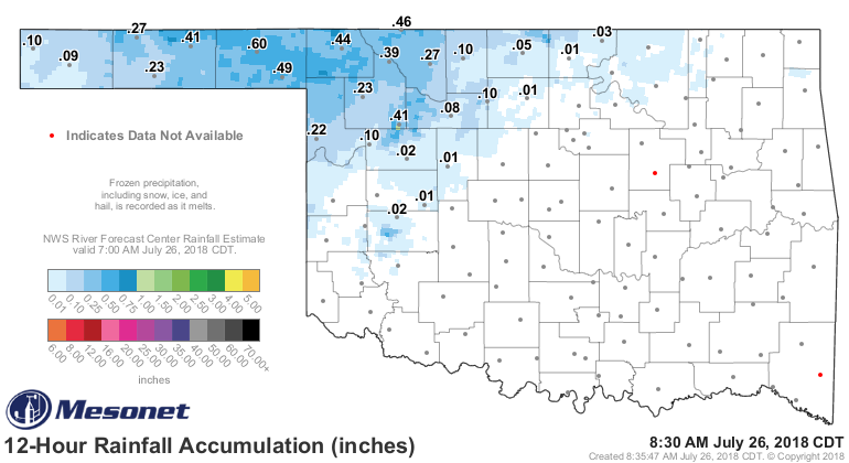
as the first map shows, is that we do have some good chances of rain coming
up. In fact, it's raining NOW! And we had some decent totals overnight across
NW OK.
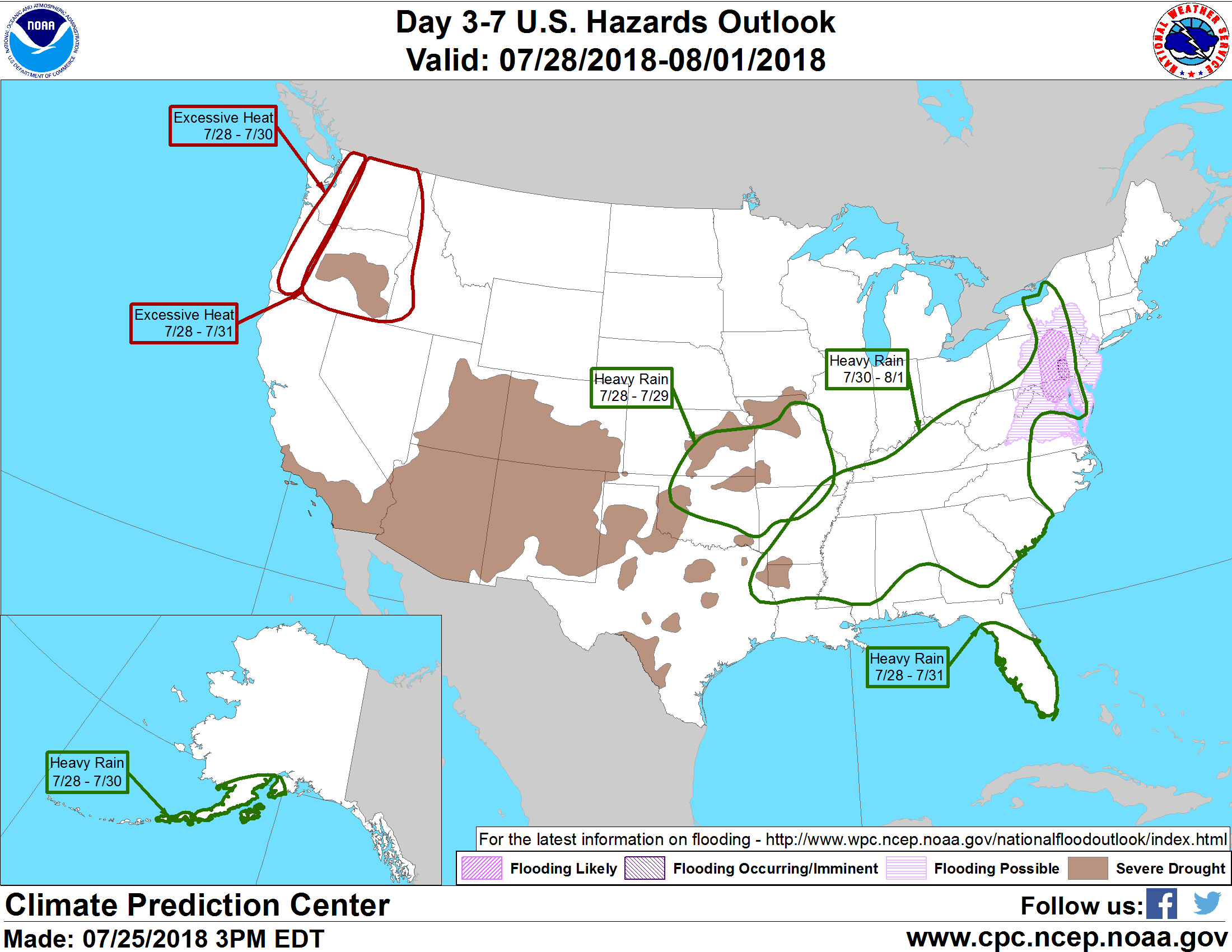
CPC even has the NE quarter of the state in its "Heavy Rain" category in the
hazards outlook.
This rain is much needed. MUCH needed. MUCH NEEDED. It is not, however,
guaranteed. How many times have we been teased like this, only to see light
rains in general with heavy rains for a few? Here's hoping we break that
trend.
Seems like it rains, it rains so far away. It just rains, it rains all night
and day.
Gary McManus
State Climatologist
Oklahoma Mesonet
Oklahoma Climatological Survey
(405) 325-2253
gmcmanus@mesonet.org
July 26 in Mesonet History
| Record | Value | Station | Year |
|---|---|---|---|
| Maximum Temperature | 111°F | HOLL | 2011 |
| Minimum Temperature | 50°F | CAMA | 2004 |
| Maximum Rainfall | 5.09 inches | BROK | 2013 |
Mesonet records begin in 1994.
Search by Date
If you're a bit off, don't worry, because just like horseshoes, “almost” counts on the Ticker website!