Ticker for July 23, 2018
MESONET TICKER ... MESONET TICKER ... MESONET TICKER ... MESONET TICKER ...
July 23, 2018 July 23, 2018 July 23, 2018 July 23, 2018
Imagine
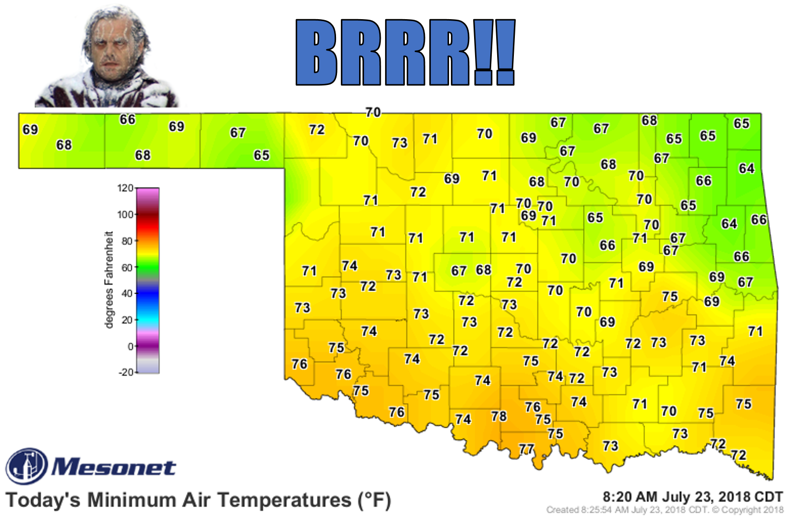
Quick, go outside and imagine it's 4:30 in the afternoon. Now doesn't that feel
downright autumnal? Maybe not frozen Jack Nicholson weather just yet, but still,
in comparison to this? Pretty close!
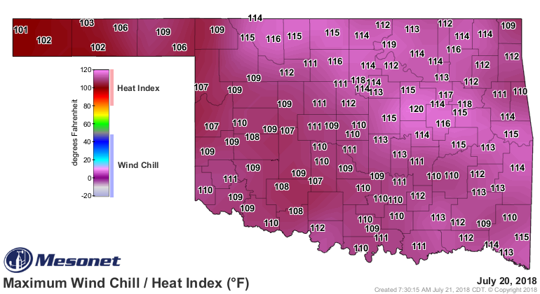
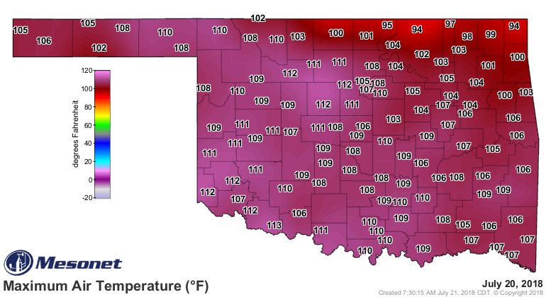
Yeah, that's a 2-3 day stretch that we won't long forget (although I think most
of us forgot just what that felt like from back in 2011 and 2012).
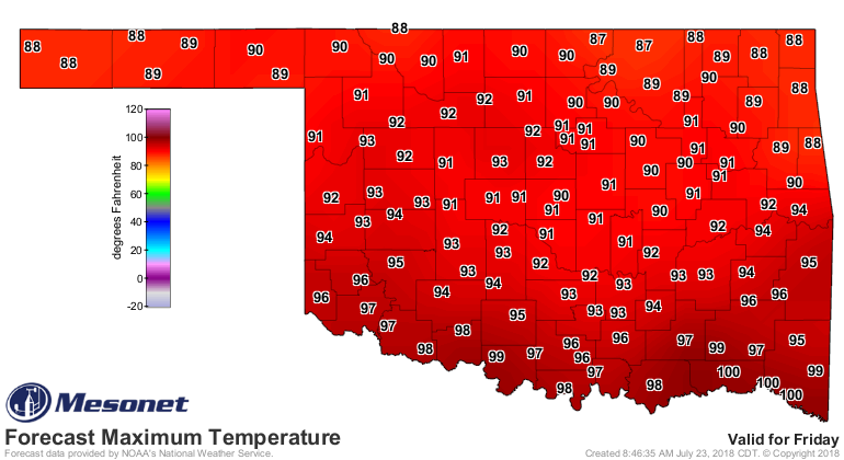
This week's weather will seem downright moderate in comparison. I'll show you
today's forecast highs and Friday's to give you a sense of the week.

And there's even a chance of rain across the northern half of the state as
we get later into the week, darned near every day through the weekend!

It's not May type of rains, but rains = clouds = milder weather.
SCIENCE!
We'll see how long it lasts. We're still in the height of summer. We went up
(or some would say down) about as high as the roller coaster will take us, now
time for a lull in the action.
What's around the next curve? More summer no doubt. The curve after that? Well,
true autumn is getting closer.
Gary McManus
State Climatologist
Oklahoma Mesonet
Oklahoma Climatological Survey
(405) 325-2253
gmcmanus@mesonet.org
July 23 in Mesonet History
| Record | Value | Station | Year |
|---|---|---|---|
| Maximum Temperature | 109°F | CHER | 2001 |
| Minimum Temperature | 54°F | ELRE | 2019 |
| Maximum Rainfall | 4.28 inches | TAHL | 2013 |
Mesonet records begin in 1994.
Search by Date
If you're a bit off, don't worry, because just like horseshoes, “almost” counts on the Ticker website!