Ticker for July 19, 2018
MESONET TICKER ... MESONET TICKER ... MESONET TICKER ... MESONET TICKER ...
July 19, 2018 July 19, 2018 July 19, 2018 July 19, 2018
July Foolishness
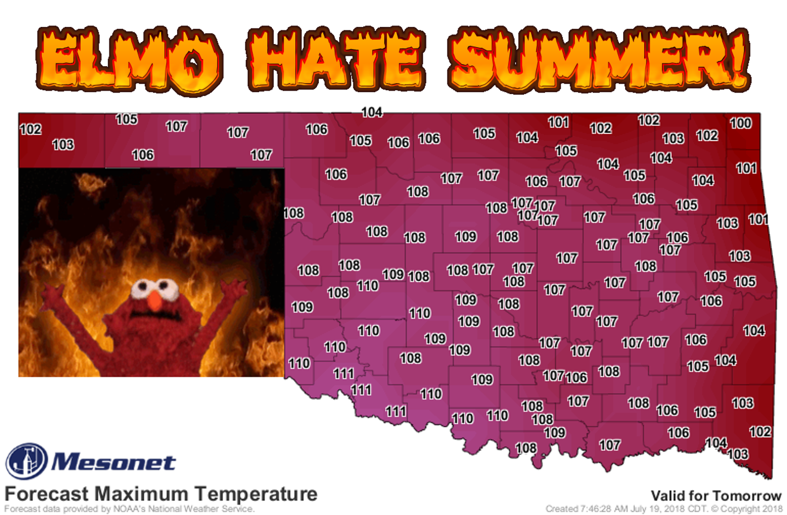
Come on, wouldn't we all want to see that little...okay, enough of that. So
yesterday's forecast for Friday was a little low? Nice. Let's kick things up
a few degrees so we can be truly miserable. But what's really the difference
between 111 degrees and 107 degrees.
4 DEGREES, THAT'S WHAT! AND THAT'S WORSE!
Today won't be a party either.
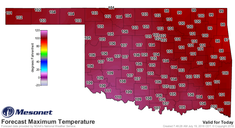
I know I said that yesterday but there ain't no showers and clouds to save us
today, I'm afraid. There will be no escape for the princess this time.
Whoops, wrong cultural reference, but you're not gonna get me to do any Elmo-speak!
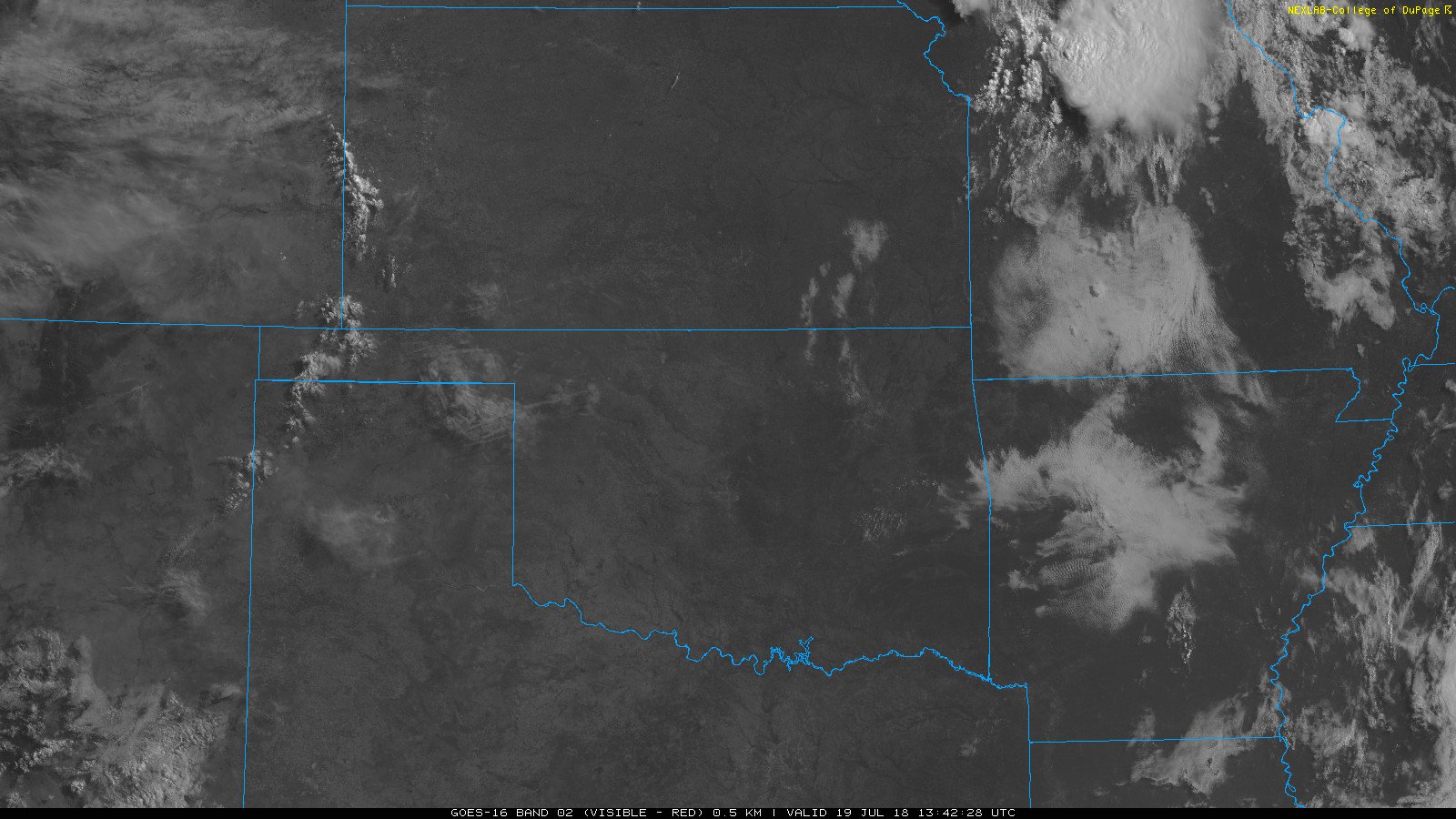
Like I said, thought, clouds are gonna be hard to come by today.
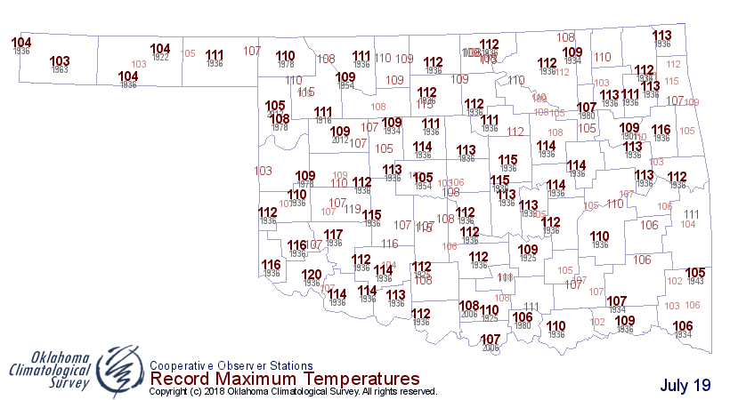
By the way, here are the historical record highs for today. I think that top
mark of 120 degrees from Altus in 1936 is safe.
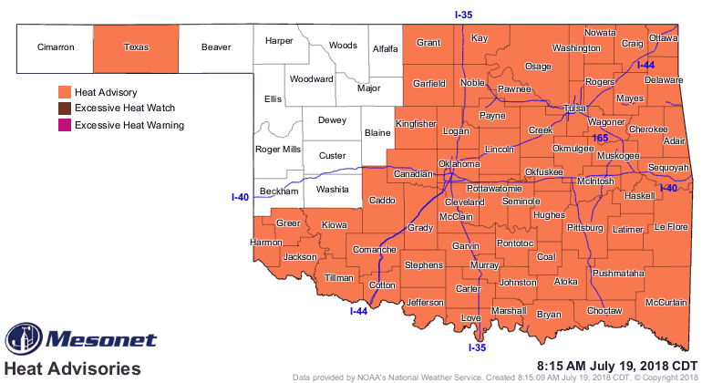
The heat advisory has been extended to cover even more of the state.
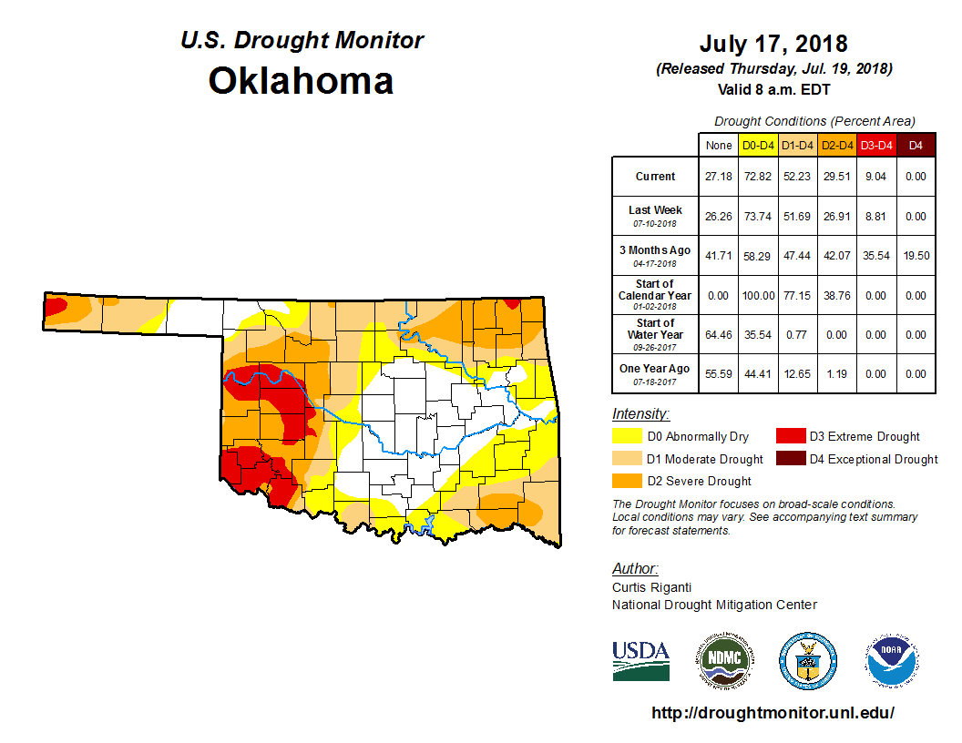
All of this is doing very little to help Oklahoma's drought situation, which
continues to intensify across northeast, southeast, and southwestern Oklahoma.
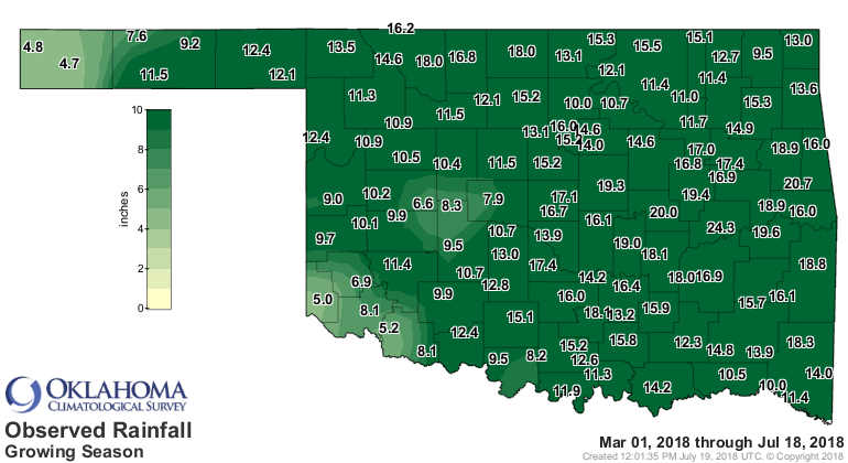
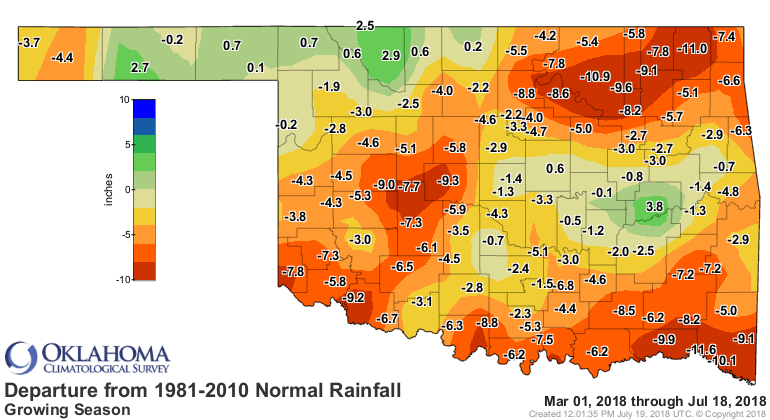
If you look at the deficits since the growing season began on March 1, it's
pretty easy to see where the worst conditions are located.
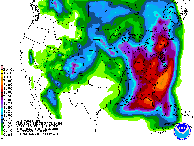
Little help in the next 7 days.
But maybe next week? Help with the heat AND the drought?
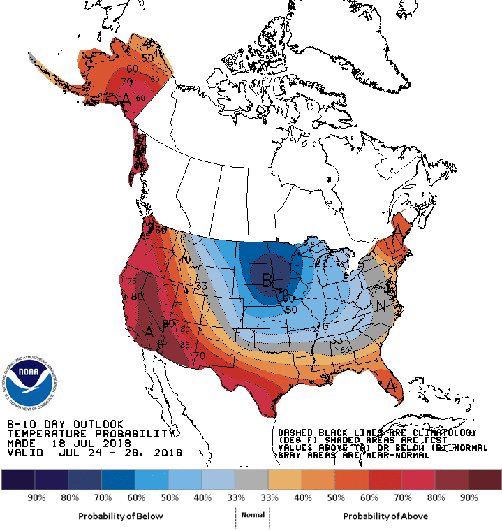
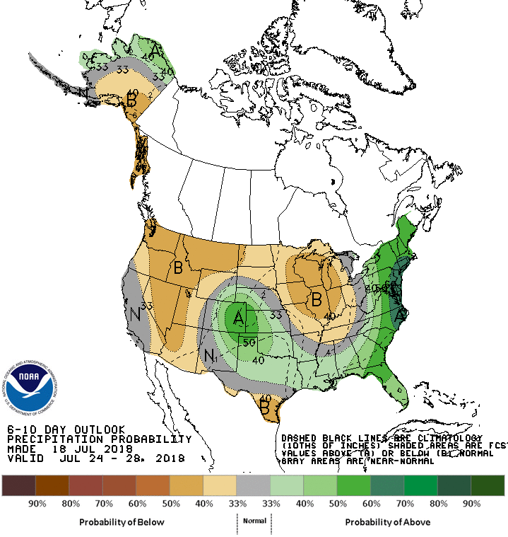
One thing to remember...it's the hottest part of the year and driest part of
the warm season, so any "below normal temps" and "above normal precip" doesn't
necessarily mean 3 inches of rain with highs in the 70s. But, a change would
be nice.
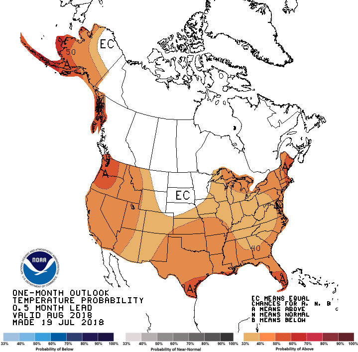
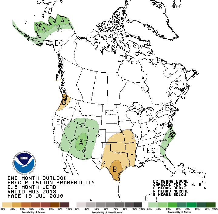
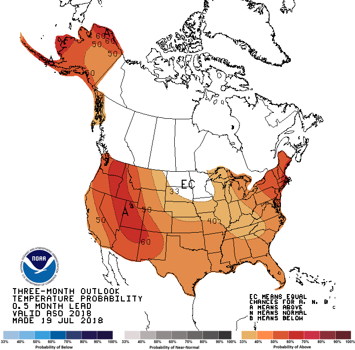
Now let's go farther out. How about for August? The outlooks from CPC show
increased odds of above normal temperatures (sorry) and below normal rainfall
(sorry again).
Much of the same for the August-October period, although the precip outlook only
shows the increased odds of below normal rainfall across the eastern half of the
state.

That doesn't lend good news for the seasonal drought outlook from CPC, from
basically today through Halloween.
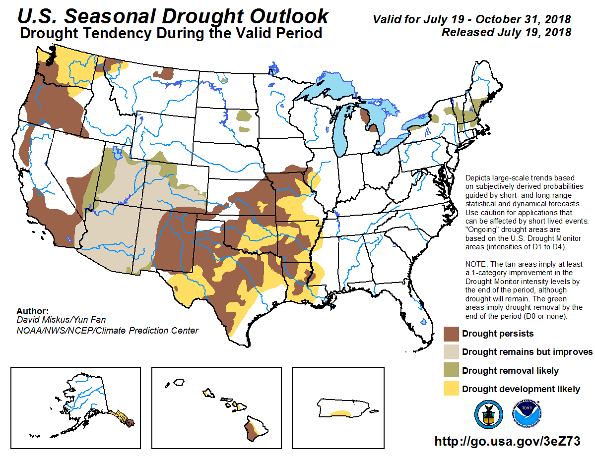
With the long-range forecasts pointing towards increased odds of above normal
temperatures, that means increased evaporation. Plus, it's still the growing
season through that period, so the plants will still be demanding their share.
With no signs of above normal precip (which could still occur, of course), that
leaves drought development and persistence as the rule across the state.
Gary McManus
State Climatologist
Oklahoma Mesonet
Oklahoma Climatological Survey
(405) 325-2253
gmcmanus@mesonet.org
July 19 in Mesonet History
| Record | Value | Station | Year |
|---|---|---|---|
| Maximum Temperature | 115°F | MANG | 2022 |
| Minimum Temperature | 53°F | COOK | 2014 |
| Maximum Rainfall | 3.82 inches | BREC | 1997 |
Mesonet records begin in 1994.
Search by Date
If you're a bit off, don't worry, because just like horseshoes, “almost” counts on the Ticker website!