Ticker for June 28, 2018
MESONET TICKER ... MESONET TICKER ... MESONET TICKER ... MESONET TICKER ...
June 28, 2018 June 28, 2018 June 28, 2018 June 28, 2018
Jailhouse sweat
Making your own gravy.
It's hotter'n blue blazes.
It's hotter'n a blister bug in a pepper patch.
It's so hot I saw a dog chasing a rabbit and they were both walking.
If it gets any hotter, I'll have to take off stuff I really ought to keep on.
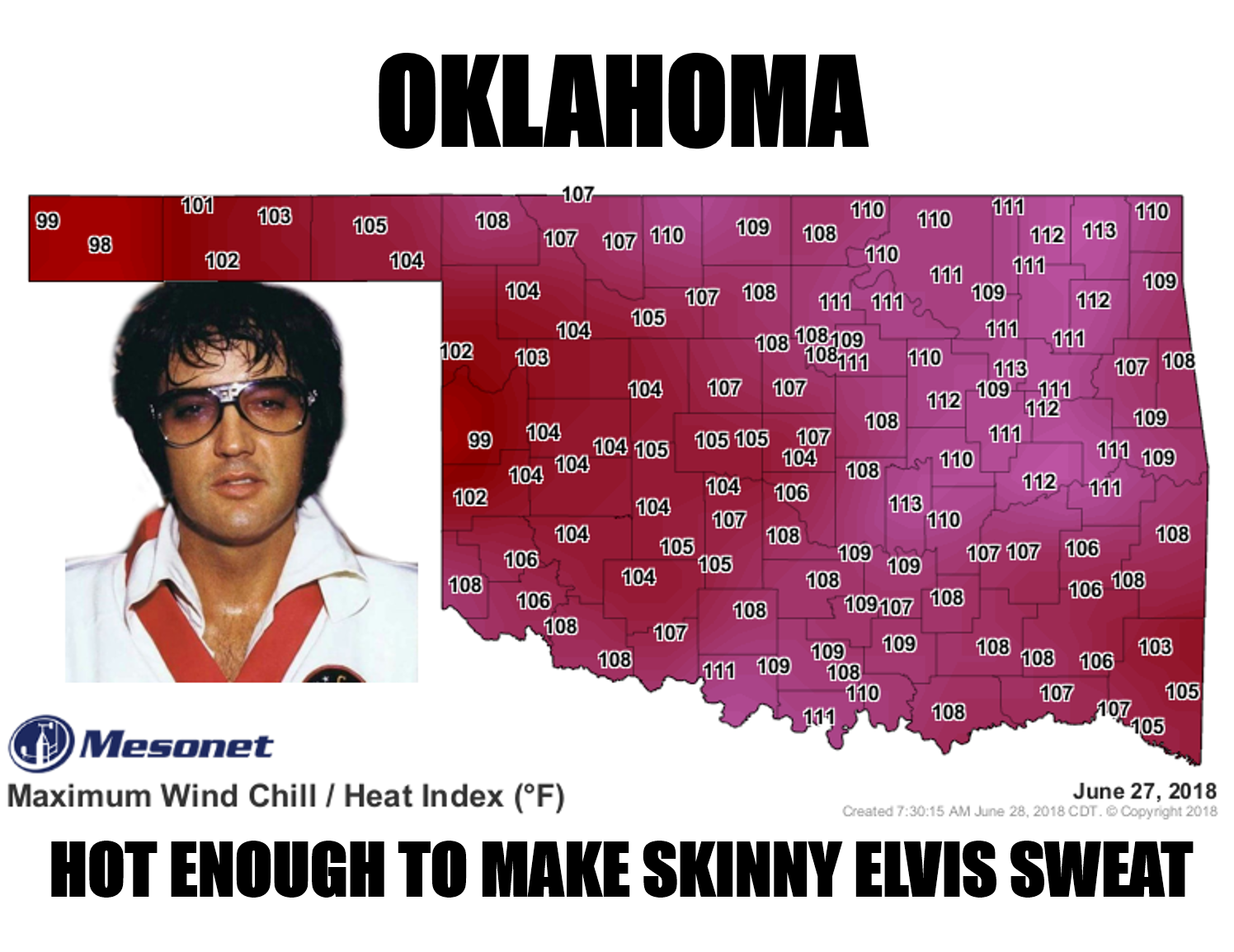
Had enough? Yeah, if a sweaty Elvis didn't get you in a bad mood, maybe some of
those sayings will. We knew we'd pay for all that rain eventually. It was nice,
helped ease the drought (more on that in a bit). But it also left us with a nice
soupy mix, just waiting for the heat dome to turn Oklahoma into Houston. The
dewpoints are off the charts, and so are the actual air temperatures (okay, not
off the charts, but you get it).

And today we're going to have more of the same, with heat indices up into the
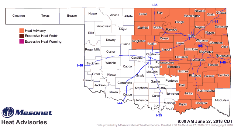
110 degrees range across the eastern two-thirds of the state, leaving us with
another heat advisory for today. Actual air temperatures will be up in the 90s
and 100s.

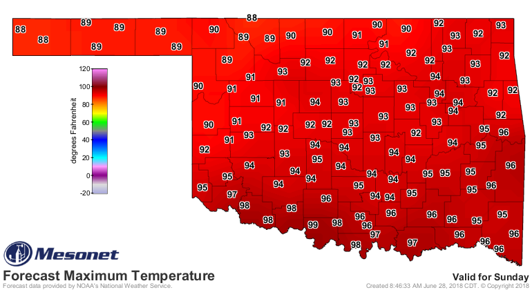
We'll catch a break this weekend as the heat dome moves off to the east,
allowing some cooler air to sneak in here from the northwest. Sunday looks like
a grand day, with a slight chance of some rain and highs in the 80s and 90s.
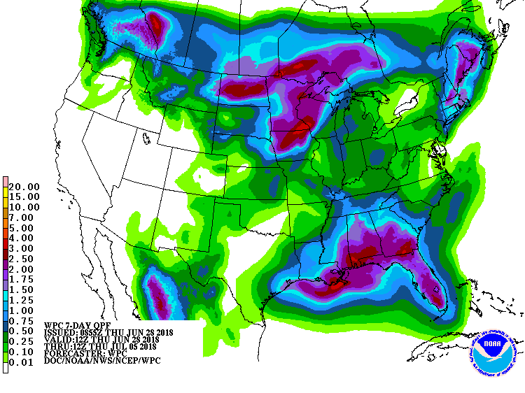
Rain chances/totals are NOTHING like we say previously in June, however.
Back to the pressure cooker after this weekend, however. Another ridge, another
week of July. Typical summer in Oklahoma. Enjoy.
Now let's talk about that drought. We're lucky for all the rain we received
before summer started to act like summer again. The latest Drought Monitor
reflects all the rain we've received during June thus far, although there are
areas on the periphery of Oklahoma that are STILL hurting.
And if you're on the periphery of Oklahoma, how about coming along with the
rest of us for a team win??
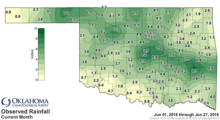
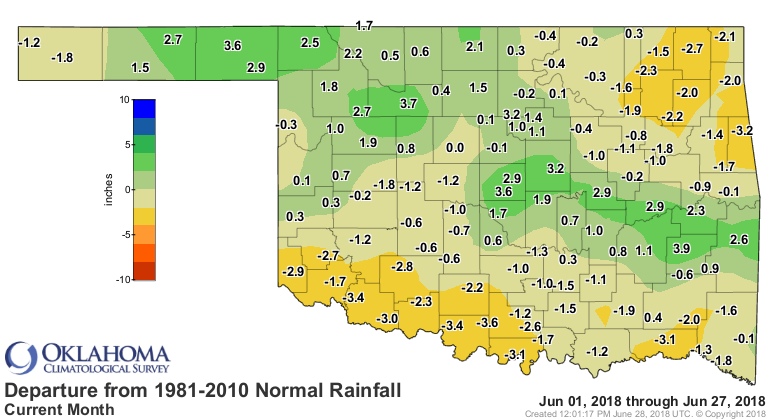
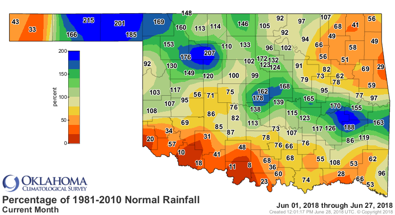
So the eastern Panhandle, far northwest (main body of state), central through
SE OK came off as big winners, but the western Panhandle, NE corner, and then
along the Red River...not so much. And that's reflected in the latest Drought
Monitor map.

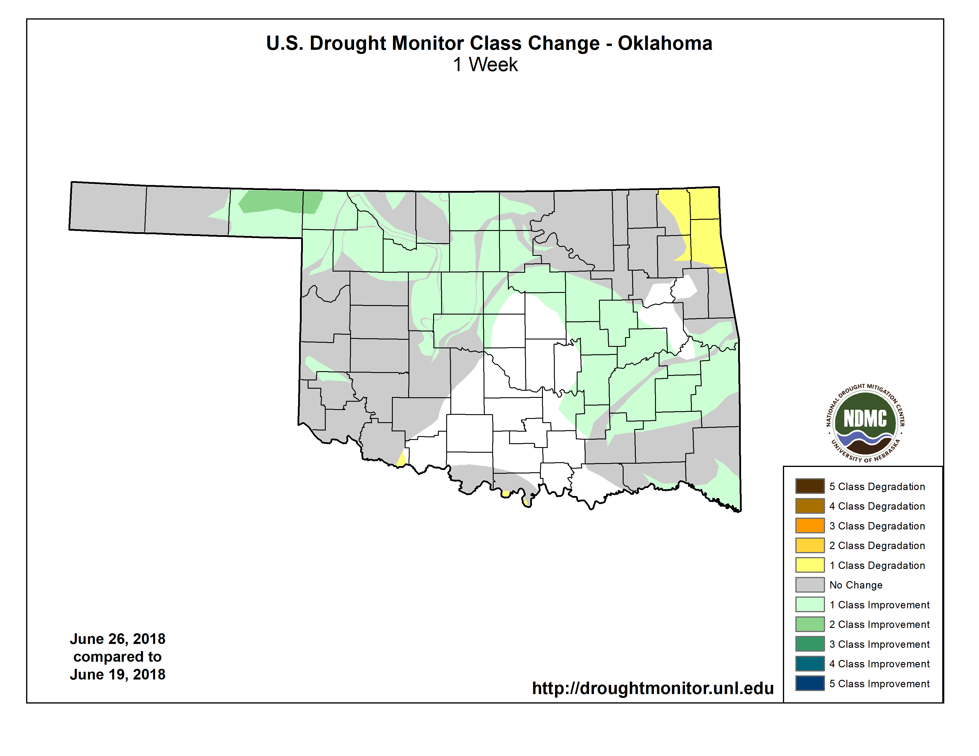
This week's national author did his best to blend in the short-term wetness of
June with the long-term dry spell since last October.
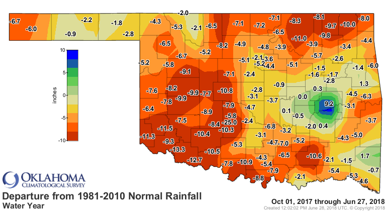
So we are now down to 54% of the state in drought, and only 28% in at least the
severe category. It's progress. The worry now is that a couple of weeks of dry,
hot weather will send some of those areas back into drought, or intensify the
existing drought. We're better off than we were before last week, but we could
use some more help.
It's now or never. We need some of that Kentucky rain in Oklahoma. Otherwise
we'll be saying "Viva Las Vegas." Don't be cruel, Mother Nature. This heat has
me all shook up.
Gary McManus
State Climatologist
Oklahoma Mesonet
Oklahoma Climatological Survey
(405) 325-2253
gmcmanus@mesonet.org
June 28 in Mesonet History
| Record | Value | Station | Year |
|---|---|---|---|
| Maximum Temperature | 113°F | ALTU | 2023 |
| Minimum Temperature | 48°F | EVAX | 2022 |
| Maximum Rainfall | 3.95 inches | WEST | 2000 |
Mesonet records begin in 1994.
Search by Date
If you're a bit off, don't worry, because just like horseshoes, “almost” counts on the Ticker website!