Ticker for May 1, 2018
MESONET TICKER ... MESONET TICKER ... MESONET TICKER ... MESONET TICKER ...
May 1, 2018 May 1, 2018 May 1, 2018 May 1, 2018
What about April?
Tornadoes...blah blah blah! Everybody always looking forward. How about a look
back instead of all this severe weather hysteria? Okay, sounds good!
But first, a bit of tornado hysteria.
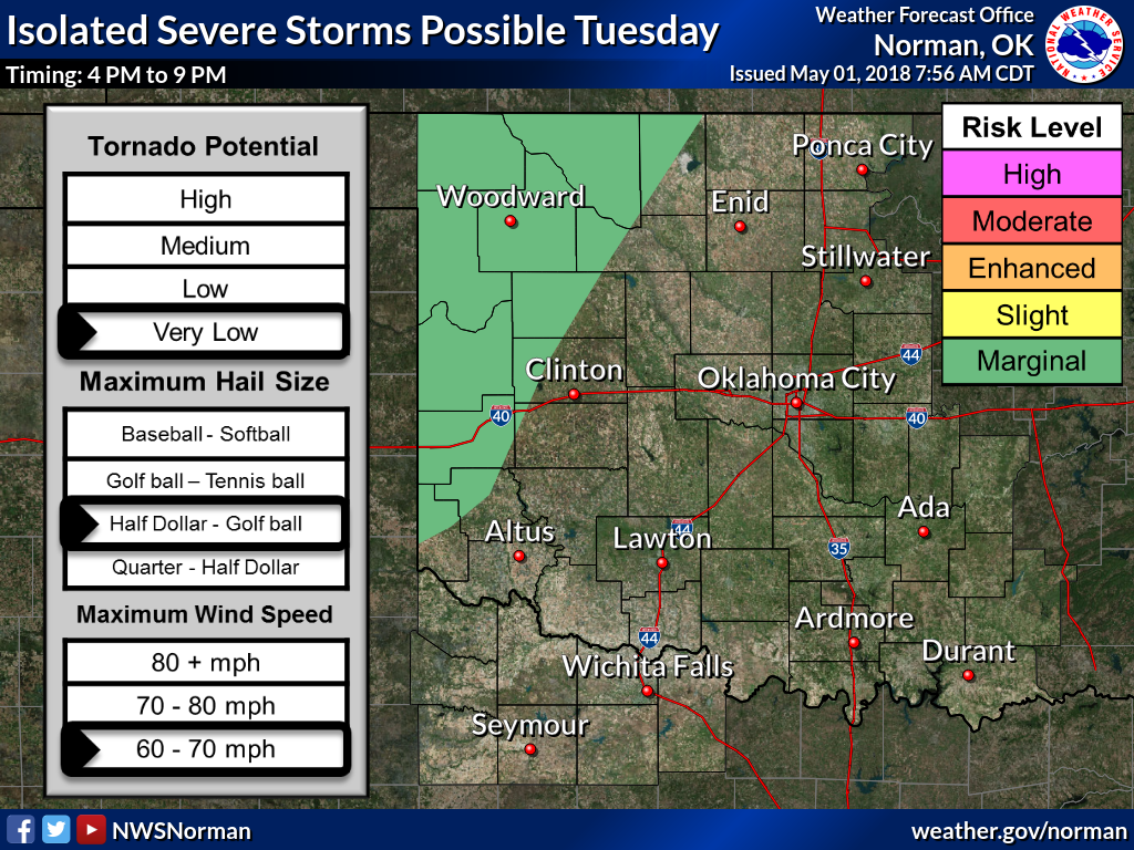
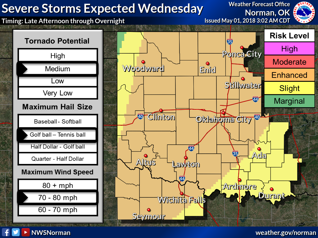
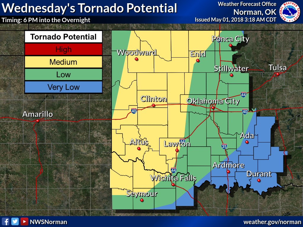
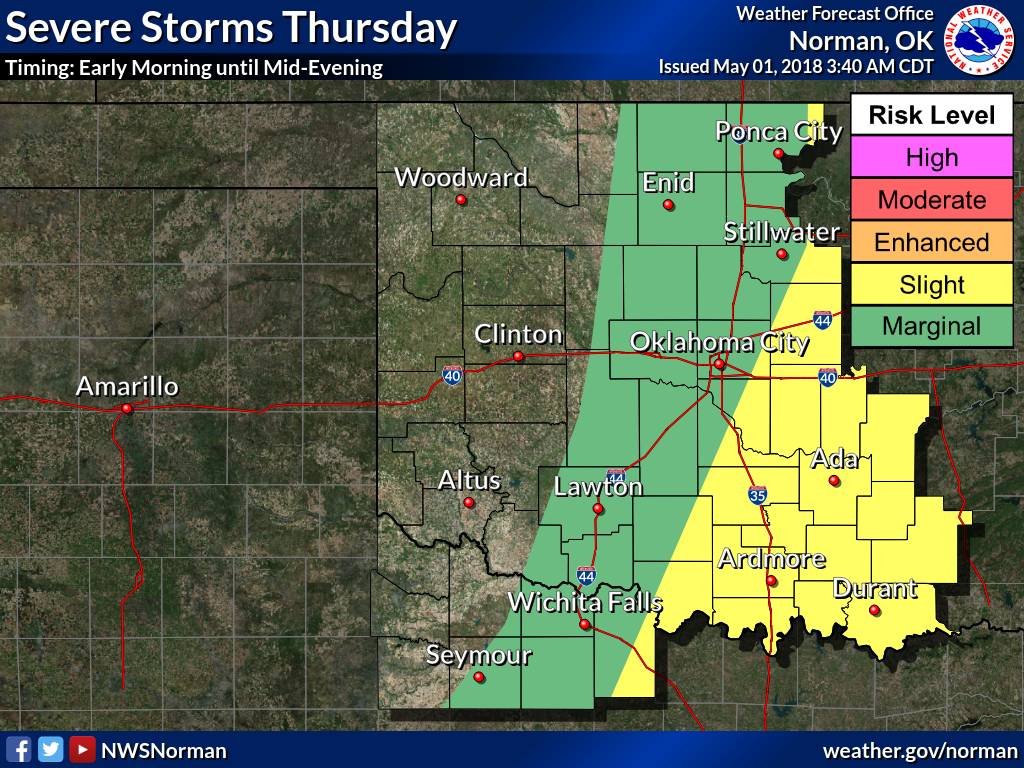
We're still looking at three more days of possible severe weather, AND an end
to our now infamous tornado drought of 2018. Some of it still looks a bit
conditional, with those fateful words "IF storms do form, they could quickly
become severe..." being uttered by forecasters, especially today and across
southern portions of Oklahoma tomorrow. And another caveat is being thrown around
for Thursday's chances, with "Depending on what happens on Wednesday..."
Here are a few graphics to help you along.

And, of course, the Panhandle gets to deal with wildfires whilst everybody else
is worried about storms.
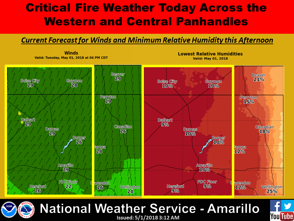
We hope for rain which usually come with storms during spring, but this isn't
a western OK drought buster, it would appear. Buster!

They say to look back is to be depressed, to look forward is to be anxious. So
enough anxiety...bring on the depression.
April's Fiery Chill
-----------------------------------------------------------------------------
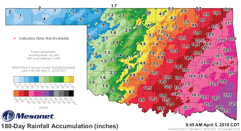
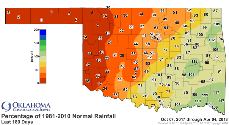
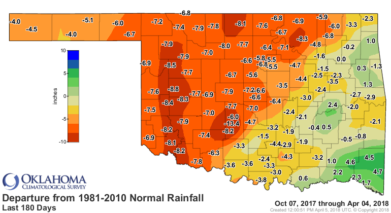
Wildfires rolled across the Oklahoma prairie for two weeks in April, scorching
hundreds of thousands of acres and placing entire towns in jeopardy. The fires
came on the heels of more than six months of drought in which western Oklahoma
received virtually no significant precipitation.
Vegetation that had seen abundant growth during 2017 lay dormant or dead,
awaiting a spark. Weather conditions coalesced on the 12th and 17th to produce
fire danger labeled ?historic.? As feared, fires roared to life on the 12th,
driven to a frenzy on winds gusting to over 50 mph. The two largest fires began
near each other in northwest Oklahoma. The ?Rhea Fire? ignited southwest of
Leedey in Dewey County and would go on to consume over 286,000 acres.
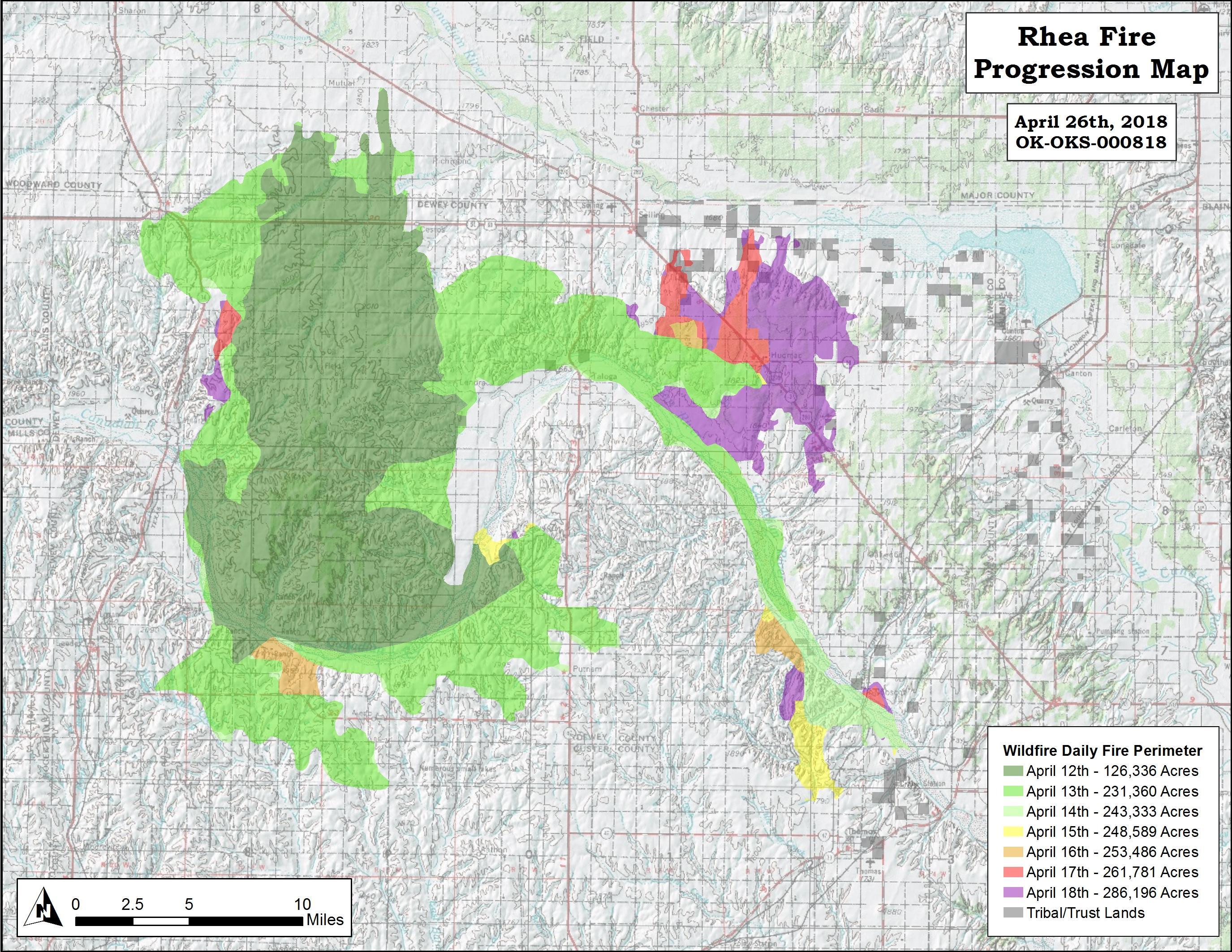
The ?34 Complex Fire,? began as three separate fires in Woodward and Harper
counties that merged into one, eventually burning over 60,000 acres. The fires
were not fully contained until the 25th following a couple of beneficial rain
events. Numerous smaller fires dotted the Oklahoma landscape. Nearly 400,000
acres burned across the state during the outbreak, burning dozens of homes and
causing tens of millions of dollars in damage. The small town of Martha in
Jackson County lost at least 15 homes and over $20 million in cotton and cotton
seed alone, according to one estimate. Twenty fire-related injuries were
reported by area hospitals, mostly due to smoke inhalation. The fires claimed
two lives ? a 61-year-old man died in Roger Mills County fighting a small fire
that began near Leedey, and a woman died in her vehicle near Seiling.
While the moisture that helped extinguish the fires across western Oklahoma was
helpful to firefighters, it was still well short of a normal April?s worth
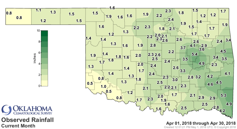
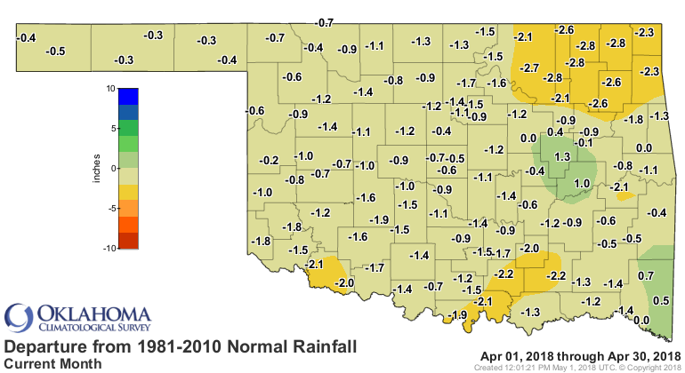
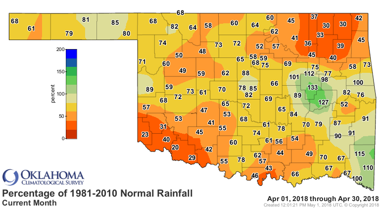
according to preliminary data from the Oklahoma Mesonet. The statewide average
of 2.14 inches was 1.12 inches below normal to rank as the 25th driest April
since records began in 1895. Northeastern Oklahoma was the driest section of
the state with deficits of 2-3 inches, the 11th driest April for that region of
the state. Tipton had the lowest total of any Mesonet site with 0.52 inches,
although Hollis was close behind at 0.54 inches. Okmulgee led the state with
5.35 inches. Only eight of the Mesonet?s 120 sites finished April with an above
normal rainfall total.
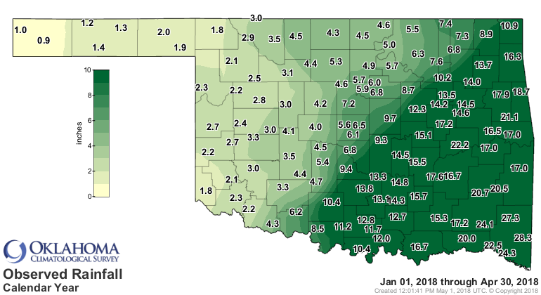
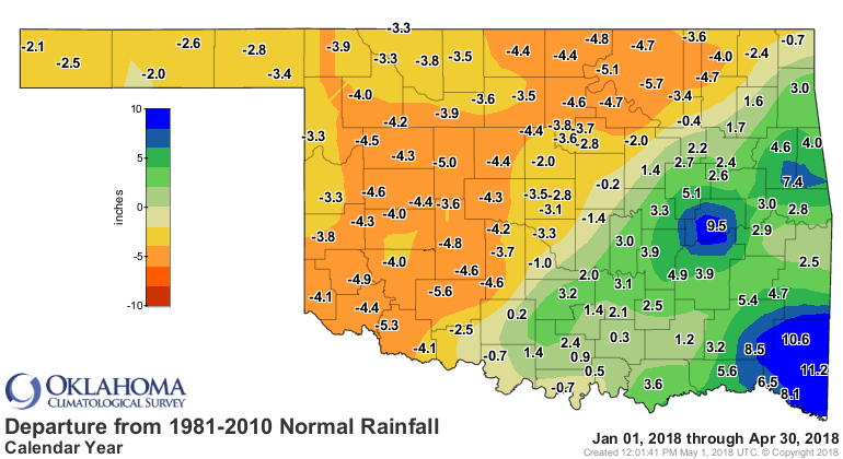
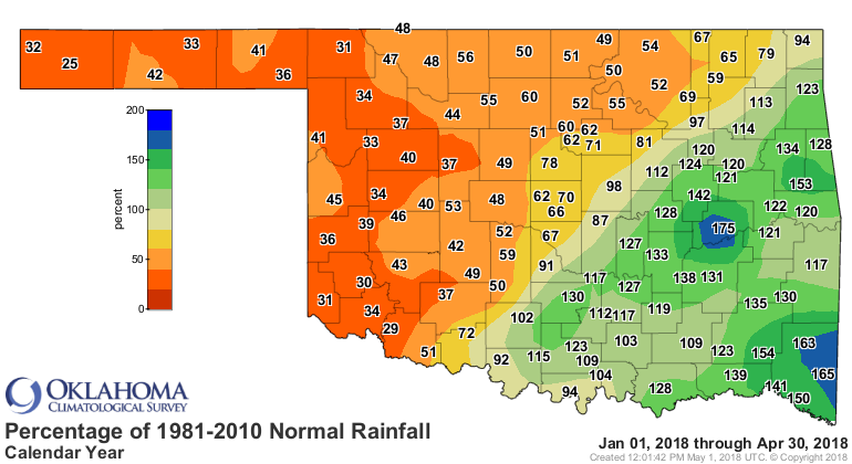
The statewide deficit for the year through April stood at 1.15 inches, the 60th
driest January-April on record. The northwestern half of the state was much
drier than the southeast through that period, however, with deficits of 3-6
inches common. As an example of the contrast, the southwest experienced its
11th driest January-April on record while east central enjoyed its 13th wettest
such period. Boise City has recorded a paltry 0.9 inches of precipitation since
the beginning of the year, while Broken Bow has had a whopping 28.3 inches.
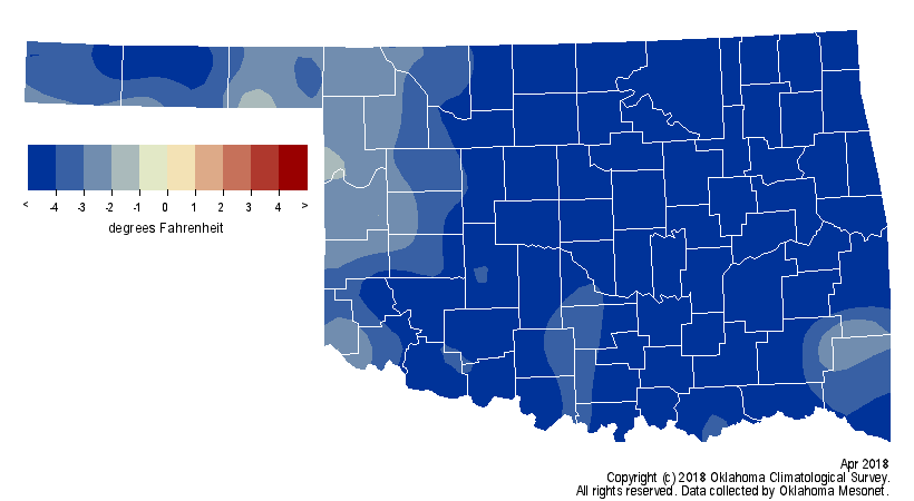
April was remarkably cool with a statewide average of 54.1 degrees, 5.2 degrees
below normal to make it the second coolest on record. Only 1983?s mark of 53.2
degrees was lower.

Freezing weather occurred as late as the 27th in the Panhandle, and in some
cases Mesonet sites spent more time below freezing during April than in March.
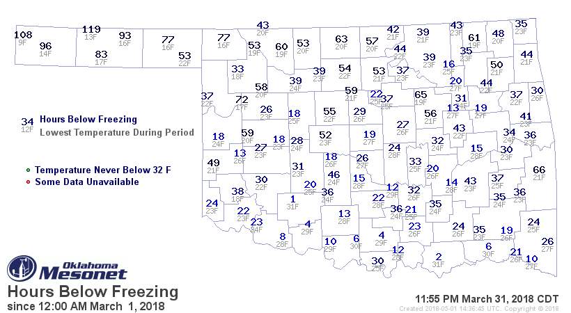
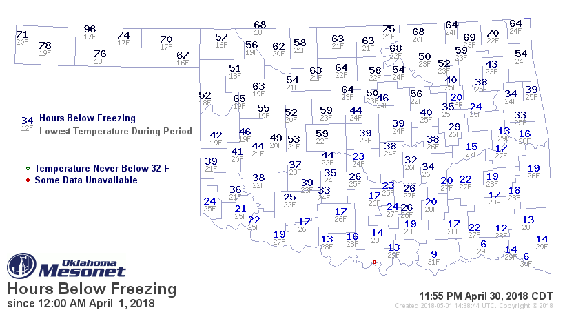
The lowest April temperature of 16 degrees occurred at Buffalo on the fourth
and Slapout on the seventh. The highest temperature 102 degrees at four Mesonet
sites across western Oklahoma on the 12th. The only other triple-digit
temperatures occurred on the 17th. Both dates coincide with the historic fire
danger days as indicated by the NWS. The January-April statewide average
temperature was 46.2 degrees, 1.2 degrees below normal to rank as the 50th
coolest such period on record.
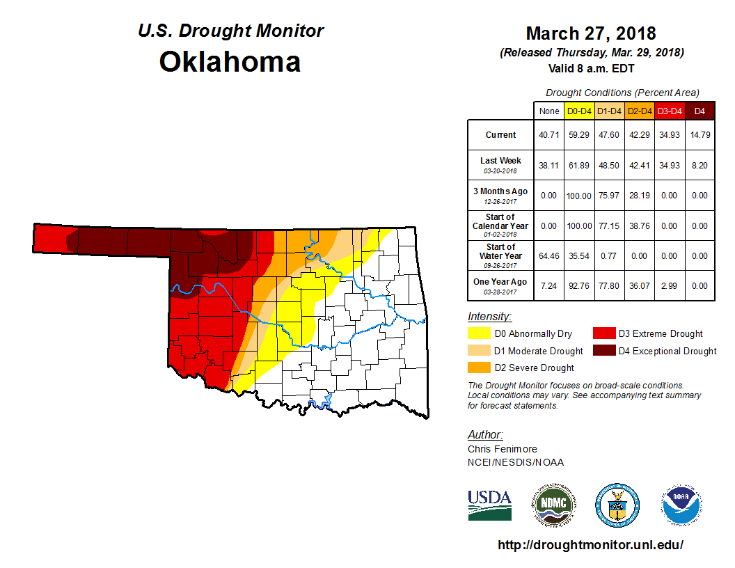
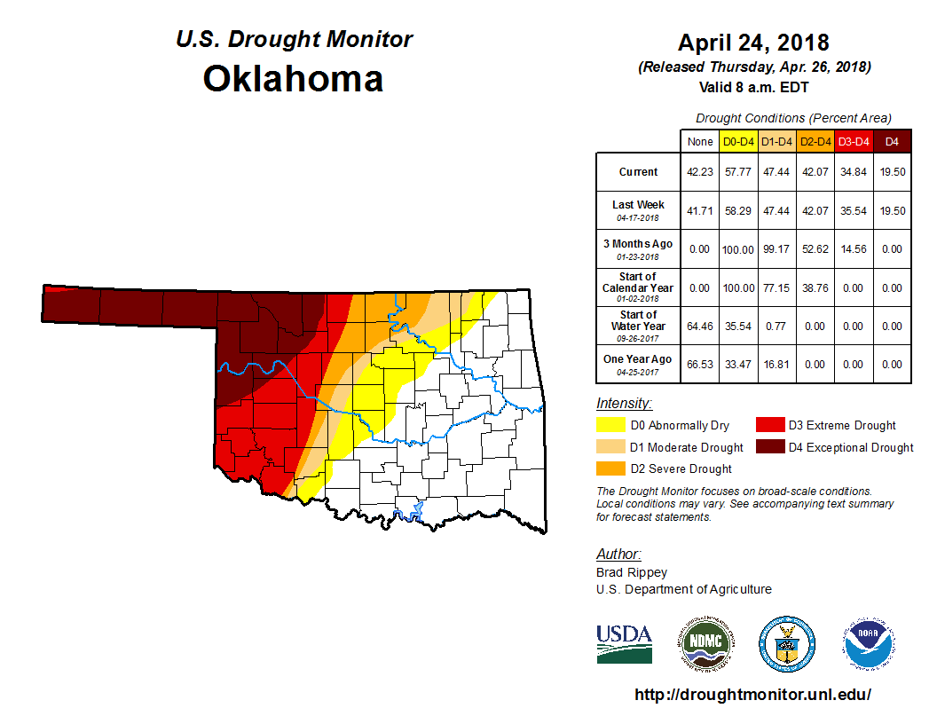
Despite the modicum of relief experienced by northwestern Oklahoma, the amount
of drought in the state remained steady at 47 percent from the end of March
through April, according to the U.S. Drought Monitor. The percentage of drought
considered extreme-to-exceptional, the two worst categories, also remained
unchanged at 35 percent. Exceptional drought, the highest level on the Drought
Monitor?s intensity scale, actually increased from 15 to 20 percent.
The extension of the fire season into mid-spring was perhaps the most obvious
drought impact. However, other impacts worsened across western Oklahoma during
April as well. The condition of Oklahoma?s winter wheat was rated 66 percent
poor to very poor according to statistics from the USDA. Oklahoma?s topsoils
were rated 47 percent short to very short of moisture, while the subsoils had
a similar rating at 54 percent.
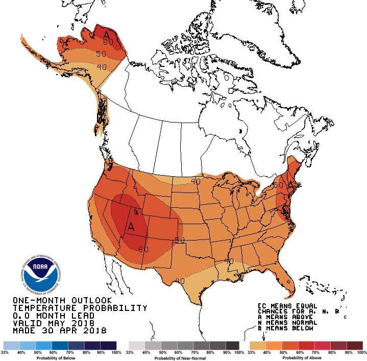
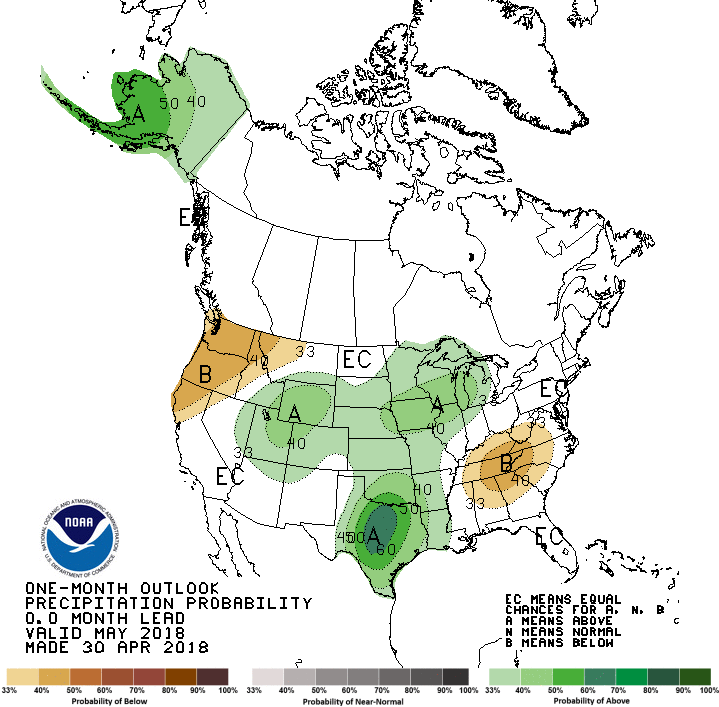
The May temperature and precipitation outlooks from the Climate Prediction
Center call for increased odds of above normal temperatures across the entire
state and above normal precipitation across all but the far western Panhandle.
The greatest odds for above normal rain amounts fall across far southern
Oklahoma.
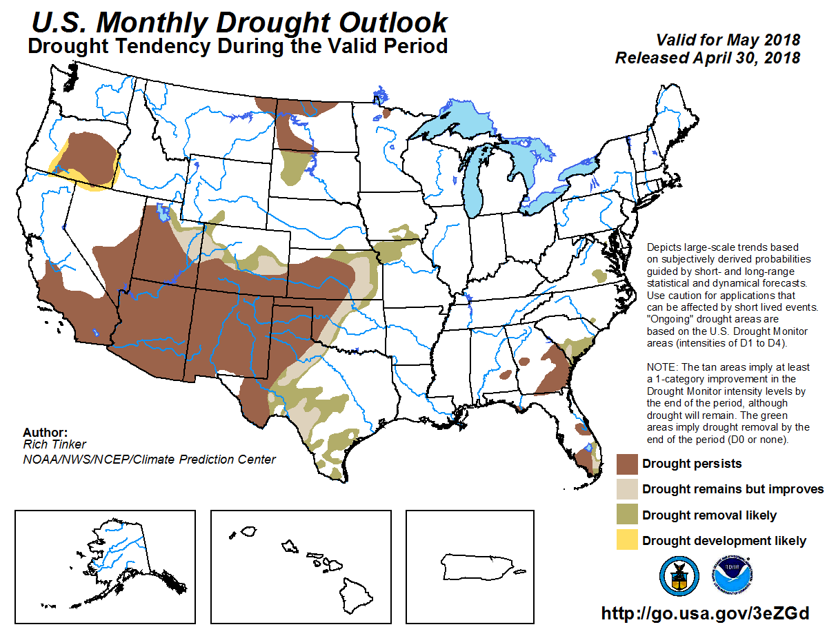
Despite those odds, drought is expected to persist or intensify across much of
western Oklahoma due to the severity of the deficits seen in those areas since
last October. To the east of that area where drought is not quite as severe,
some drought improvement or removal is favored.
Gary McManus
State Climatologist
Oklahoma Mesonet
Oklahoma Climatological Survey
(405) 325-2253
gmcmanus@mesonet.org
May 1 in Mesonet History
| Record | Value | Station | Year |
|---|---|---|---|
| Maximum Temperature | 101°F | ALTU | 2002 |
| Minimum Temperature | 28°F | BOIS | 2011 |
| Maximum Rainfall | 7.70″ | PRYO | 2009 |
Mesonet records begin in 1994.
Search by Date
If you're a bit off, don't worry, because just like horseshoes, “almost” counts on the Ticker website!