Ticker for May 2, 2018
MESONET TICKER ... MESONET TICKER ... MESONET TICKER ... MESONET TICKER ...
May 2, 2018 May 2, 2018 May 2, 2018 May 2, 2018
Tornado Zone
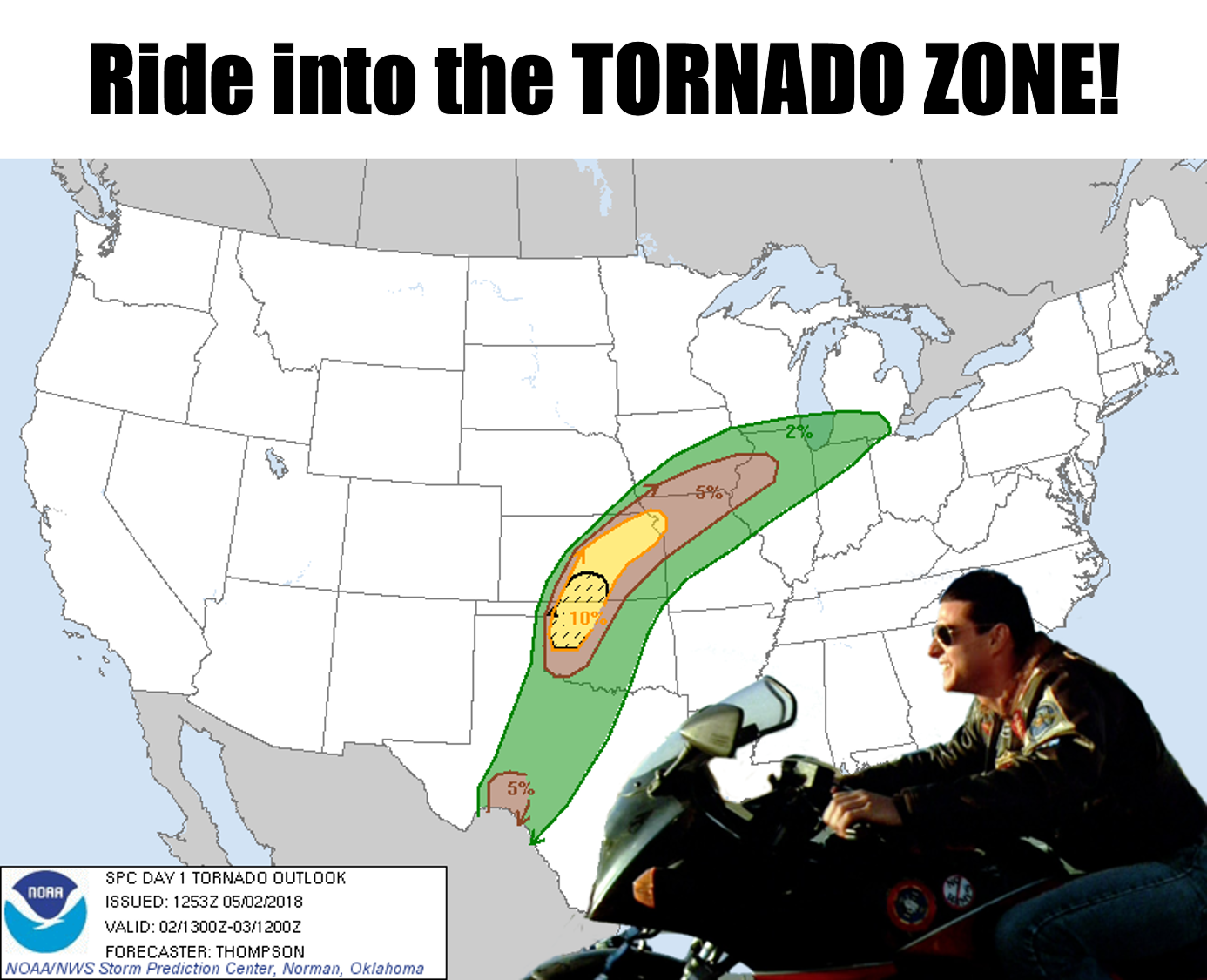
(Ticker's Note: Do NOT ride into the tornado zone.)
So I guess you've heard we're to have severe weather today? I haven't seen much
about it, so I hope I'm not shocking you. So I guess we possibly might have had
our first possible tornado last night up near (AHEM!) BUFFALO in HARPER COUNTY?
I saw videos and whatnot, guess we'll wait for the official word from the
official-official word people at the NWS. I noticed it knocked down a cottonwood
tree up north of Buffalo, whatever it was, which is a shame since that's the
county's only tree.
I'm from there, I can make fun.
Not so much fun coming today, with chances of severe storms and all the bad
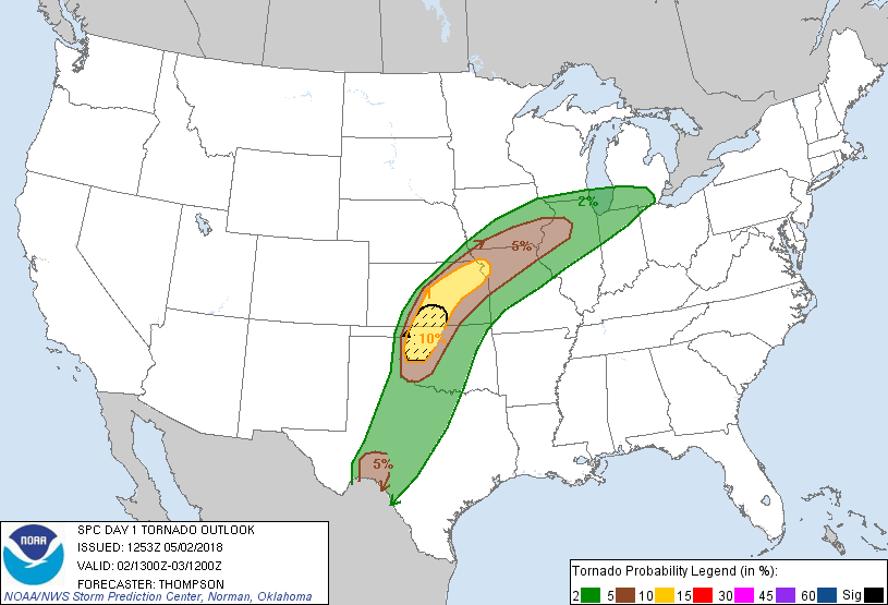
things that come with them across much of Oklahoma. Hence the latest maps from
the Storm Prediction Center.


For a little help on the first map, here's an explanation on the categories
and their descriptions.

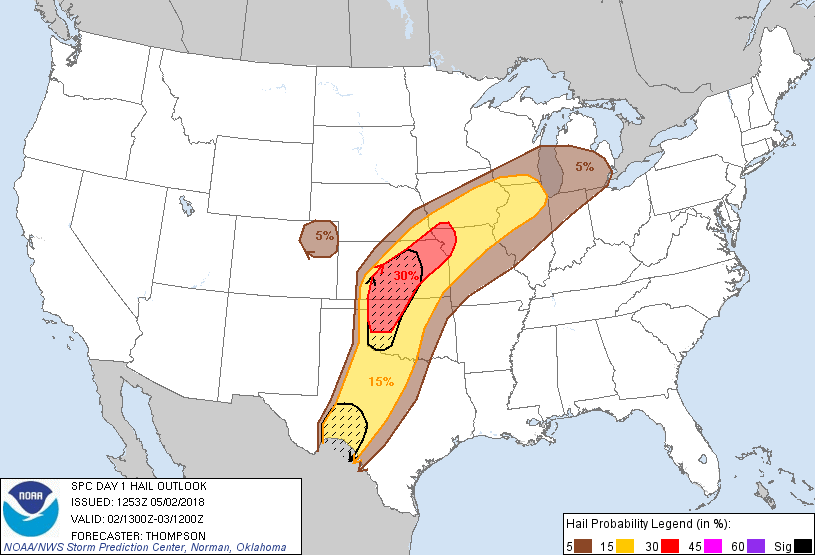
On the other maps (tornado, wind and hail), the hatched areas signify areas of
probability for the more high end of each hazard, so the 10% on the tornado map
that's hatched with the lines running through it means the probability of the
strong tornadoes (EF2-EF5) within 25 miles of a point in that area, whilst the
other non-hatched ares just simply mean probability of tornadoes within 25
miles of a point. The 25 miles part applies to the other maps as well.
Winds, non-hatched means probability of wind gusts of 50 knots or greater,
hatched areas...65 knots.
Hail, non-hatched means probability of one-inch diameter hail, hatched areas...
two-inch diameter hail.
From what I gather, the best ingredients for discrete supercells (and thus
tornadoes) will occur this afternoon and evening across NW OK and SW KS. The
storms that fire up a bit farther north into Kansas will probably cluster
together and form bow echoes, thus the higher probability of severe wind
makers. For the hail, the big supercells tend to have the bigger hail, so it
mirrors the highest tornado risk areas somewhat.
Here's a bit of fine tuning from our local NWS offices.
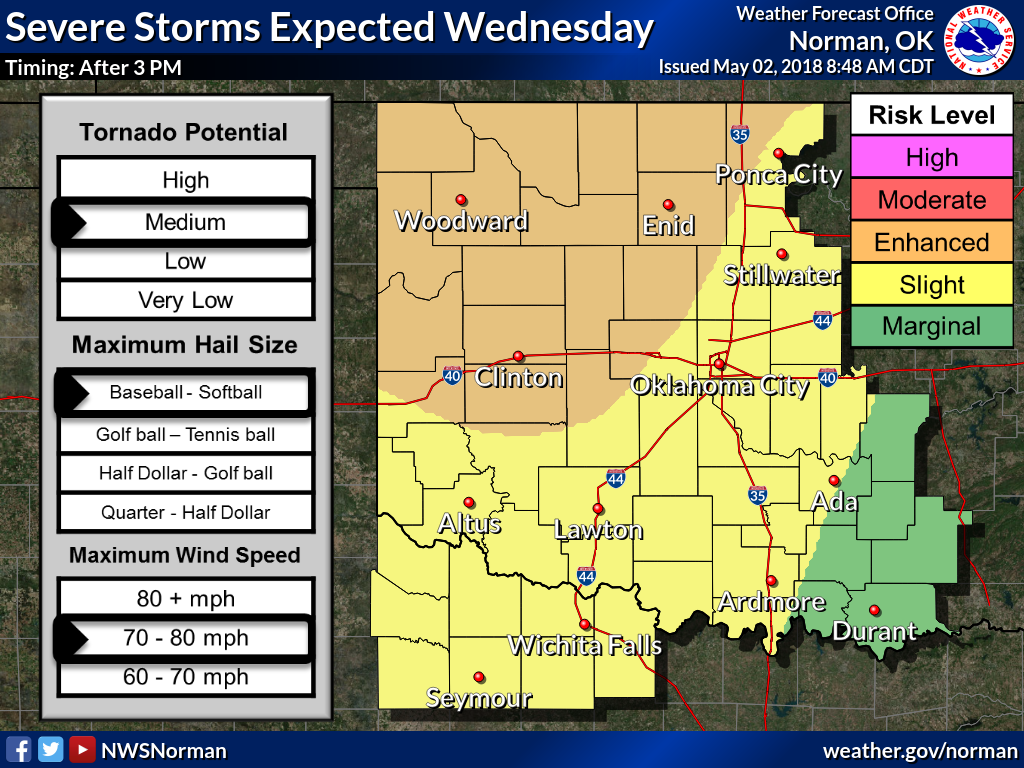

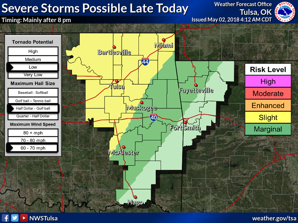
We should get a new update from SPC here in a couple of hours with some more
fine tuning, as well as updated graphics from the NWS offices throughout the
day. This is standard the day of the event as the high-resolution forecast
models get better handles on the pre-storm environment.
It's important to keep abreast the weather later this afternoon as conditions
change from hour to hour, minute to minute.
As for me, I stay out along the edges, always where I burn to be,
and the further on the edge, the hotter the intensity.
But that's just me. I'll have the TV on, the NWS and SPC feeds up on twitter,
ready to head for cover at any moment.
I will NOT, however, ever ever leave my wing man.
Gary McManus
State Climatologist
Oklahoma Mesonet
Oklahoma Climatological Survey
(405) 325-2253
gmcmanus@mesonet.org
May 2 in Mesonet History
| Record | Value | Station | Year |
|---|---|---|---|
| Maximum Temperature | 105°F | ALTU | 2020 |
| Minimum Temperature | 24°F | BOIS | 2013 |
| Maximum Rainfall | 4.04″ | HASK | 2022 |
Mesonet records begin in 1994.
Search by Date
If you're a bit off, don't worry, because just like horseshoes, “almost” counts on the Ticker website!