Ticker for April 30, 2018
MESONET TICKER ... MESONET TICKER ... MESONET TICKER ... MESONET TICKER ...
April 30, 2018 April 30, 2018 April 30, 2018 April 30, 2018
Here comes Mother Nature!
Technically, Russel from "Up" isn't a Boy Scout, but come on. And besides, as an
old Boy Scout myself (Troop 276, Buffalo, OK!!), I am prepared to take creative
license.
Mother Nature has given us just about everything this year, except a big snow. But
we did have that day or two of sorta icy weather and everybody got to stay home,
remember? Okay, long gone. The focus now turns from our moisture drought out west
to the now-famous tornado drought for the year thus far. We have storms possible
out west today and tomorrow, with tomorrow looking the worse of the two. Today
will be mostly hail and wind, if much at all, then tomorrow's severe chances are
considered "conditional," meaning if storms form, they could be severe with all
the not-so-good things that come with them. Emphasis on the "IF" in that sentence.
Today's maps from the Storm Prediction Center


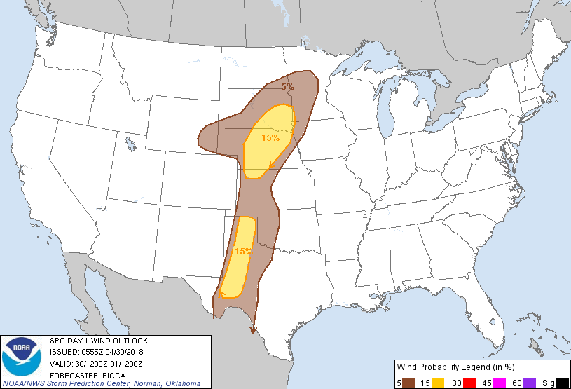
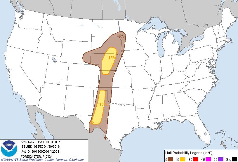
Tuesday's SPC map

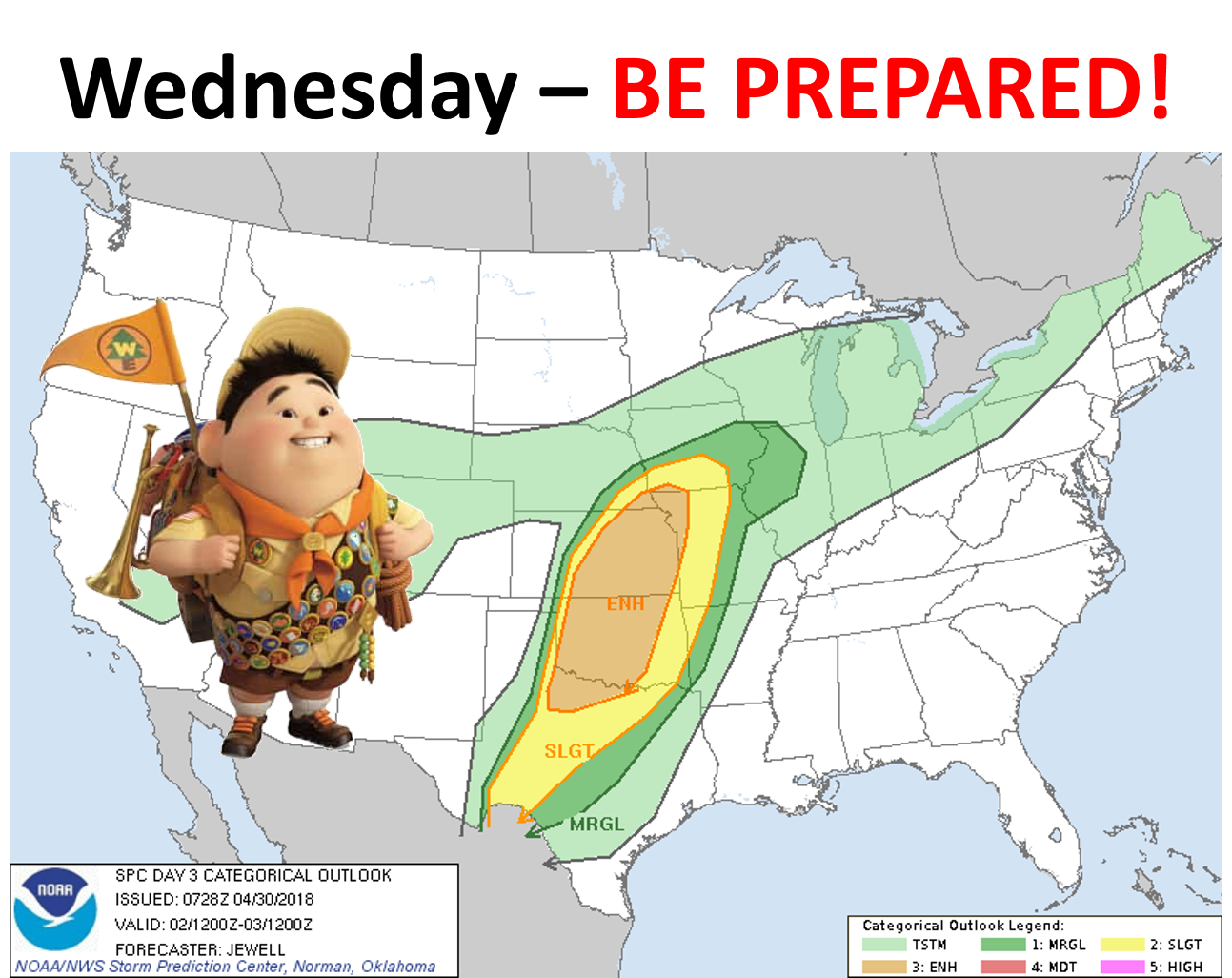
Wednesday looks like the prime day for severe weather risk, including those
large supercells roaming the Southern Plains. We should have a strong surface
low pressure system in Kansas and an accompanying cold front and dryline
extending down into Oklahoma. Add lots of sheer from strong winds just above
the surface and then in the mid-levels and you have a chance for some bad
things to happen. Doesn't mean they're going to, just means it's a good idea to
go ahead and figure out what you're going to do if they do what they do.
How was THAT for a sentence?
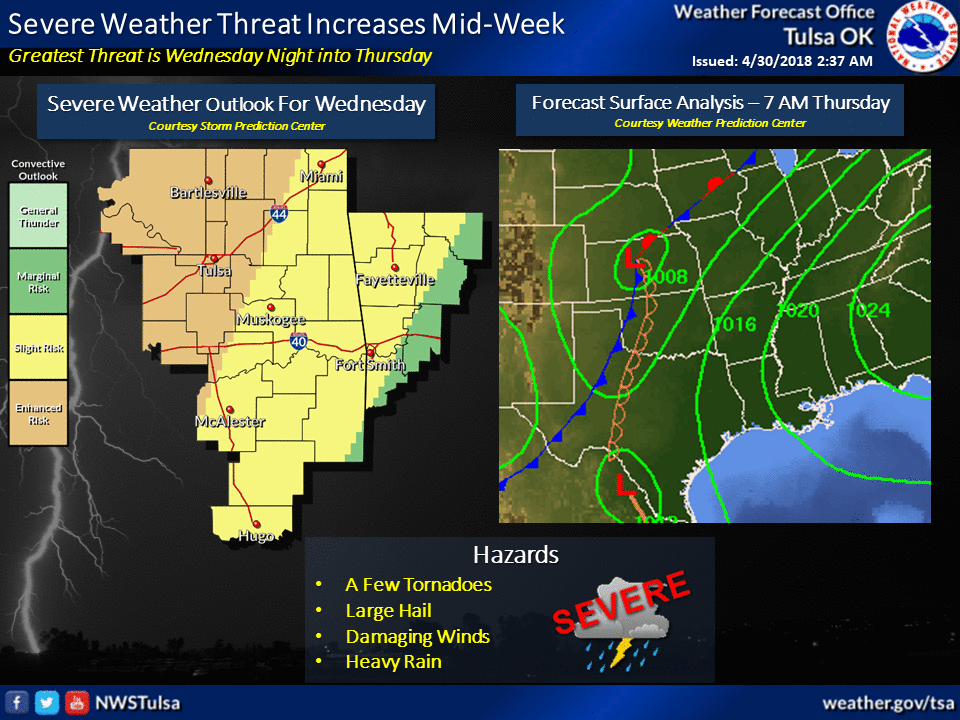
Here's NWS Tulsa's take on the matter.
And the SPC's.
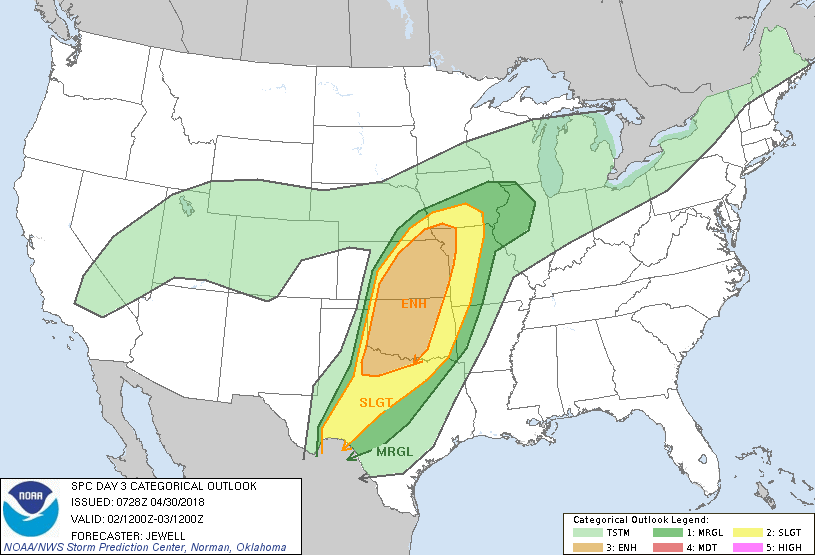

Since we're going out to day three on that one, don't zero in on NW OK. The area
of greatest risk can and probably will change just a bit before we get there.
Also wouldn't shock me if we go from "enhanced" to "moderate" somewhere in our
vicinity, give or take a hundred miles.
NWS Norman's take, and then their recommendations on how to get prepared.
The greatest risk for severe storms this week will likely be
Wednesday afternoon and night across portions of Oklahoma and north
Texas. There is an Enhanced Risk for severe storms for most of the
area. Very large hail, damaging winds, and tornadoes will all be
concerns Wednesday afternoon and night.
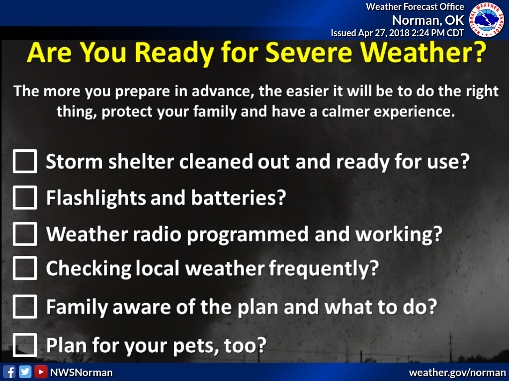
The threat of severe weather will extend into Thursday, but we'll cross that
bridge as we get closer. One of the benefits of OK's spring severe season is
the rainfall that goes with it (unless it's flooding rainfall, which we might
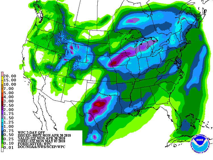
see across eastern OK). The biggest rains appear to be headed for Texas, but
parts of Oklahoma will get their share. Hard to predict convective rainfall,
but here's a guess from the Weather Prediction Center.
So now you know, it's coming on Wednesday, so the time to prepare is now. Don't
wail and gnash your teeth, or gnash and wail your teeth. No fetal position. No
abandoning your posts and fleeing for your lives.

It's Oklahoma. It's spring. A storm is coming. You know the drill.
Gary McManus
State Climatologist
Oklahoma Mesonet
Oklahoma Climatological Survey
(405) 325-2253
gmcmanus@mesonet.org
April 30 in Mesonet History
| Record | Value | Station | Year |
|---|---|---|---|
| Maximum Temperature | 96°F | BEAV | 2013 |
| Minimum Temperature | 26°F | EVAX | 2017 |
| Maximum Rainfall | 6.12″ | NOWA | 2019 |
Mesonet records begin in 1994.
Search by Date
If you're a bit off, don't worry, because just like horseshoes, “almost” counts on the Ticker website!