Ticker for April 26, 2018
MESONET TICKER ... MESONET TICKER ... MESONET TICKER ... MESONET TICKER ...
April 26, 2018 April 26, 2018 April 26, 2018 April 26, 2018
It could be worse!
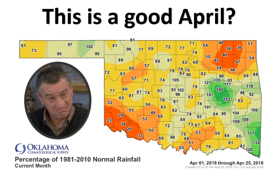
It's a rhetorical question, because obviously the answer is "YES" when this is
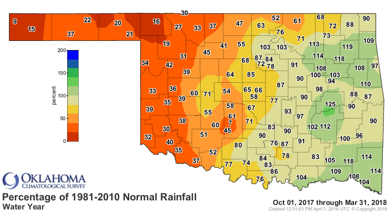
what you saw the previous 6 months.
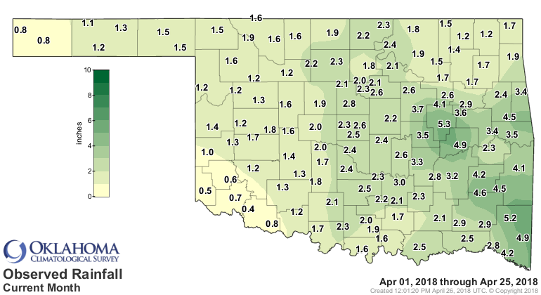
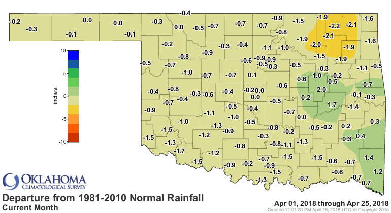
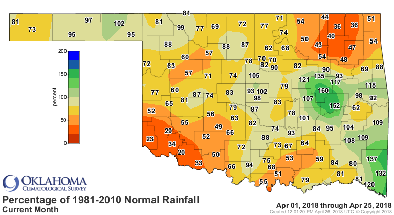
So when you see rainfall maps like this, you're thankful that parts of
northwestern and central OK got close to or even above normal moisture amounts,
but at the same time recognize that you're battling now 7 months worth of
deficits. And southwest Oklahoma, which missed out on significant moisture,
now becomes target #1 for drought intensification.
Our drought concerns remain, and those are reflected by the newest U.S. Drought
Monitor map, which barely saw any changes.
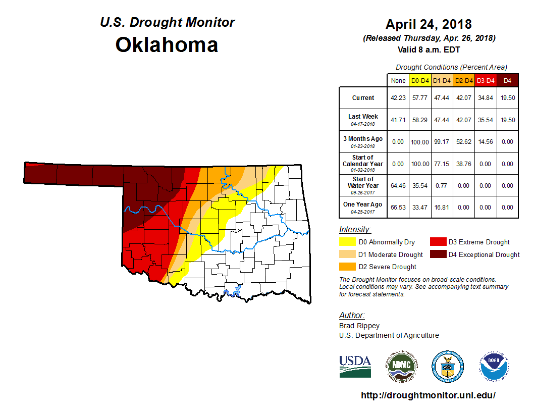
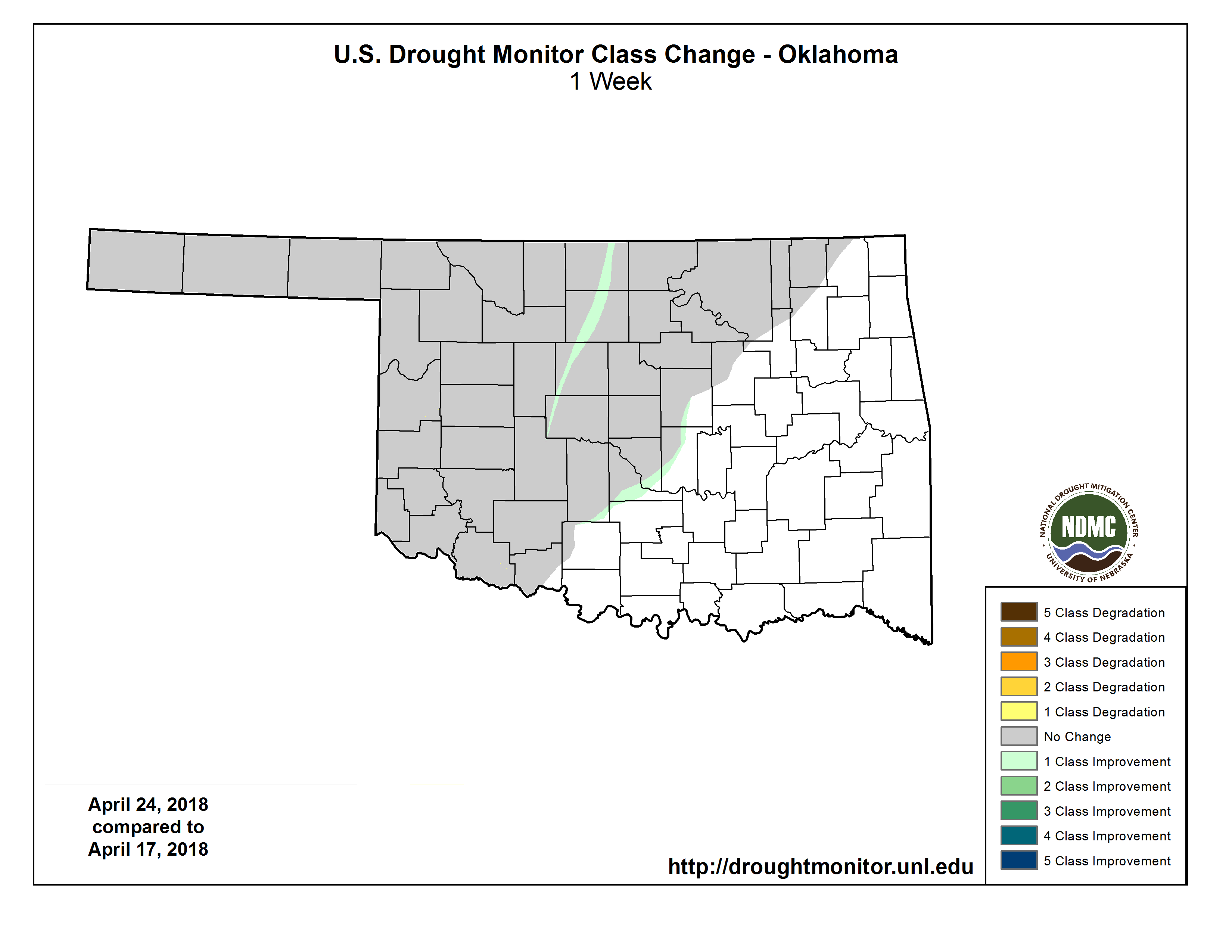
But remember, the Drought Monitor only considers rains that have fallen through
early Tuesday morning, so yesterday's additional bounty will get figured into
next week's map. Also, when we've seen such a long stretch of drought, we want
to wait a bit and see how the impacts improve before the drought map improves.
With more rain's possible today, that should help move some colors around even
more.
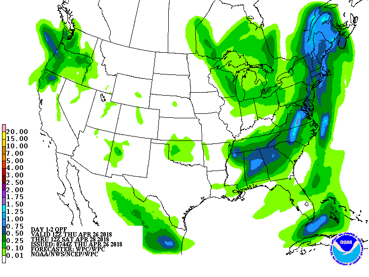
After that, our hopes are pegged on the most erratic of Mother Nature's charms,
convective rainfall. The weather could start going bump in the night early next
week, which is a bad thing. But it's springtime in Oklahoma, and unfortunately,
to get the good things (i.e., RAIN!), we have to put up with the bad things
(i.e., high winds, hail and sometimes, tornadoes).
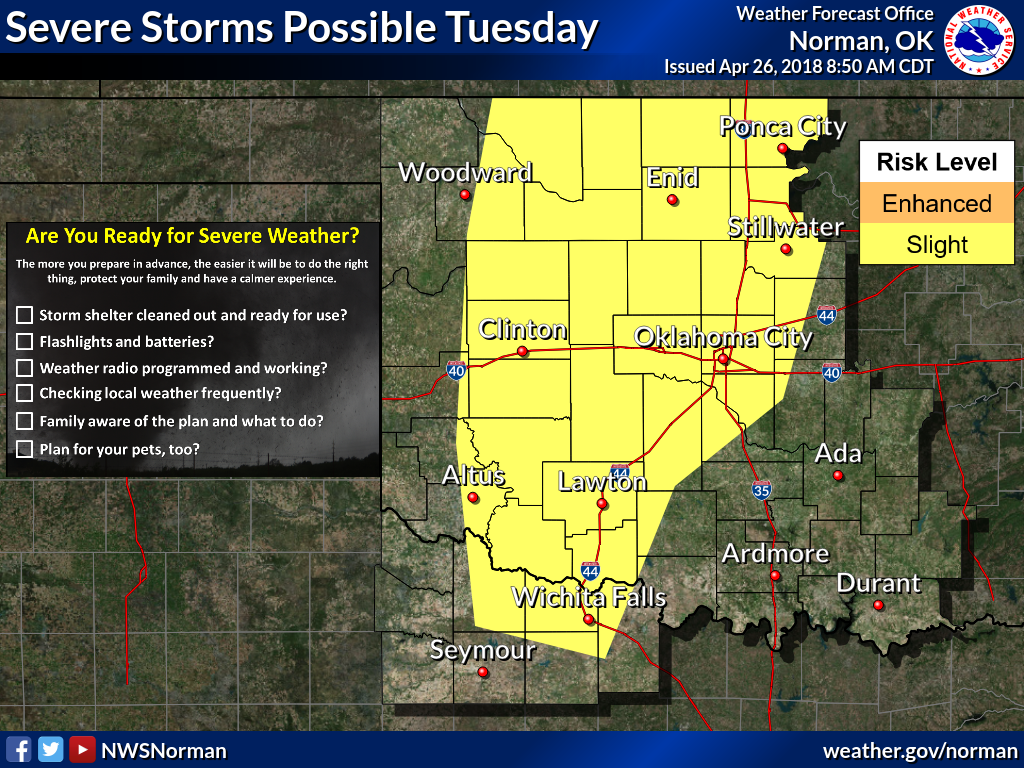
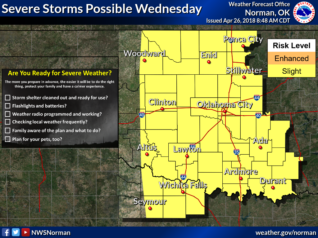
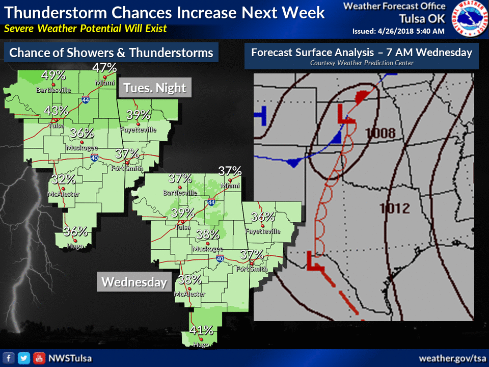
It's always a crapshoot determining where the lines of storms will form (if they
even will), where will they train over as they form again and again, etc. But
at least the rain forecast map is starting to light up with possibilities.
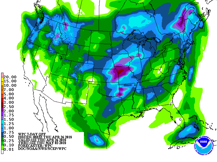
Ahhhhh, possibilities.
Gary McManus
State Climatologist
Oklahoma Mesonet
Oklahoma Climatological Survey
(405) 325-2253
gmcmanus@mesonet.org
April 26 in Mesonet History
| Record | Value | Station | Year |
|---|---|---|---|
| Maximum Temperature | 95°F | ALTU | 2014 |
| Minimum Temperature | 25°F | BOIS | 2006 |
| Maximum Rainfall | 5.51 inches | BOWL | 1998 |
Mesonet records begin in 1994.
Search by Date
If you're a bit off, don't worry, because just like horseshoes, “almost” counts on the Ticker website!