Ticker for April 17, 2018
MESONET TICKER ... MESONET TICKER ... MESONET TICKER ... MESONET TICKER ...
April 17, 2018 April 17, 2018 April 17, 2018 April 17, 2018
ZOINKS!
First off, I've always thought Shaggy said "ZOIKS!" So I begrudgingly go with the
consensus "ZOINKS!" At any rate, we're right back in the same position we were
late last week with what's being deemed "HISTORIC" fire danger for today as yet
another dry storm system approaches, complete with a problematic wind shift due
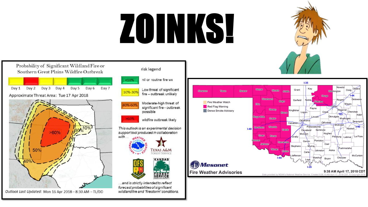
to a cold front later tonight. The above graphic contains the experimental outlook
from the agencies listed, and it has the probability of a significant wildland
or Southern Plains wildfire outbreak pegged at greater than 60%, and you can also
see the Red Flag Fire warning that covers most of the western half of the state
(and Pawnee/Osage counties to boot). From the OK Forestry Service this morning,
they've gone from "Ominous" last week to "Particularly Dangerous Situation."
Tornado watchers take note of that one. Here's some of their text for the day:
A particularly dangerous situation is expected to develop with extreme
fire weather and very dry fuels across western Oklahoma and parts
of northern Oklahoma on April 17, 2018. The resulting fire behavior on
any of the ongoing wildfires and new fire occurrence will present
significant hazard to both incident responders and the public.
A Red Flag Warning is in effect for much of western Oklahoma and the
Oklahoma Panhandle. Extreme fire danger is predicted to begin early in
the burning period lasting well into the night and on into the early
morning hours on Wednesday given the current state of wildland fuels
and forecast weather conditions. Within the Warned Area, temperatures
in the upper 80??s and low 90??s, clear skies and relative humidity
values of 5-15% will deliver fine-dead fuel moisture values as low as
2% with widespread observations of 3% expected. Extreme rates of fire
spread complicated by problematic fire behavior including single and
group tree torching, crown runs in juniper (red cedar), and spotting
will be present on any fire that becomes established.
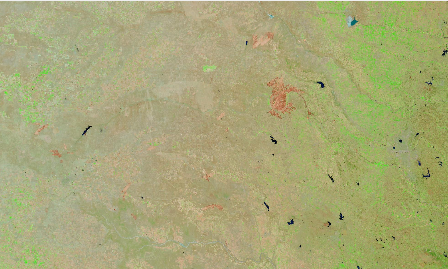
Obviously we're dealing with a very serious situation, especially around the
areas that fires are still burning. The burn scars were still very much visible
on a MODIS False Color satellite image. If you see a brown patch, that's a
burn scar (unlike in Beaver each year, where if you see a brown patch, you
pick it up and throw it).
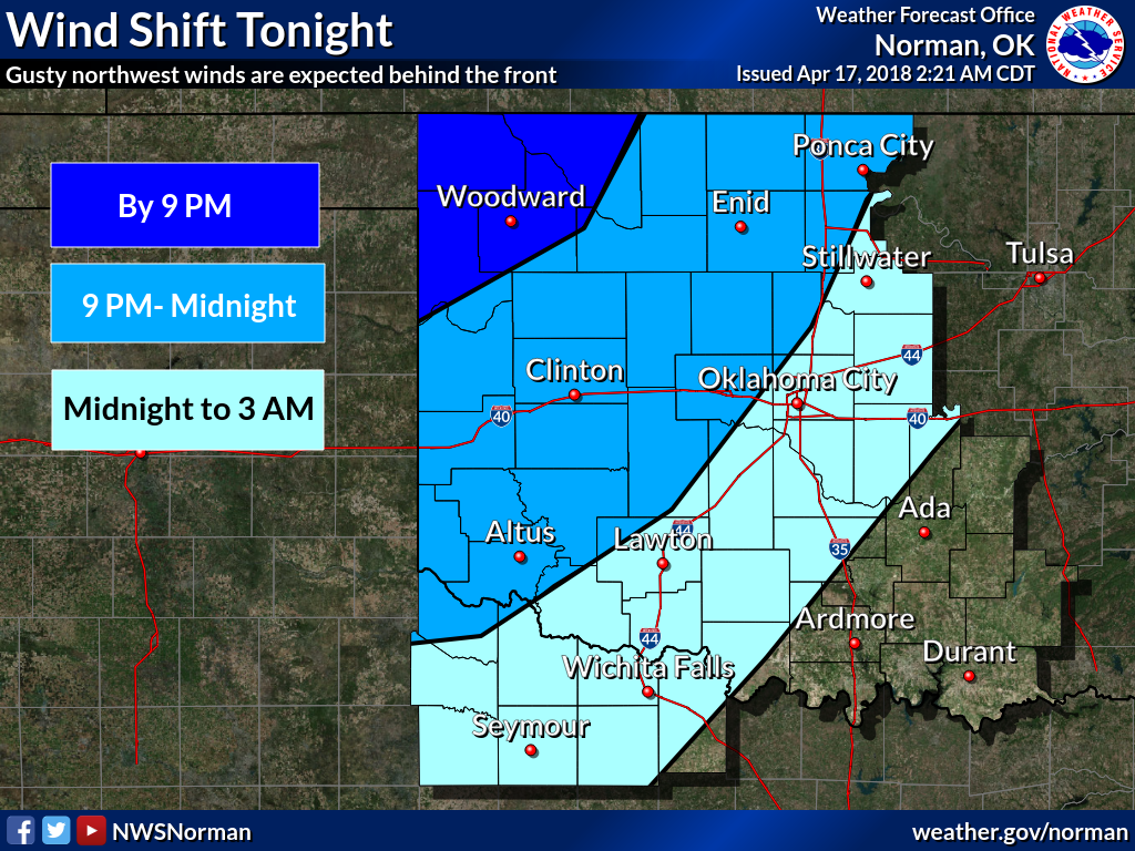
As noted, any fires that start will likely have to deal with another wind shift
as the cold front moves through.
The Governor's burn ban has been increased as well, to try and prevent any
unnecessary burning, which for today means ALL BURNING (and sparking, and
smoking, and so on and so forth).
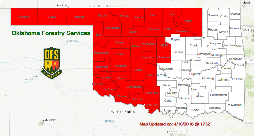
If you get caught burning in the burn ban area, YOU will get burnt.
We're still looking at the best chance for significant rain we've seen across
far western Oklahoma since probably last October, coming our way Thursday and
primarily Friday.

We need green vegetation to start reducing the dead/dormant fuels that cause
these days with the proper conditions to turn into extreme fire danger days
(or "historic/ominous/particularly dangerous"). The only way to do that is to
get rain, and also stop freezing. Climatologically speaking, our freezing weather
should start to dwindle. Now we just need the rain.
Speaking of which, Kenton turned 200 yesterday. Not in age, but in consecutive
days without at least a quarter-inch of rain in a single day. Not the longest
period we've ever seen on one of these maps, but fairly significant nevertheless.
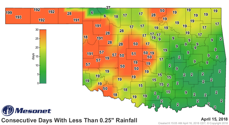
Let it rain. Please!
Gary McManus
State Climatologist
Oklahoma Mesonet
Oklahoma Climatological Survey
(405) 325-2253
gmcmanus@mesonet.org
April 17 in Mesonet History
| Record | Value | Station | Year |
|---|---|---|---|
| Maximum Temperature | 102°F | GRA2 | 2006 |
| Minimum Temperature | 22°F | BOIS | 2020 |
| Maximum Rainfall | 6.57 inches | MEDI | 2013 |
Mesonet records begin in 1994.
Search by Date
If you're a bit off, don't worry, because just like horseshoes, “almost” counts on the Ticker website!