Ticker for April 16, 2018
MESONET TICKER ... MESONET TICKER ... MESONET TICKER ... MESONET TICKER ...
April 16, 2018 April 16, 2018 April 16, 2018 April 16, 2018
Here we go again
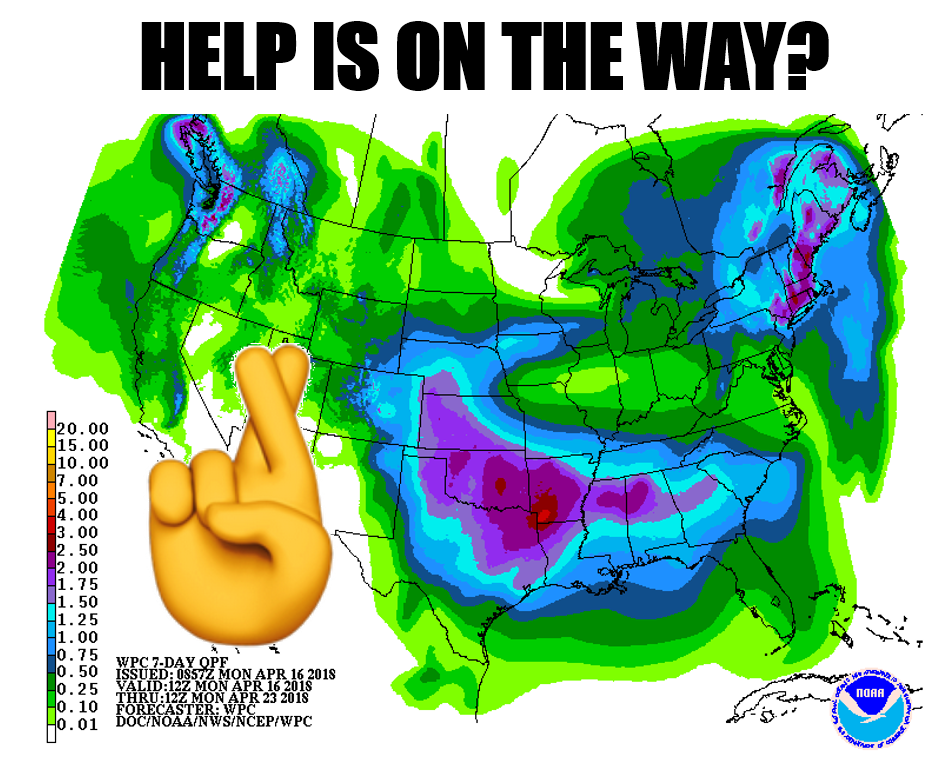
Never bury the lead, and after the last few days (weeks, months?), I decided to
go with the good news first. Now I put a question mark on the graphic because
it is a FORECAST, and we all know what can go wrong with a 7-day forecast,
although the good rains you see our across western OK and the Panhandle are
expected in 4-5 days. A lot can happen between now and then, both to that
forecast, AND to the state. One of the things that's gonna happen is another
bout of what is called "Historic" fire danger on Tuesday, at least according to
the Norman NWS office. Here are their fire danger graphics as well as from the
offices covering other parts of the state.
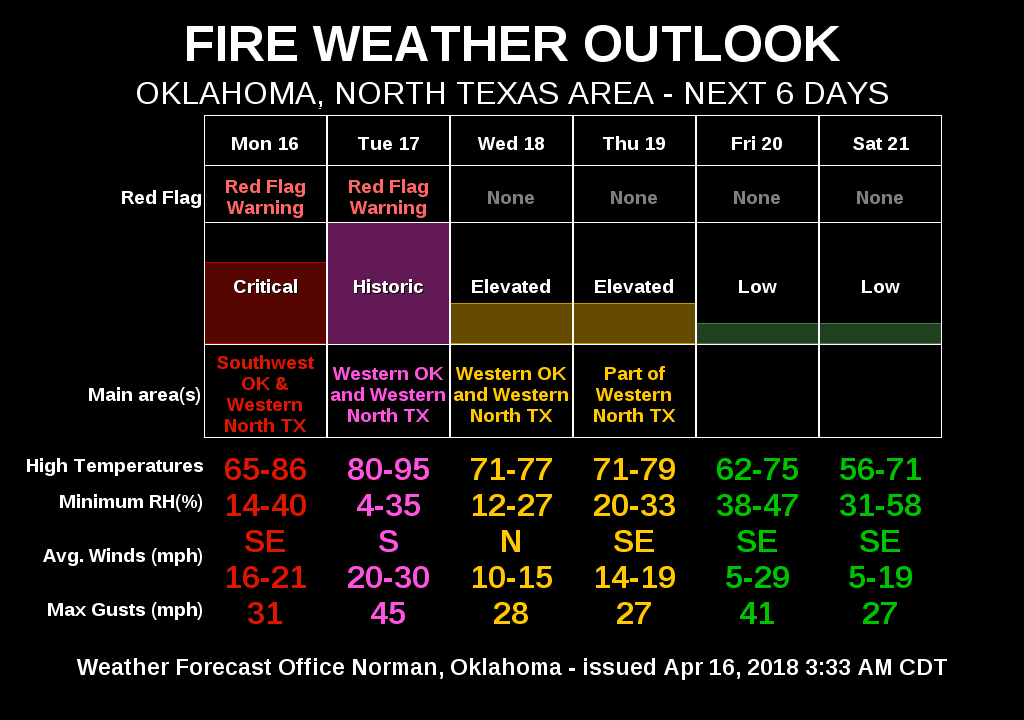
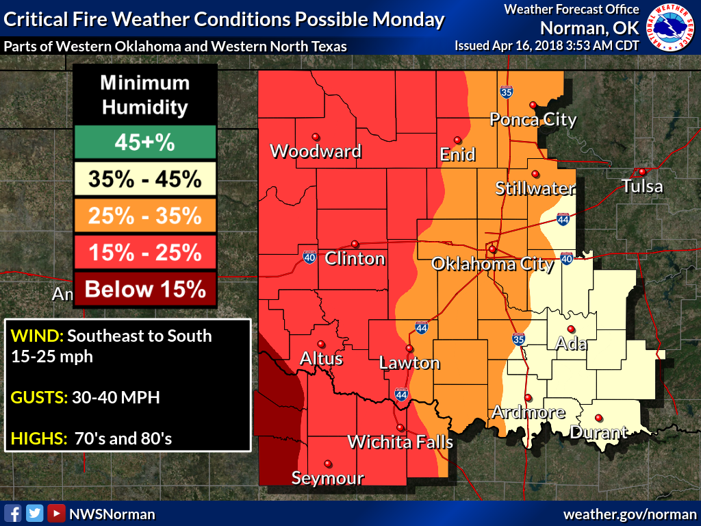
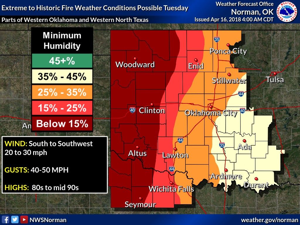
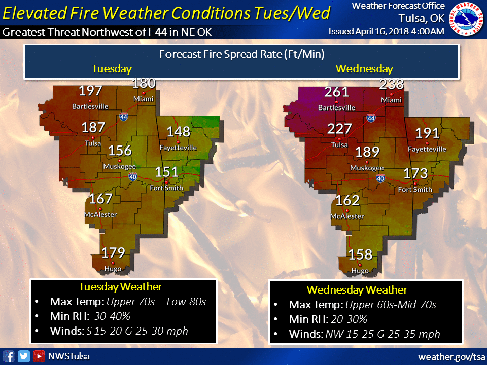
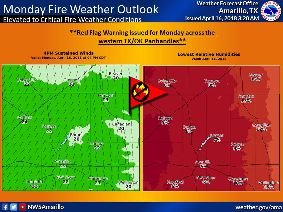
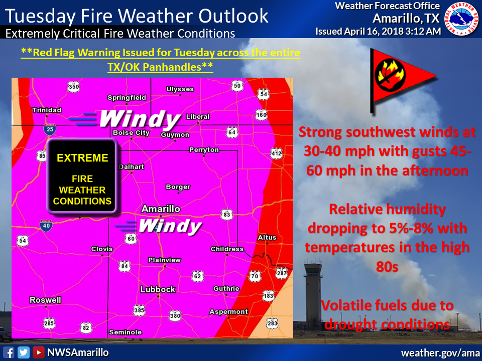
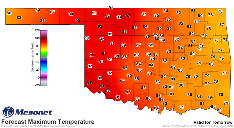
Tomorrow, again called "historic" in relation to fire danger, will be another
hot, dusty day, just like last Friday.
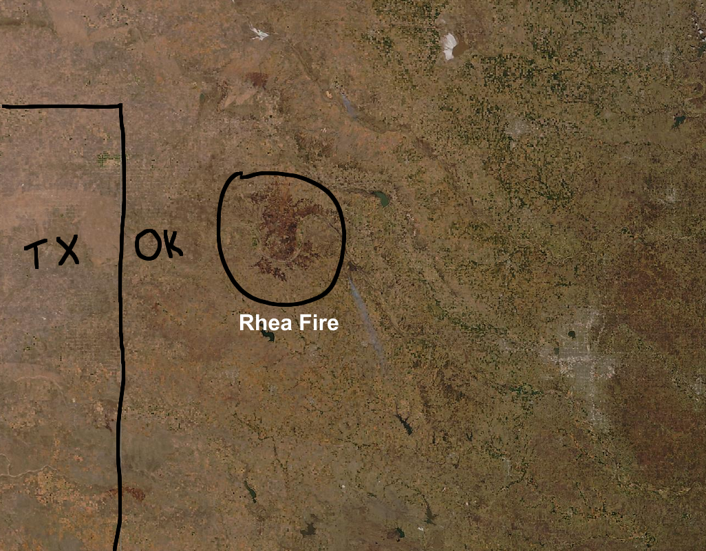
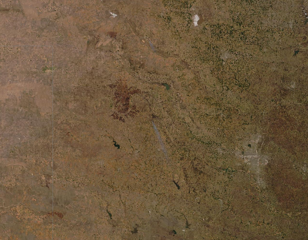
The Rhea fire, which has now burned close to 250,000 acres across Dewey County,
still smolders, its scar quite visible from space (here's a marked-up version,
then a clear one for you to look at).
As mentioned last week, this is what we can expect until we get some rain that
will allow for a green up of the vegetation across western Oklahoma. Green up
is the spring wildfire season's biggest enemy. The rain is in the forecast...
will it stay?
KEEP YOUR FINGERS CROSSED!
Gary McManus
State Climatologist
Oklahoma Mesonet
Oklahoma Climatological Survey
(405) 325-2253
gmcmanus@mesonet.org
April 16 in Mesonet History
| Record | Value | Station | Year |
|---|---|---|---|
| Maximum Temperature | 96°F | BURN | 2006 |
| Minimum Temperature | 20°F | FORA | 2018 |
| Maximum Rainfall | 3.75″ | TIPT | 2016 |
Mesonet records begin in 1994.
Search by Date
If you're a bit off, don't worry, because just like horseshoes, “almost” counts on the Ticker website!