Ticker for April 19, 2018
MESONET TICKER ... MESONET TICKER ... MESONET TICKER ... MESONET TICKER ...
April 19, 2018 April 19, 2018 April 19, 2018 April 19, 2018
And the beat goes on
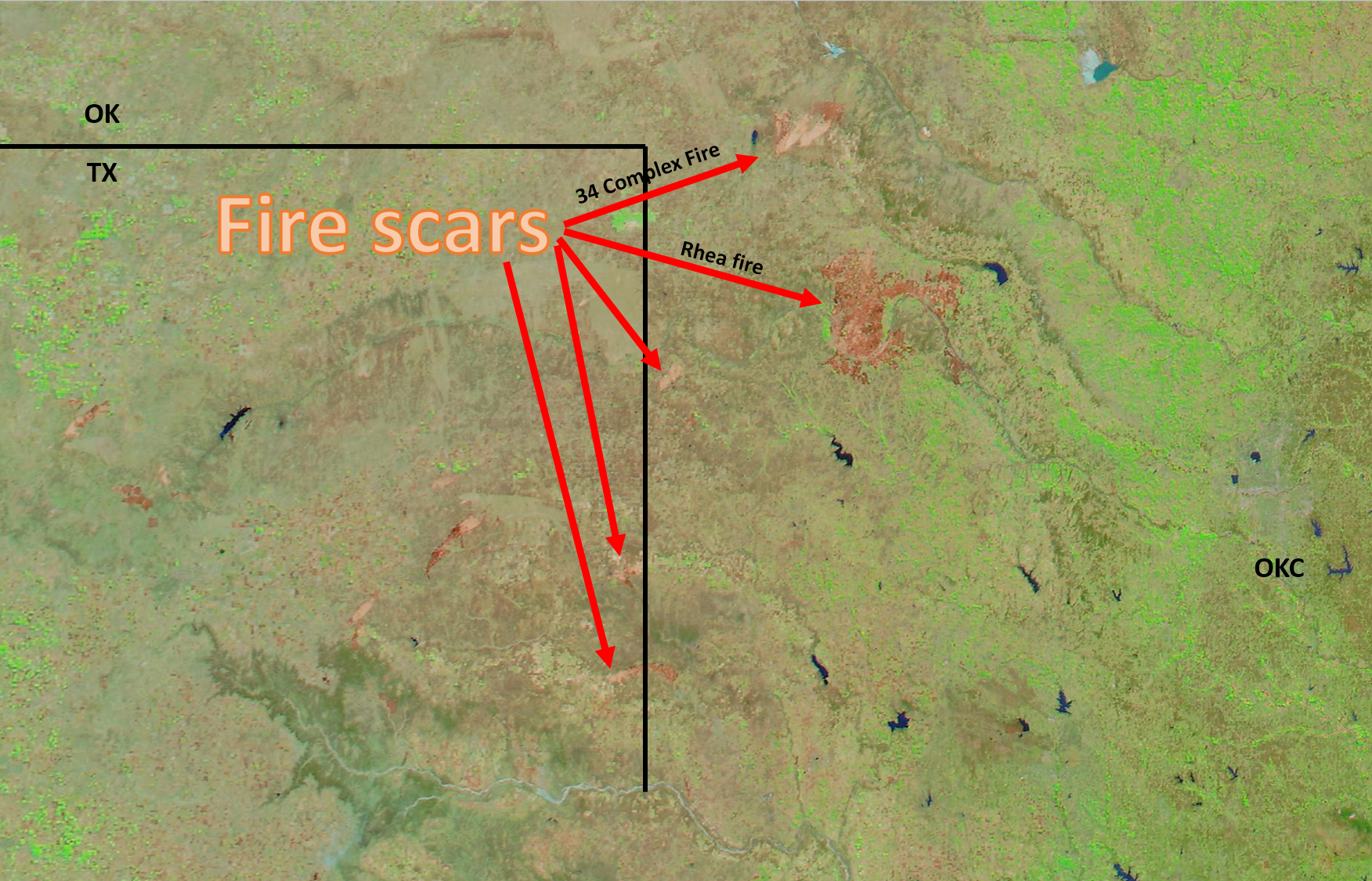
A fascinating look at the view of the Southern Plains fires from space on this
MODIS false color image. You can see the burn scars quite clearly up and down
western Oklahoma. A bunch of them dot the TX Panhandle as well. I didn't mark all
of them because, well, Texas. An interesting perspective with the size of the
Rhea fire in Dewey County, last estimate I saw was close to 300,000 acres. You can
see the size of OKC in the right side of the image. Even the 34 Complex Fire in
Woodward County looks pretty massive from space. Here's an unedited view as well.

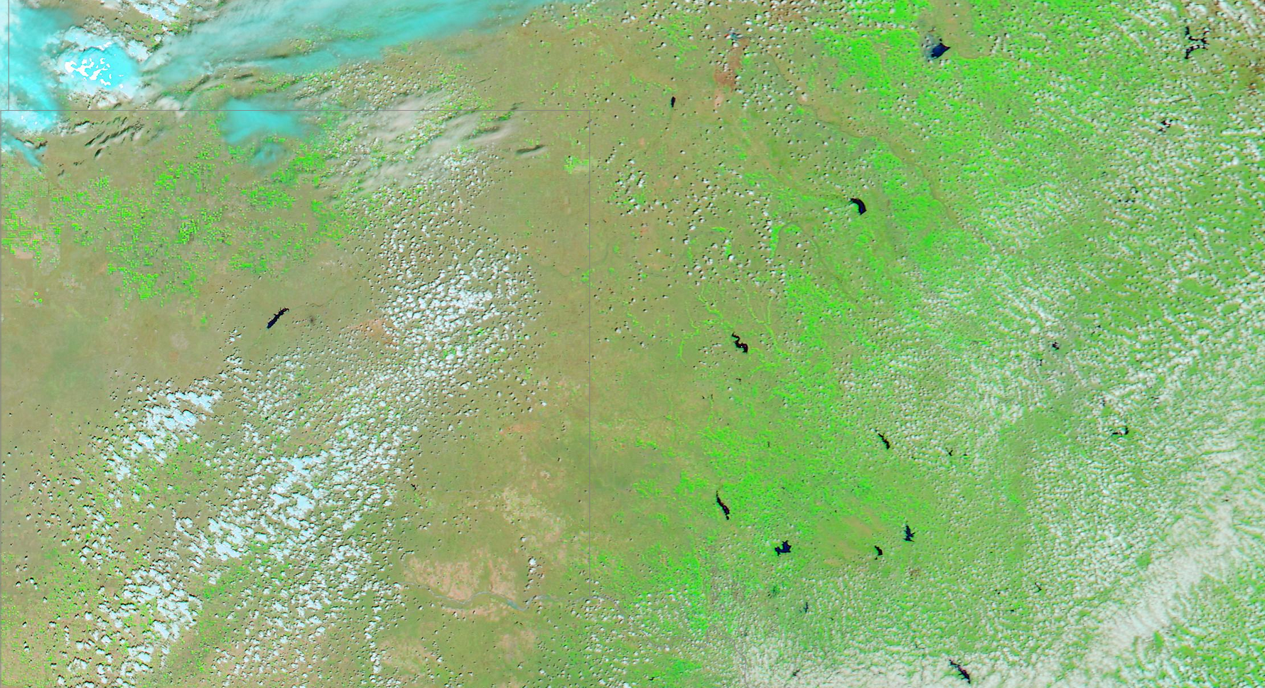
You can also see the green up of Oklahoma's winter wheat crop. Looks decent in
that view, but again, viewed in comparison to a "good" year, there is a vast
difference. Here's the same false color MODIS view from Apr. 20, 2016.
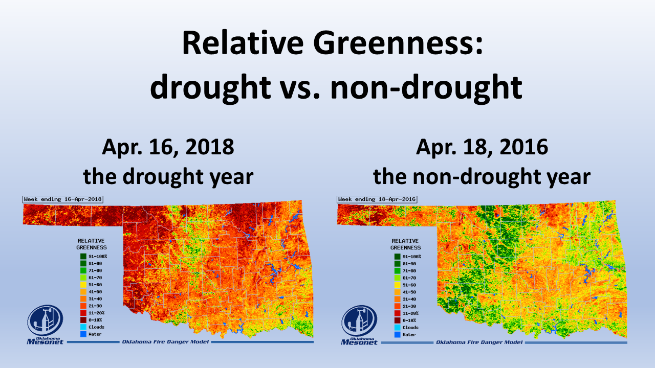
Here's another version of our parched landscape from this year vs. 2016 from
the Mesonet's OK-FIRE relative greenness images.
While the fires have begun to slow their advance with more favorable weather
conditions, I think the final quenching is going to require Mother Nature's help.
And that will come in the form of a slow-moving storm system approaching from
the West that will allow some decent moisture return from the Gulf of Mexico.
Ticker readers will remember (if not, I'll remind you now!) that we've been
saying that's what it's going to take to finally get some rain in western OK.
Enough of these fast-moving storms that only get enough ingredients to make rain
east of I35. The rain chances should start to increase as early as tomorrow,
peak on Saturday, and then taper off on Sunday.
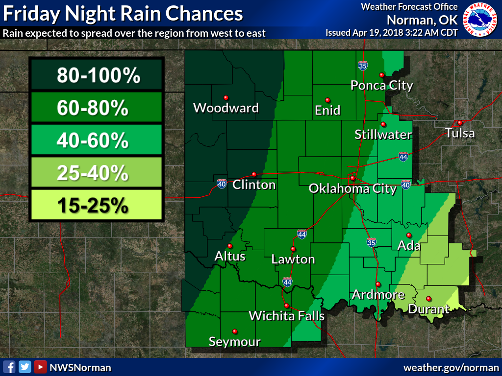

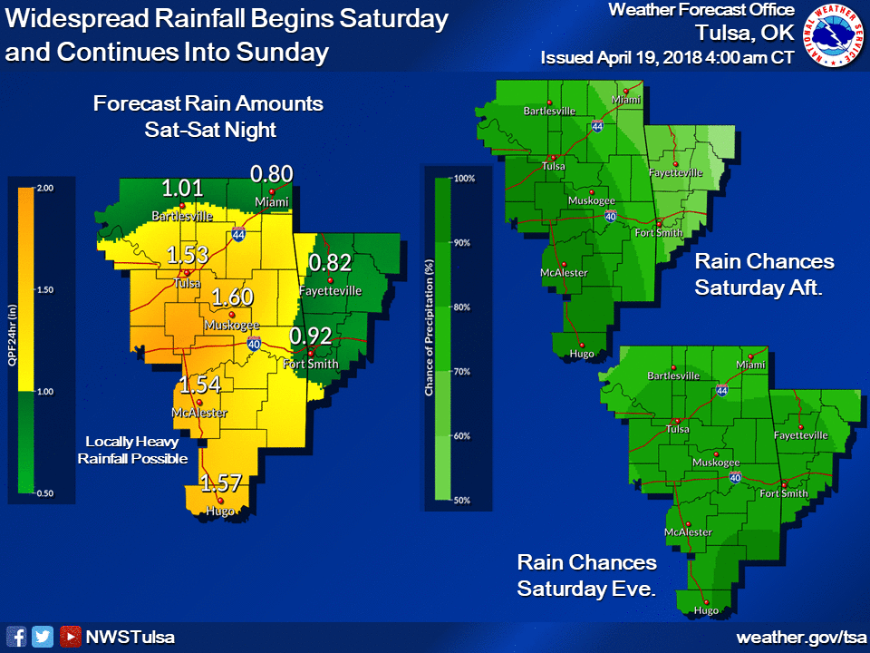
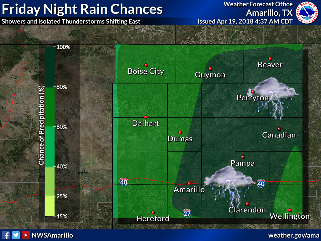
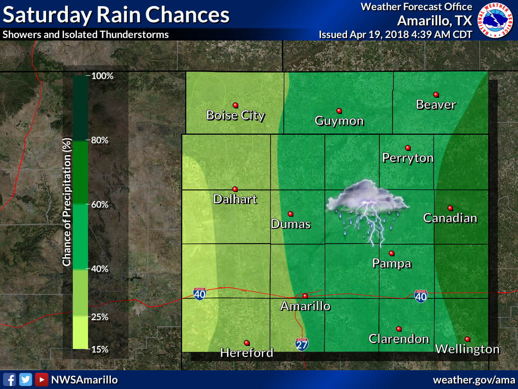
I do believe western Oklahoma will get a decent rainfall, but not a
drought-busting storm by any means. And I'm afraid the rainfall projections are
starting to do the "Eastern Shuffle" that we've seen with storm after storm.
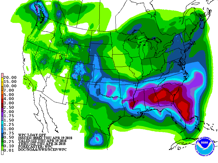
Latest projections show maybe an inch in some spots, but perhaps less than a
half-inch in other areas. The folks at WPC are a tad more optimistic than
the Norman NWS office, but the Norman forecasters actually live here, and thus
they know of the western OK moisture jinx!
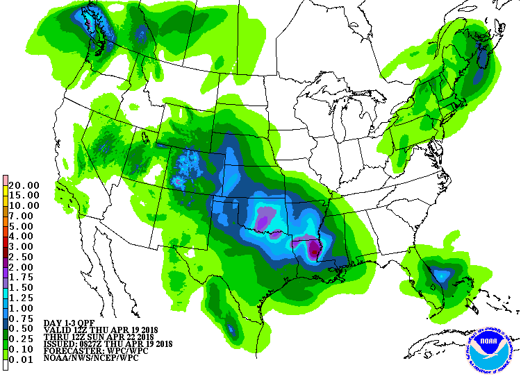

Ugh. Let's hope we get a get a favorable roll of the dice this weekend. The 7-day
forecast reflects additional rain chances in the middle of next week, but just
like this last storm, predicting its actual impacts are pretty difficult this
far out.
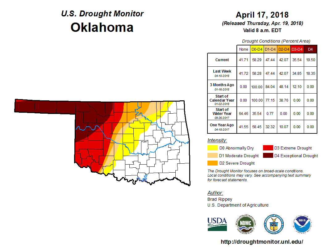
We will just have to wait and see how this weekend's rain impacts next week's
U.S. Drought Monitor, which continues to see expanding drought across the
state.
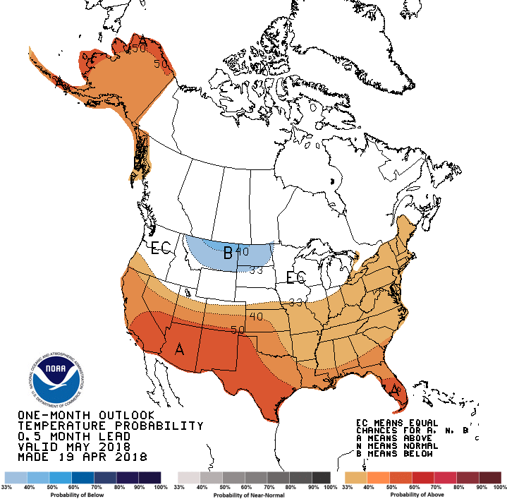
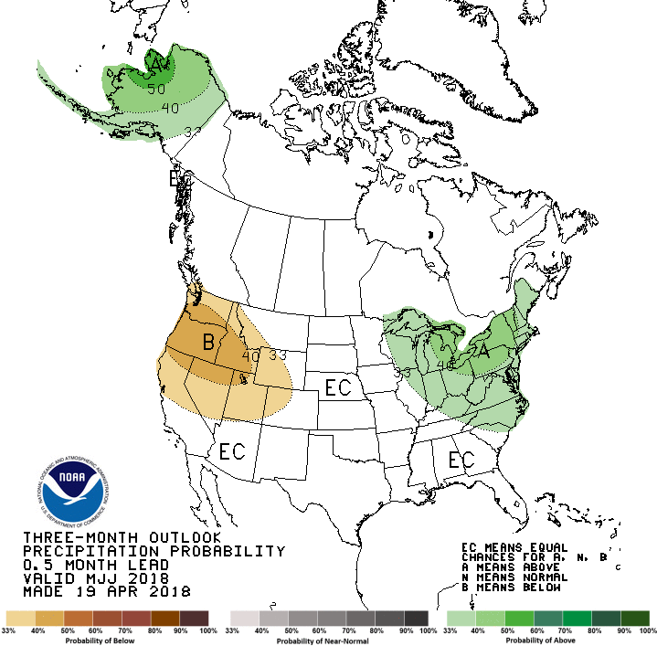
Now we look even farther into the future with the CPC's May and May-July
outlooks. Bad news for far western OK and the Panhandle with the May outlook,
although the odds for below normal precip are just slightly increased. Still,
it would be better if those odds favored wetter than normal conditions. Temps
are expected to be above normal, at least the odds favor that outcome. That
won't help matters since that means more evaporation, possibly.

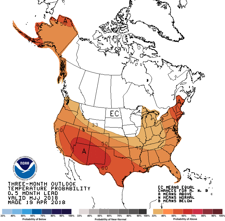
The same temperature outcomes are favored fro the May-July period as a whole,
but at least we don't see the increased odds of below normal precip for that
period.
Climatology says now through mid-June is the wet season for most of the state
(a bit farther into the summer for the Panhandle), so the Drought Outlook through
the end of July does favor a bit of improvement across western Oklahoma, but
drought is expected to remain.
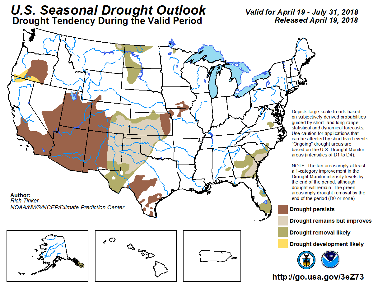
Here, the forecaster is relying heavily upon the upcoming rain systems over the
next week or so improving things across western OK, but ALSO relying on some
semblance of a normal wet season after that. Now this outlook was made BEFORE
the models began their Eastern Shuffle of the higher precip totals, so we're
already behind the 8-ball. Our advantage is we could see a decent spring out
that way to make up for any shortfalls in the next week. The disadvantage...it's
Oklahoma. It might not rain again for a couple months. Doubtful, but again,
Oklahoma.
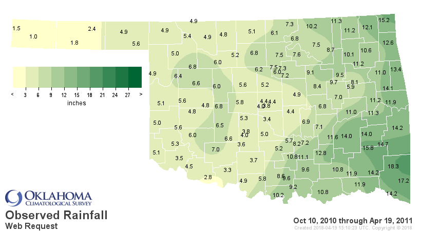
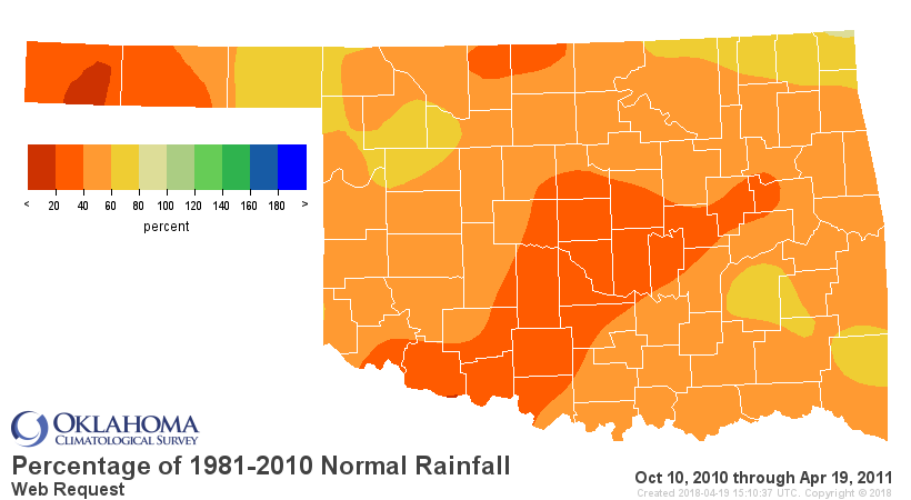
I'm struck by how much this first 6 months of drought resembles the Oct. 2010-
April 2011 beginnings of the 2010-15 drought. Actually looks worse now than
back then for western OK. Worries me.


Gary McManus
State Climatologist
Oklahoma Mesonet
Oklahoma Climatological Survey
(405) 325-2253
gmcmanus@mesonet.org
April 19 in Mesonet History
| Record | Value | Station | Year |
|---|---|---|---|
| Maximum Temperature | 95°F | HOLL | 2023 |
| Minimum Temperature | 21°F | BOIS | 2013 |
| Maximum Rainfall | 4.77″ | NEWP | 2025 |
Mesonet records begin in 1994.
Search by Date
If you're a bit off, don't worry, because just like horseshoes, “almost” counts on the Ticker website!