Ticker for April 12, 2018
MESONET TICKER ... MESONET TICKER ... MESONET TICKER ... MESONET TICKER ...
April 12, 2018 April 12, 2018 April 12, 2018 April 12, 2018
We've gone to
We've gone from "Historic" fire danger (at least across SW OK tomorrow) to now
"Ominous" from the Oklahoma Forestry Department. I'm waiting for somebody to
invoke "Ragnarok." What's next, "Infinity War?" Unfortunately, we don't have the
Avengers or Thor here to help us the next few days. At any rate, I think they're
trying to tell us something. But first off, all of this is made possible in large
part by the ongoing drought conditions, and as you can see here, things are
not improving across the NW half of Oklahoma. Here's the latest U.S. Drought
Monitor report.
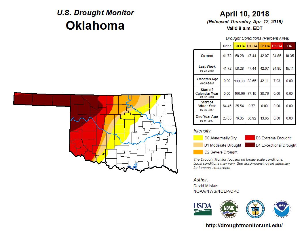
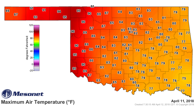
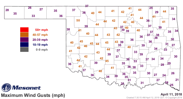
No changes from last week, but the last few days, as well as the next few, WILL
exacerbate those drought conditions. Starting with the high temperatures and high
winds of yesterday.
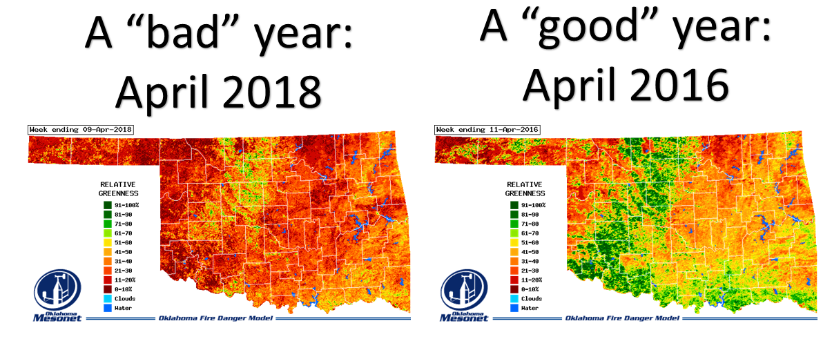
The relative greenness maps from the Mesonet's OK-FIRE program show the sad
results of the continuing drought, as vegetation still lies in a dormant/dead
state. Basically a continuation of winter vegetative conditions, WITHOUT the
normal green wheat fields we'd expect. Check out the comparison from a "good"
year, 2016...vs. a "bad" (or droughty) year such as 2018; both from early April.
So lots of dead/dormant fuels out there just waiting for a spark. Here's how
the Oklahoma Forestry describe the situation for the next couple of days.
Ominous fire danger will be present both Thursday and Friday with
subsequent fire danger remaining firmly in place through the weekend.
The Fire Environment will support problematic and extreme fire behavior
with potential for historic fire weather to occur over the most
significantly drought influenced fuels. A dry line will push firmly
into western Oklahoma with temperatures above 90?, single digit relative
humidity and very strong southwest winds on Thursday. With minimal
moisture recovery in the overnight hours and sustaining strong winds
over extremely dry fuels, the burning period will last through Thursday
night into Friday morning in the Panhandle, northwest and potentially
far western Oklahoma. A cold front will push into northwest Oklahoma
progressing through the state during the peak of the burning period.
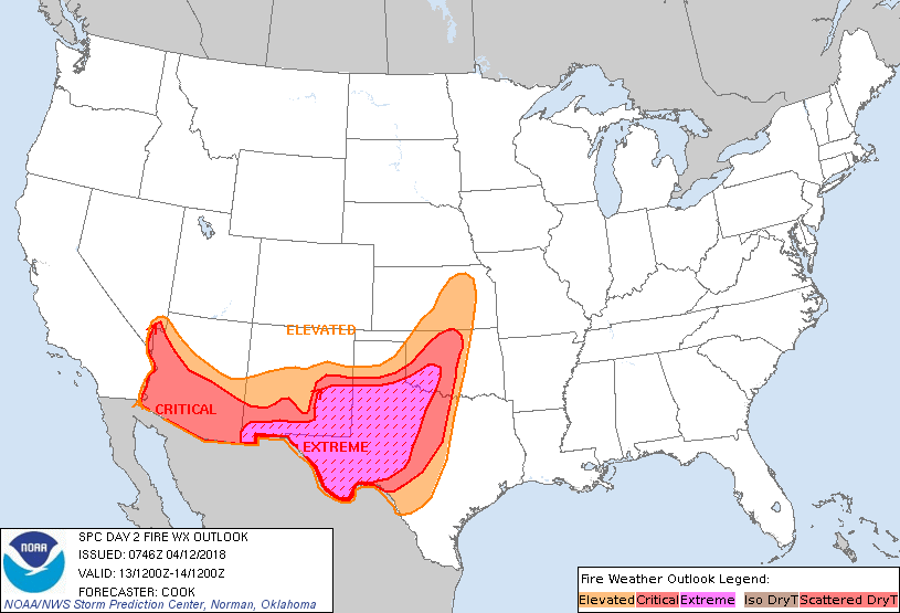
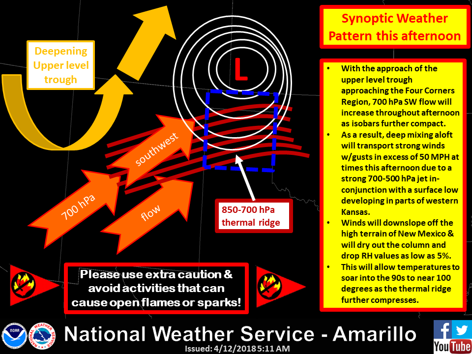
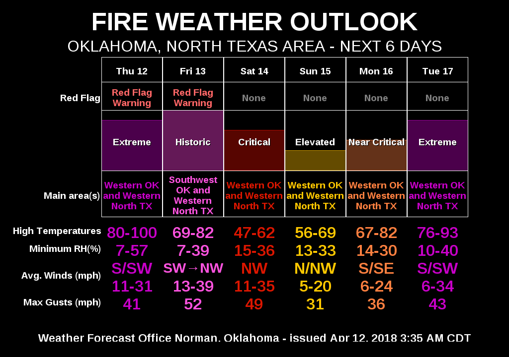
Here are a slew of graphics from many different sources, all pointing towards
the same thing...Ragnarok! Whoops, I mean extreme fire danger.

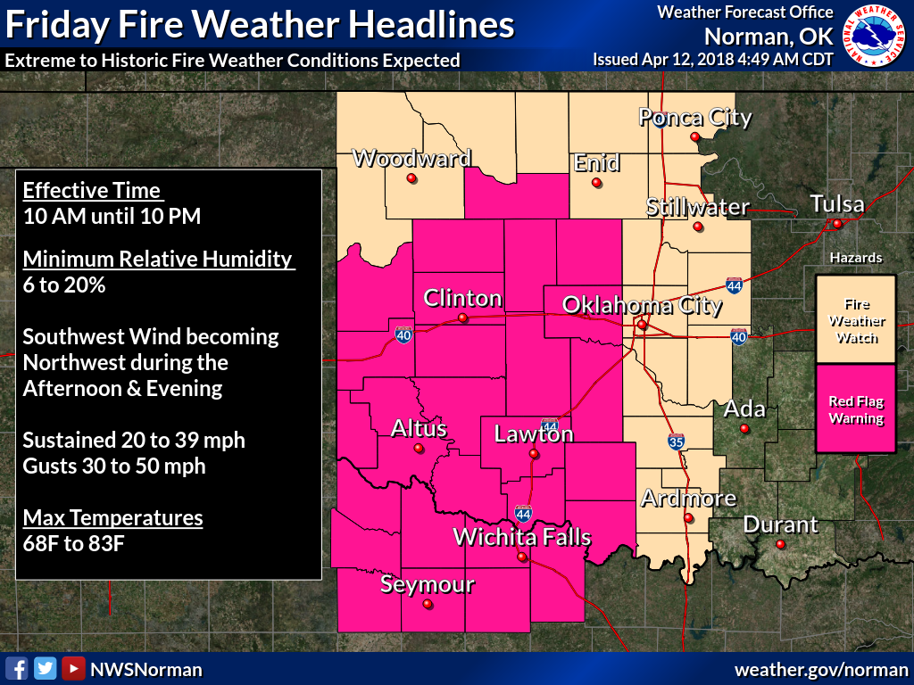
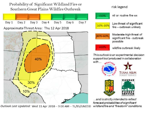
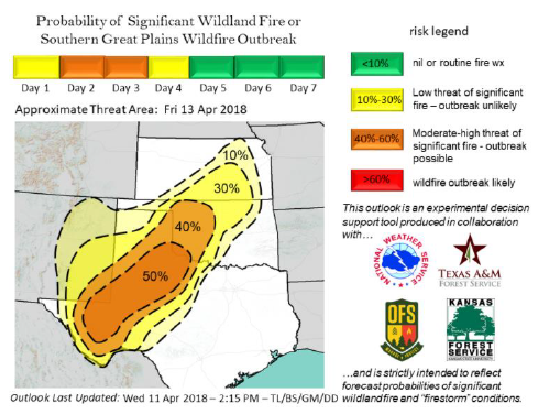
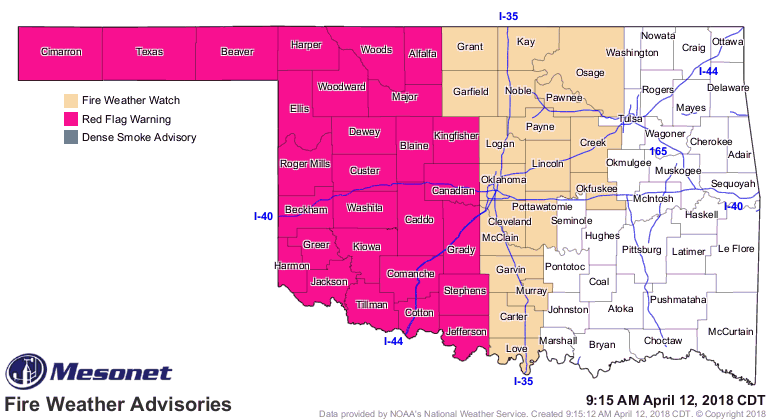
Okay, now that I've gotten you all fired up, I'm about burnt out. One final map,
here are the areas, at least now, where we see the Red Flag Fire warning and
Fire Weather Watch.
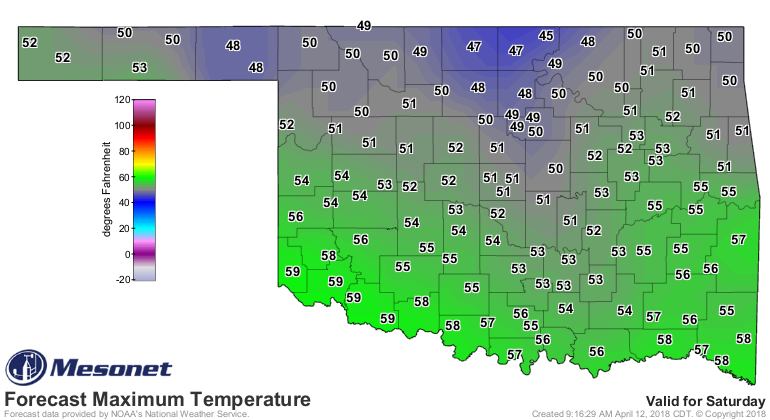
Watch for our first triple-digit temperatures today, probably somewhere in the
drought-ravaged northwest and also southwest.

The cold front coming through will bring a cool weekend and another hard freeze
to a large part of the state.
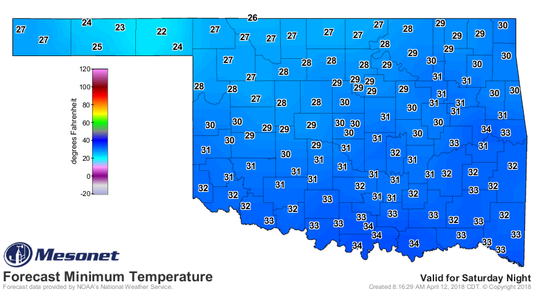
Now for the hard truth...until it rains, these fire weather outbreak conditions
will continue, because the only way to fight wildfire danger in Oklahoma in
early spring is to GREEN UP! And if it doesn't rain, there is no green up. Now
for the sad truth. The 7-day rainfall forecast map.
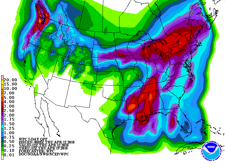
Okay, go ahead. Bring on Thanos.
Gary McManus
State Climatologist
Oklahoma Mesonet
Oklahoma Climatological Survey
(405) 325-2253
gmcmanus@mesonet.org
April 12 in Mesonet History
| Record | Value | Station | Year |
|---|---|---|---|
| Maximum Temperature | 102°F | MANG | 2018 |
| Minimum Temperature | 14°F | BOIS | 1997 |
| Maximum Rainfall | 3.14 inches | CHEY | 2015 |
Mesonet records begin in 1994.
Search by Date
If you're a bit off, don't worry, because just like horseshoes, “almost” counts on the Ticker website!